Life Cycle using BIM and GIS GeoBIM BIM for Transportation Niels - - PowerPoint PPT Presentation

life cycle using bim and gis
SMART_READER_LITE
LIVE PREVIEW

Life Cycle using BIM and GIS GeoBIM BIM for Transportation Niels - - PowerPoint PPT Presentation

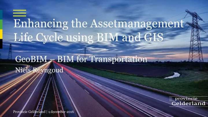
Enhancing the Assetmanagement Life Cycle using BIM and GIS GeoBIM BIM for Transportation Niels Reyngoud Provincie Gelderland | 1 december 2016 Province of Gelderland Gegeven 1.200 km roads 84.000 trees 1.400 km bike roads 14.700.000 m2


slide-1
SLIDE 1

Provincie Gelderland | 1 december 2016

Enhancing the Assetmanagement Life Cycle using BIM and GIS

Niels Reyngoud

GeoBIM – BIM for Transportation

slide-2
SLIDE 2

2

Province of Gelderland

Gegeven

1.200 km roads 1.400 km bike roads 84.000 trees 14.700.000 m2 grass 540 bridges, tunnels, overpasses 6.000 culverts 30 km acoustic screens 20.000 lamp posts 190 traffic light controls 242 traffic measurement systems 24 camera systems 780 bus stops 16 carpool sites 110 gas stations

slide-3
SLIDE 3
  • Budgets shrink
  • Pressure for smaller government
  • Pressure for more transparency (why do we do the things we do)
  • Bigger accent on life cycle management
  • Shift from active to more directing rol of our department
  • Answer: implementation of asset management!

Developments in road management

slide-4
SLIDE 4

Provincie Gelderland | 01 December 2016 4

Asset Management – How?

slide-5
SLIDE 5

Asset Management Life Cycle

slide-6
SLIDE 6

Essential in asset management:

  • Actual, complete and sound data
  • Use data to find the balance between costs, risks and achievements
  • Gather data just once, at the ‘source’ and then use it throughout the whole

life cycle

  • We realise that information management should have a dominant place in

all of our processes

Information management using GIS and BIM is the heart of the asset management life cycle!

Importance of information management

6

slide-7
SLIDE 7

7

Examples of GIS and BIM in the life cycle

How we use GIS and BIM in the life cycle: 1. Project information management 2. IMGeo basemap as the source for all data 3. Gelderland Object Type Library (OTL) 4. Using COINS to keep data actual and complete 5. Using COINS 2.0 in maintenance projects

slide-8
SLIDE 8

8

  • 1. Project information management
  • Using an information system from the first phase of the project

1. Relatics

  • system breakdown structure
  • customers and system requirements
  • risk management
  • issue management

2. iViewer (GIS viewer)

  • Location of cables
  • Land use plans
  • System boundaries
  • Traffic models
  • Design alternatives
  • Both systems are coupled and function as one
  • Users are very enthusiastic; they have all the information they need in one

systems

slide-9
SLIDE 9

9

Project information management

slide-10
SLIDE 10
  • 2. IMGeo basemap - source of all data
slide-11
SLIDE 11

11

  • 2. IMGeo basemap - source of all data

Monitoring completeness of data in the basemap (2011-2016)

slide-12
SLIDE 12

12

Dictionary or encyclopaedia of general features of objects (objecttypes)

  • 3. Gelderland Object Type Library (OTL)
slide-13
SLIDE 13

13

  • Taxonomy with subtypes till the level used in the integral information

system

  • Decomposition following (partly) NEN2767-4 standard
  • 3. Gelderland Object Type Library (OTL)
slide-14
SLIDE 14

14

  • Instruction how to delimit objects in the IMGEO map
  • Schema of properties for in the integral management system
  • 3. Gelderland Object Type Library (OTL)
slide-15
SLIDE 15

15

  • Sets of standards requirements that can be used in maintenance projects
  • 3. Gelderland Object Type Library (OTL)
slide-16
SLIDE 16

16

  • COINS 1.1 export function (COINS 2.0 is under construction)
  • Link with CB-NL library (not yet filled)
  • 3. Gelderland Object Type Library (OTL)
slide-17
SLIDE 17
  • Until 2014 we did all of our data management ourselves
  • Team of surveyors that collected the data after a project was finished
  • Searching through big piles of papers produced by the projects to find

the information for the maintenance phase

  • But: most of data finds its origin in projects; that is where
  • bjects are created, modified or deleted
  • The information is there, why don’t we use that?
  • Using COINS to standardize revision information
  • 4. Using COINS to keep data complete

17

slide-18
SLIDE 18

VISI

data exchange

Contractor Province of Gelderland

transform transform

Gelderland Object Type Library COINS container Semantics of information Structure

  • f

information

  • 4. Using COINS to keep data complete
slide-19
SLIDE 19
  • 5. Using COINS 2.0 in maintenance projects

1-2: Asset information of the integral management system is typed along OTL-GLD and delivered as an ‘as-is’ container 3: Contractor modifies data and sends ‘as-built’ container back 4: (Geo)SparQL queries are used for delta-analysis 5: Mutations are read back into integral management system using IMGEO messages coded with the ‘GeoSTUF’ standard. Synchronisation between management system and system for large scale topography uses the same messages

slide-20
SLIDE 20

Questions