
SLIDE 1
Lemmon Valley Heights Tentative Map with Hillside Development and - - PowerPoint PPT Presentation
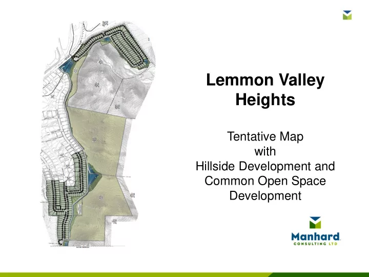
Lemmon Valley Heights Tentative Map with Hillside Development and Common Open Space Development PROJECT LOCATION Located within the eastern portion of Lemmon Valley, east of the existing Lemmon Valley subdivision. PROJECT GOALS
Total Area 128.50 acres Master Plan Designation Suburban Residential- 68.64 acres Rural- 59.95 acres Zoning Designation Medium Density Suburban- 68.64 acres General Rural- 59.95 acres Residential Lot Area 30.93 acres Right-of-Way Area 9.11 acres Total Common Area/Open Space 88.47 acres Total Number of Lots 206 Average Lot Size 6,540 sq. ft. Overall Gross Density 1.6 units per acre
Concentration Point Peak Flow Rate Peak Flow Rate Discharge to Swan Lake 100-YEAR 24-HOUR PEAK FLOW (CFS) 100-YEAR 24-HOUR PEAK FLOW (CFS) 100-YEAR 24- HOUR EVENT (ACRE FEET) Existing Conditions Main Outlet & WS3 381.1 23 Existing Channel 199 Proposed Conditions Main Outlet & WS3 230.3 14 Existing Channel 48 Percent Change