SLIDE 1
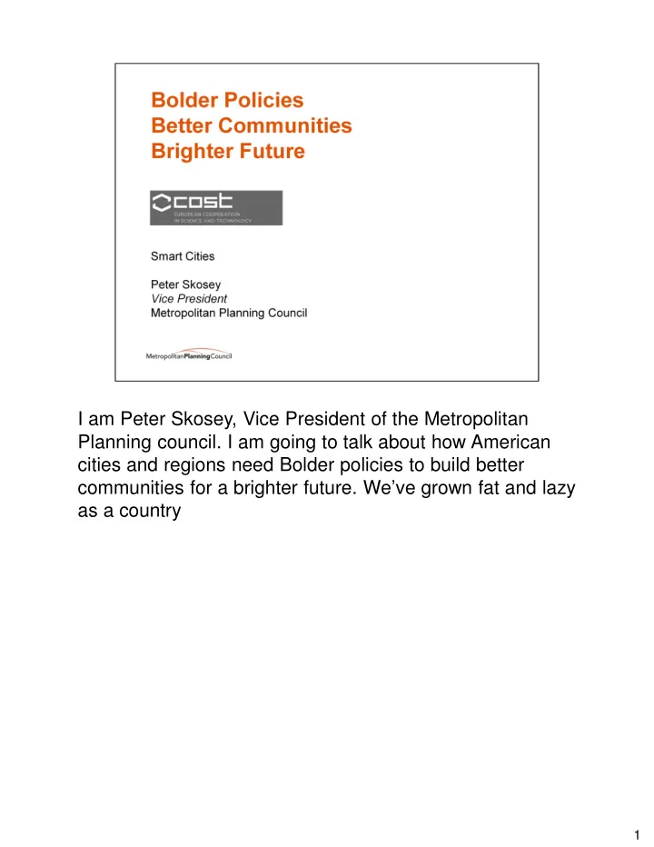
I am Peter Skosey, Vice President of the Metropolitan Planning council. I am going to talk about how American cities and regions need Bolder policies to build better communities for a brighter future. We’ve grown fat and lazy as a country
1
SLIDE 2
2
SLIDE 3
3
SLIDE 4
Looking back Economic growth in the current decade has been slower than in any decade since before World War II. Inequality has risen sharply, growth has gone to a relatively small slice of the population. Real value accounts for inflation. Large inflation during the 70’s
4
SLIDE 5
In the Hey Day, Tax revenues increase without raising taxes Economic growth in `50-`60 was 4% per year compared to 2.5% today Every one percent of GDP growth brings in $150 billion dollars ($15 trillion economy) (current US Debt is $14.419 trillion) ($46,000 per citizen $129,000 per tax payer) Medicare, social security and defense. Average economic growth in the current decade has been the slowest of any since 1930’s (great depression) Over the next 25 years if growth could be lifted by just one tenth of a percentage point a year the extra tax revenue would pay for Obama’s stimulus (AARA)
5
SLIDE 6
In good economic times the politics to beat back bad investment policies doesn’t exist 2010 US GNP - $15 trillion 2010 US GDP - $14.7 trillion This lead to a nation that was Complacent – expecting government to pay for everything but not wanting to pay taxes to fund government, “Fat and Lazy” we like to say
6
SLIDE 7
In terms of American Infrastructure that looked like this: Completed in 1993 “biggest, tallest, most costly structure yet built by California Department of Transportation” (and ever?) Five-level stack interchange of I-110 and I-105 in Los Angeles, near Watts Includes direct HOV-to-HOV lane ramps, light rail station, and bus rapid transit (Harbor Transitway) station 7
SLIDE 8
In terms of American People, it looked like this: Created a fat and lazy culture. (remote caddy, multiple remotes, sleepy dog,) we want instant gratification.
8
SLIDE 9
United States rates of obesity have doubled since 1970 to over 30% . One out of three American children is obese Four major categories of economic impact linked with the obesity epidemic: Direct medical costs Productivity costs Transportation costs Human capital costs Livable communities could turn this around Brookings direct medical costs productivity costs - Absenteeism, disability, health care costs transportation costs – larger costs, paratransit, human capital costs – negative relationship between weight and GPA Note: GDP is the market value of everything produced within a country; GNP is the value of what's produced by a country's residents, no matter where they live. The health care slide is GNP because that’s what the Census based the data on.
9
SLIDE 10
We were lulled into a false sense of compalcency as personal consumption increased – TV’s, iPads, Cars and even houses. Economists predict on it’s current path economy will grow slower than ever before Two engines of economy – consumer spending and Wall Street that led growth are an illusion Consumer debt and spending lifted short term growth at the expense of future growth Wall Street activities had little real value
10
SLIDE 11
11
SLIDE 12
China spends 9%. Europe spends 5%. U.S. 2% (MSNBC) (current transportation bill proposal is $240 billion is 1.6% of GDP) The past decades of economic growth have created a culture that is…..(next slide) Source: Congressional Budget Office, Public Spending on Transportation and Water Infrastructure, 2010 Note: GDP is the market value of everything produced within a country; GNP is the value of what's produced by a country's residents, no matter where they live. The health care slide is GNP because that’s what the Census based the data on.
12
SLIDE 13
Today, the US spends 2.0% of GNP on Infrastructure. China and India’s share of Global GDP is increasing while the US’s in decreasing. (not as badly as Germany’s though) (Purchasing –power parity adjusts for exchange rates.) Note: GDP is the market value of everything produced within a country; GNP is the value of what's produced by a country's residents, no matter where they live. The health care slide is GNP because that’s what the Census based the data on.
13
SLIDE 14
Regional population is: 8,444,447 +3.6% since 2000 Chicago population is 2,695,598 -6.9% since 2000 14
SLIDE 15
15
SLIDE 16
The solution is a three pronged approach to transportation planning and investments. 16
SLIDE 17
Corrallary bill here in DC, National Transportation Objectives Act, HR 2724 IDOT regions do not match DCEO or IEPA
17
SLIDE 18
2040 supports policy-based efforts to improve the bicycle and pedestrian systems, such as the use of Complete Streets principles to accommodate non-motorized travel in roadway design. Land Use: Density , Mixed income Transit Oriented Development (MITOD) , Reduce Jobs/Housing Mismatch Alternative Modes: Transit, Bike, Pedestrian Placemaking: Train Stations, Streets, Plazas and Parks
18
SLIDE 19
- Relates back to redevelopment/infil. Connection to
existing facilities, towns, schools, etc. better land use connection
- MnPass - In 2005, nine miles of carpool lanes along
Minnesota’s I-394 corridor were converted into toll lanes
- 940,000 vehicles use every year
- Tolls are adjusted hourly based on the level of congestion
- Average toll cost drivers $1 to $4 during rush hour
- More than 60 percent of residents support the program,
and more than 90 percent of toll lane users maintain a very high level of satisfaction
- Because of the success the federal government provided
Minnesota with a $133 million grant to expand the program
19
SLIDE 20
- We have some limited experience here in Chicago with
technology, but we’re goring and learning.
- Bus TSP on Western (CTA) and Pace routes serving the
Harvey Transportation Center.
- Go Roo is RTA serving Meta, CTA, and Pace
20
SLIDE 21
21
SLIDE 22
- Point here on bikes is to say this reduces demand for auto
travel at a minimum cost
- Chicago plans to begin with 2,000 bikes next year (2012)
and expanding to 5,000 shortly there-after.
- Dynamic Variable Pricing – what the future could hold for
Chicago
22
SLIDE 23
23
SLIDE 24
- Multimodal Integrated Corridor Management: operational
coordination of multiple transportation networks and cross network connections comprising a corridor and the coordination among institutions responsible for corridor mobility. The USDOT has selected eight "Pioneer Sites" as part of its 7-year ICM Initiative. All eight Pioneer Sites are recognized leaders in the area
- f congestion management. For example, all have
implemented real-time signal control on their arterials. Many have implemented high-occupancy vehicle (HOV) and value-pricing strategies, others have advanced bus
- perations that include express bus and bus rapid transit
services. There are three stages to the USDOT partnership with the
24
SLIDE 25 Pioneer Sites: Stage 1—Concept Development (FY07-08): COMPLETE. All eight sites will develop site-specific concept of
- perations (CONOPS) and System Requirements
- documents. Each site provided sample data for evaluation.
These documents are available from the ICM Knowledgebase. Stage 2—Modeling (FY09–FY10). Dallas, Minneapolis, and San Diego were selected, to model their proposed ICM
- systems. All three sites have successfully modeled their
proposed ICM systems. Stage 3—Demonstration and Evaluation (FY10–FY13). Dallas and San Diego were selected to demonstrate their ICM strategies These sites will demonstrate the application
- f institutional, operational and technical integration
approaches in the field and document implementation issues and operational benefits Dallas: Dallas: U.S. 75 Corridor The U.S. 75 project is a collaborative effort led by Dallas Area Rapid Transit (DART) in collaboration with USDOT; the cities of Dallas, Plano, Richardson, and University Park; the town of Highland Park; North Central Texas Council of Governments; North Texas Tollway Authority; and the Texas Department of Transportation (TxDOT). U.S. 75 is a north-south radial corridor that serves commuter, commercial, and regional trips, and is the primary connector from downtown Dallas to the cities to the
- north. Weekday mainline traffic volumes reach 250,000
vehicles, with another 30,000 vehicles on the frontage
24
SLIDE 26
- roads. The corridor has 167 miles (269 kilometers) of
arterial roadways. The U.S. 75 corridor currently has two concurrent flow- managed, high-occupancy vehicle (HOV) lanes, light rail, bus service, and park-and-ride lots. The corridor sees recurring congestion and a significant number of freeway
- incidents. Light rail on the DART red line is running at 75
percent capacity, and arterial streets are near capacity during peak periods and are affected by two choke points at the U.S. 75/Lyndon B. Johnson Freeway (I-635) interchange and U.S. 75/President George Bush Turnpike interchange. DART will contribute $3 million to the $8.3 million project, which will use a transportation management model to predict travel conditions 30 minutes into the future. Those predictions will facilitate diversion of traffic from U.S. 75 to
- ther routes during freeway incidents and special events.
Through wireless and Web-based alerts, travelers will have access to real-time information about traffic, public transit, and expected travel times. Another goal of the Dallas research is to improve incident management through interagency communication and coordinated response. Specific practices that the Dallas team intends to employ include the following: Provide comparative travel times to the public and operating agencies for the freeway, HOV lanes, frontage roads, arterial streets, and light-rail transit line. Use simulations to predict travel conditions for improved incident response.
24
SLIDE 27 Implement interdependent response plans among agencies. Divert traffic to strategic arterials with adaptive control that can adjust signal timing in response to real-time traffic demands. Shift travelers to the light-rail system during major incidents
San Diego: I-15 Corridor The I-15 project is a collaboration led by the San Diego Association of Governments (SANDAG), along with USDOT, the California Department of Transportation, Metropolitan Transit System, North County Transit District, and the cities of San Diego, Poway, and Escondido, in addition to private sector support. The goals are to augment technical management, software and systems development, and cutting-edge innovation. The interstate is a north-south corridor that runs from S.R. 78 in the north to the S.R. 163 interchange in the south. I-15 is a primary artery for the movement of commuters, goods, and services from inland northern San Diego County to downtown San Diego. Weekday traffic volumes range from 170,000 to 290,000 vehicles on the general purpose lanes. The corridor currently has two reversible high-occupancy toll (HOT) lanes. Approximately 20,000 vehicles use the I- 15 express lanes during weekdays, and the corridor experiences recurring congestion. SANDAG and its partnering agencies will contribute $2.2 million for the $10.9 million project. San Diego will use investments in intelligent transportation systems (ITS) to implement a "smart" transportation management system
24
SLIDE 28
that combines road sensors, transit management strategies, video, and traveler information to reduce congestion. The smart system will deliver information to commuters via the Internet and message signs, and will enable managers to adjust traffic signals and ramp meters to direct travelers to HOV and HOT lanes, bus rapid transit, and other options. Examples of practices the SANDAG team intends to employ include the following: Provide corridor users with the operational condition of all corridor networks and components, such as comparative travel times, parking space availability, incident information, and expected delays. Use a decision support system with real-time simulation, predictive algorithms, and analysis modeling. Establish, improve, and automate joint agency action plans. Identify means of enhancing corridor management across all networks, including shared control of field devices such as lane controls, traveler information messages, and transit priority.
24
SLIDE 29
- Multimodal Integrated Corridor Management: operational
coordination of multiple transportation networks and cross network connections comprising a corridor and the coordination among institutions responsible for corridor mobility. http://www.youtube.com/watch?v=cd0doR0Ga-I
25
SLIDE 30
- Multimodal Integrated Corridor Management: operational
coordination of multiple transportation networks and cross network connections comprising a corridor and the coordination among institutions responsible for corridor mobility.
26