
SLIDE 1
1
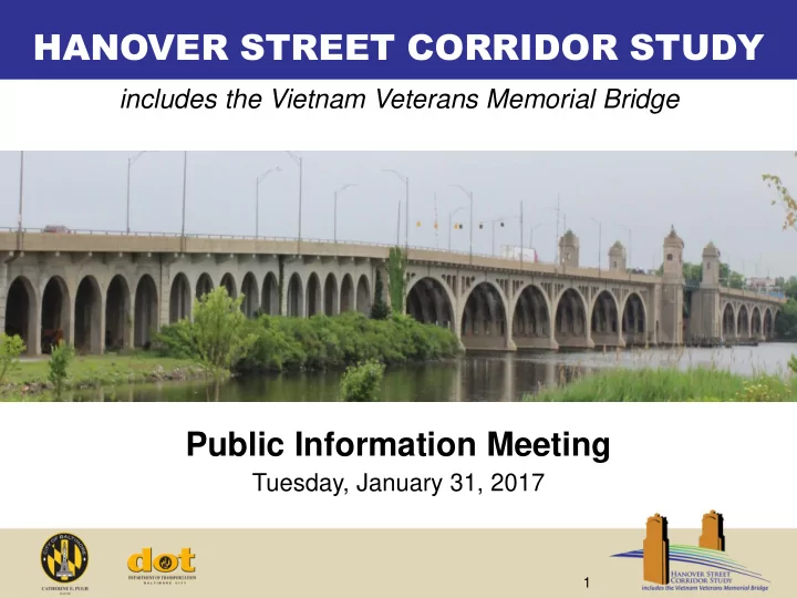
HANOVER STREET CORRIDOR STUDY
Public Information Meeting
Tuesday, January 31, 2017
includes the Vietnam Veterans Memorial Bridge
HANOVER STREET CORRIDOR STUDY includes the Vietnam Veterans Memorial - - PowerPoint PPT Presentation
HANOVER STREET CORRIDOR STUDY includes the Vietnam Veterans Memorial Bridge Public Information Meeting Tuesday, January 31, 2017 1 Tonights Presentation Study Overview Project Goals Process & Schedule Work Completed to
1
Tuesday, January 31, 2017
includes the Vietnam Veterans Memorial Bridge
2
3
Veterans Memorial Bridge and Hanover Street corridor to address accessibility, connectivity, and safety for multiple modes:
$700,000 match from Baltimore City
(a distance of 1.4 miles)
4
At the end of this process, the team will produce a PLAN to upgrade and enhance the Hanover Street corridor and Vietnam Veterans Memorial bridge by:
access to key quality of life resources
and pedestrian trails
the Port of Baltimore
services
5
plan
principles
recommendations in Project Plan
factors needed to advance project Develop Corridor Plan and Guiding Principles
and constraints
concepts to study area needs
constructability challenges Identify Design Opportunities and Constraints
potential barriers to multi-modalism
pedestrian and bicycle facilities
facilities and assess
assessment Study Existing Transportation Network
economic climate
potential development
and challenges Conduct Economic Market Analysis
master plans
and community demographic data
and proposed land uses
traffic data
inspection reports Assess Existing Conditions & Collect Data Summer 2016 Winter 2017 Summer 2017 Winter 2018
Solicit Public and Agency Feedback
6
7
Key areas of focus for the project team to consider:
8
9
Information Gathering
Demographic, Economic, and Real Estate Data
Economic Analysis
identified through analysis
investment & strategies to
bridge and the components that are needed by business / community
Corridor Plan and Guiding Principles
respond to principles and recommendations
10
Baltimore region
improvements, truck route improvements
implications than the number of employees on-site
link
11
areas where residents work
12
short term due to moderate household growth in the next several years
could positively impact demand
critical for resident access to larger supermarkets
13
14
and Baltimore City DOT
15
Hanover St Corridor Study Area I-95 Access Improvement Study Port Covington (Sagamore) Port Covington (Under Armour)
16
project study area limits
LOS during the AM and PM peak hours
during PM peak hour at intersection of Hanover Street at Cromwell Street
significantly with Port Covington development
Existing Level of Service (LOS) Results
17
½ Mile Pedestrian Study Area (walkable within 30 minutes) 3 Mile Bikeshed Study Area (bikeable within 10 – 15 minutes)
Pedestrian and Bicycle Demand
18
Hill, have a transit-dependent population
local bus routes 27, 64, and express route 164 cross the bridge
serve the area south of the bridge
19
Truck Route Designations on Hanover Street:
trucks from 7:00pm to 7:00am)
through truck route (unrestricted access 24 hours a day, seven days a week)
handle the geometry, heights, and weights
Source: Baltimore City Truck Route Map
20
freight (local deliveries, fuel trucks, etc.) and not international freight traveling to and from the Port of Baltimore
freight if there are any tunnel closures
City neighborhood streets to avoid tolls (not Hanover Street as much as other downtown City streets)
21
storm drain system – curb, gutter, and pipe system
constructed prior to water quality regulations
for future bioretention type facilities
22
Existing Pedestrian Facilities
23
Existing Bicycle Facilities
from Reedbird Avenue to Cherry Hill Road
Hanover Street to points west
24
width recommended for ADA compliance Pedestrian / vehicle conflicts at free right turns
25
Hanover Street at Cromwell Street intersection geometric configuration is challenging for all users, especially pedestrians and cyclists
26
Sidewalk ramps on bridge not ADA compliant
27
Lane signals dim / difficult to read Poor bridge deck and pavement conditions Blocked inlets (flooding and safety concerns)
28
Overgrown vegetation and limited pedestrian access from bridge to Gwynns Falls Trail and no suitable, accessible bicycle connectivity Overgrown vegetation on Gwynns Falls Trail blocks views and contributes to pedestrian safety concerns
29
Overgrown vegetation on sidewalk reduces width along corridor; 60” width recommended for ADA compliance Missing sidewalk / pedestrian connections to bus stops
30
Faded crosswalks Lack of low level lighting for pedestrians along corridor
decrease width
compliance
31
not present at all stops along the corridor
for stops with average daily ridership of 100 or more
average daily ridership greater than 100, but only three of those stops have shelters
32
Existing Freight Conditions
Missing connection from westbound Frankfurst Avenue to Potee Street Constrained geometry at intersection of Hanover Street at Frankfurst Avenue Deficiencies cause additional truck traffic to use bridge to access Waterview Avenue
33 33
Minor Maintenance
Major Rehabilitation/Replacement
Vietnam Veterans Memorial Bridge (BC5210) * Overlaps with Port Covington development
34 34
Transportation
configurations make it significant on a national scale
Movable Span
Arched Approaches
35
the National Register of Historic Places (NRHP)
and state laws:
36
electrical and mechanical operating systems required for continued bridge openings
and track) good for continued use
closed position
150-foot channel width
37
Assessments based upon guidelines established by the current AASHTO publications – Manual for Bridge Element Inspection and Movable Bridge Inspection, Evaluation, and Maintenance Manual.
Movable Span Element Description Potential Repair Additional Study Bridge Lighting None present N/A Architectural Evaluation of Period Lighting Standards Traffic Barriers Open Steel Barrier Replacement Barrier Studies to consider supplemental pedestrian protection and period elements Deck and Sidewalk Open Steel Grid Replacement N/A Steel Superstructure Riveted Steel Truss / Girder
Operator’s Houses Masonry and Concrete Rehabilitation of exterior and interior elements Architectural and Hazardous Materials Evaluations Electrical and Mechanical Operating Systems Rall Mechanical Operating System General Reconstruction Detailed Inspection Bascule Piers Reinforced Concrete and Masonry Rehabilitation
Concrete Pile Foundations Reinforced Concrete Unknown at this time
Waterway Fenders and Dolphins Timber Unknown at this time Analyze piers in accordance with AASHTO Vessel Collision Criteria
38
Assessments based upon guidelines established by the current AASHTO publication – Manual for Bridge Element Inspection
Arched North and South Main Approach Spans Element Description Potential Repair Additional Study Bridge Lighting Standard Roadway Replace/Augment with “Pedestrian Friendly” Period Lighting Standards Architectural Evaluation of Period Lighting Standards Traffic Barriers Concrete w/ Steel Rail Replacement Barrier Studies to consider supplemental pedestrian protection and period elements Deck and Sidewalk Reinforced Concrete Replacement N/A Floor System Reinforced Concrete w/ Steel Encased Members Replacement Detailed Inspection Concrete/Steel “Arched” Superstructure Composite Steel Truss with Concrete General Rehabilitation
Member Capacities
Members
Piers Reinforced Concrete General Rehabilitation
Concrete Pile Foundations Reinforced Concrete Unknown at this time
39
Assessments based upon guidelines established by the current AASHTO publications – Manual for Bridge Element Inspection
Arcade North Approach Spans Element Description Potential Repair Additional Study Bridge Lighting Standard Roadway Replace/Augment with “Pedestrian Friendly” Period Lighting Standards Architectural Evaluation of Period Lighting Standards Traffic Barriers Concrete w/ Steel Rail Replacement Barrier Studies to consider supplemental pedestrian protection and period elements Deck and Sidewalk Reinforced Concrete Replacement N/A Concrete Arcades Reinforced Concrete General Rehabilitation
Timber Pile Foundations Georgia Long-leaf Pine Unknown at this time
Piles
Analyses
40
41 41
Truck traffic Bus circulation Pedestrian systems Intersection safety is critical to intermodal connectivity
42 42
Pedestrians feel unprotected Crosswalks not adequately visible
43 43
Crosswalks not adequately visible Free right turn can create conflicts between pedestrians and truck traffic Signage not supporting pedestrian safety, comfort or convenience
44 44
Unmet demand for pedestrian facilities Street lighting designed for vehicles rather than pedestrians
45 45
Narrow, unprotected sidewalk space creates intimidating situation for pedestrians Lack of accessible crossing at bascule span creates barrier Lack of pedestrian scaled lighting reduces perceived safety Insufficient bicycle facilities and high-speed traffic can create intimidating condition for bicyclists
46
compliance with current ADA design standards
maritime access
47
including the effect of new development at Port Covington and other area growth
patterns
and accessibility
48
Study Area Destinations
Westport
Residential
Recreational
Commercial / Industrial
development)
(ongoing development)
49
Design Opportunities
Westport
Multimodal desire lines are the paths that travelers desire to use to move between various destinations, regardless of transportation mode
50