HANOVER STREET CORRIDOR STUDY includes the Vietnam Veterans Memorial - - PowerPoint PPT Presentation

hanover street corridor study
SMART_READER_LITE
LIVE PREVIEW

HANOVER STREET CORRIDOR STUDY includes the Vietnam Veterans Memorial - - PowerPoint PPT Presentation

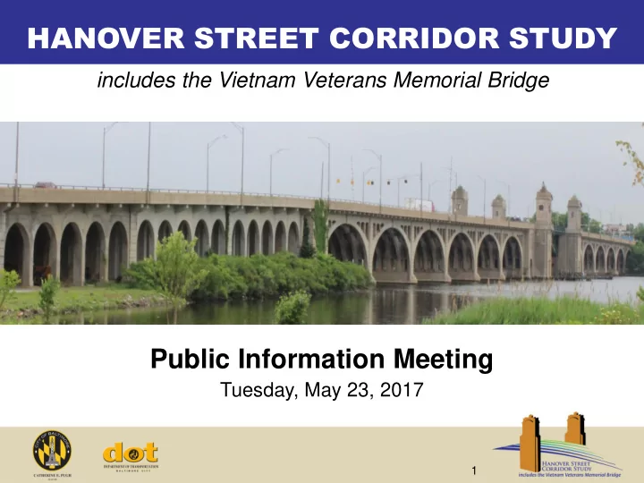
HANOVER STREET CORRIDOR STUDY includes the Vietnam Veterans Memorial Bridge Public Information Meeting Tuesday, May 23, 2017 1 Tonights Presentation Study Overview Project Goals Process & Schedule Work Completed to Date


slide-1
SLIDE 1

1

HANOVER STREET CORRIDOR STUDY

Public Information Meeting

Tuesday, May 23, 2017

includes the Vietnam Veterans Memorial Bridge

slide-2
SLIDE 2

2

Tonight’s Presentation

  • Study Overview
  • Project Goals
  • Process & Schedule
  • Work Completed to Date
  • Design Opportunities
  • Next Steps
  • Your Input
slide-3
SLIDE 3

3

  • Purpose: Identify improvements to the Vietnam

Veterans Memorial Bridge and Hanover Street corridor to address accessibility, connectivity, and safety for multiple modes:

  • Bicycle
  • Pedestrian
  • Transit
  • Automobiles
  • Freight
  • Funding: USDOT $1.1 MM TIGER Grant and a

$700,000 match from Baltimore City

  • Study Limits: Wells Street to Reedbird Avenue

(a distance of 1.4 miles)

Study Overview

slide-4
SLIDE 4

4

Adjacent Projects

Hanover St Corridor Study Area I-95 Access Improvement Study Port Covington (Sagamore) Port Covington (Under Armour)

slide-5
SLIDE 5

5

At the end of this process, the team will produce a PLAN to upgrade and enhance the Hanover Street corridor and Vietnam Veterans Memorial bridge by:

  • Providing the surrounding communities with safe and reliable

access to key quality of life resources

  • Maintaining a critical link between existing and planned bicycle

and pedestrian trails

  • Improving access for local and regional motorists and freight to

and from the Port of Baltimore

  • Promoting better connectivity between local bus and light rail

services

Project Goals

slide-6
SLIDE 6

6

  • Develop corridor

plan

  • Create guiding

principles

  • Outline

recommendations in Project Plan

  • Determine costs
  • Identify key

factors needed to advance project Develop Corridor Plan and Guiding Principles

  • Identify growth
  • pportunities
  • Identify design
  • pportunities

and constraints

  • Compare

concepts to study area needs

  • Evaluate

constructability challenges Identify Design Opportunities and Constraints

  • Identify

potential barriers to multi-modalism

  • Review existing

pedestrian and bicycle facilities

  • Identify transit

facilities and assess

  • perations
  • Conduct safety

assessment Study Existing Transportation Network

  • Assess current

economic climate

  • Identify future

potential development

  • pportunities

and challenges Conduct Economic Market Analysis

  • Review area

master plans

  • Collect regional

and community demographic data

  • Assess existing

and proposed land uses

  • Review current

traffic data

  • Review bridge

inspection reports Assess Existing Conditions & Collect Data Summer 2016 Winter 2017 Summer 2017 Winter 2018

Solicit Public and Agency Feedback

Process & Schedule

slide-7
SLIDE 7

7

  • Conducted Public Outreach
  • Interagency Advisory Group (IAG)
  • Community Advisory Panel (CAP)
  • Public Meetings – September 2016 and January 2017
  • Collected Existing Conditions Data
  • Review of available data and previous plans, studies, and inspection reports
  • Field visits to verify existing conditions
  • Conducted Economic Market Analysis
  • Review of previous economic and master plans
  • Analysis of demographic, economic, and real estate data
  • Stakeholder interviews
  • Documentation of economic strengths and weaknesses
  • Analyzed Existing Transportation Network
  • Investigation of existing demand
  • Review of safety and capacity of existing facilities

Work Completed to Date

slide-8
SLIDE 8

8

Existing Conditions: Barriers to Multimodal Safety, Connectivity, and Accessibility

slide-9
SLIDE 9

9 9

Truck traffic Bus circulation Pedestrian systems Intersection safety is critical to intermodal connectivity

Barriers to Multimodal Safety, Connectivity, and Accessibility

slide-10
SLIDE 10

10 10

Pedestrians feel unprotected Crosswalks not adequately visible

Barriers to Multimodal Safety, Connectivity, and Accessibility

slide-11
SLIDE 11

11 11

Crosswalks not adequately visible Free right turn can create conflicts between pedestrians and truck traffic Signage not supporting pedestrian safety, comfort or convenience

Barriers to Multimodal Safety, Connectivity, and Accessibility

slide-12
SLIDE 12

12 12

Unmet demand for pedestrian facilities Street lighting designed for vehicles rather than pedestrians

Barriers to Multimodal Safety, Connectivity, and Accessibility

slide-13
SLIDE 13

13 13

Narrow, unprotected sidewalk space creates intimidating situation for pedestrians Lack of accessible crossing at bascule span creates barrier Lack of pedestrian scaled lighting reduces perceived safety Insufficient bicycle facilities and high-speed traffic can create intimidating condition for bicyclists

Barriers to Multimodal Safety, Connectivity, and Accessibility

slide-14
SLIDE 14

14

  • Sidewalks adjacent to trucks and high speed traffic
  • Lack of accessibility to bus stops (no sidewalks or
  • bstructed sidewalks)
  • Lack of pedestrian type lighting
  • Some pedestrian signals and curb ramps not in

compliance with current ADA design standards

  • Crosswalks in need of maintenance
  • Insufficient bike facilities
  • Poor bridge deck and pavement conditions
  • Movable span operating system that creates

challenges with maritime access

Summary of Corridor Conditions

slide-15
SLIDE 15

15

What We’ve Heard from Stakeholders

Key areas of focus for the project team to consider:

  • Safety and comfort for pedestrians and cyclists
  • Improving traffic signalization and signage
  • Future construction impacts to community
  • Neighborhood beautification (landscaping, community signage, etc.)
  • Maintaining historic view into Baltimore
  • Vehicular riding surface on bridge
  • Speeding in corridor
  • Poor transit access to downtown (jobs)
  • Commercial vehicle travel
  • Consistency with area master plans and ongoing development
slide-16
SLIDE 16

16

Design Opportunities

slide-17
SLIDE 17

17

Potential Bridge Typical Sections

Option A No-Build (maintain existing bridge) Option B Maintain existing bridge, improve roadway approaches Option C Rehabilitate bridge within existing footprint Option D Rehabilitate existing bridge (Option C), build new adjacent pedestrian/bike bridge Option E Build new bridge, demolish existing bridge

slide-18
SLIDE 18

18

Potential Bridge Typical Sections

Option A: No-Build (maintain existing bridge)

slide-19
SLIDE 19

19

Potential Bridge Typical Sections

Option B: Maintain existing bridge, improve roadway approaches

slide-20
SLIDE 20

20

Potential Bridge Typical Sections

Option C: Rehabilitate bridge within existing footprint

Option C1

  • Reduce travel lanes to four lanes
  • Add median barrier
  • Add two barrier-separated pedestrian/bike paths
slide-21
SLIDE 21

21

Potential Bridge Typical Sections

Option C: Rehabilitate bridge within existing footprint

Option C2

  • Reduce travel lanes to four lanes
  • Add median barrier
  • Add two 5’ bike lanes with 2’ buffer
slide-22
SLIDE 22

22

Potential Bridge Typical Sections

Option C: Rehabilitate bridge within existing footprint

Option C3

  • Reduce travel lanes to four lanes
  • Add median barrier
  • Add barrier between roadway and existing 5’ sidewalk
  • Add barrier-separated 12’ pedestrian/bike path
slide-23
SLIDE 23

23

Potential Bridge Typical Sections

Option D: Rehabilitate existing bridge, build new adjacent pedestrian/bike bridge

Note: All Option C typical sections could be considered for Option D

slide-24
SLIDE 24

24

Potential Bridge Typical Sections

Option E: Build new bridge, demolish existing bridge

  • Future travel forecasting analysis will determine the sizing of

the new bridge

  • New bridge would be designed to accommodate all modes of

travel (including transit, freight, and ped/bike)

slide-25
SLIDE 25

25

  • Identify design opportunities and constraints
  • Evaluate future demand and traffic conditions on Hanover Street,

including the effect of new development at Port Covington and other area growth

  • Continue to investigate other potential options to accommodate traffic

patterns

  • Continue to develop typical sections and concepts to improve safety,

connectivity, and accessibility

  • Refine potential bridge typical sections
  • Develop overall aesthetic plan for the corridor – lighting, sidewalks/paths,

crosswalk treatments, trees/shrubs, street furniture, bus stops, etc.

  • Determine costs and impacts of the various concepts
  • Continue robust public outreach program
  • Fall 2017 Public Meeting

Next Steps

slide-26
SLIDE 26

26

Your Input…

Are there other typical sections for the bridge that would better accommodate the needs

  • f the community?

Guidelines

  • Minimum 2’ median separation between

vehicular travel directions

  • Minimum 11’ vehicle lane (consider trucks and

buses)

  • Minimum 2’ separation between towers and

vehicle lanes (if adjacent)

  • Consider separation between pedestrians/bikes

and travel lanes

  • Minimum 5’ sidewalk width for pedestrians (if

used)

  • Minimum 5’ bike lane (if used)
  • Minimum 8’ shared use path width for

pedestrians and bikes (if used)

Existing Bridge Proposed Bridge