
SLIDE 1
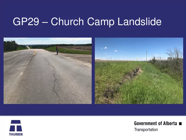
GP29 Church Camp Landslide Church Camp GP29 ~250 m wide and ~200 m - - PowerPoint PPT Presentation
GP29 Church Camp Landslide Church Camp GP29 ~250 m wide and ~200 m in length to the river Ponding water Background The river valley is a pre-glacial valley with drift deposits to about 50m- 100m depth. It is unknown if the
Church Camp GP29
~250 m wide and ~200 m in length to the river Ponding water
100m depth.
seated landslide.
backscarp.
36 m and 3 piezometers
regime
2015 Lidar
deep seated movement
information
6.6 m 6.6 m 11.1 m 6.6 m 36.1 m 51.4 m 51.2 m 51.4 m 39.2m
Gas Well Heads
2 4 6 8 10 12 14/Aug/13 23/Sep/13 2/Nov/13 12/Dec/13 21/Jan/14 2/Mar/14 GROUNDWATER DEPTH (m) DATE FIGURE 17102 PIEZOMETRIC DEPTHS FOR HWY 2:70 11.8 km SOUTH OF RYCROFT
PN17-1A PN17-1B PN17-2A PN17-2B PN17-2C PN17-3B PN17-3C PN17-4A PN17-4B PN17-4C PN17-5A PN17-5B SP17-6 SP17-7 SP17-8 SP17-9
Ground Surface
PN17-3C PN17-3B PN17-4B PN17-4C Frozen
43 m (586.4 m elev.)
SI17-3
44.3 m (586.8 Elev.)
SI17-4
Wasn’t read in January because pneumatics were frozen and stuck inside
Karl’s old SIs
70 m Setback Bridge 110 m Setback Well heads