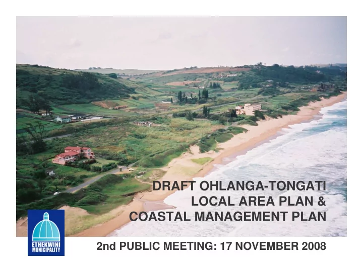
SLIDE 1
DRAFT OHLANGA-TONGATI LOCAL AREA PLAN & COASTAL MANAGEMENT PLAN
2nd PUBLIC MEETING: 17 NOVEMBER 2008
SLIDE 2 WELCOME & INTRODUCTION
Facilitator: Genevieve Hartley
Purpose and objectives of meeting –
1st meeting: 6 October – Strategic planning and
coastal management intentions for the area
2nd meeting: 17 November – Detailed land use and
coastal management guidelines
Ground rules Attendance register and apologies isiZulu Translator available Agenda
SLIDE 3 PROPOSED AGENDA
- 1. Welcome & Introduction
- 2. Project Overview
- 3. Report back on issues raised at first meeting
- 4. Local Area Plan: Land Use Management Guidelines Vicky Sim & Themba
Masimula
- 5. Questions re. LUMS Guidelines
- 6. Coastal Management Plan: Coastal Management Guidelines Andrew
Mather
- 7. Questions re. Coastal Management Guidelines
- 8. City response and general discussion
- 9. Way Forward – opportunity to comment
- 10. Closure
Vicky Sim
SLIDE 4
PROJECT OVERVIEW
SLIDE 5
PROJECT OVERVIEW cont.
Project Managers: Vicky Sim – Local Area Plan Andrew Mather – Coastal Management Plan Consultant team: Cathy Ferguson Town and Regional Planner Futureworks: Tony Markewicz, Nicci Diederichs eThekwini Municipality: Themba Masimula, Gcina Makhubu Project initiated in March 2006
SLIDE 6 PROJECT OVERVIEW cont.
Project Phases:
Phase 1
Strategic Assessment/ Situational Analysis
Phase 2
Role of area and Spatial Framework
Phase 3
Infrastructure implications and phasing of development & Coastal Management Plan
Phase 4
Detailed land use management guidelines
Phase 5
Recommended Actions
Phase 6
Monitoring and review
SLIDE 7 Report Back on Issues Raised at 1st Meeting & Comments
Advertising of meeting:
2nd meeting postponed to allow for time to readvertise:
Press release – 10 November Metro Ezasegagasini – 3 & 14 November Newspapers – North Coast Courier, Coastal Weekly,
Northglen News, Daily News – 10-14 November
Posters at strategic locations in area, libraries Reports at Seatides, Umdloti, Verulam and Tongaat
Libraries
Not possible to put notices in electricity bills Emailed notice to attendees at last meeting and community
- rganisations, interest groups etc.
SLIDE 8
Report Back on Issues Raised at 1st Meeting & Comments
Noise contour maps – 2015 & 2060
SLIDE 9 Report Back on Issues Raised at 1st Meeting & Comments
Proposed M4 realignment: Cost estimate: R627.5 million Cost estimate to upgrade current M4 (excluding environmental costs and loss of opportunity to development coastal precinct): R1.21 billion
(above figures May 2008, and exclude professional fees, topographic survey, materials testing, relocation of services and land acquisitions)
SLIDE 10 Report Back on Issues Raised at 1st Meeting & Comments
Proposed Umdloti Wastewater Treatment Works: Capacity up to 52ML per day to be phased in as 4
upgrades (13ML per upgrade) as required.
Subject to EIA approval – EIA still underway. Estimated operational date: end of 2011/early 2012 Informal settlements: City’s strategy to manage informal settlements Impacts on property values All informal settlements in City’s five year housing
programme, subject to available land
SLIDE 11 VISION for Ohlanga Tongati area:
Dominant roles for the area –
Residential Leisure/tourism Commercial to support the
above
Area to play a supporting
role to new International airport & Dube Tradeport
Underpinned by importance
support these roles
SLIDE 12 Land Use Management Guidelines
Purpose: to translate the strategic spatial framework
and coastal management guidelines into detailed land use management guidelines
These guidelines should be the day-to-day working
documents used by:
Municipal town planning staff to assist with their
assessment of development applications
Developers to determine the Municipality’s requirements
for development
Main LUM Guidelines doc Precinct Guidelines for each precinct
SLIDE 13 Land Use Management System
LUMS: a suite of tools for managing land
development in the LAP area.
Scheme : a tool used by a municipality to manage
development according to the vision, strategies and policies of the Integrated Development Plan & Spatial Development Framework to promote sustainable development
LAP area has two schemes
- Tongaat Scheme
- Umdloti Scheme
SLIDE 14
SLIDE 15
SLIDE 16
Land Use Management Guidelines
Purpose: To translate strategic Spatial
Planning Framework & coastal management into Land Use Management Guidelines which will inform the review of the relevant schemes, and extension of these schemes over the rest of LAP area
SLIDE 17
General Guidelines
Residential Development – density and urban
design
Mixed Use Development Nodes Recreational Nodes Coastal Development
SLIDE 18
Land Use & Activity Planning Framework
SLIDE 19 General Guidelines for Residential Development
DENSITY DESCRIPTION/DENS ITY EXAMPLE OF DENSITY TYPE AERIAL EXAMPLES Low density Single house on an individual site > 650m2 5-10 du/ha Durban North, La Mercy and Westbrook suburbs Medium density Single or double storey attached or detached units on a single site 10-25 du/ha Sunningdale and parts
High density Comprises flats >3 storeys >25du/ha Residential around Musgrave Centre, Albert and Umdloti North
SLIDE 20
Land Use & Activity Planning Framework
SLIDE 21 General Guidelines for Mixed Use Development Nodes
Metropolitan nodes
Provide highly
accessible shopping and entertainment facilities for a metropolitan area, high density residential and office/business park
Possible zones;
Commercial, General Business & Mixed Use
Examples: Umhlanga Ridge including Gateway shopping centre, residential, hotel and business park development
SLIDE 22 General Guidelines for Mixed Use Development Nodes
District nodes
Provide highly
accessible shopping and entertainment facilities for a district with high density residential
Possible zones; General
Commercial & Mixed Use
Examples: La Lucia Mall, Montclair Mall
SLIDE 23 General Guidelines for Mixed Use Development Nodes
Local nodes
To provide accessible
shopping facilities for the population within a local area or neighborhood
Largely serves a local
population who live within a short car journey of the centre
Possible zones: General
Commercial 2
Examples: Umdloti, Broadway, Davenport Centre
SLIDE 24
Land Use & Activity Planning Framework
SLIDE 25 General Guidelines for Recreational Nodes
Type of node Statement of intent Threshold, location, land use Possible zones Examples
node
Medium to High intensity recreation nodes To provide recreational facilities for local residents, metropolitan residents & tourists Serve the wider metropolitan area Beach Zone Durban Beach, Umdloti & Westbrook Low intensity recreation nodes To provide recreational facilities for local residents and tourists Serve the local population and tourists Beach Zone La Mercy Lagoon Picnic area Ecologically sensitive recreation nodes To provide recreational facilities for local residents and tourists Serve local population and tourists Beach Zone Hawaan Forest
SLIDE 26 Coastal Residential Development Guidelines
Coastal policy and legislation stress the need for sustainable and sensitive approach to coastal development ENVIRONMENTAL CONSIDERATIONS:
- EIA regulations – development within
100m of the high water mark (zoned)/ 1km (unzoned) requires EIA
- Coastal erosion line – impact of 1:50
year storm combined with sea level rise.
- Beach shadow line policy – no
shadows on swimming beaches prior to 3pm mid winter. High Water Mark
Approx 100m
Coastal erosion line
SLIDE 27 Coastal Residential Development Guidelines
- eThekwini Environmental Services
Management Plan To protect and secure the full range of environmental goods and services provided by our natural heritage
- seek input from Environmental
Management Department
- n certain properties development may
not be possible
- Stormwater Management
- need to manage increased stormwater
flows as a result of hardened surfaces
- stormwater management plans
- impacts of run-off from M4 onto
eastern coastal properties
- Soakpits
- For stormwater management - subject
to soil profile & slope stability
SLIDE 28 Coastal Residential Development Guidelines
- Flood Lines
- No development within 1:100
year floodline
- Setbacks and buffers
- Compatible land uses
- Wetlands
- Need to be delineated
- Retain and rehabilitate
- Comply with EIA regulations
- Forests and protection of
trees
- Consult with Environmental
Management Dept
- Geotechnical Assessment
- Bluff Slopes Controlled Areas
- Geotechnical Assessment
required in these areas
SLIDE 29 Coastal Residential Development Guidelines
Rehabilitation
- Coastal environment
- Soften visual impacts of
development
- Indigenous planting
- Construction Management
- EMP required
- Sand winning/ mining
- No sand winning without
consent from Municipality and DME and EIA authorisation
SLIDE 30 Development Guidelines for Coastal Areas
VISUAL AND ARCHITECTURAL CONSIDERATIONS
- Visual perspectives
- Viewsheds and vistas of
coastline, ocean, dune forests and estuaries
- Important part of tourist/leisure
and residents’ experience of this unique coastal environment
complement this environment and permit unobstructed views
- Visual perspectives of multi-unit
developments especially from M4 east to sea and adjacent to estuaries
SLIDE 31 Development Guidelines for Coastal Areas
VISUAL AND ARCHITECTURAL CONSIDERATIONS
Architectural
considerations
Protect aesthetic and
ecological characteristics
Design & built form in
harmony with coastal location
Use of natural colours,
materials, natural form, permeable fencing, landscaping etc
SLIDE 32
Appropriate architectural design
SLIDE 33
Appropriate architectural design
SLIDE 34
Inappropriate architectural design
SLIDE 35
Precinct Guidelines
SLIDE 36
Precinct Guidelines
Statement of intent Existing Town Planning Scheme Precinct size, existing and proposed
development
Existing & proposed nodes Environmentally significant areas Residential components Land use issues & challenges
SLIDE 37 Precinct Guidelines: Westbrook Beach
Retain existing zoning of individual sites but should consider densification on larger lots once sewerage issues resolved. Rehabilitate wetland Rezone to Open Space or Govt & Mun. Precinct Plan for recreational node Retain Forest, including Special Zone No further densification Local Node – rezone to align with current development proposals (GR1/Commercial with height restriction to 6 storeys) Rezone to GR1
SLIDE 38 Precinct Guidelines: Westbrook Hinterland
Buffer Estuary and Protect views Set backs from valley lines, streams and wetlands Mix of residential lifestyles – higher density along Watson Highway and M4; low density along estuary
SLIDE 39 Precinct Guidelines: Tongaat Beach
Possible high density and hotels Retain forested areas Precinct plan for recreational node Retain open space zoning to protect dune cordon
Precinct Plan recommended for Casuarina Beach – recreational node
SLIDE 40 Precinct Guidelines: Tongaat Beach cont.
Rezone to
Retain existing GR1 Zoning – 6 stories
Retain existing GR1 Zoning – 6 stories.
Allow GR1 Zoning – 6 stories Encourage a mix of residential and commercial and restrict height to 6 stories.
Retain existing GR2 Zoning – 2 storey. Allow B&Bs and Boutique Hotels by Special Consent. See coastal res. guidelines. Restrict development to west of South Beach Rd. Medium intensity recreational node
Existing GR2 Zoning; subject to flooding rezone to Open Space and investigate acquisition by the Municipality Retain as Open Space and investigate acquisition by the Municipality
Rezon e to Open Space
Precinct Plan/urban design for Precinct & along M4
SLIDE 41 Precinct Guidelines: Tongaat Beach Hinterland
Potential sub- metro, district and local nodes Mixed residential densities – low near estuary, high at nodes and along M4 realignment
SLIDE 42 Precinct Guidelines: Umdloti Beach
Retain existing forest
No further densification. B&Bs in line with existing zoning.
No further densification
Back of beach parking and shuttle feasibility urgently required. Beach related restaurants and shops may be considered if parking resolved.
Mix of low to high densities in underdeveloped western area – low adjacent to estuary, higher at interchanges/ along major routes
SLIDE 43 Precinct Guidelines: Umdloti Beach Hinterland
Potential sub- metro, & district nodes Mixed residential densities – low near estuary, high at nodes and along M4 realignment
SLIDE 44 Precinct Guidelines: Sibaya
Sibaya Entertainment Node Potential sub- metro, & district nodes Mixed residential densities – low near estuary/ wetlands, high at nodes and along M4 realignment Visual impact on estuary – development to be sensitively designed
SLIDE 45
Recommended Actions
Precinct Plan/s for coastal strip - La Mercy
and Casuarina Beach
M4 realignment Amendments to Town Planning Scheme Extension of Scheme over whole area to
facilitate development – zone Undetermined
Social and Community Facility Study Design of local road network – west of
current M4
SLIDE 46
QUESTIONS & COMMENTS
Do you have any questions or comments related to the Land Use Management Guidelines?
SLIDE 47
COASTAL MANAGEMENT PLAN: KEY STRATEGIC INFORMANTS
Proposed Integrated Coastal Management
Act
Draft KZN Provincial coastal policy eThekwini draft Coastal Management
Strategy
SLIDE 48
PURPOSE OF COASTAL MANAGEMENT PLANS
“to ensure responsibility, accountability, consistency and continual improvement in the standard of coastal management”
SLIDE 49
- 1.Assessment of area precincts – coastal risks,
features, facilities, activities & management
- 2.Coastal vision & inputs of coastal zonings and
controls into LUM Guidelines (LAP)
- 3.Development and Management Strategies for the
coastal zone.
COASTAL MANAGEMENT PLAN Phases:
SLIDE 50 The vision for the Ohlanga-Tongati coast is a future sustainable development path that:
Maximises the economic and social
development potential of this high-value stretch of coast.
Protects, enhances and expands the coastal
asset / resource base such that coastal amenity, character, productivity and environmental service supply is maximised.
SLIDE 51
Inherent risks - directly associated with the
fact that the coast forms the interface between two major biophysical systems: the land and the sea.
Introduced risks - directly associated with
human activities, built facilities, infrastructure or types of land / ocean use that have associated human or environmental risk.
Coastal management is primarily about addressing potential risks and threats to coastal integrity and character in a way that will minimise negative impacts and maximise positive impacts and opportunities.
SLIDE 52 Beach Erosion, Sea Level Rise & Land Instability Point Source Pollution: Sewage Pumpstations, WWTW & Stormwater Outfalls Air Transport Routes & Airport: Potential Air Disasters & Air Pollution Road Transport Routes: Potential Spills & Air Pollution Shipping Route: Potential Shipping Disasters Poor Catchment Management Human access to coastal assets
Summary of coastal risks
SLIDE 53
Tools to be discussed:
Coastal Management Plans Shoreline Management Plans Estuary Management Plans
SLIDE 54
Coastal Management Plans Tongaat beach example
SLIDE 55 Assessment Summary
Roles (functions that this sector of coast can perform)
- Local & regional (Casaurina Beach, La Mercy Beach) beach
access points.
- Residential & hospitality associated with King Shaka Airport.
- Coastal lifestyle opportunities: residential & leisure.
- Forests provide major stability to steep dunes / potential erosion
areas.
- Estuary regulates silt flows / beach sediment supplies.
- Ocean, estuaries major diluters & assimilators of pollution, waste.
Coastal Use Vision
Use/Activity Zoning (Preferred uses and activities for the Sector)
- Control development set-backs from estuaries & beachfront to
consider sea erosion, estuary bank erosion, future sea level rise implications & need to protect access to beaches & estuaries for
- recreation. No further development or fencing of the foredune
zone should be allowed.
- Control development set-backs from wetlands & forests to extend
& enhance natural asset base throughout the precinct.
- Maintain & enhance visual & sense of place amenity along
forested access roads (e.g. M4, beach road)
- Prevent development on / near oversteep or unstable dune areas.
SLIDE 56 Key Issues (Summary of concerns raised by stakeholders)
- Conversion / development & fencing of dune cordon & tertiary dune slopes.
- Illegal / poorly serviced beach accesses through dune cordon.
- Beach & dune erosion due to high energy coast & infrastructure in / near beach erosion line
(including dune blow-outs).
- Limited & fragmented natural asset base – needs to be expanded, enhanced & rehabilitated.
- Umdloti catchment issues: water quality, accelerated flooding & high silt loads caused by
upstream land uses.
- Limited available capacity for additional wastewater effluent discharge into Umdloti estuary as
a result of ecological reserve requirements (future development limitation).
- Stormwater discharge onto beaches with visual impacts, pollution & health risks.
- High value agricultural land under pressure for development.
- Accelerated stormwater outflows from vegetable & sugar cane farms, with high silt &
agrochemical outputs.
- Noise & air pollution associated with N2, M4 & King Shaka Airport.
- M4 bridge causing change in estuarine flow & sediment movement patterns.
Assessment Summary
Risks
(loss of, or hazard to, human life / loss or damage to irreplaceable
assets/resourc es)
- Sea level rise aggravating erosion of the coastline & increased flood levels in estuary areas.
- Shipping disasters.
- Landfill site – potential groundwater pollution.
- Informal settlement with land instability risk, possible water pollution & stomrwater impacts.
- Wastewater pumpstations along dune cordon with high risk of spills, ecological impacts,
health risk, odour & amenity impacts.
- Spills at M4 bridges causing ecological impacts to estuaries.
- Aquatic & terrestrial weed invasions.
- Uncontrolled fire associated with sugar cane.
- Siltation / disturbance of estuarine structure or function as a result of catchment land uses /
disasters.
SLIDE 57 DEVELOPMENT RESPONSES (Key Development Projects/Programmes) Responsibility
D1: Establish formalised and controlled pedestrian beach accesses through dune cordon throughout the precinct, and close off illegal access points. EM (Parks, Leisure & Cemeteries) D2: Upgrade storm water outfalls along beaches to reduce visual impacts & pollution risk. EM (Coastal, Stormwater & Catchment Management) D3: Implement additional / failsafe measures to prevent spillage of sewage from pumpstations to beaches. EM (Wastewater Management) D4: Implement dune rehabilitation at all blow-outs, and areas where foredune has been removed (including beach access parking areas). EM (Parks, Leisure & Cemeteries) D5: Establish additional formal parking areas for beach access behind foredune. EM (Parks, Leisure & Cemeteries; Roads) D6: Wetlands & forests rehabilitation programme to be implemented as part of development roll-out in the precinct. Landowners / developers Coastal Development and Management Responses D7: Relocate or upgrade informal settlements that pose a risk to coastal amenity. EM (Housing)
SLIDE 58 STRATEGIC MANAGEMENT (Urgent and or long term management interventions/actions) Responsibility
SM1: Investigate sustainable sewage management alternatives for coastal zone that minimise risk of sewage spills & discharge of substandard effluent to coastal zone. EM (Coastal, Stormwater & Catchment Management; Wastewater Management; Environmental Management) SM4: Prepare Shoreline Management Plan. EM (Project Exec: Coastal Policy; Coastal Stormwater & Catchment Management) SM10: Prepare Estuary Management Plan for Umdloti estuary to include:
- Monitoring of estuary health
- Alien plant control programme.
- Fire / burning management programme on floodplains.
- Recreational use of estuary (no motorised craft, fishing
bag limits).
- Disaster management plan for spills on N2 / M4 that may
affect estuary.
- Links to Catchment Management Plan (controlling
upstream impacts). Links to upstream Wastewater Treatment Works Disaster Management Plan & Monitoring Programmes. EM (Environment Management; Coastal, Stormwater & Catchment Management); EKZNWildlife; DAEA MCM
SLIDE 59
Coastal erosion and setback
SLIDE 60
Shoreline Management Plans
Why a Shoreline Management Plan? A Shoreline Management Plan (SMP) sets out to produce a sustainable policy for the coastal defense of our shoreline, taking into account natural coastal processes and issues relating to the environment and human needs.
SLIDE 61 What is a Shoreline Management Plan?
The Shoreline Management Plan will focus and provide three principal policy options for consideration at management level. These relate to the movement of the shoreline as follows:
Do nothing Hold the existing line Retreat
SLIDE 62
Shoreline Management Plans
This will provide the strategic framework in which all coastal structures and sea defenses are evaluated.
SLIDE 63
Estuary Management Plans
SLIDE 64 Estuary Management Plans
Objective 1: Situation Assessment
A review of all existing local information in the
form of local research reports and management processes.
A map of the estuary should be developed
identifying different habitats and potential and existing management zones. The map should identify and record all developments in at least a 500m zone surrounding the estuary. The possible direct impacts of these and other local developments should be noted.
SLIDE 65 Estuary Management Plans
Objective 2: Estuary Management Plan (EMP) Develop a Vision and Strategic Objectives for each
estuary
Develop a range of Management Strategies to
achieve the Vision and Objectives
Prepare an Estuarine Zonation Plan and
Operational Objectives based on the above
Identify Management Action Plans (MAPs) to
achieve all strategies and operational objectives including implementation procedures
Develop a monitoring and evaluation programme
including a description of a process for reviewing the EMP
SLIDE 66
Do you have any questions or comments on the Coastal Management Guidelines?
SLIDE 67
DISCUSSION: QUESTIONS & COMMENTS
SLIDE 68 WAY FORWARD
- Opportunity to provide written comments:
- Copies of reports:
Local libraries: Umdloti, Seatides, Tongaat, Verulam eThekwini website:
http://www.durban.gov.za/durban/government/munadmin/ planning/projects
Comment sheets available: Complete them here OR Fax: 031-3117279 OR Email: Kajal Singh at singhkaj@durban.gov.za Closing date for comments: 15 December 2008
- Review of Plans based on comments received
- Third public meeting in 2009
- Approval by Council
SLIDE 69
CLOSURE
THANK YOU FOR ATTENDING THE MEETING. YOUR INPUT IS APPRECIATED.