SLIDE 1
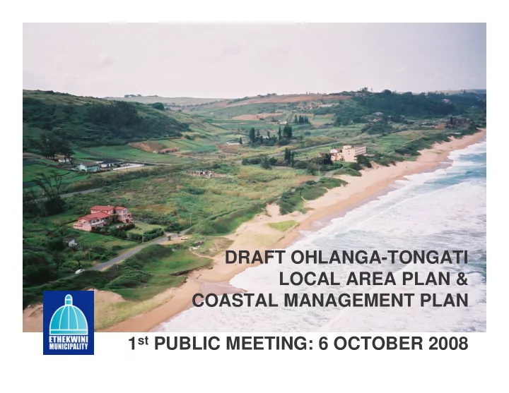
DRAFT OHLANGA-TONGATI LOCAL AREA PLAN & COASTAL MANAGEMENT PLAN 1st PUBLIC MEETING: 6 OCTOBER 2008
SLIDE 2 WELCOME & INTRODUCTION
Facilitator: Genevieve Hartley
Purpose and objectives of meeting –
- 1st meeting: 6 October – Strategic planning and coastal
management intentions for the area
- 2nd meeting: 20 October – Detailed land use and coastal
management guidelines
Ground rules Attendance register and apologies isiZulu Translator available Agenda
SLIDE 3 PROPOSED AGENDA
- 1. Welcome & Introduction
- 2. Project Overview
- 3. Local Area Plan: Strategic Assessment
- 4. Local Area Plan: Spatial Framework
- 5. Coastal Management Plan: Strategic Assessment &
Coastal Vision Andrew Mather
- 6. Question and Answer Session
- 7. Way Forward – opportunity to comment
- 8. Closure
Vicky Sim
SLIDE 4 PROJECT OVERVIEW
Ohlanga-Tongati Context:
Strategic location of the
area - east of new International Airport & Dube Tradeport
High value coastal land –
largely undeveloped and unzoned
Development pressures Infrastructure constraints Environmental
considerations
SLIDE 5 PROJECT OVERVIEW cont.
Purpose of Local Area Plan:
- Framework for management of
development and land use
- Direction and certainty
- Vision with respect to land uses and
settlement densities to integrate with the transportation and infrastructure planning
- LAP seeks to translate intentions of
higher order plans into a greater level
- f detail at the local level, and thereby
to inform the Land Use Management System for the area.
Purpose of Coastal Management Plan:
- Sensitive coastal and estuarine
environment
- Manage activities in coastal zone
- Required in terms of draft eThekwini
Coastal Management Strategy
- Opportunity for alignment between
land use planning and coastal management
Corporate Strategy/Policy Long Term Development Framework Integrated Development Plan Spatial Development Framework Spatial Development Plan Local Area Plan Precinct / Special Area Plans Land Use Schemes Development Plans
SLIDE 6
PROJECT OVERVIEW cont.
Project Managers: Vicky Sim – Local Area Plan Andrew Mather – Coastal Management Plan Consultant team: Cathy Ferguson Town and Regional Planner Futureworks: Tony Markewicz, Nicci Diederichs eThekwini Municipality: Themba Masimula, Gcina Makhubu Project initiated in March 2006
SLIDE 7 PROJECT OVERVIEW cont.
Project Phases:
Strategic Assessment/ Situational Analysis
Role of area and Spatial Framework
Infrastructure implications and phasing of development & Coastal Management Plan
Phase 4
Detailed land use management guidelines to inform scheme revision
Phase 5
Recommended Actions
Phase 6
Monitoring and review
Submission of draft reports to Economic Development Committee
- approval to proceed with public process – June 2008
SLIDE 8 PROJECT OVERVIEW cont.
Public participation process:
Originally to be undertaken during the project Uncertainties with regard to the EIA for the new international
airport, and consequently, planning for the Northern Area, services provision etc.
Therefore public process delayed until there was more clarity
with regard to these issues.
Traffic modelling and studies also took some time to complete
as we tested certain proposals of the LAP.
However, ample opportunity to provide input into the process:
LAP/CMP are draft documents.
Purpose of the public process is to now obtain public
comment on the documents prior to their submission to Council for final approval.
SLIDE 9
STRATEGIC ASSESSMENT
Key components:
Land use assessment Social, economic and spatial trends &
pressures
Environmental assessment Infrastructure assessment
SLIDE 10 Land Use Assessment:
- 11% of study area is developed, 16% undeveloped and 65%
under sugar cane (predominantly west of the M4).
- Settlement pattern towards coastline – land zoned in terms of
Umdloti and Tongaat Beach Town Planning Schemes
- Mix of higher densities along the coastline at Umdloti, La
Mercy and Westbrook, with suburban densities west of M4
- Almost 5,000 units in the area (including informal settlements)
- Development trends & pressures – seek to almost double
existing development:
- Development applications from 2000 – 2006 = 2,380 units
applied for
- Sibaya Nodes 1 & 5 (current EIA & rezoning) = 2,325 units
and 235 hotel rooms
STRATEGIC ASSESSMENT (cont.)
SLIDE 11
SLIDE 12
SLIDE 13
SLIDE 14
STRATEGIC ASSESSMENT (cont.)
SLIDE 15
Trends & Pressures
SLIDE 16 STRATEGIC ASSESSMENT (cont.)
Environmental Assessment:
- 1. Key issues/constraints:
- Poor quality water in estuaries
- Limited & fragmented coastal biodiversity
- Limited capacity of coastal environment to
sustain high demand for recreational access and use
- High energy and eroding coastline
- Sea level rise
- 2. Opportunities:
- High quality coastal zone –
recreation/residential use
- Coastal forest & estuaries – high visual
amenity & biodiversity refuge value
- Opportunity still exists to buffer
environmental resource through careful planning
SLIDE 17 Special coastal and estuarine landscape character
SLIDE 18 Infrastructure Assessment:
- 1. Roads:
- M4 currently operating below capacity, except
for south of the M27 (to Verulam)
- N2 below capacity in the area, predominantly
north of M27
- Impact of heavy vehicles on M4 slowing traffic
- 2. Sanitation:
- Limited treatment works capacity at both
Genazzano and Umdloti Treatment Works.
- Development currently limited to zoned land
- nly; no rezonings or extensions of the Town
Planning Scheme can be permitted as waterborne sewerage cannot be provided.
- Reserve determinations for the Umdloti and
Tongati Rivers have indicated that these estuaries are able to accept further treated effluent.
- Therefore an EIA is underway for new
treatment works on the Umdloti River, which will ultimately replace these two existing treatment works.
STRATEGIC ASSESSMENT (cont.)
SLIDE 19 SPATIAL PLANNING FRAMEWORK
VISION for Ohlanga Tongati area: Dominant roles for the area –
Residential Leisure/tourism Commercial to support the
above
Area to play a supporting
role to new International airport & Dube Tradeport
Underpinned by importance
support these roles
SLIDE 20 SPATIAL PLANNING FRAMEWORK (cont.)
Four key planning frameworks/strategies:
Environmental Planning Access and Movement Land Use and Activity Landscape Strategy
SLIDE 21
Environmental Planning Framework
SLIDE 22
Land Use & Activity Planning Framework
SLIDE 23 Land Use & Activity Planning Framework (cont.)
Density Strategy:
- Capacity for approximately 24,000 additional units in study area.
Based on private transport model.
- Gross density 6 units/ha
- Nett densities ranging from 5 to 30 units/ha
- Densities dependent on location:
- Lower densities adjacent to core open space assets
- Medium density between lower and higher (suburban)
- Higher densities along primary transport routes (ultimately public
transport corridors), within mixed use nodes and in areas already zoned for higher densities (e.g. Umdloti, La Mercy and Westbrook beach).
SLIDE 24
Precincts & Neighbourhoods
SLIDE 25
Potential noise impact from new international airport
SLIDE 26
Access & Movement Planning Framework
SLIDE 27 Access & Movement Planning Framework
Proposed realignment of M4 - rationale:
- Provide increased road based access capacity in long term (+10
years)
- Open up the western hinterland for development
- Create opportunities for mixed use development and recreation
along the coast through the downgrading of the current M4 to a coastal collector and access road.
SLIDE 28 Access & Movement Planning Framework (cont.)
Two studies to test M4 realignment proposal have been completed:
1.
Optimum route location of realigned M4
2.
Viability of upgrading current M4 to accommodate densities proposed in LAP. Realignment of M4 is still preferred option due to range of impacts (especially environmental), costs and opportunity costs associated with upgrading in current alignment.
NOTE: This issue is still subject to broader transportation planning for the Northern area of the city, in particular with respect to public transport.
SLIDE 29
Landscape Strategy
SLIDE 30 Spatial Planning Framework / Phasing
Precinct Framework – broad planning
guidelines for each precinct:
Precinct role Guidelines – land use, access and movement,
settlement character and environment
Development Phasing
To be undertaken at broader Northern SDP level
and will then be applied to LAP area.
SLIDE 31
COASTAL MANAGEMENT PLAN: KEY STRATEGIC INFORMANTS
Proposed Integrated Coastal Management
Act
Draft KZN Provincial coastal policy eThekwini draft Coastal Management
Strategy
SLIDE 32
PURPOSE OF COASTAL MANAGEMENT PLANS
“to ensure responsibility, accountability, consistency and continual improvement in the standard of coastal management”
SLIDE 33
- Assessment of area precincts – coastal risks,
features, facilities, activities & management
- Coastal vision & inputs of coastal zonings and
controls into LUM Guidelines (LAP)
- Development and Management Strategies for the
coastal zone.
COASTAL MANAGEMNT PLAN Phases:
SLIDE 34
COASTAL MANAGEMENT PLAN
SLIDE 35 The vision for the Ohlanga-Tongati coast is a future sustainable development path that:
Maximises the economic and social
development potential of this high-value stretch of coast.
Protects, enhances and expands the coastal
asset / resource base such that coastal amenity, character, productivity and environmental service supply is maximised.
SLIDE 36
Strategic aspects of the coast that underpin this vision are:
Environmental - The study area contains a
portion of the national coastal corridor, and the area is thus of national significance.
Economic - The spatial relationship of the
study area with the key development and activity nodes of Dube Trade Port, King Shaka Airport and the N2 corridor dictate the strategic role of the study area for high value residential, tourism and commercial development.
SLIDE 37 Strategic aspects of the coast that underpin this vision are
Physical
The high energy eroding coastline, the sensitive and fragile condition of the coastal dune systems
Social
Limited access points to the beach result in very limited opportunities for the establishment of major tourist or mass recreation facilities.
SLIDE 38
COASTAL RISKS
Inherent risks - directly associated with the
fact that the coast forms the interface between two major biophysical systems: the land and the sea.
Introduced risks - directly associated with
human activities, built facilities, infrastructure or types of land / ocean use that have associated human or environmental risk.
Coastal management is primarily about addressing potential risks and threats to coastal integrity and character in a way that will minimise negative impacts and maximise positive impacts and opportunities.
SLIDE 39
Inherent Risks
Sea Level Rise (associated with global
climate change )
Beach / Coastal Erosion (ongoing natural
process, not specifically associated with sea level rise)
Land Instability
SLIDE 40 Climate Change and sea level rise
y = 0.00022x + 0.15656
0.2 0.4 0.6 1970 1971 1972 1973 1974 1975 1976 1977 1978 1979 1980 1981 1982 1983 1984 1985 1986 1987 1988 1989 1990 1991 1992 1993 1994 1995 1996 1997 1998 1999 2000 2001 2002 2003 Years M onthly m ean tide levels
SLIDE 41
Need for realignment of M4
SLIDE 42 Inherent Risks
Sea Level Rise (associated with global
climate change
Beach / Coastal Erosion (ongoing natural
process, not specifically associated with sea level rise
Land Instability
SLIDE 43 Introduced Risks
Poor / Lack of Catchment Management Transport Routes: Air, Road and Shipping
SLIDE 44 Introduced Risks
Sewage Transfer and Disposal (to groundwater,
estuaries and sea).
Stormwater Discharge (to beaches, sea,
estuaries)
SLIDE 45 Beach Erosion, Sea Level Rise & Land Instability Point Source Pollution: Sewage Pumpstations, WWTW & Stormwater Outfalls Air Transport Routes & Airport: Potential Air Disasters & Air Pollution Road Transport Routes: Potential Spills & Air Pollution Shipping Route: Potential Shipping Disasters Poor Catchment Management Human access to coastal assets
Summary of coastal risks
SLIDE 46
Tools which will be discussed at the next meeting
Coastal Management Plans Shoreline Management Plans Estuary Management Plans
SLIDE 47 CONCLUSION
CMP will soon be a legal requirement The CMP is to provide strategic direction to
managing the coast
SLIDE 48
DISCUSSION: QUESTIONS & COMMENTS
Do you have any questions or comments?
SLIDE 49 WAY FORWARD
Opportunity to provide written comments:
Copies of reports:
Local libraries: Umdloti, Seatides, Tongaat, Verulam eThekwini website:
http://www.durban.gov.za/durban/government/ munadmin/planning/projects
Comment sheets available: Complete them here OR
Fax: 031-3117279 OR Email: simv@durban.gov.za
Closing date for comments: 31 October 2008
Second public meeting: Monday 20 October 2008;
La Mercy Community Hall, Everest Drive, La Mercy
SLIDE 50
CLOSURE
THANK YOU FOR ATTENDING THE MEETING. YOUR INPUT IS APPRECIATED.