
SLIDE 1
Coastside County Water Districting Overview
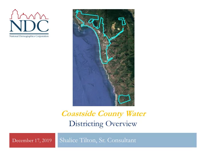
December 17, 2019
Districting Overview Shalice Tilton, Sr. Consultant December 17, - - PowerPoint PPT Presentation
Coastside County Water Districting Overview Shalice Tilton, Sr. Consultant December 17, 2019 California Voting Rights Act (CVRA) 2 Under the Federal Voting Rights Act (passed in 1965), a jurisdiction must fail 4 factual tests before it is
December 17, 2019
December 17, 2019
Under the Federal Voting Rights Act (passed in 1965), a jurisdiction must fail 4 factual
tests before it is in violation of the law.
The California VRA makes it significantly easier for plaintiffs to force jurisdictions into
“by-district” election systems by eliminating two of the US Supreme Court Gingles tests:
(crossed-out tests are Federal Tests that plaintiffs no longer have to prove to show a violation of the California law)
1.
Can the protected class constitute the majority of a district?
2.
Does the protected class vote as a bloc?
3.
Do the voters who are not in the protected class vote in a bloc to defeat the preferred candidates of the protected class?
4.
Do the “totality of circumstances” indicate race is a factor in elections?
Liability is now determined only by a statistical test for a correlation (not causation)
between ethnicity and voting
2
No jurisdiction has successfully fought a
CVRA lawsuit
Palmdale, Santa Clara and Santa Monica
fought “on the merits.” All lost.
Santa Monica and Santa Clara are appealing. Palmdale spent about $1.8 million, Santa Clara
about $800,000, and Santa Monica between $5 and $8 million, just on their defense.
Santa Monica plaintiffs requested $22 million No jurisdiction has won a case.
Key settlements: Palmdale: $4.7 million Santa Clara: $3.16 million Modesto: $3 million Highland: $1.3 million Anaheim: $1.1 million Whittier: $1 million Santa Barbara: $600,000 Tulare Hospital: $500,000 Compton Unified: $200,000 Madera Unified: about $170,000 Hanford Joint Union Schools:
$118,000
Merced City: $42,000 December 17, 2019
3
Switched (or in the process of switching) as a result of CVRA:
At least 215 school districts 34 Community College Districts 126 cities
For comparison, before passage of CVRA only 29 California cities used by-district elections.
With all of the CVRA-driven changes we have gone from 29 to over 150 cities
1 County Board of Supervisors 35 water and other special districts.
December 17, 2019
4
5
December 17, 2019
Step Description Two Initial Hearings
Held prior to release of draft maps. Education and to solicit input on the communities in the City. Hearings on Draft Maps
Two meetings to discuss and revise the draft maps and to discuss the election sequencing. Final Hearing and Adoption
Final public hearing; selection of map and election year sequence; Board adoption. Election Day: November 2020 First by-division elections held. Adjust Maps: 2021 Map adjusted using 2020 Census data Election Day: November 2022 First by-division election held in remaining divisions.
Equal Population Federal Voting Rights Act No Racial Gerrymandering Communities of interest Compact Contiguous Visible (Natural & man-made)
Respect voters’ choices /
Planned future growth
(2021 consideration)
Federal Laws Traditional Redistricting Principles
6
December 17, 2019
Category Field Count Pct Category Field Count Pct Total Pop 17,845 ACS Pop. Est. Total 19,769 Hisp 5,225 29% age0-19 4,407 22% NH White 11,348 64% age20-60 9,812 50% NH Black 148 1% age60plus 5,550 28% Asian-American 889 5% immigrants 4,727 24% Total 13,598 naturalized 2,193 46% Hisp 2,278 17% english 12,722 68% NH White 10,010 74% spanish 4,561 24% NH Black 59 0% asian-lang 513 3% Asian/Pac.Isl. 943 8%
875 5% Total 11,182 Language Fluency Speaks Eng. "Less than Very Well" 2,858 15% Latino est. 1,515 14% hs-grad 5,412 37% Spanish-Surnamed 1,361 12% bachelor 4,089 28% Asian-Surnamed 305 3% graduatedegree 3,062 21% Filipino-Surnamed 158 1% Child in Household child-under18 1,680 24% NH White est. 9,191 82% Pct of Pop. Age 16+ employed 10,807 66% NH Black 65 1% income 0-25k 681 10% Total 8,711 income 25-50k 844 12% Latino est. 950 11% income 50-75k 803 11% Spanish-Surnamed 853 10% income 75-200k 2,870 40% Asian-Surnamed 231 3% income 200k-plus 1,902 27% Filipino-Surnamed 106 1% single family 6,473 85% NH White est. 7,396 85% multi-family 1,186 15% NH Black 53 1% rented 2,012 28% Total 9,386
5,088 72% Latino est. 1,128 12% Spanish-Surnamed 1,014 11% Asian-Surnamed 229 2% Filipino-Surnamed 117 1% NH White est. 7,738 82% NH Black est. 45 0% Housing Stats Household Income Education (among those age 25+) Total Pop Immigration Citizen Voting Age Pop Age Voter Registration (Nov 2018) Voter Turnout (Nov 2018) Voter Turnout (Nov 2016) Language spoken at home
February 20, 2018
7
Each of the 5 zones must contain about 3,569 residents.
Total population data from the 2010 Decennial Census. Surname-based Voter Registration and Turnout data from the California Statewide Database. Latino voter registration and turnout data are Spanish-surname counts adjusted using Census Population Department undercount estimates. NH White and NH Black registration and turnout counts estimated by NDC. Citizen Voting Age Pop., Age, Immigration, and other demographics from the 2013-2017 American Community Survey and Special Tabulation 5-year data.
February 20, 2018
8
There are three distinct pockets of relatively dense population, with sparsely populated areas in between.
11,317 in Half Moon Bay (enough for 3.17 zones). 6,528 not in the city (enough for 1.83 zones). North: 4,893 (1.37 zones) Central: 6,869 (1.92) South: 2,651 (0.74) Other: 3,432 (0.96) Some zones will have to stretch/link between the population concentrations.
3 people in southern non- contiguous portion (not shown)
February 20, 2018
9
Latinos are particularly concentrated around the Hwy 1 / San Mateo Rd (Hwy 92) intersection, and in the south along Miramontes Rd.
December 17, 2019
1st Question: what is your neighborhood or community of interest?
A Community of Interest is generally defined as a neighborhood or community of shared interests, views, problems, or characteristics.
Possible community feature/boundary definitions include:
School attendance areas
Natural neighborhood dividing lines, such as highway or major roads, rivers, canals, and/or hills
Areas around parks and other neighborhood landmarks
Common issues, neighborhood activities, or legislative/election concerns
Shared demographic characteristics
Such as similar levels of income, education, or linguistic isolation
10
December 17, 2019
2nd Question: Does a Community of Interest want to be united in one district, or to be divided to have a voice in multiple elections?
11
December 17, 2019
12
Glendale Unified
Compton
Examples of highly compact maps that keep regions and communities united, with nooks and jogs driven only by equal population requirements.
December 17, 2019
13
Central Unified
Pasadena
Colorado Blvd.
Examples of maps where a desire to have all members touch downtown (Pasadena) or rural areas (Central), or as many neighborhoods as possible (South Pas), led to policy-driven but non-compact maps.
December 17, 2019
December 17, 2019
15
1.
2.
Some felt the Canada Cove mobile home park should not be with the significantly different, though adjacent, Ocean Colony
But other Councilmembers preferred the much more compact approach of Canada Cove with Ocean Colony
3.
4.
Except one pairing required in any 4-district map
December 17, 2019
16
Only map to include two “pairs” of Councilmembers (D3 and D4). Most-compact map, but uses shopping mall to reach western population for D3. Also highly compact, but note western D3’s odd shape.
December 17, 2019
17
Bringing D3 south enables a more-compact center-city. Alternative version with D3 coming south to Canada Cove. D3 picks up east side of Hwy 1, but not Canada Cove.
August 21, 2018
18
101 modified to avoid using the shopping center as a D3 ‘bridge.’ After resulting rotation
D3 crosses Hwy 1 below Grove St.
Council had decided connecting Canada Cove with Lesley Gardens was too much of a ‘stretch’ district.
106 modified to bring D2 east above Kelly Ave instead of crossing Kelly and to align D1 along Main St instead of Johnston. Population-balancing changes to D3 and D4. Map 106b adopted 4-0 (one member absent).
December 17, 2019
19
1.
2.