SLIDE 1
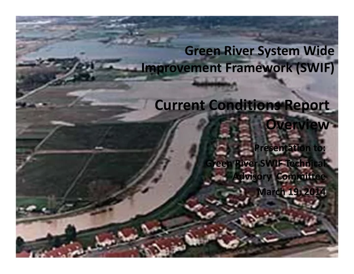
Presentation to: Green River SWIF Technical Advisory Committee March 19, 2014
Green River System Wide Improvement Framework (SWIF)
Current Conditions Report Overview
SLIDE 2
SWIF Timeline and Decisions
SLIDE 3 PRESENTATION OUTCOMES
- Overview of the Green River SWIF Current Conditions Report
- How report will inform completion and implementation of the
Green River SWIF
- Timeline and process for completing, including TAC review
SLIDE 4 Green River SWIF Current Conditions Report
- Audience: technical and non‐technical
- Synthesis of SWIF work completed to date, including:
– SWIF vision/goals (informed by advisors and approved by FCD) – Geographic scope (informed by advisors and approved by FCD) – Current Condition Topics:
- Community, Economy and Land Use
- Shoreline Vegetation
- Aquatic, Shoreline and Floodplain Habitat
- Existing Flood Risks and Vulnerabilities
- Authors: consultant team and King County staff
SLIDE 5 Community, Economy and Land Use
- Tribal treaty fishing
- Cities and jurisdictions
- Land uses
- Primary transportation
corridors
- Public/private lands
- Regional and local economic
drivers
- Recreation – parks/trails
- Agriculture
SLIDE 6
Green River SWIF Current Conditions: Vegetation and Habitat
SLIDE 7 Green River SWIF Current Conditions: Vegetation and Habitat
- Large woody vegetation/trees located in the vicinity of PL84‐99 levees is
a primary SWIF issue to resolve
- Vegetation provides multiple ecological and social benefits to the Lower
Green River system, yet the USACE PL84‐99 levee eligibility policy favors removing large vegetation near levees, for structural stability purposes
- SWIF projects and vegetation management recommendations will
resolve PL84‐99 vegetation issues
SLIDE 8
Current Conditions Report
Vegetation
Vegetation questions answered by the SWIF: 1. What was the river system’s historical vegetative condition? 2. What are the locations and characteristics of current shoreline vegetation throughout the Lower Green? 3. What is the current state of King County levees/revetments that were repaired using bio‐ engineered approaches, in the Lower and Middle Green River? 4. What have others, outside of the region, learned about the structural impacts of large woody vegetation located proximate to levees, including PL84‐99 levees?
SLIDE 9 Current Conditions Report
Vegetation
- GIS maps: current locations and characteristics of land cover and
vegetation were mapped within a 200’ shoreline zone
– Data sources: 2009/2011 aerial orthophotos; 2013 LIDAR; and field validation
- Vegetation and land cover map categories:
– Impervious surface – Bare ground – Grass – Ornamentals – Agriculture – Shrubs (invasive; native) – Trees
SLIDE 10 Current Conditions Report
Vegetation on PL84‐99 Levees
Vegetation + Land Cover Category Tukwila 205 Levee System 1 (ha) Levee % Agriculture ‐ ‐ Bare Earth 5.09 12.2% Grass 4.6 11.1% Impervious 19.48 46.8% Ornamental 0.65 1.6% Other 0.23 0.6% Shrubs 7.59 18.2% Trees 3.95 9.5% Totals 41.6 10.1%
12.20% 11.10% 46.80% 1.60% 0.60% 18.20% 9.50%
Tukwila 205 (Levee System #1) Vegetation and Land Cover
Bare Earth Grass Impervious Ornamental Other Shrubs Trees
SLIDE 11
Current Conditions Report
Habitat
1. What were the river system’s historical fish populations, aquatic and floodplain habitat features? 2. What fish populations are currently present? 3. What are the characteristics of the current aquatic and floodplain habitat? 4. What shade is provided by large vegetation/trees to the river?
SLIDE 12 Current Conditions Report
Habitat
What are the characteristics of aquatic and floodplain habitat features in the Lower Green River system?
- Data sources: SWIF’s shoreline vegetation maps; existing and
recently completed habitat studies; WRIA 9 and Muckleshoot Tribe technical work; 2013 LIDAR
- Habitat features characterized using maps, tables and narrative:
– Aquatic
- Large wood
- Pools
- Spawning gravels
- Slow water edge
– Floodplain
- Riparian forest (within 200’ shoreline zone)
- Wetlands
- Ponds
- Forested floodplain
SLIDE 13 Current Conditions Report: Aquatic Habitat Map Example
SLIDE 14 Current Conditions Report
Habitat
What shade is provided by large vegetation/trees to the river?
– A GIS model that analyzes potential shade cast by trees within a 150’ shoreline zone during daylight hours on August 1st – Analysis reflects recently completed TMDL work for Green River – Model output summarizes potential for various shade scenarios to reduce (“cool”) river temperatures. Categorized as: Poor, Fair, Good or Very Good potential shade condition
SLIDE 15 Shade Category Index Range Percent of Maximum Actual Percent Effective Shade River Area Reach 2 (Ha) Percent Area (Reach 2) Very Good 0.751‐ 0.98 78‐100% 61‐75% 0.04 0.1% Good 0.51‐ 0.75 53‐77% 46‐60% 2.61 4.1% Fair 0.251‐ 0.5 28‐52% 31‐45% 21.29 33.3% Poor 0.02‐ 0.25 2‐27% 15‐30% 39.96 62.5% Totals Per Reach: 63.9 100.0%
Current Conditions Report: Habitat
Lower Green River: Reach 2
DRAFT Potential Shade from existing vegetation
SLIDE 16 Current Conditions Report: Habitat
Lower Green River: Reach 3
DRAFT Potential Shade from existing vegetation
Shade Category Index Range Percent of Maximum Actual Percent Effective Shade River Area Reach 3 (Ha) Percent Area (Reach 3) Very Good 0.75‐0.98 78‐100% 61‐75% 0.48 1.3% Good 0.51‐0.75 53‐77% 46‐60% 9.27 24.3% Fair 0.25‐0.5 28‐52% 31‐45% 21.18 55.6% Poor 0.02‐0.25 2‐27% 15‐30% 7.18 18.9% Totals Per Reach: 38.1 100.0%
SLIDE 17
Current Conditions Report
Vegetation and Habitat
How will vegetation and habitat info be used in the SWIF?
– Inform identification of SWIF alternatives – Vegetation management action planning, including resolution of USACE PL84‐99 issues – Inform conceptual design of priority capital projects – Inform river corridor habitat goals, multi‐benefit project priorities, and future WRIA9 plan updates
SLIDE 18
Green River SWIF: Existing Flood Risks and Vulnerabilities
SLIDE 19 Current Conditions Report
Flood Risk
- What are the system‐wide existing levee system
flood risks and vulnerabilities?
- At what peak flow rate is there a risk of levee failure
(breaching or overtopping followed by breaching)?
- What is the extent of flood inundation in the valley
if the existing levee systems overtop and/or breach?
- What are the economic damages associated with
different levels of inundation? Analysis will serve as a baseline for future system‐level alternatives development.
SLIDE 20 Current Conditions Report
Flood Risk
Purpose of Existing Condition Levee System Analysis is to characterize existing flood risks and vulnerabilities
There are four components of the analysis:
- Geomorphic assessment – lateral and vertical channel changes
(e.g., channel migration, bed scour), sediment transport
- Geotechnical assessment – levee stability and probability of
failure analysis (breach locations); levee fragility curves
- Hydraulic analysis and flood risk analysis – HEC‐RAS and FLO‐2D
modeling to examine possible inundation over range of flood events: 12,000 up to 26,800 cfs
- Economic evaluation of flood risk – two economic models (HEC‐
FDA for physical damages and losses, and IMPLAN to assess regional economic and income impacts of flooding
SLIDE 21 Current Conditions Report: Flood Risk Horseshoe Bend RM 25.5 Right Bank
Stage Probability of Failure and Breach Progression Mapping
Breach Progression Mapping (NHC, 2010)
SLIDE 22 Current Conditions Report
Flood Risk
- Hydraulic model has included new 2012 USACE Design Flood
Hydrographs, 2013 LiDAR and recently constructed and planned projects
- Four levee failure scenarios analyzed:
- Overtopping/breach failure composite
- Dykstra/Tukwila left bank breach scenario
- Horseshoe Bend breach scenario
- Meyer’s Golf breach scenario
- Economic damage categories:
- Structure and content damage, Vehicle damage, structure cleanup costs,
utility infrastructure damage
- Lost recreation value, crop losses, rail and traffic detour & delay
- Regional economic impacts
SLIDE 23 Current Conditions Report: Flood Risk
Overtopping/Breach Failure Composite Modeled Breach Locations
DRAFT
SLIDE 24 Current Conditions Report
Flood Risk
- The economic evaluation includes assessment of
flood impacts over a range of flood events and multiple scenarios
- Estimate system‐wide expected annual damages
(EAD) over a period of analysis (e.g., 50‐100 years)
- Data on expected annual damages and net present
values (Example: 50‐year, 3.5% discount rate) will be presented in April
SLIDE 25 Green River SWIF Current Conditions Report
Schedule for Completion
Task Date
SWIF TAC meeting #3: Current Conditions Report
Overview March 19, 2014 Current Conditions Symposium for TAC and AC, including flood risk assessment results April 16, 2014 DRAFT Current Condition Report available for review by TAC April 24, 2014 TAC comments due to SWIF PM (Jennifer Knauer) May 1, 2014 Current Conditions Report finalized mid‐May 2014
SLIDE 26
Questions?