
SLIDE 1
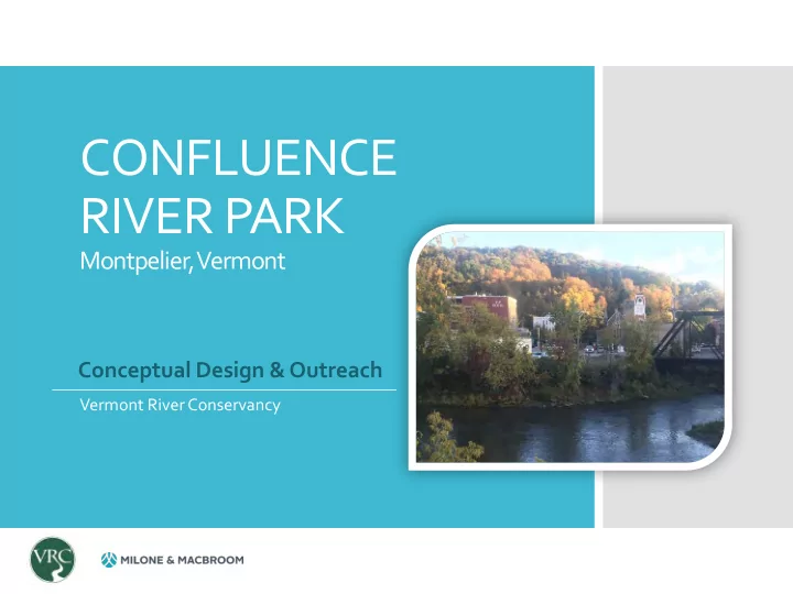
CONFLUENCE RIVER PARK
Montpelier, Vermont
Vermont River Conservancy
Conceptual Design & Outreach
CONFLUENCE RIVER PARK Montpelier, Vermont Conceptual Design & - - PowerPoint PPT Presentation
CONFLUENCE RIVER PARK Montpelier, Vermont Conceptual Design & Outreach Vermont River Conservancy Presentation to City Council September 24, 2019 One Taylor Street Multi- Propose osed Future Redevelopment Modal Transit & Welcome
Montpelier, Vermont
Vermont River Conservancy
Conceptual Design & Outreach
September 24, 2019
New Shared Use Path and Bridge to Main Street Propose
Confluen ence R e River ver Pa Park
PROJECT CONTEXT Knitting projects together
One Taylor Street Multi- Modal Transit & Welcome Center Proposed River Restoration Future Redevelopment Site, Typical
Montpelier, Vermont
CONCEPT DESIGN CONSIDERATIONS:
River access Accessibility Recreational opportunities Flood storage & resiliency Context & history Public space Integration of shared-use path
Project Outreach
Project objectives and design have been guided by the community
CONCEPT
A
CONCEPT
C
CONCEPT
B
CONFLUENCE RIVER PARK
1 T aylor Project Winooski River
CONCEPT D DESCRIPTION:
Open space with seating at top Overlooks & niche spaces Accessible access to river Kayak launch area with off loading area Larger spaces at river’s edge
Railroad Crossing Winooski River
Project Outreach
Summary of Responses Survey Participation: 112 responses 9% margin of error 95% confidence level
3% 9% 11% 20% 26% 31% 34%
1
What are the top activities you are most likely to do at the park?
community events social, community river activities river, water Walk, bike, run Picnic, eat Sit, relax, watch, enjoy
Summary of Responses
Summary of Responses
69% 10% 21%
1
Will you recreate (swim, kayak, etc.) in the Rivers
Yes No Unsure / Other (please specify)
Summary of Responses
37% 22% 41% 0% 10% 20% 30% 40% 50%
1
Most Important Use of Park Space?
A flat, open space at the water’s edge for river access and events A flat, open space near the bike path for events Small nooks at multiple levels with different river views
Summary of Responses
23% 15% 21% 42%
1
Which design concept do you like the best?
A B C D
Summary of Responses
Outreach results General Size/Space
Access
abilities
Recreation
fishing, swimming, whitewater
biking, playing
picnicking, eating, reading, relaxing, watching
Environment
REFINED DESIGN PROGRAM
Setting the stage for a vibrant river!
1 T aylor Project Winooski River Railroad Crossing
CONFLUENCE RIVER PARK
1 T aylor Project
FINAL CONCEPT DESCRIPTION:
Open greenspace with seating, performance space, oriented for maximum views Overlooks & niche spaces Accessible path to river Kayak launch area with off loading area Larger spaces at river’s edge Native plantings
Railroad Crossing
Planted berm with seating & lawn space River Stepped access Stabilized slope & accessible path Multiuse path and amenities
A
Planted berm with seating & lawn space River Riverfront path Stabilized slope & accessible paths Multiuse path
B
Kayak drop off zone
23% 22% 24% 3% 11% 5% 4% 8%
Cost Breakdown Montpelier Confluence River Park Opinion of Cost Based on Conceptual Design $650,000 to $1,000,000
Construction Retaining Walls and Paths Amenities (Seats, Bike Racks, Sign, Lights, Boulders) ADA Fishing Platform Stormwater Trees and Plantings Pavillion Design and Permitting
Confluence Park - South Platte River Denver, CO Truckee River Park Reno, NV Confluence Park Denver, CO
Truckee River Park Reno, NV
Capitalize on the full potential to “Face the River” by improving river health and creating connected and unified public spaces and access points
Confluence River Park Future Redevelopment with Trail Connection Future Development with Trail Connection Transportation Center River Restoration & Access
Montpelier High School Canoe launch and athletic fields State House Lawn (picnic, disc, events, trails to Hubbard Park) Church courtyard (picnic, sun & shade, events) PROPOSED CONFLUENCE RIVER PARK Parklet next to Charlie-O’s 0.75 miles from confluence up North Branch to Lane Shop Dam
Hubbard Park State House Grounds Elm Court Park City Hall Plaza Blanchard Park SYMBOLS KEY: Parks & Open Spaces (Ex. & Proposed) Bike Path (Proposed) Central Vermont Recreation Path Cross Vermont Trail
DOWNTOWN PUBLIC OPEN SPACE & RECREATION NETWORK
PLAN AC ACTIONS NS: RIVERBAN ANK
& new bridge abutments) RIVER C CHANNE ANNEL C CLEAN N UP UP
RIVER C CHANNE ANNEL RESTORA RATION ( (North h Branc nch) h)
RIVER C CHANNE ANNEL RESTOR ORATION ON ( (Winoos
River er)
RIVER ER C CHANNEL EL W WATER ER QUAL ALITY
Sewer Overflow (CSO)
A B A C C
RIVER RESTORATION STRATEGY
D
Riverbank Revegetation (3-5 Years) Rat Dam Removal (3-5 Years) River Channel Trash Removal (1-2 Years) Bailey Dam Removal (5-7 Years)
E A
Riverbank Revegetation (3-5 Years) Remove CSO (5-7 Years)
B D E
Preliminary Data Collection
Gage Readings ID Date Time Sampler Gage1 Height (feet) Gage2 Height (feet) EL (ft NAVD88) 1 4/15/2019 4:00 PM Roy N/A N/A 513 2 5/20/2019 11:14 AM Richarda N/A N/A 511 3 6/19/2019 5:22 PM Roy 0.70 N/A 506.37 4 6/19/2019 5:32 PM Roy 0.75 N/A 506.42 5 6/20/2019 4:08 PM Roy Submerged N/A 512 6 6/25/2019 8:28 AM Roy 1.15 N/A 506.82 7 6/26/2019 8:22 AM Roy 2.79 N/A 508.46 8 6/27/2019 8:30 AM Roy 2.00 N/A 507.67 9 7/5/2019 4:15 PM Roy 0.50 N/A 506.17