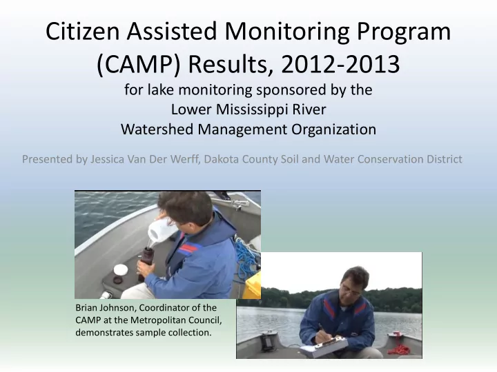
camp results 2012 2013
play

(CAMP) Results, 2012-2013 for lake monitoring sponsored by the - PowerPoint PPT Presentation

Citizen Assisted Monitoring Program (CAMP) Results, 2012-2013 for lake monitoring sponsored by the Lower Mississippi River Watershed Management Organization Presented by Jessica Van Der Werff, Dakota County Soil and Water Conservation District


  1. Citizen Assisted Monitoring Program (CAMP) Results, 2012-2013 for lake monitoring sponsored by the Lower Mississippi River Watershed Management Organization Presented by Jessica Van Der Werff, Dakota County Soil and Water Conservation District Brian Johnson, Coordinator of the CAMP at the Metropolitan Council, demonstrates sample collection.

  2. Eutrophication Criteria • The CAMP evaluates lakes for eutrophication, which is caused by excess nutrients. • Standards have been developed for lakes and shallow lakes, based on their ecoregion. • The parameters of interest include – Total Phosphorus (TP): a nutrient that helps plants grow – Chlorophyll a: a pigment found in green plants, used as a proxy for algal abundance – Secchi depth: a measure of water clarity • If TP and one or both of the other parameters is not meeting the standard, it may be ‘impaired’. Lake Byllesby, Dakota County. Photo from Minnesota Center for Environmental Advocacy www.mncenter.org , courtesy of Amy Goerwitz.

  3. Sunfish Lake (DNR ID 19-0050-00) Added to the 303(d) Impaired Waters List in 2010 for eutrophication parameters. Included in the Watershed Restoration and Protection Strategy (WRAPS). Max depth: 9.8 meters (about 32 feet) Acres: 45 Monitored by citizen volunteer, James Stowell. Deep lake criteria, North Central Hardwood Forest (NCHF) Ecoregion. Upper limits of thresholds indicated by blue dashed line; <40µg/L TP, <14µg/L Chl a , ≥1.4m Secchi. Orange line indicates the average summer (June 1 through September 30) condition.

  4. Rosenberger Lake (DNR ID 19-0041-00) Max depth: 8.2 meters (about 27 feet) Acres: 20 Monitored by Dakota County SWCD staff Deep lake criteria, North Central Hardwood Forest (NCHF) Ecoregion. Upper limits of thresholds indicated by blue dashed line; <40µg/L TP, <14µg/L Chl a , ≥1.4m Secchi. Orange line indicates the average summer (June 1 through September 30) condition.

  5. Ohmans Lake (DNR ID 19-0037-00-201) Max depth: 10 meters (about 33 feet) Acres: 22 (34 includes both basins) Monitored by Dakota County SWCD staff Deep lake criteria, North Central Hardwood Forest (NCHF) Ecoregion. Upper limits of thresholds indicated by blue dashed line; <40µg/L TP, <14µg/L Chl a , ≥1.4m Secchi. Orange line indicates the average summer (June 1 through September 30) condition.

  6. Ohmans Lake shallow basin (DNR ID 19-0037-00-202) Max depth: 2.5 meters (about 8.2 feet) Acres: 12 (34 includes both basins) Monitored by Dakota County SWCD staff Shallow lake criteria, North Central Hardwood Forest (NCHF) Ecoregion. Upper limits of thresholds indicated by blue dashed line; <60µg/L TP, <20µg/L Chl a , ≥1m Secchi. Orange line indicates the average summer (June 1 through September 30) condition.

  7. Simley Lake (DNR ID 19-0037-00) Winter 2013-2014 fishkill Max depth: 5.2 meters (about 17 feet) Acres: 11 Monitored by Dakota County SWCD staff Shallow lake criteria, North Central Hardwood Forest Common carp and catfish stir up sediment (NCHF) Ecoregion. Upper limits of thresholds indicated by and re-suspend phosphorus in the water blue dashed line; <60µg/L TP, <20µg/L Chl a , ≥1m Secchi. column, contributing to algal growth and Orange line indicates the average summer (June 1 through reduced clarity. September 30) condition.

  8. Horseshoe Lake (DNR ID 19-0051-00) Max depth: about 3.1 meters Acres: 14 Monitored by citizen volunteer, Jim Nayes. Shallow lake criteria, North Central Hardwood Forest (NCHF) Ecoregion. Upper limits of thresholds indicated by blue dashed line; <60µg/L TP, <20µg/L Chl a , ≥1m Secchi. Orange line indicates the average summer (June 1 through September 30) condition.

  9. Rogers Lake (DNR ID 19-0080-00) Included in the Watershed Restoration and Protection Strategy (WRAPS). Max depth: 2.4 meters (about 8 feet) Acres: 107 Monitored by citizen volunteer, Doug Hennes. Shallow lake criteria, North Central Hardwood Forest (NCHF) Ecoregion. Upper limits of thresholds indicated by blue dashed line; <60µg/L TP, <20µg/L Chl a , ≥1m Secchi. Orange line indicates the average summer (June 1 through September 30) condition.

  10. Seidl’s Lake (DNR ID 19-0095-00) Max depth: 5 meters (17 feet) Acres: 7 Monitored by City of South St. Paul. Shallow lake criteria, North Central Hardwood Forest (NCHF) Ecoregion. Upper limits of thresholds indicated by blue dashed line; <60µg/L TP, <20µg/L Chl a , ≥1m Secchi. Orange line indicates the average summer (June 1 through September 30) condition.

  11. Anderson Pond (DNR ID 19-0094-00) Both defined by MPCA as wetlands, therefore not evaluated against lake eutrophication criteria. Max depth: unknown for both Acres: unknown for both Monitored by City of South St. Paul LeVander Pond (DNR ID 19-0088-00)

Download Presentation
Download Policy: The content available on the website is offered to you 'AS IS' for your personal information and use only. It cannot be commercialized, licensed, or distributed on other websites without prior consent from the author. To download a presentation, simply click this link. If you encounter any difficulties during the download process, it's possible that the publisher has removed the file from their server.

Recommend


More recommend