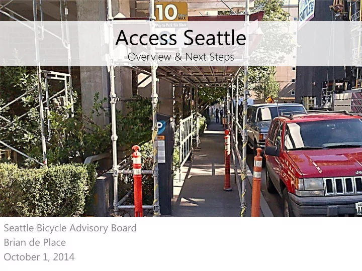
Access Seattle Overview & Next Steps Seattle Bicycle Advisory - - PowerPoint PPT Presentation

access seattle
SMART_READER_LITE
LIVE PREVIEW

Access Seattle Overview & Next Steps Seattle Bicycle Advisory - - PowerPoint PPT Presentation

Access Seattle Overview & Next Steps Seattle Bicycle Advisory Board Brian de Place October 1, 2014 SDOTs mission & vision Mission: delivering a first-rate transportation system for Seattle. Vision: a vibrant Seattle with connected


slide-1
SLIDE 1

Seattle Bicycle Advisory Board Brian de Place October 1, 2014

Access Seattle

Overview & Next Steps

slide-2
SLIDE 2

SDOT’s mission & vision

Mission: delivering a first-rate transportation system for Seattle. Vision: a vibrant Seattle with connected people, places, and products.

2

slide-3
SLIDE 3

SDOT’s core principles

Keep it safe Focus on the basics Build healthy communities Support a thriving economy Provide great service

3

slide-4
SLIDE 4

Presentation overview

  • Setting the context
  • Proposed framework
  • Three Pillars:
  • 1. Construction Coordination
  • 2. Traveler engagement
  • 3. Business and community support
  • Questions & discussion

4

slide-5
SLIDE 5

Context

  • Unprecedented growth

and development

  • Progressive policies

yield strong housing and job growth in Center City

  • Neighborhoods outside
  • f Center City are

growing and want to remain vibrant and thriving

5

Source: Downtown Seattle Association

slide-6
SLIDE 6

Construction Coordination Traveler Engagement Business and Community Support

6

Three pillars of Access Seattle

slide-7
SLIDE 7

Traveller Maps and Mitigation

7

Missio ion: n: Coordinate construction and all activity that impacts right-of-way mobility T arget et Audienc ience: e: Everyone performing work or having events that affect the right of way Potent ntia ial S l Strategy gy: Establish formal Command Center to centralize and improve coordination functions

  • 1. Construction coordination
slide-8
SLIDE 8

Construction hubs

slide-9
SLIDE 9

9

  • Assess all project schedules together -

identify conflicts and minimize mobility/access impacts

  • Create mapping systems showing all

planned and active mobility impacts from all hub-area construction, in all phases

  • Establish reliable lines of

communication with impacted communities

  • Provide on-site enforcement to

monitor and resolve conflicts

Construction hub program objectives

slide-10
SLIDE 10

Coordination tools

slide-11
SLIDE 11
  • Pre

re-pla lanne nned bicyc ycle e rout

  • utes ba

base sed d

  • n

n Bicycle Mas Master P Plan an u use volume mes: – Determined routes to be maintained by private and public projects

Construction – current practice

  • If

If b bike l e lane ne sho hort-term cl closu sure i is s pe permi mitted, d, pr provide de:

  • Advanced warning signs to bicyclists noting

merge, detour or re-route

  • On-site signage with closure dates, times
  • Advanced notification to the bicycle community
slide-12
SLIDE 12
  • Real time map to guide a

bicyclist through area with construction closures

  • Map to be integrated with

Pronto! bike share and Bicycle Master Plan maps

Construction – near future tool

slide-13
SLIDE 13

13

Missio ion: n: Engage travelers with real-time, actionable information

  • n travel and transportation
  • ptions

T arget et A Audienc ience: e: Traveling public Potent ntia ial S l Strategy gy: Develop “One Stop” mobile app and other dynamic tools that provide information on construction activity, parking, and optimal modal choice

  • 2. Traveler engagement
slide-14
SLIDE 14

Leveragi ging o g oppo pportunities:

  • Next Generation ITS,

Traveler Map, Traffic Management Center Rebuild, e-Park and DMS programs

  • Seattle as T

ech Incubator and OED-Supported Industry

  • Travel Options programs

including Bike Share, Car2Go

14

slide-15
SLIDE 15

15

Next t Genera neratio ion C Center er City ITS ITS Increases ability to manage mobility for all modes during particularly heavy periods of construction. Examples ples o

  • f system

em i improvem ement ents:

  • Real-time responsive signal

timing

  • Adaptive signal control on key

corridors feeding into Center City

  • Dynamic signs allowing SDOT to

modify lane assignments and improve traffic flow

slide-16
SLIDE 16

16

  • Traveler Information Map

available as smart phone app

  • Sensors that provide

travel time information

  • Dynamic signs showing

travel times on multiple routes

  • e-Park expansion into

SODO and Seattle Center area

  • Automated commercial

vehicle load zone

  • ccupancy information

Examples of communications programs

slide-17
SLIDE 17

Command Center Traveller Maps

17

Missio ion: n: Support business districts as thriving destinations by ensuring inviting experience and intuitive wayfinding T a T arget Audienc ience: e: Business owners, residents, and visitors in construction hubs Potent ntia ial l Strategies gies:

  • Designate SDOT Ombudsman for all

construction-related issues, spanning across public and private projects

  • Develop “Construction Hub T
  • olkit” to

provide business assistance, signage and streetscape improvements, etc.

  • 3. Business and community support
slide-18
SLIDE 18

Questions & discussion

http://www.seattle.gov/transportation

Brian.dePlace@seattle.gov

Brian de Place | (206) 233-3855

http://www.seattle.gov/transportation/hub.htm