
SLIDE 1
Use of radiation / cloud observations to reduce cloud-radiation - - PowerPoint PPT Presentation
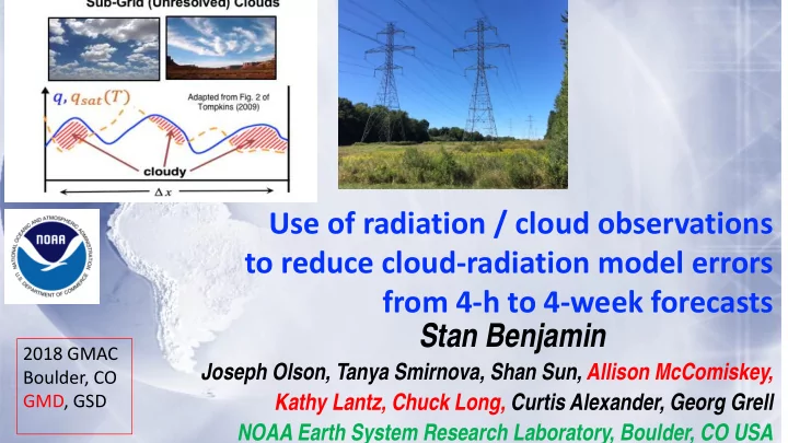
Use of radiation / cloud observations to reduce cloud-radiation model errors from 4-h to 4-week forecasts Stan Benjamin 2018 GMAC Joseph Olson, Tanya Smirnova, Shan Sun, Allison McComiskey, Boulder, CO GMD, GSD Kathy Lantz, Chuck Long,
Initial & Lateral Boundary Conditions
Initial & Lateral Boundary Conditions
23 May 2018 - GMAC
Spatial resolution Forecast range Domain 3km 1-36h Regional 13km 1-39h Regional 10-15km 1-10 day Global 15-30km Week 2 – 9 month Global Model development area HRRR (High-Resolution Rapid Refresh model) – RAP (Rapid Refresh) NGGPS – FV3 (current physics testing with FIM and FV3) FIM-HYCOM coupled seasonal (for NOAA SubX experiment, switch to FV3)
Data assimilation
Radar/cloud/surface/land, 3km ensemble DA 4D Ensemble DA (Whitaker-PSD, EMC) Dynamic core numerics Use/refinement of WRF-ARW, hybrid vert coordinate FV3 – cubed sphere, FIM - icosahedral
Physical parameterization
PBL/MYNN, cloud microphysics (Thompson), RUC land-surface, Same as HRRR but with Grell-Freitas scale-aware cumulus GFS physics + Grell- Freitas cu. Testing of HRRR/RAP suite-2017 GFS physics + Grell-Freitas
starting late 2017. Application of inline chemistry 2-aerosol – NCEP, testing of 18- aerosol “ + gas-phase chemistry 18-aerosol and gas- phase chem 18-aerosol only so far
Systematic error investigations
Clouds, precipitation Clouds Clouds, blocking, precipitation Clouds, blocking, precipitation
23 May 2018 - GMAC
Severe Weather Aviation Tactical Planning Renewable Energy (wind/solar) Same-Day Decision Support General Forecasting
0–2 hr 2–8 hrs 8–15 hrs 15–24 hrs 24–48 hrs Forecast Length Aviation Strategic Planning Severe Weather -Watches, Convective Outlooks Severe Weather Day 2 Outlooks Renewable Energy (wind/solar) Day-Ahead Decision Support Example: National Weather Service including Storm and Weather Prediction Centers (SPC and WPC) Aviation Weather Center (AWC) and FAA Command Center National Severe Storms Laboratory (NSSL) and Air Resources Laboratory (ARL) National Centers for Atmospheric Research (NCAR) and Lincoln Laboratory (LL) QPF / hydro Heavy rainfall/snowfall watches, National Water Model Heavy rainfall/snowfall Day 2 Outlooks
23 May 2018 - GMAC
Atmospheric Processes
There is an fundamental connection between solar radiation forecasts (both diffuse and direct) and low- level wind forecasts. Surface Net Radiation
Energy available for SH, LH, and ground heat flux Drives turbulent mixing, PBL formation, low- level winds, clouds
Aerosol-Cloud Interactions
23 May 2018 - GMAC
Courtesy: Kathy Lantz - GMD
Model Version Assimilation Radar DA Radiation LW/SW Cloud Microphysics Cumulus Param Turb /PBL Land-sfc scheme RAP WRF-ARW v3.8.1+ GSI Hybrid Ensemble to 0.85 13-km DFI, 20-min LH RRTMG/ RRTMG Thompson Aerosol v3.8.1 GF + Shallow MYNN v3.8.1, EDMF/cl RUC v3.8.1, 2mT/snow, mosaic HRRR WRF-ARW v3.8.1+ GSI Hybrid Ensemble to 0.85 3-km 15-min LH RRTMG/ RRTMG Thompson Aerosol v3.8.1 None MYNN v3.8.1, EDMF/cl RUC v3.8.1, 2mT/snow, mosaic Model Horiz/Vert Advection Scalar Advection Upper-Level Damping Diffusion Option 6th Order Diffusion SW Radiation Update Land Use MP Tend Limit Time- Step RAP 5th/5th Positive- Definite w-Rayleigh 0.2 Full (2) Yes 0.12 20 min MODIS Seasonal, VIIRS GVF 0.01 K/s 60 s HRRR 5th/5th Positive- Definite w-Rayleigh 0.2 Full (2) Yes, 0.25 no slope 15 min with SW-dt MODIS Seasonal, VIIRS GVF 0.07 K/s 20 s Model Run at: Domain Grid Points Grid Spacing Vertical Levels Vertical Coordinate Pressure Top Boundary Conditions Initialized RAP GSD, NCO North America 953 x 834 13 km 50 Sigma-Isob Hybrid 10 mb GFS Hourly (cycled) HRRR GSD, NCO CONUS 1799 x 1059 3 km 50 Sigma-Isob Hybrid 20 mb RAP Hourly (pre- forecast hour cycle)
23 May 2018 - GMAC
Surface METARs Including Ceiling/cloud obs RAOBs Aircraft SURFRAD Precipitation StageIV SOLRAD Radar reflectivity NSSL MRMS
CERES cloud radiation
(W/m2, day 1)
23 May 2018 - GMAC
23 May 2018 - GMAC
Bias – 12h HRRR 2m temp forecast valid 00z Bias – HRRR 0.5” precip / 6h
Model Version Assimilation Radar DA Radiation LW/SW Cloud Microphysics Cumulus Param Turbulence PBL Land-sfc scheme RAP WRF-ARW v3.8.1+ GSI Hybrid Ensemble to 0.85 13-km DFI, 20-min LH RRTMG/ RRTMG Thompson Aerosol v3.8.1 GF + Shallow MYNN v3.8.1, EDMF/cl RUC v3.8.1, 2mT/snow, mosaic HRRR WRF-ARW v3.8.1+ GSI Hybrid Ensemble to 0.85 3-km 15-min LH RRTMG/ RRTMG Thompson Aerosol v3.8.1 None MYNN v3.8.1, EDMF/cl RUC v3.8.1, 2mT/snow, mosaic Model Horiz/Vert Advection Scalar Advection Upper-Level Damping Diffusion Option 6th Order Diffusion SW Radiation Update Land Use MP Tend Limit Time-Step RAP 5th/5th Positive- Definite w-Rayleigh 0.2 Full (2) Yes 0.12 20 min MODIS Seasonal, VIIRS GVF 0.01 K/s 60 s HRRR 5th/5th Positive- Definite w-Rayleigh 0.2 Full (2) Yes, 0.25 no slope 15 min with SW-dt MODIS Seasonal, VIIRS GVF 0.07 K/s 20 s Model Run at: Domain Grid Points Grid Spacing Vertical Levels Vertical Coordinate Pressure Top Boundary Conditions Initialized RAP GSD, NCO North America 953 x 834 13 km 50 Sigma-Isob Hybrid 10 mb GFS Hourly (cycled) HRRR GSD, NCO CONUS 1799 x 1059 3 km 50 Sigma-Isob Hybrid 20 mb RAP Hourly (pre- forecast hour cycle)
23 May 2018 - GMAC
RAP and HRRR use the Thompson microphysics scheme with 5 hydrometeor types Explicit (Resolved) Clouds/Precipitation Sub-Grid (Unresolved) Clouds
Parameterize: assume subgrid PDFs for thermodynamic variables Chaboureau and Bechtold (2002) Assume a PDF of s (saturation ratio) Retrieve Cloud Fraction, Cloud Condensate
Adapted from Fig. 2 of Tompkins (2009)
RAPv3/HRRRv2
23 May 2018 - GMAC
Process Model Component Change/Addition
Turbulent Diffusion Non-local Turbulent Transport Surface Fluxes Clouds Numerics/ Dynamics Turbine Drag
Vertical Coordinate Vertical Coordinate, Advection
MYNN PBL/ 3d-Blended TKE
MYNN Mass-flux
RUC LSM/ MYNN Sfc Layer w’q’ w’T’ w’u’
Thompson Aerosol / Chaboureau- Bechtold
Wind Farm Parameterization
23 May 2018 - GMAC
Visible Imagery Previous version (v3.9)
5-h GHI forecasts valid 1800 UTC 19 August 2015
W m-2
23 May 2018 - GMAC
5-h GHI forecasts valid 1800 UTC 19 August 2015
Visible Imagery Updated Version W m-2
23 May 2018 - GMAC
23 May 2018 - GMAC
SURFRAD geographical diversity critical for model evaluation
HRRR-exp HRRR-oper
23 May 2018 - GMAC
SURFRAD geographical diversity critical for model evaluation
23 May 2018 - GMAC
Experimental HRRRv3 13 hr fcst Valid 00 UTC 17 May 2017 Composite Reflectivity Observations 00 UTC 17 May 2017 Operational HRRRv2 13 hr fcst Valid 00 UTC 17 May 2017
More Accurate Convection Along Weakly Forced Dryline
Reflectivity Verification
23 May 2018 - GMAC
WRF-ARW v3.9+ incl. phys changes Physics changes: MYNN PBL update – yet better sub- grid clouds, improved EDMF mixing length, goal: retaining stable layers Aerosols sources/sinks – fire/smoke, dust - Add smoke with VIIRS fire radiative power Improved land-surface/snow model including better 2m T/Td diagnostics
Latest Grell-Freitas conv (RAP only) Lake model for small lakes Enhanced gravity-wave drag Merge with GSI trunk – 2018 New Observations for assimilation: GOES-16 radiances, GLM lightning MRMS dual-polarization radar mosaics Extra mesonet data incl. anemometer hgt TC vitals for trop cyclone location/ strength Satellite-based AOD (aerosol optical depth) Aircraft/raob moisture obs for p<300 hPa Assimilation Methods: HRRR - 3km ensemble DA (40 members out to 1h) – effective in 2017/18 tests. Reduced LH for radar assim in HRRR Cloud/hydrometeor assim within ens DA DA for subgrid cloud fraction/cloud water w/ METAR, satellite cloud fraction Revised hydrometeor assim (project to resolvable scale) to improve 1h precip Switch to MODIS albedo (higher), replace 1-deg albedo. Add zenith-ang albedo adj Fractional sea/lake ice concentration ? – FVCOM SST/ice VIIRS/MODIS/GOES fire radiative power HRRRE prob products Full cycle RAP land-sfc
Larger impact for wind/ solar forecast accuracy
23 May 2018 - GMAC
New Observations for assimilation: Add satellite cloud-drift winds over land Add TAMDAR aircraft observations Add new polar-orbiter satellite data IASI, CrIS, SEVIRI radiances Assimilation Methods: Revised PBL pseudo-observations from sfc –better winds/RH Cloud building (satellite, surface)
Radar reflectivity assimilation
WRF-ARW v3.8.1+ incl. physics changes Physics changes: Thompson cloud microphysics – improved ice clouds (not excessive) MYNN PBL update – better sub-grid clouds, EDMF (local/deep) mixing Land-sfc model update – mosaic snow, 2m temp diagnostic Revised Grell-Freitas cumulus (RAP) MODIS higher-res 15” land-use data VIIRS real-time greenness veg fraction Revised roughness lengt 10m wind (not ~8m) Wind gust diag fix (stronger at night)
Larger impact for wind/ solar forecast accuracy
23 May 2018 - GMAC