
SLIDE 1
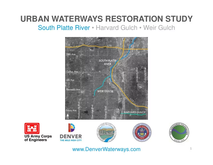
URBAN WATERWAYS RESTORATION STUDY
South Platte River • Harvard Gulch • Weir Gulch
www.DenverWaterways.com
1
URBAN WATERWAYS RESTORATION STUDY South Platte River Harvard Gulch - - PowerPoint PPT Presentation
URBAN WATERWAYS RESTORATION STUDY South Platte River Harvard Gulch Weir Gulch www.DenverWaterways.com 1 Study Sponsors 2 Tonights Agenda 1. Overview of Study 2. Review Existing Conditions 3. Present Potential Ways to Meet Study
1
2
3
4
5
Photos: The Greenway Foundation
6
7
8
9
10
11
http://www.flyfishing.co.uk/
http://wildlife.ohiodnr.gov Stutzman, Jim, USFWS Zahm, Gary, USFWS
12
13
14
15
16
17
18
19
I-70
N Speer Blvd
20
21
22
23
I-70
N Speer Blvd
24
25
26
I-70
N Speer Blvd
27
28
29
http://www.flyfishing.co.uk/
30
I-70
I-70
31
32
33
34
35
36