Toll Considerations for US 27 to I-75 Connector Scoping Study June - - PowerPoint PPT Presentation

toll considerations for us 27 to i 75 connector scoping
SMART_READER_LITE
LIVE PREVIEW

Toll Considerations for US 27 to I-75 Connector Scoping Study June - - PowerPoint PPT Presentation

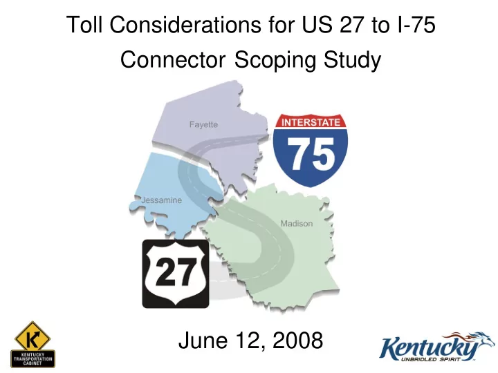
Toll Considerations for US 27 to I-75 Connector Scoping Study June 12, 2008 Project Purpose The purpose of this study is to determine the need and explore methods to improve safety, connectivity, and regional access within Jessamine, Fayette,


slide-1
SLIDE 1

Toll Considerations for US 27 to I-75 Connector Scoping Study June 12, 2008

slide-2
SLIDE 2

Project Purpose

The purpose of this study is to determine the need and explore methods to improve safety, connectivity, and regional access within Jessamine, Fayette, and/or Madison counties between US 27 and I-75.

slide-3
SLIDE 3

Project Need

  • Study Needs Include:

– Connectivity – Vehicle Safety – Traffic Congestion – Travel Time Reliability – Economic Development – Improved Access for Truck Traffic – Homeland Security

slide-4
SLIDE 4

US 27 to I-75 Corridor Scoping Study Team Organization

Regional Agencies PB Team Project Work Group Planning/ Traffic Roadway Environmental Structures Public Involvement

slide-5
SLIDE 5

Study Area

slide-6
SLIDE 6

Study Characteristics

  • Planning Level Study (not design)
  • Looking at Possible Connection from US 27 to I-75

– No Plans for Other Parts of a Roadway East or West

  • End Result may be a Corridor (1,000 – 2,000 ft wide)

– Not an Alignment – Examining a No Build Option

  • Alternative Funding Methods are Being Examined

– Tolls – Project Privatization

  • No other Project Development Funds Available at this Time
slide-7
SLIDE 7

Alternative Corridors

From To 4-2 Eastern Nicholasville Bypass / KY 169 intersection I-75 / KY 627 intersection 4-4 Eastern Nicholasville Bypass / KY 169 intersection I-75 near Northridge Way 5-2 Eastern Nicholasville Bypass between KY 169 and KY 39 I-75 / KY 627 intersection 5-4 Eastern Nicholasville Bypass between KY 169 and KY 39 I-75 near Northridge Way 6-2 Eastern Nicholasville Bypass just south of KY 39 I-75 / KY 627 intersection 6-4 Eastern Nicholasville Bypass just south of KY 39 I-75 near Northridge Way No-Build Alternative Corridors Description

slide-8
SLIDE 8

Model Options

Criteria Kentucky Statewide Model Lexington Area MPO Model Comments Includes 3-County Study Area X

  • Lexington Model does not include Madison County

Contains Detailed Information for Part or Entire Study Area

  • X

Lexington Model provides more detailed SE data for TAZs in Fayette / Jessamine County Model is Calibrated for Part or Entire Study Area

  • X

Lexington Model is calibrated for Fayette / Jessamine County whereas KYSTM is calibrated less for urbanized Has Potential for Sub-Area Model X

  • TransCAD has built-in utilities to conduct sub-area analysis

May Have Potential to be Expanded Based on Other Models

  • X

Lexington's Two-County Model could be expanded based

  • n KYSTM or Madison County Model

Has a Freight (Truck) Component X

  • KYSTM has Truck Model built on TRANSEARCH data;

Lexington recently has conducted Freight Research Has an Adaptable User Interface

  • Both models have a strict GISDK code; model may have to

be developed 'outside' the code.

'- As shown, both the Kentucky Statewide Model and the Lexington Area MPO Travel Demand Model have advantages and disadvantages with respect to their use on the US 27 to I-75 Scoping Study.

  • From previous modeling experiences, sub-area models have proven to be a legitimate and logical option for creating a new

model for a specified study area.

  • On the other hand, expanding an existing model may prove challenging with respect to zonal development, network

development, and the collection of similar data as in the existing model.

  • Both a sub-area model and an expanded model will present challenges with respect to calibration.
slide-9
SLIDE 9

Role of KYSTM

  • In order to determine the need for a connector,

the amount of traffic that would potentially use it needs to be quantified.

  • The KYSTM was used to:

– Determine how many vehicles would use a new connector; – Determine truck percentages on a new connector; – Compare connector volumes among the various alternatives; and – Determine impacts on competing roadways.

slide-10
SLIDE 10

KYSTM Calibration Analysis

  • Summary:

– ADT assignments from KYSTM were within 1.2% of ADT counts in the 3 county study area – US 27 between Nicholasville Bypass and Lexington – assignments are high – Man O’ War Blvd between US 25 and I-75 – assignments are low – Downtown Nicholasville – assignments are low – Local roads adjacent to I-75 – assignments are low

slide-11
SLIDE 11

Revised Corridor Traffic Volumes

  • Level 2 Analysis:

– Percent change in traffic volumes along US 27, Man O’ War Blvd. and I-75 were compared for the 18 corridors with the no-build alternative. – Some sections of US 27, Man O’ War Blvd., and I-75 experience increases in traffic volumes as a result of a new connector while others realized a decrease in

  • verall traffic volumes.

– The increases and decreases on these roadways was determined to not be a differentiating factor for the remaining 6 build alternatives – Corridor volumes from the statewide model were grown at a rate of 1% per year to get a relative comparison among corridors.

slide-12
SLIDE 12

Revised Corridor Traffic Volumes (cont.)

  • Level 3 Analysis:

– The Kentucky Statewide Model (KYSTM) is not able to forecast the corridor volumes to future years. – For this level of detail, using the historical growth rates would yield an unrealistic volume of traffic on a new corridor. – A meeting was held with KYTC staff to discuss traffic forecasting and the KYSTM. – It was decided that the best way to forecast the corridors was to take a weighted average of:

  • Growth factors in the study area based on a KYTC Central

Office spreadsheet of growth rates by traffic count station, and

  • The Lexington MPO travel demand model.
slide-13
SLIDE 13

Revised Corridor Traffic Volumes (cont.)

  • The study area growth rate was calculated to be

2.2% and the ADT for each corridor was forecasted to the year 2040 using that growth rate.

  • LOS was calculated for each corridor for the 4

typical roadway cross sections.

slide-14
SLIDE 14
  • Average toll costs $0.05 to $0.13 per mile.
  • Tolls are more than doubled for commercial

vehicles, depending on the number of axles.

  • Tolls are higher for bridges and tunnels.
  • Tolls can help cover maintenance and operation

costs as well as some initial construction costs.

Quick Facts about Toll Roads

slide-15
SLIDE 15
  • Tolls provide opportunities for Public-Private

Partnerships.

  • Tolls help reduce demand.
  • Depending on the price of the toll, cars and trucks

may choose different routes.

Quick Facts about Toll Roads (Cont.)

slide-16
SLIDE 16

Lessons Learned from Tolling Study for Ohio River Bridges

  • Travel time savings is equivalent to $9.60 per

hour for passenger vehicles and $33.00 per hour for trucks.

  • Vehicle operating savings are equal to $0.16 per

mile for passenger cars and $0.65 per mile for trucks.

  • Yearly toll operations cost (not including

customer service center operations cost) is $655,600 for alternatives where only 1 bridge is tolled.

slide-17
SLIDE 17

Ohio River Bridges ADT Toll Impacts

I-65 Bridge

20000 40000 60000 80000 100000 120000 140000 160000 180000 200000 No Toll $0.50 $1.00 $2.00 $3.00 Cost ADT

East End Bridge

10000 20000 30000 40000 50000 60000 70000 No Toll $0.50 $1.00 $2.00 $3.00 Cost ADT

  • 2 alternatives were studied where only one of

the four bridges was tolled.

  • The figures show the 2030 ADT for the I-65 and

East End bridges if there is no toll, a toll of $0.50, $1.00, $2.00 or $3.00.

slide-18
SLIDE 18

States that Currently Use Tolls

slide-19
SLIDE 19

Representative Toll Pricing in the US for Entire Roadways

  • The selected comparison data was based on existing facilities with similar

lengths.

  • Data compiled from: Toll Facilities in the United States: Bridges - Roads -

Tunnels – Ferries. December 2007. Publication No: FHWA-PL-07-029

  • Toll fee is for entire length and may include bridges.
  • In many states, the toll is dependent on distance of travel and number of

axles.

State Length (mi.) Road Type Min Pass Fee Max Pass Fee Min Truck Fee Max Truck Fee New York 5 Rural Minor Collector $9.00 New York 5.6 Urban Freeway $0.32 $23.05 $0.67 $93.85 New York 5.9 Rural Local $6.00 Colorado 6.6 Urban Interstate $0.50 $3.25 $18.00 $18.00 South Carolina 7.5 Rural Principal Arterial $0.50 $1.00 California 10 Urban Freeway $1.15 $9.25 $1.15 $9.25 Texas 10.42 Urban Principal Arterial $1.00 $1.25 $6.25 Texas 10.58 Urban Principal Arterial $1.00 $1.25 $6.25 Texas 11 Urban Freeway $2.00 $12.50 New York 15 Urban Interstate $1.13 $2.50 $2.61 $8.25 Oklahoma 17.3 Rural Minor Arterial $1.00 $1.00 $2.00 New York 17.9 Rural Interstate $0.32 $23.05 $0.67 $93.85 Texas 21.7 Urban Principal Arterial $2.00 $2.50 $12.50 Utah 22.5 Rural Principal Arterial $2.00 $8.00 Ohio 22.5 Rural Interstate $1.00 $1.50 $3.25 Oklahoma 25 Rural Interstate $4.00 $16.00

slide-20
SLIDE 20

Representative Toll Pricing in the US for Bridges

State Length (mi.) Road Type Min Pass Fee Max Pass Fee Min Truck Fee Max Truck Fee Minnesota - North Dakota 0.1 Non-interstate $0.63 $0.75 $0.63 $0.75 Illinois - Iowa 0.19 Non-interstate $0.50 $0.50 New York 0.2 Non-interstate $2.00 $4.00 $2.00 $12.00 New York - Canada 0.2 Non-interstate $3.00 $3.00 $55.00 Texas - Mexico 0.2 Non-interstate $2.00 $7.00 $7.00 $20.00 Texas - Mexico 0.2 Non-interstate $2.50 $6.00 $8.00 $20.00 Texas - Mexico 0.2 Non-interstate $1.65 Texas - Mexico 0.26 Non-interstate $2.50 $7.00 $19.00 Texas - Mexico 0.3 Non-interstate $1.65 Alabama 0.39 Non-interstate $1.50 $3.50 $5.00 New York 0.4 Non-interstate $1.00 $2.25 $3.60 $27.00 Texas - Mexico 0.4 Non-interstate $2.50 Illinois - Indiana 0.5 Non-interstate $1.00 $1.50 $3.00 New York - Canada 0.5 Non-interstate $3.00 $3.00 $55.00 Texas - Mexico 0.5 Non-interstate $1.65 Alabama 0.59 Non-interstate $1.25 $2.50 $3.25 Illinois - Iowa 0.6 Non-interstate $1.00 $4.00 $10.00 New York 0.6 Non-interstate $0.30 $1.00 $2.50 $9.00 Alabama 0.62 Non-interstate $1.50 $3.50 $5.00 New York 0.7 Non-interstate $0.30 $1.00 $2.50 $9.00 New York 0.7 Non-interstate $1.75 $2.25 $3.60 $27.00 New York - Canada 0.7 Non-interstate $2.70 $3.00 $5.40 $13.00 New York 0.8 Non-interstate $1.00 $2.25 $3.60 $27.00 Illinois - Indiana 0.9 Non-interstate $0.50 $0.70 $1.70 Interstate Bridges 1 to 5 $0.30 $6.00 $1.43 $108.00 Interstate Bridges >5 $0.40 $4.00 $1.15 $53.44

  • The selected comparison data was based on existing facilities with similar lengths.
  • Data compiled from: Toll Facilities in the United States: Bridges - Roads -

Tunnels – Ferries. December 2007. Publication No: FHWA-PL-07-029

  • In many states, the toll is dependent on vehicle type and number of axles.
slide-21
SLIDE 21

Potential Facility Toll Revenue

  • The ADT reductions due to tolling are based on the Ohio River Bridges

Study.

  • The revenue shown is based on the upper limit of the ADT volumes.
  • The revenue shown is per year for the different tolling prices
  • The 2040 revenue dollars includes a 3% inflation factor for the time-

value of money based on the CPI Index

$0.50 $1.00 $2.00 $3.00 $0.50 $1.00 $2.00 $3.00 4-2 24,000 21,000 19,000 13,000 9,000 $9,900,000 $17,900,000 $24,400,000 $25,400,000 4-4 28,000 25,000 22,000 15,000 11,000 $11,700,000 $20,700,000 $28,200,000 $31,000,000 5-2 23,000 20,000 18,000 13,000 9,000 $9,400,000 $16,900,000 $24,400,000 $25,400,000 5-4 25,000 22,000 20,000 14,000 10,000 $10,300,000 $18,800,000 $26,300,000 $28,200,000 6-2 20,000 18,000 16,000 11,000 8,000 $8,500,000 $15,000,000 $20,700,000 $22,600,000 6-4 21,000 19,000 16,000 12,000 8,000 $8,900,000 $15,000,000 $22,600,000 $22,600,000 2040 Revenue Corridor 2040 ADT 2040 ADT (Toll Reduction)

slide-22
SLIDE 22
  • Tolling decreases the ADT / amount of traffic that would use

the toll road.

  • The majority of states surrounding Kentucky have toll roads.
  • Based on similar roadways, tolls between $1 to $2 may be

appropriate.

  • Tolling the bridge over the Kentucky River only does not

seem to be cost-effective.

  • Given the high estimated construction costs, tolls will not

pay for the roadway and may not pay for the operation and maintenance costs for this project.

  • A more complete toll study will need to be performed at a

later date if this is considered for one of the build alternatives.

Toll Information Conclusions

slide-23
SLIDE 23
  • NCHRP 377 is entitled “Compilation of Public

Opinion Data on Tolls and Road Pricing”

  • The report:
  • Explores how the public feels about tolls and road

pricing;

  • Examines public opinion concerning charging for the use
  • f roads; and
  • Highlights factors associated with the acceptance or

rejection of road pricing.

NCHRP 377 Information

slide-24
SLIDE 24
  • Themes in Public Opinion Results:
  • The public wants to see the value
  • The public wants to react to tangible and specific examples
  • The public cares about the use of the revenues
  • The public learns from the experience
  • The public uses knowledge and information available
  • The public believes in equity but wants fairness
  • The public wants simplicity
  • The public favors tolls over taxes

NCHRP 377 Results

slide-25
SLIDE 25

Next Steps in the Study Process

  • Hold 2nd Public Meeting - June 16, 2008
  • Hold PWG Meeting Following Public Meeting to

Discuss Public Feedback

  • Feedback Collected will Include Public Perception
  • f Tolls
  • Choose a Preferred Corridor
  • Complete Project Documentation
slide-26
SLIDE 26

Questions? Questions?