
SLIDE 1
SURAT URBAN DEVELOPMENT AUTHORITY
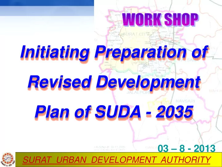
Initiating Preparation of Revised Development Plan of SUDA - 2035
03 – 8 - 2013
Initiating Preparation of Revised Development Plan of SUDA - 2035 - - PowerPoint PPT Presentation
Initiating Preparation of Revised Development Plan of SUDA - 2035 03 8 - 2013 SURAT URBAN DEVELOPMENT AUTHORITY SUDA Constituted under the Gujarat Town Planning and Urban Development Act, 1976 on 31.01.1978 Jurisdiction of SUDA = 722 Km 2
SURAT URBAN DEVELOPMENT AUTHORITY
03 – 8 - 2013
SURAT URBAN DEVELOPMENT AUTHORITY
Constituted under the Gujarat Town Planning and Urban Development Act, 1976 on 31.01.1978 Jurisdiction of SUDA = 722 Km2
SMC SUDA 1978 55 Km2 667 Km2 (130 Villages) 2006 327 Km2 395 Km2 (95 Villages)
SURAT URBAN DEVELOPMENT AUTHORITY Demographic Profile
Census Population (SUDA including SMC) Census Population (SMC)
1981 11.41 lakhs 7.76 lakhs 1991 17.91 lakhs 14.98 lakhs 2001 30.83 lakhs 24.33 lakhs 2011 50.00 lakhs 44.62 lakhs
SURAT URBAN DEVELOPMENT AUTHORITY
Census Population SUDA (including SMC) Decadal Growth Rate 1981 11.41 lakhs
57 % 2001 30.83 lakhs 72 % 2011 50.00 lakhs 62 %
City Growing at the Decadal Growth Rate of 60%+ in last four decades
SURAT URBAN DEVELOPMENT AUTHORITY
Two tier planning process as per GTP & UD Act,1976.
entire Development area is prepared.
SURAT URBAN DEVELOPMENT AUTHORITY
SURAT URBAN DEVELOPMENT AUTHORITY
SURAT URBAN DEVELOPMENT AUTHORITY
Landuse
Existing - 1995 Proposed - 2011
Area in Hectares %age of Urbanized Land Area in Hectares %age of Urbanized Land 1 Residential Use Zone
6190 52.98 16727 55.84
2 Commercial Use Zone
256 2.19 944 3.15
3 Industrial Use Zone
2784 23.83 4483 14.98
4 Educational Use Zone
735 6.29 3350 11.19
6 Recreational Use Zone
58 0.50 1210 4.04
7 Transportation Use Zone
1661 14.22 3212 10.73
Urbanized Land
11684 100 29926 100
Non-Urbanized Land
60516 42274
Total
72200 72200
8
SURAT URBAN DEVELOPMENT AUTHORITY
Area under reservations : 79.68 Km2 (11% of SUDA area)
Public Purpose Acquiring Agency Area (Hectares)
1 Commercial SMC SUDA APMC GIDC Custom
192.62
2 Housing SMC SUDA GHB GSCB GIDC PWD Panchayat Dept of Social Welfare
2158.47
3 Industrial GIDC
1887.99
4 Open space, garden SMC SUDA GIDC Kribhco GSPCL ONGC
714.72
5 Public purpose SMC SUDA TELE SEC GEB POST SGU PWD GMTB
2447.74
6 Transport SMC SUDA GSRTC CIVIL AVIATION GIDC
565.93
TOTAL
21 Agencies 7967.47
SURAT URBAN DEVELOPMENT AUTHORITY
Atleast once in ten years from the date on which a final development plan comes into force, the area development authority shall revise the development plan after carrying out, if necessary, a fresh survey and the provisions
apply to such revision.
SURAT URBAN DEVELOPMENT AUTHORITY
(Publication u/s 13)
SURAT URBAN DEVELOPMENT AUTHORITY
»SMC 131 ( since 2004 = ) »SUDA 20 ( After 2006)
SURAT URBAN DEVELOPMENT AUTHORITY
SURAT URBAN DEVELOPMENT AUTHORITY
SURAT URBAN DEVELOPMENT AUTHORITY
SURAT URBAN DEVELOPMENT AUTHORITY
SURAT URBAN DEVELOPMENT AUTHORITY
SURAT URBAN DEVELOPMENT AUTHORITY
3D VIEWS. . .
SURAT URBAN DEVELOPMENT AUTHORITY
3D VIEWS. . .
SURAT URBAN DEVELOPMENT AUTHORITY
SURAT URBAN DEVELOPMENT AUTHORITY
90 mts wide 66-Km long Outer Ring Road on the periphery to decongest the traffic from the major Highways passing through city and easy access to Navsari which will act as High Speed Road Linkage between Surat, Hazira & Navsari
SURAT URBAN DEVELOPMENT AUTHORITY
SUDA 90 mt wide outer ring road
SURAT URBAN DEVELOPMENT AUTHORITY
SURAT URBAN DEVELOPMENT AUTHORITY
SURAT URBAN DEVELOPMENT AUTHORITY Owners meeting of 11 TP schemes as part of Outer Ring Road (ORR) over without any hassles in less than 5 months from date of declaration. SMC = 3 SUDA = 8 (published in official gazette also)
Draft TP scheme shall be submitted to Govt by the end of Sept 2013
SURAT URBAN DEVELOPMENT AUTHORITY
SURAT URBAN DEVELOPMENT AUTHORITY
Survey of India's City-Systems – "Best Urban City of India" and – "Best City to Live in India"
City' in India in 2010 awarded by INTACH
among 11 major cities to live according to Quality of City Systems & Quality of Life in City by Janaagraha, a non- profit
has selected Surat as one of the three cities in the world, to be developed as "Global Eco-cities”
SURAT URBAN DEVELOPMENT AUTHORITY
million (2011)
Mayors Foundation, an international think tank on urban affairs.
prosperity.
SURAT URBAN DEVELOPMENT AUTHORITY
2008 which was the Fastest growing GDP in India according to data compiled by the economic research firm Indicus Analytics
studded gold jewelry manufacturing.
machines than any other city
SURAT URBAN DEVELOPMENT AUTHORITY
SURAT URBAN DEVELOPMENT AUTHORITY
Hon’ble Chief Minister on 26.07.2013 emphasized not to treat urbanization as a problem but an opportunity.
SURAT URBAN DEVELOPMENT AUTHORITY
To formulate a meaningful development plan of the area to regulate and guide the urban growth in the region by 2035, under the provisions of –
Gujarat Town Planning & Urban Development Act, 1976 Gujarat Town Planning & Urban Development Rules, 1979
32
SURAT URBAN DEVELOPMENT AUTHORITY
Developing SUDA with Global standards
Planned and balanced development using GIS techniques Introduce Multi – Nuclei Concept Promotion of green city , Education, Culture, Trade, Commerce, Industry, Recreation, Sports , and Heritage activities Human Development factor in planning for better quality of urban life Upgrading Infrastructure and Services Capacity building of SUDA
33
SURAT URBAN DEVELOPMENT AUTHORITY
MET ETHODOL DOLOGY Y OF DEVEL DEVELOPM PMEN ENT T PLA PLANS
DRAFT DEVELOPMENT PLAN
For Publication u/s 13 of the GTPUD Act, 1976 Objections / Suggestions Modification to the Plan based on above u/s 14 Draft Development Plan Submission to GOG u/s 16 of the GTPUDA, 1976 Studies and Analysis Data Collection Primary and Secondary Data Draft Development Plan Modifications For Publication u/s 15 of GTPUDA, 1976 Objections / Suggestions Modification to the Plan u/s 15 Land Use Survey Land use for urban/ rural areas FINAL DEVELOPMENT PLAN Sanction by GOG u/s 17 of the GTPUDA, 1976
SURAT URBAN DEVELOPMENT AUTHORITY
SMC SUDA
Population Decadal growth rate Population Decadal growth rate
1981 7,76,583
14,98,817 93.17 2001 24,33,835 62.37 2011 44,62,002 83.32 2021 75,00,000 60.00 2031 100,00,000 45.00
Projected (Rough estimation)
SURAT URBAN DEVELOPMENT AUTHORITY
1. Base Map Preparation 2. Simplification of GDCR 3. Affordable Housing 4. Traffic & transportation proposals 5. Infrastructure Planning 6. Zoning proposals 7. Tapi river alignment 8. Outer Ring road implications
SURAT URBAN DEVELOPMENT AUTHORITY
Committee - 1 Base Map Preparation Committee - 2 Simplification of GDCR Committee - 3
Committee - 4
proposals
SURAT URBAN DEVELOPMENT AUTHORITY
1 Digital Basemap Creation And Landuse Mapping Digitization & geo-referencing 1.Digitization of Cadastral map 2.Digitization of Block No 3.Geo referencing of Cadastral map 4.Preparation of cadastral mosaic Image Interpretation Ground Truth Data Collection GIS Database Creation 2 Present Urban Structure – Existing Landuse The GIS database to be developed in ArcGIS platform.
38
BASE MAP PREPARATION
SURAT URBAN DEVELOPMENT AUTHORITY
GENERATE LANDUSE MAP THROUGH INTERPRETATION OF SATELLITE IMAGERIES AND GIS TECHNIQUE
Acquire Satellite Data from NRSA, Hyderabad
Geo-reference Satellite Image using Ground Control
Points (GCPs) collected with Differential Global Positioning System (DGPS)
Visual Interpretation of satellite Image into different
layers Landuse Roads and Railways Important places, monuments etc. Generate Grid in 1:2000 scale Prepare Maps for Planning
Overlay Socio-economic & existing Infrastructure
details Prepare Map with proposed landuse and other developmental details
39
SURAT URBAN DEVELOPMENT AUTHORITY
1. Meeting of authorities for which land is reserved convened in Jan 2013 to start acquisition before Sept 2014. Review meeting soon. 2. Gram sabhas – 4 to solicit public opinion 3. Stakeholders were informed by letters to submit suggestions on MARA Swapn nu Surat 4. Planning Unit for preparation of RDP formed
SURAT URBAN DEVELOPMENT AUTHORITY
Planning proposals to be made as per the UDPFI new guidelines if it is published in near future otherwise guidelines of 1996 shall be referred.
Urban Development Plans Formulation & Implementation Guidelines
SURAT URBAN DEVELOPMENT AUTHORITY
Option must be chosen to ensure
SURAT URBAN DEVELOPMENT AUTHORITY
SURAT URBAN DEVELOPMENT AUTHORITY
FOR ORUM M IS IS OP OPEN EN FOR OR DISC DISCUSSIO ION ON
ON
PREP PREPARA ARATIO TION OF OF DRAF DRAFT T RDP RDP
fo for
as s a
44