
SLIDE 1
Slide 1
Revised Business Plan Revised Business Plan Presented to the DC - - PowerPoint PPT Presentation
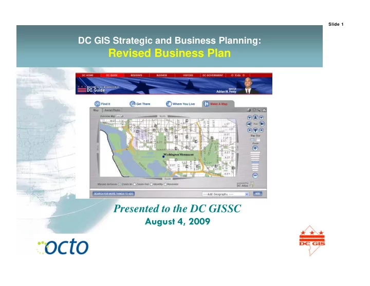
Slide 1 DC GIS Strategic and Business Planning: Revised Business Plan Revised Business Plan Presented to the DC GISSC August 4, 2009 Slide 2 Wordle View Slide 3 DC GIS Business Planning: Steps g p Form Business Plan Subcommittee (BPS)
Slide 1
Slide 2
Slide 3
Slide 4
Slide 5
Slide 6
Slide 7
Slide 8
Slide 9
Slide 10
1) Photogrammetric a) Orthoimages b) Planimetrics 6) Routing (pedestrian, vehicular, & mass transit) 7) Aerial Oblique Imagery b) Planimetrics c) Impervious Surfaces d) Elevation e) 3D Buildings 2) P t 7) Aerial Oblique Imagery 8) Business Data 9) LiDAR 10) Regional Data 11) D i D t 2) Property a) VPM b) MAR c) Zoning 11) Dynamic Data 12) Partner Data 13) Utilities Data 14) All Other ) g d) Planning e) ROW f) Survey 3) Demographics ) a) OCTO Maintained b) Agency Contributed 3) Demographics 4) Ground Imagery 5) Transportation
Slide 11
Data Type Investment Strategy Data Type Investment Strategy Photogrammetric Maintain/Invest in Business Data Invest Photogrammetric Maintain/Invest in next cycle Business Data Invest Property Invest LiDAR Invest Demographics Invest Regional Data Maintain Ground Imagery TBD Dynamic Data Invest Transportation Maintain Partner Data Maintain Routing Invest Utilities Invest Aerial Oblique Imagery Maintain All Other Maintain
Slide 12
Slide 13
Platform Type Investment Strategy Platform Type Investment Strategy Google Maps Invest Route Smart Invest Google Maps Invest Route Smart Invest Google Earth Invest Oracle RDBMS Maintain EFS (Pictometry Maintain VM Ware Maintain EFS (Pictometry Family) Maintain VM Ware Maintain ESRI ArcGIS Desktop Maintain DC Guide DB Sunset ESRI ArcIMS Sunset DC Guide WS Sunset ESRI ArcGIS Server (and ext ) Maintain DC Guide Link Sunset Server (and ext.) ESRI ArcPad Maintain Citrix Maintain
Slide 14
Slide 15
Slide 16
Slide 17
Slide 18
Slide 19
Slide 20
Slide 21
Slide 22
Slide 23
Slide 24
Slide 25
Slide 26
Louis Desjardins, DCWASA
2
† - CSO: Combined Sewer Overflow
3
p y p , rooftops, sidewalks, paved driveways, patios, and parking lots.
This fee has been implemented to recover the debt service costs of executing the Combined Sewer Overflow – Long Term Control Plan (CSO-LTCP) .
The amount of impervious area on each property will be determined from information contained in the District of Columbia’s Geographical Information System (DCGIS).
Current Database is built on the 2004 Planimetric Data and the September 2008 Vector Property
Residential Unit): a simplified billing that represents a typical house. – 1 ERU = 1000 square feet of impervious surface. – In line with DCWASA Board Resolution #08-34 and Policy #3 on Impervious Surface Area Charge, a preliminary review of the data and rate options to consider a multi-tier rate structure was completed. 4 – DC WASA and the District Department of the Environment (DDOE) are exploring an incentive program for the future to recognize property owners that have implemented wet weather control techniques.
5
$2.2 billion program Consent decree Consent decree Facility planning and geotechnical work has begun Projected to reduce 96% of CSOs 98% reduction on Anacostia 98% reduction on Anacostia River Plan includes: 3 large storage tunnels Pumping station improvements Pumping station improvements Targeted sewer separation Consolidation/elimination of several outfalls Low Impact Development Low Impact Development projects
Nine Minimum Control CSO improvements completed by 2008; reduce 40% of CSOs Received federal funding of about $122 million to date
for FY 2010
6
for FY 2010
Storm Water Overflow No Overflow Combined Sewer No Overflow During Dry Weather Blue Plains Advanced 7 Blue Plains Advanced Wastewater Treatment Plant
8
9
Category Share of Equivalent Residential Share of Metered Water Consumption Residential Units (%) Consumption Residential 24.4% 21.3% Commercial 33.2% 33.0% Multifamily 10 9% 20 7% Multifamily 10.9% 20.7% Federal 21.0% 16.9% Municipal 6.7% 3.2% DCHA 1.2% 2.9% WASA 2 6% 2 0%
WASA 2.6% 2.0% Totals 100% 100%
metered water consumption for each customer category.
customer categories due to differences in their water use and the amount of i i impervious area.
group due to the high-density of the land use.
10
same reason as above.
SF Res Non Res TOTALS Number of Premises to be Billed 104,285 27,610 131,895 Total Billing Impervious Area (sq. ft.) 125,759,654 310,929,129 436,688,783 Percent of Total Billing Impervious Area (%) 28.8% 71.2% 100% Percent of Total Water Consumption (%) 21.3% 78.7% 100% M I i A Bill bl P i ( ft ) 1 206 11 261 3 269 Mean Impervious Area per Billable Premise (sq. ft.) 1,206 11,261 3,269 Median Impervious Area per Billable Premise (sq. ft.) 981
11
Costs range from $7.4 million in 2009 to $80+ million in 2017 Includes all DC WASA approved LTCP costs
$90,000,000 CSO "Cost Pool" $60,000,000 $70,000,000 $80,000,000 $30,000,000 $40,000,000 $50,000,000 $0 $10,000,000 $20,000,000 2009 2010 2011 2012 2013 2014 2015 2016 2017
12
Adopted Proposed Rate FY 2009 May 1, 2009 w/IAC Rate Change E i iti U R t W t & W t t $/CCF* Exisiting Usage Rate - Water & Wastewater $/CCF* Water Rate 2.30 $ 2.30 $ Sewer Rate 3.47 $ 3.31 $ (0.16) $ Combined Rate 5.77 $ 5.61 $ (0.16) $ * 1 Ccf = 748 gallons IAC Charge $/ERU
$ 13 1 Ccf 748 gallons
IAC M thl Ch IAC Monthly Charge
(Per ERU)
$16.33
$16.00 $18.00
ge
$9.49 $11.46 $13.26
$10 00 $12.00 $14.00 $16.00
e Area Charg
$5.68 $ $7.21 $3 01
$6.00 $8.00 $10.00
ious Surface
$3.01 $2.20 $1.24
$0.00 $2.00 $4.00
Impervi
2009 2010 2011 2012 2013 2014 2015 2016 2017
14
Monthly Bill With and Without IA Charge for SF Customer with 8.33 CCF Water Use
$100 $80 $90 $100 $60 $70 hly Bill $30 $40 $50 Total Month $10 $20 $30 $0 Fiscal Year
No IAC $56.56 $61.66 $69.26 $77.49 $83.24 $86.16 $89.14 $91.86 With IAC $56.22 $61.47 $68.99 $76.99 $82.61 $85.33 $88.14 $90.70 2009 2010 2011 2012 2013 2014 2015 2016
15
Fiscal Year
$25,000 $20,000 $15,000
hly Bill
$10,000
Total Month
$5,000 $0 Commercial AH-No IAC $13,932.65 $15,284.36 $17,297.00 $19,478.02 $21,002.42 $21,775.73 $22,565.74 $23,208.79 C C $13 571 61 $14 752 83 $16 568 25 $18 105 01 $19 257 72 $19 480 62 $19 794 97 $20 001 74 2009 2010 2011 2012 2013 2014 2015 2016
16
Fiscal Year
Commercial AH-With IAC $13,571.61 $14,752.83 $16,568.25 $18,105.01 $19,257.72 $19,480.62 $19,794.97 $20,001.74
17
18
19
20
21
Buildings Sidewalks
ic
Premise Account IA Bill Determinant Revision layers are used to temporarily store information needed to assess the IA charges
available from the custodian agencies Swimming pools Sidewalks Stairs Pools/courts Roads/driveways Bridges/tunnels
DCGIS Planimetri Data
Appeal Process
CIS
Information from the Appeals Process is maintained in a separate set of layers that take precedence over other source dataset available from the custodian agencies This is where the IA Billing Master Address Repository (Weekly)
DCGIS A
IA Bill Determinant g Determinant information is stored for each premise. It also has effective start and end dates and a creation date (for historical view) Owner Poly (Monthly)
OTR/RPTA RA
Appeal Impervious Areas Revision Impervious Areas Appeal Property Boundary Vector Property
S D t
Permits (CapStat) (Weekly)
DCR
“Missing” Properties Revision Property Boundaries Revision Impervious Areas “Base” Owner Properties
Source Data
Premises Assigned Impervious Area The Assigned Impervious Area is the combined layer of all impervious areas that were derived from the source data for each land unit Sit Pl
22
IAB Data
Premises are maintained daily. Synchronized automatically with CIS every evening
EDMS
Site Plans Appeal Documentation
IAIS Database
CIS f (
boundary information
(Service Address, SSL, IA billing
active, inactive, purge) -- Daily synchronization with IAIS
(Se ce dd ess, SS , b g exemptions/hierarchy)
Boundary/Impervious Area information for successful appeals synchronization
billing address, outstanding balance, bill cycle, etc.) information for successful appeals
(temporary storage of information needed to assess IA charges when not available through DCGIS y , )
not available through DCGIS
Premise information Bill Dispute/Appeals Activities
23
“G d d” ll th DCWASA i
– Parsed and Normalized all the addresses – Matched against MAR – Matched against MAR using SSL Matched against MAR using SSL – Matched against OwnerPnt using address – Matched against OwnerPnt using SSL – Matched against DDOT Streets C/L
All of these had to be reviewed
– Matched against TeleAtlas – Manually Researched and Placed
C l d h l d b (G P i )
– Total Impervious Area for the land unit is truncated to the nearest 100 sq. ft.
24 24
Th i diff t t f IA E h t d t DCGIS f t l There are six different types of IA. Each type corresponds to a DCGIS feature class:
– Entire building was assigned if 80% if it’s mass was in the lot – Some were manually assigned when it was obvious they belonged there – Some had to be split because the building polygons were overlapping multiple lots p g p yg pp g p
Road
These features were clipped at the property line
25 25
26
27
O G O G Pl
Because Matt’s Data isn’t Perfect (yet!), we needed to cleanup a number of (y ), p property conflicts (in OwnerPly) and capture 500 or so land units that were not in the database.
28 28
Redevelopment
29
“Junk” Properties
(JTX) Framework
Job Tracking for ArcGIS is a workflow management application designed to improve the efficiency of any multiuser GIS project. Job Tracking for ArcGIS (JTX) provides advanced job tracking and workflow management tools
30 30
31 31
32 32
The IAIS Application is made of 3 ArcGIS Extensions and 11 batch jobs:
– IAIS Query Tools – IAIS Manage Premise Tools – IAIS Manage IA Tools
Export Premise Update – Export Premise Update – Import Premise Update Exceptions – Import Premise Extract from CIS – Import MAR – Import OwnerPly p y – Export Charge File Update – Import Charge File Update Exceptions – Administrative Routine Cleanup – Create Bill Determinant Report – Download Premise Extract – Download DCGIS Updates
33 33
Address (Service Address)
matched Address, Get MAR Address button.
found use Get DDOT found, use Get DDOT Address button.
sufficient, you may manually enter an address SSL U C d W d ll
34
35 35
Contact DC WASA with your comments or questions – E-mail at info@dcwasa.com @ – Supervisor - Eric Hunt 202-354-3685 @ eric.hunt@dcwasa.com – GIS Technician - Kristian Dennis 202-354-3673 kristian.dennis@dcwasa.com – GIS Technician - James Harris 202 354 3695 202-354-3695 james.harris@dcwasa.com – GIS Technician – Mia Burton-Joyner 202-354-3650 mia l.burton-joyner@dcwasa.com C stomer Ser ice Fa 202 354 3740
36
Customer Service Fax 202-354-3740