SLIDE 1 THE ANCIENT MINES OF USSEGLIO (Turin, Italy)
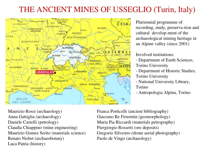
Pluriennial programme of recording, study, preserva-tion and cultural develop-ment of the archaeological mining heritage in an Alpine valley (since 2001) Involved institutions:
- Department of Earth Sciences,
Torino University
- Department of Historic Studies,
Torino University
- National University Library,
Torino
- Antropologia Alpina, Torino
Maurizio Rossi (archaeology) Franca Porticelli (ancient bibliography) Anna Gattiglia (archaeology) Giacomo Re Fiorentin (geomorphology) Daniele Castelli (petrology) Maria Pia Riccardi (materials petrography) Claudia Chiappino (mine engineering) Piergiorgio Rossetti (ore deposits) Maurizio Gomez Serito (materials science) Gregorio Silvestro (drone aerial photography) Renato Nisbet (archaeobotany) Paolo de Vingo (archaeology) Luca Patria (history)
SLIDE 2 TOPOGRAPHY AND GEOLOGY
Punta Corna mountain mining complex:
- located on the left side of the Arnàs stream valley (western Po basin)
- from 2.250 to 2.900 metres high (main peaks from 2.930 to 3.108 metres)
- between Rossa Lake (hydroelectric storage near French border, 2.718 metres) westwards and Torre d’Ovarda
mountain group (3.075 metres) eastwards
- mineralizations belonging to a trending system of post-metamorphic hydrothermal veins, mainly within the
metabasites of the Piemonte Zone, related to the circulation of hydrothermal fluids along extensional structures at the end of the alpine orogenesis
- protected by the institution of a 10 square kilometres area, wherein minerals collection and man-made objects
removal are totally forbidden
SLIDE 3
LIMITS OF PUNTA CORNA PROTECTED AREA
SLIDE 4 AERIAL RECONNAISSANCE OF ARCHAIC MINES
A sheaf of some kilometres long, till 10 metres large and 12 metres deep, open air trenches, issued from archaic iron ores mining (see, up left, hydroelectric Rossa Lake dam for size comparison). Trenches are associated with pits, ditches, descending galleries (often voluntarily filled up), sink-holes, undermined boulders, spoil banks, remnants of little rough- stone half-buried buildings and also walls, used for terracing, ore crushing and picking, sheltering gallery entrances and closing natural rock-shelters.
Areas: A = Aoutoùr B = Bòiri C = Corna L = Lucellina M = Masòc O = Ovarda P = Piani R = Terre Rosse S = Servìn T = Taglio del Ferro
SLIDE 5 TECHNICAL FEATURES OF EXPLOITATION
- exploitation focalized on iron hydroxides
(limonite, goethite)
- fragmentation strictly limited to mineralised
vein, particularly in upper and softer levels
- halt of exploitation when reaching inner and
harder levels of massive, un-weathered iron carbonates (siderite)
- no drill holes and rare tool marks on trench
sidewalls
- use of steel manual tools (found near the
trenches)
SLIDE 6 PRESENT LOOK OF TRENCHES
- nearly completely removed iron ores
- presence of not-removed boulders and panels of the
embedding rock
- widespread spoil banks running along the ditches
- presently unattainable bottom
- trenches connected to descending galleries entrances
in lower levels
- rather stable sidewalls with well preserved salbands
SLIDE 7 PRESENT LOOK OF PITS, DITCHES, DESCENDING GALLERIES AND SINK-HOLES
- excavated under main boulders, to shelter the access to veins
- circular, oval or funnel-shaped, placed upright the veins
- flanked by little, mound-shaped spoil banks
- obstructed by post-functional collapses or voluntarily filled in
- with underground rough-stone walls, slabs and stairs preserved
for few metres
- often well preserved in comparison with their working time,
because of scarce post-functional colluvium
SLIDE 8 PRESENT LOOK OF ROUGH-STONE BUILDINGS
- half-buried
- surrounded by spoil-
banks
irremovable boulders
divided into two little rooms with niches in the walls
roof rarely well preserved, generally collapsed into the rooms
descending galleries by narrow corridors
SLIDE 9
VERTICAL SECTION OF A TYPICAL PLANT
SLIDE 10
SITE MAPPING
Surface mining features, like gallery entrances, spoil banks and building remains, are photographed by a camera-bearing drone. After recomposition and correction of distortion, a general plan is drawn.
SLIDE 11 PICTORIAL SUGGESTIONS OF PRE-BLASTING MINING
Above: Plinian codex by Matteo Contugi (XVth century, Torino National University Library, ms.J.I.22-23). Left: organization of a pre-blasting mining plant in the polyptych by Hans Hesse (1522) for the altar of mine workers in the church of
- St. Anne at Annaberg-Buchholz
(Herzgebirge, Sachsen, Germany). Gunpowder diffusion in mining activities begins in the 17th century (first statements in the duchy of Savoy date since 1671, in the duchy of Milan since 1665).
SLIDE 12 CHRONOLOGY OF ARCHAIC EXPLOITATION
The dating of the exploitation to the middle ages is based on:
- historical documents, referring to mines activity, cast iron, steel and silver production, ore
thefts, in the years 1264 (but carrying on previous contracts), 1316, 1318, 1333, 1335, 1402, 1438, 1515 and not later;
- archaeological finds, particularly steel tools (12th-14th century), pottery (12th-13th
century), soap-stone vessels and Beech charcoal (14C date GrA-56663: cal AD 1016-1155 = 12th-13th century in reason of “old wood effect”).
SLIDE 13 ARCHAEOLOGICAL STRATIGRAPHY
Medieval pottery and soap-stone vessels from a forge near one of the trenches, found in association with steel mining tools and muleshoes, forge slags and charcoals. Stratigraphy: SKBpd, LSKBc, F8, LSMclr and TSKRlc (GrA-56663
14C date) = medieval forge levels; LSKG = non-anthropic level.
SLIDE 14
RADIOCARBON DATING OF FORGE CHARCOAL
SLIDE 15
WOOD REMAINS
Anthracological spectrum of forge charcoals (2744 samples). 1 = Larix decidua Mill.. 2 = Quercus sp.. 3 = Fagus sylvatica. 4 = Alnus sp. (not Alnus viridis). Reassemblage of a larch-wood manufactured plank and larch- wood joists from a mining hypogean shelter, 2.722 metres high, near the entrance of some descending galleries.
SLIDE 16
FORGE AND BLAST FURNACE SLAGS
SLIDE 17
THE AGE OF COBALT (1753-1845)
Since 1753, after a long period of scarce production, a new chapter begins, because of the discovery of cobalt ores, exploited by counts Rebuffo also for what concerns copper and silver (cobalt-iron-nickel arsenides with tetrahedrites). Two maps, dating to 1758-1772, mark the exact positions and directions of several veins. In 1758, a building, much larger than medieval ones, rises at 2.625 metres to house the workers.
SLIDE 18 A PROTO-INDUSTRIAL PERSPECTIVE
The exploitation is no longer opencast mining, but mainly underground, with several multi-level grids, sometimes intercepting former works, in a proto-industrial
- perspective. Two new buildings are constructed before 1815, at 2.374 and 2.439 metres
respectively: both are recorded in the above section, near the entrance of crosscuts.
SLIDE 19
PAPER MAPS AND MATERIAL REALITY (1)
Still today, veins, galleries, spoil banks and buildings reported by sections and maps can be identified in the field, even if galleries, rooms and stopes are mostly inaccessible, because of landslides, or dangerous, because of timbering fall down.
SLIDE 20
PAPER MAPS AND MATERIAL REALITY (2)
Sometimes, miners lived in hard conditions: the “Dwelling of Workers” (“Abitatione de Lauoranti”), recorded by the map, in 1758-1772, at the foot of “St. Mary Mine” (“Caua di S. Maria”), was a walled prehistory-like rock-shelter, still used occasionally in the twenties of the 20th century by the last prospectors.
SLIDE 21
PROTECTING THE ENTRANCES
To reach the deposit bed, that was hidden by a thick layer of debris, miners built some long galleries into such sediments, protected by side walls and roofed by rough-stone slabs. This one linked a dwelling to the real lower entrance of a mine, that was cut in hard rock: in that way, miners avoided blockings of the entrance by landslides or avalanches and escaped long removal works in spring, when restarting the exploitation after the winter break-time (documents inform us that the season lasted no more than four to six months).
SLIDE 22
OBSERVING THE MINERALIZATIONS: UNDERGROUND AND...
Siderite veins can be observed underground, where the exploitation stopped: they show a series of parallel, almost vertical bands, with a lot of gangue.
SLIDE 23 ... BY LABORATORY THIN SECTION ANALYSIS
a = skutterudite in siderite vein d = Co-Fe-Ni arsenides, goethite, b = Co-Fe-Ni arsenides, weathered erythrite siderite, ankerite e = rammelsbergite, siderite c = tetrahedrite, siderite, quartz f = skutterudite, goethite cp = chalcopyrite sf = safflorite lo = löllingite skut = skutterudite po = pyrrhotine td = tetrahedrite ram = rammeslbergite
SLIDE 24
“THE COBALT FACTORY”
Usseglio buit-up area still hosts the “Cobalt Factory”, at 1.290 metres, built in 1755-57 according to a model imported from Saxony and Bohemia by S.B. Nicolis di Robilant. The dressed ore that was producted by this plant was exported to Württemberg (55 tons until 1756). The original look of the building is recorded by maps and drawings dating to 1823- 1854.
SLIDE 25
FROM FACTORY TO HOTEL
The factory was then enlarged and modified, becoming one of the earlier hotels devoted to the rising mountain tourism, with the evocative appellation “Albergo Miniere” (“Mines Hotel”).
SLIDE 26
NOT JUST A LOCAL MARKET
SLIDE 27
IN CONCLUSION
activities but pasture took place.
Several sites are accessible, as guided tours in Punta Corna protected area are possible. For further information: www.antropologiaalpina.it studio@antropologiaalpina.it Researchers are carrying out a full survey of archaeological mining structures in relationship to geological, technological, historical and iconographic data. The state of preservation of this heritage is good, as the area is geologically stable, vegetation is almost absent, mining was suddenly abandoned and no subsequent