
SLIDE 1
Sinks and Fill
Lowell Anthony
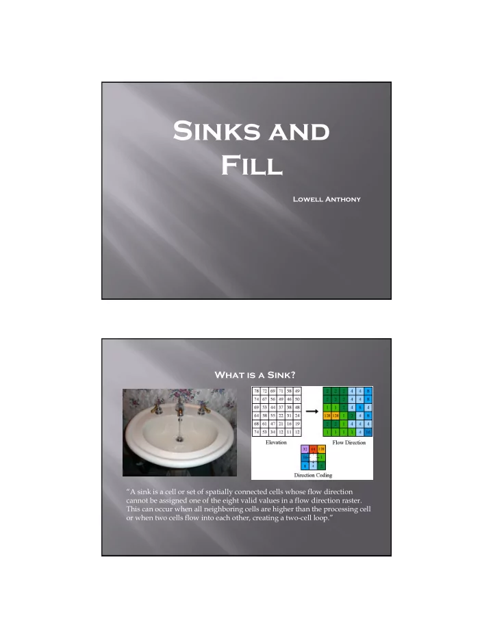
What is a Sink?
“A sink is a cell or set of spatially connected cells whose flow direction cannot be assigned one of the eight valid values in a flow direction raster. This can occur when all neighboring cells are higher than the processing cell
- r when two cells flow into each other, creating a twocell loop.”