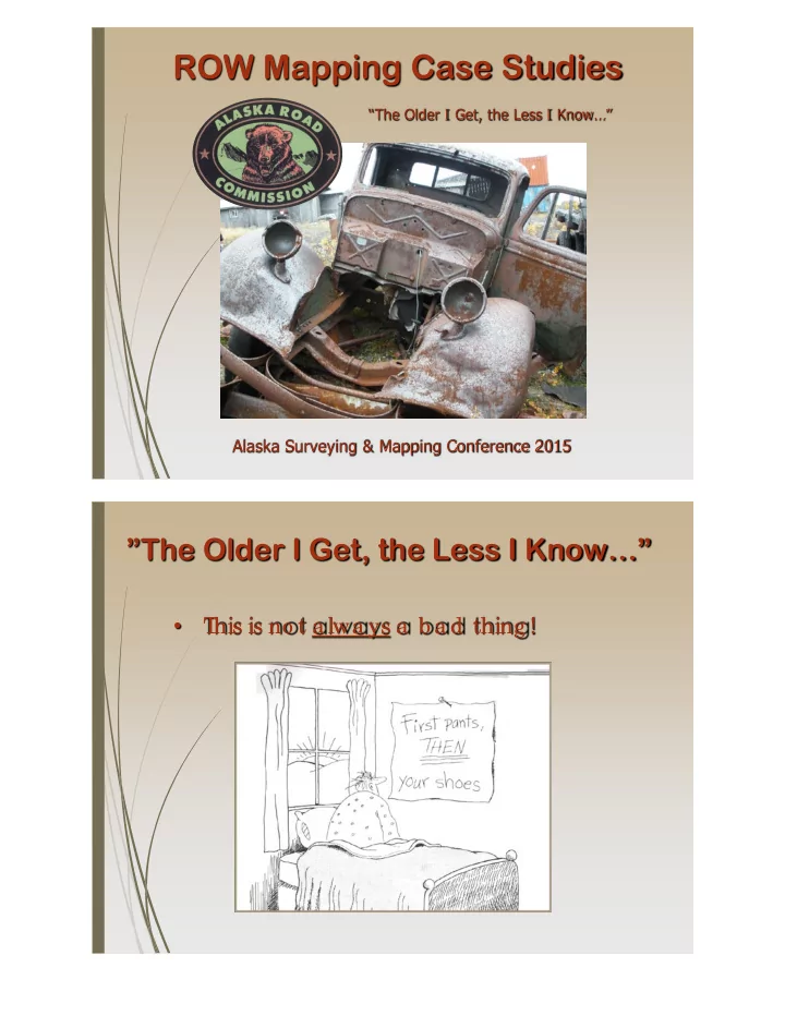
ROW Mapping Case Studies The Older I Get, the Less I Know Alaska - - PDF document

row mapping case studies
SMART_READER_LITE
LIVE PREVIEW

ROW Mapping Case Studies The Older I Get, the Less I Know Alaska - - PDF document

ROW Mapping Case Studies The Older I Get, the Less I Know Alaska Surveying & Mapping Conference 2015 The Older I Get, the Less I Know T his is no t a lwa ys a b a d thing ! The Older I Get, the Less I Know


slide-1
SLIDE 1

ROW Mapping Case Studies

Alaska Surveying & Mapping Conference 2015

“The Older I Get, the Less I Know…”

”The Older I Get, the Less I Know…”

  • T

his is no t a lwa ys a b a d thing !

slide-2
SLIDE 2

”The Older I Get, the Less I Know…”

  • T

his is no t a b a d thing !

  • We g ro w in e xpe rie nc e & e duc a tio n
  • Unlike o ur kids, we ne ve r kno w e ve rything !
  • T

he mo re we kno w wha t we do n’ t kno w

  • So re la x a nd pe e l b a c k a no the r la ye r o f

the “Onio n”

A Surveyor’s Dilemma…

  • Wha t do e s a surve yo r kno w a b o ut ROW?

Re tra c e me nt: L

  • c a te e xisting ROW

Sub divisio n: E sta b lish ne w ROW

slide-3
SLIDE 3

A Surveyor’s Dilemma…

  • Wha t do e s a surve yo r kno w a b o ut ROW?

Re tra c e me nt: L

  • c a te e xisting ROW

Sub divisio n: E sta b lish ne w ROW

  • E

xisting ROW is a nything b ut unifo rm! Autho ritie s va ry I nte re sts va ry Widths va ry

  • “A Pa tc hwo rk Quilt o f T

itle I nte re sts…”

Nome-Council Road MP 14-32 ~ Mapping the Right-of-Way at Statehood

slide-4
SLIDE 4

Getting Started

  • T

his ma pping pro je c t a lo ng time in the ma king 1899 Ma p o f No me Mining Distric t

Getting Started

  • T

his ma pping pro je c t a lo ng time in the ma king

  • Why so lo ng ? T

itle tra nsfe rre d in 1959…

  • ROW ma pping wa s no t c o nside re d a prio rity
  • Po rtio ns o f prima ry syste m still witho ut ma pping
  • MP 14-32 – L

a st g a p o n No me -Co unc il ro a d

  • Sto rm da ma g e re sulte d re lo c a tio n o f ro a d
  • 2011 “Sno wic a ne ” – E

q ua l to Ca t 4 Hurric a ne

  • Whe re is the ROW? ...no …Whe re is the ro a d?
  • F

e de ra l funds re q uire ROW “c e rtific a tio n”

  • E

R funds wa ive r if ro a d re c o nstruc te d in

  • rig ina l lo c a tio n
  • Co ntinua l lo b b ying fo r ma pping funds
  • T
  • o muc h mo ne y….to o little time
slide-5
SLIDE 5

Getting Started

  • Ma pping funde d a s a pa rt o f “No me Se a

Sto rm Pe rma ne nt Re pa irs – No ve mb e r 2011” 1913 No me Sto rm

Co urte sy o f Ca rrie M. Mc L a in Me mo ria l Muse um

2004 No me Sto rm

Getting Started

  • Ma pping funde d a s a pa rt o f “No me Se a

Sto rm Pe rma ne nt Re pa irs – No ve mb e r 2011”

  • I

ssue d to R&M Co nsulta nts unde r DOT &PF No rthe rn Re g io n Surve y T e rm Co ntra c t

  • NT

P issue d Aug ust 2013

  • Ae ria l Pho to g ra phy & F

ie ld Surve ys c o mpe te b y e nd o f the ye a r

  • Re tire d in Ma y 2014 – 29 ye a rs with De pt. o f

Hig hwa ys a nd DOT &PF

  • Jo ine d R&M Co nsulta nts – F

a irb a nks

  • Gre a t o ppo rtunity to se e pro je c t ta ke n to

c o mple tio n

slide-6
SLIDE 6

Finding the Historic ROW

  • Ma pping PL

O ROW – Be st E vide nc e

1920 Ala ska Ro a d Co mmissio n

Finding the Historic ROW

  • Ma pping PL

O ROW – Be st E vide nc e

  • L
  • c a te Ce nte rline : By Surve y o r Pho to g ra phy
  • Ha s Ce nte rline Mo ve d Sinc e Sta te ho o d?
  • F

it Ge o me try: T a ng e nts & Curve s

  • Offse t PL

O Rig ht-o f-Wa y Width

  • T

ie s to Adjo ining Surve ys & Bo unda rie s

  • Wha t is Se nio r? PL

O o r Prio r L a nd Ac tio ns

  • L

a nds: Sta te , F e de ra l, ANCSA, Priva te & N/ A

  • Prio r Ma pping : USGS Qua d - 1950
  • Sc a le – 1:63,360
  • Qua lity o f Pho to g ra phy
  • Ca rto g ra phic L

ic e nse

slide-7
SLIDE 7

Research Elements

  • No me -Co unc il Ro a d (Curre nt)
  • Are a Histo ry
  • Ae ria l Pho to g ra phy
  • Co nstruc tio n & Ma inte na nc e Re c o rds
  • Othe r Pub lic Ma pping Re c o rds
  • Ba c kg ro und I

nte rvie ws

  • Pub lic L

a nd Orde rs

  • Pub lic E

a se me nts b y Pre sc riptio n

  • F

lo a ting E a se me nts

  • F

e de ra l Rig ht-o f-Wa y Gra nts

  • Na tive Allo tme nt Use & Oc c upa nc y

Research Elements

  • No me -Co unc il Ro a d (Old L
  • o p)
  • Pub lic L

a nd Orde rs

  • Omnib us Ac t Quitc la im De e d I

ssue s

  • ROW Jurisdic tio n & Ma na g e me nt
  • RS-2477 T

ra ils & T e rrito ria l Ac t o f 1917

  • Othe r Pub lic Ma pping Re c o rds
slide-8
SLIDE 8

Research Elements

  • ROW I

ssue Qua lifie rs

  • Co nte xt – Wha t we re the y thinking ?
  • L
  • c a tio n – Whe re is it a t?
  • Width – Spe c ifie d o r?
  • I

nte re st – E a se me nt, fe e , o r?

  • Po lic y – Ag e nc y Po sitio n
  • !!! – Ho ly Co w! T

his wa s kind o f c o o l!!!

Area History

  • 1898 Go ld Disc o ve ry in Co unc il I

nitia te s Ro a d

  • 1904 Ro a d & Bridg e to MP3 Priva te T
  • ll F

a c ilitie s

  • 1905 Ala ska Ro a d Co mmissio n E

sta b lishe d

  • E

xte nsive ARC Ma inte na nc e in Suppo rt o f Mining

slide-9
SLIDE 9

Area History

  • 1913 sto rm de stro ys No me in pa rt, a ll o f So lo mo n,

la rg e se c tio ns o f the ro a d a nd a ll o f the b ridg e s!

  • 100 ye a rs la te r, Mo the r Na ture still in c o ntro l…
  • I

f a nyo ne se e s Wya tt, te ll him to sto p in June a u

  • n his wa y ho me to pic k up his pisto l!!!

Aerial Photography

Pho to g ra mme try b y K

  • dia k Ma pping , I

nc .

slide-10
SLIDE 10

Aerial Photography

  • Pho to g ra mme try b y K
  • dia k Ma pping , I

nc .

  • 2013 pho to s a c q uire d fo r a s-b uilt & de sig n
  • E

xisting ro a d e dg e dig itize d with c e nte rline splits e sta b lishe d e ve ry 500 fe e t

  • Be st fit c e nte rline to DOT

&PF 95/ 5 sta nda rd

  • 1950 Army Ma p Se rvic e fo r histo ric a l pho to s –

b a sis o f USGS So lo mo n B-6 Qua d

  • 1962 BL

M pho to s: b e tte r ima g e ry & da te – c le a rly re fle c ts re a lig nme nt a nd o ld lo o p

Construction & Maintenance Records

As-b uilts, ROW Pla ns, Re po rts, Co ntro l Surve ys

slide-11
SLIDE 11

Historical Archives Mapping Records - Federal

  • Re c ta ng ula r Surve ys
  • U.S. Surve ys
  • F

ie ld No te s

slide-12
SLIDE 12

Land Records - Federal

  • L

a nd Re se rva tio ns

  • ANCSA Pa te nts
  • Allo tme nt Ce rtific a te s

Public Land Records

  • De e ds
  • Va c a tio ns
  • Sub divisio ns
slide-13
SLIDE 13

Background Interviews

  • Ma y he lp to fill in so me histo ric a l g a ps
  • E

va n Bo o th: “Ye s, the fe rry was in o pe rate d b y the De pt. o f Hig hways until the b ridg e

  • pe ne d. I

was 8 ye ars o ld whe n I first c ro sse d.”

Nome-Council Road (Current)

T ra in to No whe re

slide-14
SLIDE 14

Public Land Orders

Arthur Gib so n Ma p - 1904

Public Land Orders

  • T

he e a sy pa rt – Mo st Omnib us QCD ROW a re PL O b a se d due to la rg e fe de ra l la nd ho lding s

slide-15
SLIDE 15

Public Land Orders

  • T

he e a sy pa rt – Mo st Omnib us QCD ROW a re PL O b a se d due to la rg e fe de ra l la nd ho lding s

  • Prio r to PL

O, prima ry b a sis fo r ROW wa s RS-2477

  • PL

O 601- Aug ust 10, 1949 - Withdra wa ls

  • Cla ssifie d: “T

hro ug h”, “F e e de r” & “L

  • c a l”
  • L
  • c a tio n: c e nte rline b a se d
  • Widths: 300’ , 200’ o r 100’
  • Sub je c t to va lid e xisting rig hts
  • SO 2665 – 1951- F

e e de r/ L

  • c a l no w e a se me nts
  • F

e de ra l/ Sta te / ANCSA g e ne ra lly sub je c t to PL O

  • Ho me ste a d, mine ra l a nd o the r fe de ra l pa te nts

& na tive a llo tme nts re q uire mo re a na lysis

  • 200’ PL

O ROW a pplie d to mo st o f pro je c t

Public Easements by Prescription

  • Whe n the ro a d fo o tprint is o utside o f the ROW
slide-16
SLIDE 16

Public Easements by Prescription

  • Whe n the ro a d fo o tprint is o utside o f the ROW
  • Adve rse Po sse ssio n – By lo ng pub lic use
  • F
  • r a “pre sc rib e d” pe rio d o f time
  • Cre a te s a n e a se me nt fo r pub lic a c c e ss
  • No c o mpe nsa tio n re q uire d
  • I

nve rse c o nde mna tio n

  • By a g e nc y with e mine nt do ma in a utho rity
  • I

na dve rte nt ta king b y e rra nt c o nstruc tio n

  • T

a king b y a g e nc y re pre se nta tio ns

  • Ge ne ra lly, the o nly issue is c o mpe nsa tio n

Public Easements by Prescription

  • I

s this a via b le to o l? Ma yb e no t!

slide-17
SLIDE 17

Public Easements by Prescription

  • I

s this a via b le to o l? Ma yb e no t!

  • ANCSA L

a nds

  • F

e de ra l pro te c tio n a g a inst a dve rse po sse ssio n fo r unde ve lo pe d ANCSA la nds

  • I

nve rse Co nde mna tio n no t pro hib ite d

  • Na tive Allo tme nts
  • No a dve rse po sse ssio n a g a inst trust la nds
  • I

nve rse c o nde mna tio n no t a pplic a b le

  • F

e de ra l & Sta te la nds: a dve rse po sse ssio n

  • Ca se la w a nd sta tuto ry pro hib itio ns
  • ANCSA la nds a nd a llo tme nts ma y b e

c o nde mne d with pa yme nt o f just c o mpe nsa tio n

Floating Easements

  • An e a se me nt with no fixe d lo c a tio n o r width
slide-18
SLIDE 18

Floating Easements

  • An e a se me nt with no fixe d lo c a tio n o r width
  • Simila r to a “b la nke t” e a se me nt in tha t the y

te nd to hinde r de ve lo pme nt due to the ir lo c a tio n a nd size b e ing inde finite a nd unc e rta in

  • SO 2665 e a se me nts fo r ne w c o nstruc tio n a nd

‘ 47 Ac t re se rva tio ns wo uld b e c o nside re d to b e “flo a ting e a se me nts” (ROW Ac t o f 1966)

  • T

he Sa fe ty So und Bridg e ROW pla ns a pplie d the 200’ wide PL O ROW a s a “flo a ting e a se me nt

Floating Easements

Sa fe ty So und ROW pla ns – no te c ro ss ha tc hing

slide-19
SLIDE 19

Floating Easements

Sa fe ty So und Bridg e As-Built – No te lo c a tio n o f e xisting hig hwa y

Floating Easements

  • T

he pro po se d c e nte rline is x-ha tc he d a s the e xisting PL O ROW

  • 1971 – DOH Co mmissio ne r a nd BL

M Dire c to r a g re e to c o nside r PL O e a se me nt a s “flo a ting ” to minimize the pa pe rwo rk re q uire d to a c q uire ne w ROW a nd va c a te o ld

  • 1976 – BL

M to DOH: Sto p do ing tha t!

  • I

n re c o g nitio n o f NE PA & ANCSA

  • ROW ma ppe rs “didn’ t g e t the me mo …”
  • As ne w pro je c t ROW wa s a c q uire d unde r BL

M Gra nt, “flo a ting e a se me nt” wa s no t a n issue

slide-20
SLIDE 20

Federal Right of Way Grants

  • E

a st a ppro a c h to Sa fe ty So und Bridg e

USGS So lo mo n 1955

Federal Right of Way Grants

  • E

a st a ppro a c h to Sa fe ty So und Bridg e

  • Co nstruc tio n sta ff fo und a lig nme nt pro b le m
slide-21
SLIDE 21

Federal Right of Way Grants

  • E

a st a ppro a c h to Sa fe ty So und Bridg e

  • Co nstruc tio n sta ff fo und a lig nme nt pro b le m
  • Pla nne d g e o me try wo uld fa ll a lmo st 100’ to

the no rth o f the e xisting ro a d

  • Did de sig ne r use ROW a s the c e nte rline tie ?
  • Or wa s it the surve y c o ntro l tie to USS 480?
  • Did c o nstruc tio n surve yo r use wro ng c o ntro l?
  • Ho w sho uld it b e so lve d?
  • Ac q uire mo re ROW
  • F

ie ld a djust c e nte rline c urve to fit

  • Ultima te ly, the surve y & ma pping e rro rs we re

a b so rb e d b y ho lding the BL M Gra nt de sc riptio n a nd c o ntro lling it with the b ridg e

slide-22
SLIDE 22

Use & Occupancy Native Allotments

Use & Occupancy

  • PL

O sub je c t to va lid e xisting rig hts

  • U&O da te s pre c e de d PL

O 601 o n 8 a llo tme nts

  • Did Omnib us QCD c re a te a c lo ud o n N/ A title ?
  • Ag uila r v. Unite d Sta te s 1979 Na tive Allo tme nts
  • U.S. o b lig a te d to re c o ve r title fo r a llo te e
  • Omnib us QCD inte re sts sub je c t to Ag uila r title

re c o ve ry pro c e ss

  • DNR c a n ne g o tia te title re c o ve ry pro c e ss
  • T

itle re c o ve ry re q ue st ma y b e re je c te d

  • Ma y b e sub je c t to e a se me nts
  • U.S. c a n a nd ma y sue to re c o ve r title
  • Po lic y: Asse rt a s va lid until sho wn the c o ntra ry
slide-23
SLIDE 23

Old Nome-Council Road

Co rne r T ie s a t Sa fe ty So und

Old Nome-Council Road

  • 1953 re a lig nme nt re sulte d in 2.5 mile lo o p
  • T

he lo o p wa s no t a ssig ne d a ro ute numb e r

  • T

he lo o p wa s no t na me d in the Omnib us QCD

  • Sta tus o f Old No me -Co unc il Ro a d?
  • I

s it a pub lic rig ht-o f-wa y?

  • I

s it the 200-fo o t wide PL O ROW?

  • I

f no t, wha t is the b a sis a nd width?

  • Do e s DOT
  • wn a nd ma na g e the ro a d?
  • Othe r title & po lic y issue s?
slide-24
SLIDE 24

Public Land Orders

  • I

nitia l ROS sho we d Old No me -Co unc il ro a d c ro ssing 30 se pa ra te pa rc e ls

Public Land Orders

PL O 200’ ROW a pplie d to o ld a nd ne w ro a ds

slide-25
SLIDE 25

Public Land Orders

  • I

nitia l ROS sho we d Old No me -Co unc il ro a d c ro ssing 30 se pa ra te pa rc e ls

  • PL

O 200’ ROW a pplie d to o ld a nd ne w ro a ds

  • PL

O no t a pplie d to 3 a llo tme nts with use &

  • c c upa nc y da te s prio r to PL

O 601

Omnibus Quitclaim Deed Issues

  • Sho uld b o th o ld & ne w ro ute s b e 200’ ROW?
slide-26
SLIDE 26

Omnibus Quitclaim Deed Issues

  • Sho uld b o th o ld & ne w ro ute s b e 200’ ROW?
  • “T

hro ug h” & “F e e de r” ro ute s ha ve b e e n re a lig ne d with “L

  • c a l” sta tus a ssig ne d to o ld

a lig nme nt…the n na me d in Omnib us QCD

  • T
  • k-Cuto ff: Ro ute 8921 - Me nta sta Spur
  • Ric ha rdso n: Ro ute 6851 - Old Ric ha rdso n
  • Sho uld a sse rtio n b e limite d to 100-fe e t?
  • Cle a rly me e ts re q uire me nts fo r PL

O ROW

  • No writte n DOT

&PF Po lic y

  • Disc usse d in prio r c o rre spo nde nc e with BL

M

  • DOT

a c c e pte d re c o mme nda tio n o f100’ ROW

  • Qua si E

sto ppe l wo uld lo c k in a sse rtio n

slide-27
SLIDE 27

ROW Jurisdiction & Management

  • T

he o ld lo o p is sub je c t to a 100’ PL O ROW

OR

ROW Jurisdiction & Management

  • T

he o ld lo o p is sub je c t to a 100’ PL O ROW

  • No t c o nve ye d b y Omnib us QCD to the Sta te
  • Wha t is ROW whe re a llo tme nt use &
  • c c upa nc y pre c e de s PL

O 601 da te ?

  • No “Ag uila r” a llo tme nt re c o nve ya nc e issue
  • Old lo o p is e ffe c tive ly a n “o rpha n” ro a d
  • Simila r to ro a ds in Uno rg a nize d Bo ro ug h
  • Or Bo ro ug hs witho ut ro a d po we rs (F

NSB)

  • Outside o f c ity jurisdic tio n
  • Outside o f Se rvic e distric t
  • Ma na g e me nt ma y b e a ssume d a t la te r da te

b y a n a utho rize d e ntity

slide-28
SLIDE 28

Patent Reservations

  • Co nflic ting re se rva tio n in a llo tme nt c e rtific a te

Patent Reservations

  • Co nflic ting re se rva tio n in a llo tme nt c e rtific a te
  • “T

his allo tme nt is sub je c t to an e ase me nt fo r hig hway purpo se s, e xte nding 100 fe e t e ac h side

  • f the c e nte rline o f the o ld No me -Co unc il Ro ad

and transfe rre d to the State o f Alaska pursuant to the q uitc laim de e d date d June 20, 1959.”

  • “sub je c t to ” c a n c re a te pro b le ms in de e ds
  • Ofte n c o nfuse d with inte nt to re se rve a rig ht
  • Do e s it c re a te a rig ht in this c o nve ya nc e …o r is it

just a n e rro r?

  • Me tho ne n v. Sto ne Ala ska 1997 – inte ntio n must

b e c le a r…a mb ig uitie s re so lve d in fa vo r o f la nd use fre e o f e a se me nts.

  • PL

O a sse rtio n wa s limite d to 100-fe e t

slide-29
SLIDE 29

RS-2477 Trails & 1917 Territorial ROW Act

  • Allo tme nt Use & Oc c upa nc y pre c e de s PL

O 601

1900 Ma p o f Ca pe No me a nd Go lo vin Ba y

RS-2477 Trails & 1917 Territorial ROW Act

  • Allo tme nt Use & Oc c upa nc y pre c e de s PL

O 601

  • “Ag uila r” do e s no t a pply
  • Alo tte e ’ s inte re st sub je c t to va lid e xisting rig hts
  • Allo tme nts a re sub je c t to va lid RS-2477 ROW
  • I

nc luding the 3 a llo tme nts o n the o ld lo o p ro a d

  • But, wha t is the width o f the RS-2477 ROW?
  • “ditc h to ditc h”…pub lic use r fo o tprint?
  • 66’ b a se d o n 1923 te rrito ria l a c c e pta nc e ?
  • 100’ b a se d o n A.S. 19.10.015 de c la ra tio n?
  • 60’ b a se d o n T

e rrito ria l Ac t o f 1917?

slide-30
SLIDE 30

RS-2477 Trails & 1917 Territorial ROW Act

  • 60’ b a se d o n T

e rrito ria l Ac t o f 1917

  • “T

he lawful width o f rig ht-o f-way o f all ro ads

  • r trails shall b e sixty fe e t (60).”
  • T

e rrito ria l funds ha d b e e n use d o n o ld lo o p

  • 1917 Ac t did no t se rve to c re a te rig hts-o f-wa y
  • Ac ts a s a a n a c c e pta nc e o f the RS-2477 Gra nt
  • Re fle c te d lo c a l la w o r c usto m with re g a rd to

sta nda rd width o f a hig hwa y.

  • 60’ a c c e pte d fo r RS-2477 ROW a c ro ss a llo tme nt

Summary

  • ROW ma pping o f the No me -Co unc il ro a d

pre se nte d a va rie ty o f issue s, so me we ha ve se e n b e fo re a nd a fe w tha t we re ne w.

  • T

he sta te ’ s a sse rtio n o f the hig hwa y ROW is no w fixe d in the ROS a nd will b e re pro duc ib le a fte r future sto rms.

  • ROS will se rve to pro te c t the rig hts o f a djo ining
  • wne rs.
slide-31
SLIDE 31

T he E nd