
SLIDE 1
SANTA MONICA PIER BRIDGE REPLACEMENT PROJECT
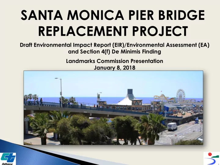
Draft Environmental Impact Report (EIR)/Environmental Assessment (EA) and Section 4(f) De Minimis Finding Landmarks Commission Presentation January 8, 2018
REPLACEMENT PROJECT Draft Environmental Impact Report - - PowerPoint PPT Presentation
SANTA MONICA PIER BRIDGE REPLACEMENT PROJECT Draft Environmental Impact Report (EIR)/Environmental Assessment (EA) and Section 4(f) De Minimis Finding Landmarks Commission Presentation January 8, 2018 PURPOSE OF THE PRESENTATION To
Draft Environmental Impact Report (EIR)/Environmental Assessment (EA) and Section 4(f) De Minimis Finding Landmarks Commission Presentation January 8, 2018
ADA-access path)
the existing bridge during construction for pedestrian access
TEMPORARY VEHICLE BRIDGE
NEW WIDE BRIDGE
TEMPORARY PEDESTRIAN BRIDGE
ADA-access path)
vehicular access
the existing bridge during construction for pedestrian access
Moss Avenue
NEW WIDE BRIDGE
TEMPORARY RAMP
TEMPORARY PEDESTRIAN BRIDGE
Alternative 3: Two-Bridge Replacement Alternative
path, that would allow emergency vehicle access
and Pier Deck Parking
the existing bridge during construction for pedestrian access
NEW BRIDGE MOSS AVE. BRIDGE
TEMPORARY PEDESTRIAN BRIDGE
Alternative 3: Two-Bridge Replacement Alternative
MOSS AVENUE BRIDGE
Design Option A: A straight path with a 5% slope and combination of either one or two elevators, an escalator, and/or stairs.
ALTERNATIVE 1 & 2 OPTION A
ALTERNATIVE 1 & 2 OPTION A
ALTERNATIVE 3 OPTION A
(COLORADO AVE. BRIDGE SHOWN)
Design Option B: A attached fixed walkway structure with a series of curved/switch-back ramps and landings that meet ADA slope requirements.
ALTERNATIVE 1 & 2 OPTION B
(COLORADO AVE. BRIDGE)
(COLORADO AVE. BRIDGE SHOWN)
NOA Filing Date: December 11, 2017 CEQA LEAD AGENCY: City of SANTA MONICA NEPA LEAD AGENCY: CALTRANS PURPOSE OF NOTICE OF AVAILABILITY
proposed minimization & mitigation measures
PURPOSE OF PUBLIC REVIEW PERIOD
effects as analyzed in the EIR/EA
and mitigation measures in the EIR/EA
Pedestrian & Bicycle Facilities
Significance
Potential Effects on Uti
tili lity ty Servic vice
Potential Effects of lane/road closures on Emer
mergen gency Respond sponders ers
Potential Traffic
ffic Con
gestion Impacts
Potential Effects on buried or adjacent Cultura
ultural l Resour sources ces
Potential Effects on Water
ter Quali uality
Potential Effects due to Geology/
eology/Soil ils
Potential Effects on buried Paleo
eontolo tologica gical l Resour sources ces
Potential Effects due to Hazar
zardo dous s Material terials
Potential Effects on Air Quali
uality
Potential Effects on Biolog
ical l Resour sources ces
Potential Effects on a Sectio
ction 4(f) f) Recreat ecreatio ional l Resour source ce
Plan to maintain uti
tili lity service vice on Pier through construction
Plan to maintain emer
ergen gency servic vice access through construction
Traff
ffic ic Impac pact Mitiga igati tion n Plan an to deal with closures/detours
Arch
chae aeolo logical gical Mon
torin ing g if human remains or cultural resources unearthed
Adjac
jacen ent t Struc uctu ture e Mon
itorin ing g and nd Shorin horing g Plan an to protect historic structures and landscaping in place and/or replanting/replacing in kind
Implementing NP
NPDES ES and d SWPPP P permits mits to protect water quality
Provide Engin
ginee eered ed Struct uctur ure e for seismic smic haza zards ds
Paleo
eontolo tologic gical al Mon
itorin ing g of soil excavation
Health & Safety Plan and Abatem
atemen ent t of asbest estos
lead-based based paint, int, groundwater dewatering, and Lead-Based Paint Survey Work Plan
Dust
t Control ntrol Measures sures, limit mit idlin ing g vehicles, and use of Tier er 4 equipmen uipment such as new ew gene neration ration lowe wer emiss issio ion constr truc ucti tion
equipm uipmen ent
Limit
mit cons nstruct ruction ion activities/staging/storage to define ined limits mits of distur turbanc bance
Nesti
ting ng bird surveys eys and nd monit itori ring by bat biolo logis gist
Weed
ed cont ntro rol l & a avoid id plan anti ting g invasiv asive e species ies
Temp
emporar
y relocat catio ion of recreation features & r reco constr truction uction for Section 4(f) property
The only potential significant impact as a result of project
mited ed inc ncrea rease se in traffi fic c congestio
cal l intersec tersecti tions and d some me loca cal l street et segme ments nts due to new ingress & egress to Pier Parking Lot under Alternative 3.
multi-modal access to and from the Pier, there is no feasible mitigation that could reduce this impact to less- than-significant, and this is the e only nly Signif gnifica icant Unavoidabl navoidable e Impac pact of the project.
SANTA MONICA
PIER
PALISADES PARK PIER SIGN HIPPODROME
BUILDING
1601~1613
OCEAN FRONT WALK BUILDINGS AND PARCELS & 1615~1619 OCEAN FRONT WALK PARCELS
SANTA MONIA PIER
All of the modifications to the pier deck that are visible will be reconstructed and replaced in kind so as to maintain the historic character of the pier, with new materials matching the original/old design, color, texture, and other visual qualities. All such work shall be accurately reproduced, based on historical, pictorial, and physical documentation and evidence.
PALISADES PARK
The City would implement minimization measure CR-4 to further ensure that Palisades Park maintains its characteristics. Detailed design plans involving modifications to Palisades Park shall be submitted to the Landmarks Commission for its review and approval prior to the beginning of any construction work, including removal
Prior to removal of any vegetation, a landscape architect experienced in the identification and preservation
project site that is within the Palisades Park. Any vegetation identified would be required to be preserved in-place. If preservation is not possible, a removal and replacement plan would prepared adhering to the Secretary of the Interior’s Standards. The plans would be submitted to the Landmarks Commission and City’s Urban Forester for review and approval.
PIER SIGN
Prior to any construction related to the proposed project, a Protection Plan and Materials Conservation Report would be prepared to ensure the protection of the Pier Sign throughout construction. The report would be prepared by a qualified historic preservation professional adhering the Secretary of the Interior’s
The preservation plan would include methods for protecting the sign in place, such as surrounding the supports or providing fencing and clearly marking and documenting in the construction plans so that construction activities would not result in move or damage to the supports or any elements of the Pier Sign.
HIPPODROME BUILDING
& 1601~1613 OCEAN FRONT WALK BUILDINGS AND PARCELS & 1615~1619 OCEAN FRONT WALK PARCELS
the existing condition for the historic record. The documentation will be kept on file at the City of Santa Monica.
Shoring Plan by Professional Engineer would be prepared, to safeguard adjacent historic resources, including the Hippodrome and 1601–1619 Ocean Front Walk buildings, during construction from damage due to general construction activities and mitigate the possibility of settlement due to the removal of adjacent soil.
HIPPODROME BUILDING
& 1601~1613 OCEAN FRONT WALK BUILDINGS AND PARCELS & 1615~1619 OCEAN FRONT WALK PARCELS
All new construction work would be performed so that adjacent buildings, including the Hippodrome and 1601–1619 Ocean Front Walk buildings, will not be adversely affected.
A qualified and California-licensed Professional Engineer will develop monitoring recommendations, based on preconstruction surveys of the existing conditions. Monitoring may include the use of vibration monitors, elevation and lateral monitoring points, crack monitors, or other instrumentation determined necessary to protect adjacent buildings from construction related damage.
Vertical and horizontal movement would be determined by a California licensed land surveyor, and vibration thresholds will be below levels that could damage adjacent buildings.
If thresholds are met, or if noticeable structural damage becomes evident to the project contractor, the work would stop until feasible steps to reduce vibratory levels have been undertaken and minimization measures have been implemented to stabilize adjacent building and prevent construction related
with the adjacent property owner and a qualified preservation consultant and, if warranted, in a manner that meets the Secretary of the Interior’s Standards.
If necessary, as determined by a California-licensed Professional Engineer, a shoring plan will be developed to protect adjacent historic resource from excavation or general construction procedures. The shoring plan will be developed by the contractor and submitted to the City of Santa Monica for review.