reducing offshore drilling and construction risks with
play

Reducing offshore drilling and construction risks with Metocean - PowerPoint PPT Presentation

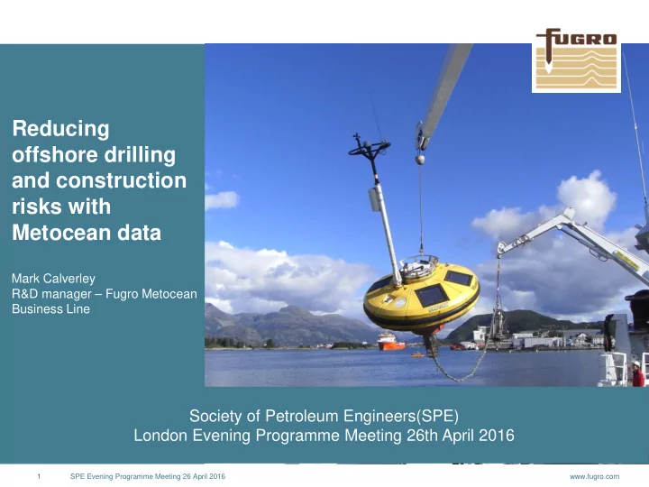
Reducing offshore drilling and construction risks with Metocean data Mark Calverley R&D manager Fugro Metocean Business Line Society of Petroleum Engineers(SPE) London Evening Programme Meeting 26th April 2016 1 SPE Evening


  1. Reducing offshore drilling and construction risks with Metocean data Mark Calverley R&D manager – Fugro Metocean Business Line Society of Petroleum Engineers(SPE) London Evening Programme Meeting 26th April 2016 1 SPE Evening Programme Meeting 26 April 2016 www.fugro.com

  2. Outline • Metocean – what, why? • Drilling • Metocean Considerations • When to measure? • Construction • Weather risk • Understanding forecasts 2 SPE Evening Programme Meeting 26 April 2016 www.fugro.com

  3. Winds 3 SPE Evening Programme Meeting 26 April 2016 www.fugro.com

  4. Waves 4 www.fugro.com

  5. Currents / Water Levels Courtesy of NASA's Goddard Space Flight Center 5 SPE Evening Programme Meeting 26 April 2016 www.fugro.com

  6. Physical Oceanography • Temperature • Flow assurance • Conductivity • Density • Member weights • Sound Profile • Survey 6 www.fugro.com

  7. Engineering / Metocean Interactions Engineering Marine Warranty Engineering Operations Schedule / Legislation Regional Metocean Data Metocean Data Metocean Oceanography Requirements Analysis Model Spatio-temporal Installation Modelling Choice Grid size Instrument Sampling Installation Measurements Choice Strategy 7 SPE Evening Programme Meeting 26 April 2016 www.fugro.com

  8. Structural / Budget Challenges Exploration Contractors Metocean Strategy Metocean Drilling Engineering design 8 www.fugro.com

  9. Metocean Strategy across the life cycle Risk Cost 9 www.fugro.com

  10. Metocean for Drilling – Operational Planning / Engineering • Selection of drilling platform • Jackup • Generally wave dominated forces • Water levels also important • Current / wind loading of less importance • Jacking operations most vulnerable • Reliable wave criteria • Reliable water level criteria • Joint probability of wave/water levels • Knowledge of temporal variability to optimise jacking operations 10 www.fugro.com

  11. Metocean for Drilling – Operational Planning / Engineering Selection of drilling platform • Drillship • Semi-sub (DP) • Semi-sub (anchored) • Wave directionality of importance to drillships • Directional differences between loading important • Wave period critical • Currents important to station keeping and riser analysis • Wind loading important in areas of squalls 11 www.fugro.com

  12. Metocean for Drilling – Operational Planning / Engineering Areas of Uncertainty • Hindcast Model reliability (atmospheric, waves, currents) • Analysis Methods • Response modelling • Metocean processes not represented in models (temporal or spatially) DNV Guidance note: For meteorological and oceanographic data a minimum of three to four years of data collection is recommended. Planning generally based on hindcast data: • Temporal and spatial resolution • Validation / verification 12 SPE Evening Programme Meeting 26 April 2016 www.fugro.com

  13. Atmospheric Model reliability Atmospheric Models Assimilation data – helps to define current state of the atmospheric – informed by satellites, observations (>8,000 Metar/Synop) 13 www.fugro.com

  14. Wave Model reliability Wave Models Assimilation data – helps to define current state of the wave field – informed by satellites (altimeter / SAR / GNSS*), observations (order of magnitude fewer than meteorological stations) 14 www.fugro.com

  15. Current Model Reliability Current Models Assimilation data – helps to define current state of the ocean circulation– informed by satellites (altimeter / SST), observations (3000 Argo floats) 15 www.fugro.com

  16. Ensemble Models Limitations of models recognised • Certainly in forecasting, lead to the implementation of ensemble forecasting • Needs end user to understand Probability map for temperature Standard deviation of a temperature ensemble forecast 16 www.fugro.com

  17. Temporal Considerations What is the temporal resolution of the model data? • 1-hourly • 3-hourly • 6-hourly What is the lead time for an operation? What is the duration of an operation? What are the time scales of the Metocean processes? Some processes not well represented in models include: • Squalls • Solitons • Polar lows Use of complementary data, e.g. satellite data. 17 SPE Evening Programme Meeting 26 April 2016 www.fugro.com

  18. Spatial Considerations Model resolution 18 SPE Evening Programme Meeting 26 April 2016 www.fugro.com

  19. Spatial Considerations Model resolution 19 SPE Evening Programme Meeting 26 April 2016 www.fugro.com

  20. Spatial Considerations Can the models capture the spatial scales of the Metocean processes. For example polar lows. During planning can you rely on the geographic registration of frontal features? Do the models domains extend, at appropriate resolution, to topography / coastlines that might drive the wind forcing? 20 SPE Evening Programme Meeting 26 April 2016 www.fugro.com

  21. Model versus Measured Data Is the environment severe? Can the requirements be addressed by a desk study? • Are metocean processes that impact drilling considerations properly represented? • Early commission of a desk study might help to understand risks. Prospectivity – could site specific measurements add value to fast tracking development? Are data needed in region for other assets? Cost constraints – typically measurements prior to discovery are increasingly rare outside frontier regions such as Barents Sea. Typical year long metocean measurement campaign equivalent to 4 or 5 days downtime! 21 www.fugro.com

  22. Metocean for Drilling – Real time support • Forecast reliability informed by site specific measurements • Operational decision making • Legislative requirements (e.g. CAA CAP437, NTL) • Informing future development through site specific data collection 22 www.fugro.com

  23. Forecast reliability Does not provide information of timing of frontal systems. 23 www.fugro.com

  24. Operational decision making 24 www.fugro.com

  25. Soliton Early Warning System Soliton Andaman Sea generation zone Malacca 2 x Real-time SEWS moorings Strait SEWS#1 Sumatra SEWS#2 25 www.fugro.com

  26. Soliton Early Warning System Warning Level Current Speed Actions (knots) Record the solitons in daily 24-hour summary, but no warning required or LOW < 1.5 action to be taken by the rig MEDIUM 1.5 to 2.0 Issue soliton warning by email, but the rig will probably not take action Issue soliton warning by email and follow up by calling OIM. The rig will tighten HIGH 2.0 to 3.0 anchor wires and standby Issue soliton warning by email and follow by calling OIM. Rig will prepare for VERY HIGH > 3.0 possible disconnect 26 www.fugro.com

  27. CAP437 27 www.fugro.com

  28. Data to support Development Drilling platforms offer a relatively cheap measurement opportunity. Leverage to collect data to understand reliability of hindcast models supporting engineering, particularly valuable for current models. Provide measurement of processes beyond model capabilities, e.g. squalls. DNV requirement to engineer against measured winds. 28 www.fugro.com

  29. Where do the uncertainties /risks lie? Hindcast Model reliability (atmospheric, Forecast Model reliability (atmospheric, waves, currents) waves, currents) Analysis Methods Metocean Awareness Response modelling Measurement QA Metocean processes not represented in models (temporal or spatially) 29 SPE Evening Programme Meeting 26 April 2016 www.fugro.com

  30. Metocean within construction Planning Transport / Execution Analysis Data to support operational Ways to forecast / measure Quantification of downtime, planning. Metocean conditions for Accuracy of forecasts, etc. operational planning. Ways to characterise Metocean conditions for operational planning. Forecast considerations. 30 SPE Evening Programme Meeting 26 April 2016 www.fugro.com

  31. Weather Cost Exposure Assume an operation west of Shetland with £250k day rate. 1. Joint frequency distribution based on 4m threshold on significant wave height. 2. Joint frequency distribution based on 4m threshold on significant wave height and peak period below 10s 3. Persistence based on significant wave height and 18 hour duration. 4. Weather windows analysis based on: • 18-hour duration • Operational threshold = 4m, Tp > 10s; 2.5m, Tp < 2.5s 31 SPE Evening Programme Meeting 26 April 2016 www.fugro.com

  32. Weather Cost Exposure 32 SPE Evening Programme Meeting 26 April 2016 www.fugro.com

  33. Weather Cost Exposure August September Analysis Hs =4m Hs=4m, Hs=4, Tp<10s Durn>18hr Downtime days August 0.45 8.2 0.10 September 3.47 18.62 4.13 Downtime cost August 112,375 2,056,452 24,800 September 868,500 4,656,458 1,031,250 Sep-Aug 756,125 2,600,006 1,006,450 WOW (hours) Weather cost (£) August September Average 1.9 8.0 20,060 83,177 Maximum 54.0 96.0 562,500 1,000,000 P10 6.0 30.0 62,500 312,500 P20 0.0 12.0 - 125,000 P30 0.0 0.0 - - 33 SPE Evening Programme Meeting 26 April 2016 www.fugro.com

Download Presentation
Download Policy: The content available on the website is offered to you 'AS IS' for your personal information and use only. It cannot be commercialized, licensed, or distributed on other websites without prior consent from the author. To download a presentation, simply click this link. If you encounter any difficulties during the download process, it's possible that the publisher has removed the file from their server.

Recommend


More recommend