
SLIDE 1
1
- Engr. Nadeem Arif,
MD, EMC Pakistan Pvt Ltd, Karachi.
Recycling of Water from Thar Coal Mines Engr. Nadeem Arif, MD, EMC - - PowerPoint PPT Presentation
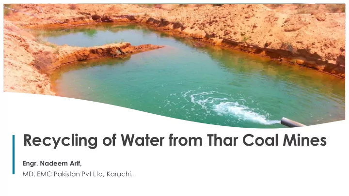
Recycling of Water from Thar Coal Mines Engr. Nadeem Arif, MD, EMC Pakistan Pvt Ltd, Karachi. 1 What we shall Discuss ? Part 1 : An Introduction to Thar Geography, Climate, Physiography and Social Context Part 2 : Mining in Thar and
1
MD, EMC Pakistan Pvt Ltd, Karachi.
2 2
Part 1 : An Introduction to Thar Geography, Climate, Physiography and Social Context Part 2 : Mining in Thar and Dewatering Coal Mining in Thar, Aquifer Hydrogeology & Mine Dewatering Part 3 : Utilizing Mine Effluent of Thar Recycling Mine Effluent Water for Water Supply to Blocks and Local Settlements, Disposal of excess water and other avenues of reuse.
3 3
Geography, Climate, Physiography and Social Context
4 4
Geography of Thar Desert » The Thar desert covers an area of approximately 320,000 km2, with dimensions of approximately 800 km by 400 km. It extends across northwest India and southeast Pakistan. The desert is bounded by the Indus River on the East and floodplains to the West, the Sutlej River and its floodplains to the North, the Aravalli ranges to the east and the seasonal salt marshes of the Rann of Kutch to the south.
5 5
The Tharparkar District is located in the south- eastern corner of Pakistan in the province of Sindh. The District derives its name from Thar and
term used locally for a region of sand ridges and Parkar literally means "to cross over". The Tharparkar District comprises six Talukas (sub-districts) i.e. Diplo, Mithi, Islamkot, Chachro, Dahli and Nagarparkar. A seventh Taluka called Kaloi has been very recently added. It covers an area of 19,638 square kilometres (km2). Thar District and its composition »
6
Temperature Precipitation Wind
In summer, the mean average temperature varies in between 24°C to 26°C. Winter are milder with average temperature varying from 4°C to 10°C The peak daily temperature in summer can reach ~52°C The precipitation pattern is irregular in this semi-arid to arid region of the Thar Desert. Droughts are cyclic with return periods of every three to four years. The Thar receives its highest precipitation in the months of July to August. In general, wind speed is highest during the summer when the prevailing monsoon brings high winds which blow southwest to northeast. During the cooler winter period (December-January), the wind direction changes to blow at a lower speed from the northeast.
7
Physiography and Soil »
Thar is a desert region dominated by aeolian dune sand topography. Elongated dune ridges separated by interdunal valleys provide the primary relief characteristics of the
The valleys and inter-dunal depressions provide a drainage flow in the monsoon season that also drains the silt / clayey silt and accumulates in these low-lying depression that are used for cultivation by the local population. These patches of silty clays not only provide an impervious base for ponded rain-water to stay for considerable time to support vegetation, but also prove to be of reasonable fertility to support agriculture.
8
Name Status Population Census 1972-09-16 Population Census 1981-03-01 Population Census 1998-03-01 Population Census 2017-03-15 Tharparkar District 359,357 540,985 914,291 1,649,661
9 9
Coal Mining in Thar, Aquifer Hydrogeology & Mine Dewatering
10 10
186 Billion Ton
Pakistan‟s Coal Reserve
175 Billion Ton
Total Thar Coal Reserve
50 Billion TOE *
More than Saudi Arabia & Iranian Oil Reserves
2000 TCF **
68 Times higher than Pakistan‟s total gas reserves
*TOE : tonne of oil equivalent **TCF: Trillion Cubic Feet
11 11
Coal Deposits are spread out over a 9,100 sq.km area. 13 Coal blocks have been identified by the Coal Authority Mining is underway in Block-II, with the
in different stages of operations. Mining method for all active blocks is
exception of Block V, which is focusing
A power generation output of 10,000 MW is envisaged for the near future.
12 12
Coal Deposits are spread out over a 9,100 sq.km area. 13 Coal blocks have been identified by the Coal Authority Mining is underway in Block-II, with the
in different stages of operations. Mining method for all active blocks is
exception of Block V, which is focusing
A power generation output of 10,000 MW is envisaged for the near future.
13
Model layer Hydrostratigraphic units represented Period/Formation Description 1 Dune Sand aquifer Quaternary/Recent Shallow, discontinuous (unconfined) aquifer 2 Sub-Recent alluvium Neogene- Quaternary / Alluvial Deposits Aquitard (leaky confined) with minor perched sand/sandstone layers 3 Coal Seam Roof aquifer Neogene- Paleogene Middle confined aquifer 4 Coal/lignite Bearing strata Paleogene (Paleocene - Early Eocene) / Bara Formation Aquitard/leakage layer 5 Coal Seam Floor aquifer Deep confined aquifer
Key Hydrostatigraphic units of Thar »
The lower aquifer is underlain by impermeable basement which is not considered to form part of the active groundwater system.
14 14
Coalfield conceptual hydrogeological model plan »
The direction of groundwater flow in the three aquifer units is generally from the north/northeast to the south/southwest. Direct rainfall recharge occurs only to the unconfined Dune Sand Aquifer. The annual recharge rate is poorly defined but likely to be extremely low. Groundwater inflow to the middle and lower aquifers (Coal Seam Roof and Coal Seam Floor respectively) is from horizontal flow from outside, and to the north. The water that is abstracted from tubewells in and around the main mining area is classed as „paleo-groundwater’ that
50,000 years ago. This is supported by both isotopic data and extremely shallow groundwater hydraulic gradients. The gradient from north to south in the Coal Seam Floor aquifer is around 10 – 15 m over a distance of 120 km (0.00008 – 0.00012) and the rate of groundwater flow is estimated to be between less than one metre to up to 10m per year. The main mining area is therefore located at the down gradient end of a very slow moving groundwater system.
15
Coalfield conceptual hydrogeological model section »
North South
16
Cross section North-South
Dune Sand Aquifer : Highly discontinuous. Thickness ~ 3-10 m Coal Seam Roof Aquifer: Thickness ~ 5 – 25 m Coal Bearing Strata: Thickness ~ 30 – 100 m. Coal Seam Floor Aquifer: Thickness ~ 25-150 m
17
Dune Sand Aquifer : Highly discontinuous. Thickness ~ 3-10 m Coal Seam Roof Aquifer: Thickness ~ 5 – 25 m Coal Bearing Strata: Thickness ~ 30 – 100 m. Coal Seam Floor Aquifer: Thickness ~ 25-150 m
Cross section West-East
18
3-D Geological Model
19
Item Unit
Analysis result
Quaternary Roof of coal seam Floor of coal seam disposal water index disposal water of power plant Amount of mixed water Water quantity m3/d 1.5 2.2 9.9 2.10 10.70 PH SU 7.59 7.34 7.56 7.52 9.00 7.81 Electric conductivity ms/cm 5.16 13.83 8.47 8.97 35.89 14.25 Na+ mg/L 1017.49 2506.60 1505.90 1613.91 6455.65 2564.16 Mg2+ mg/L 58.12 210.33 114.11 123.50 493.98 196.21 Ca2+ mg/L 81.82 387.00 171.00 196.10 784.42 311.57 K+ mg/L 18.03 30.79 22.00 22.99 91.95 36.52 SO4
2-
mg/L 248.50 285.00 168.67 196.29 785.16 311.86 Cl- mg/L 1546.52 4478.52 2487.13 2705.52 10822.09 4298.49 F- mg/L 0.66 0.97 1.53 1.34 5.38 2.14 HCO3- mg/L 317.50 427.00 379.33 380.22 1520.90 604.09 Hardness mg/L 445.75 1838.20 894.33 997.54 3990.17 1584.88 SiO2 mg/L 18.33 14.90 16.64 16.55 66.19 26.29
20
Item Unit
Analysis result
Quaternary Roof of coal seam Floor of coal seam disposal water index disposal water of power plant Amount of mixed water Mineralization degree mg/L 3303.90 8341.19 4892.44 5275.12 21100.48 8381.03 S2- mg/L 0.00 0.00 0.00 Fe mg/L 0.42 0.58 0.41 0.44 1.77 0.70 Al mg/L 0.02 0.00 0.01 0.00 As mg/L 0.00 0.00 0.00 0.00 0.00 Cd mg/L 0.00 0.00 0.00 Cr mg/L 0.05 0.07 0.06 0.06 0.25 0.10 Co mg/L 0.00 0.00 0.00 Cu mg/L 0.00 0.00 0.00 Pb mg/L 0.00 0.00 0.00 Soluble Fe mg/L 0.00 0.00 0.00 Mn mg/L 0.08 0.22 0.05 0.08 0.33 0.13 Hg mg/L 0.00 0.00 0.00 Ni mg/L 0.23 0.22 0.22 0.22 0.89 0.35 Se mg/L 0.00 0.00 0.00 0.00
21
The aquifer is of significant areal extent and has a large storage capacity. After 30 years of mining operations, models predict a regional cone of depression of similar size and magnitude that extends beyond the model domain to the west and north. Dewatering requirements for the Dune Sand and Coal Seam Roof aquifers are minor in comparison to the abstraction rates needed to depressurize the Coal Seam Floor. The Thar Fault forms a significant barrier to groundwater flow which causes the propagation of the cone of depression to the west and north away from the mining area. It significantly impacts dewatering operations in adjacent mining blocks. The amount of water that will be pumped will depend on: The location of individual Blocks in relation to the Faults, thickness of Aquifer and Pumping operations in adjacent mine blocks. Groundwater level in the coal mining area is currently about 30 – 35 m above sea level. It will be necessary to draw this down to 70 – 120 m below sea level to depressurize the bottom aquifer. Groundwater Modelling Conclusions
22
Predicted rate of abstraction in each mining block during each annual time step
23 23
Predicted rate of abstraction in each mining block
24 24
The dewatering of the mines targets the bottom coal seam floor (CSF) aquifer that needs to be depressurized to allow mining to continue. Dewatering wells will target the CSF aquifer and high volumes of water will be abstracted. The highest dewatering volumes will be abstracted during the first 4 to 8 years after which a decrease in volumes is
During year 4 the peak dewatering rate of 1,098,321 m3/d is reached after which it gradually decreases down to 334,789 m3/d in year 30 (2045). In total a volume of approximately 4 billion m3 will be dewatered over the 30 year period cumulatively from the mines, as applied to the demand study estimates. This water should be used first by all water users in the Thar coalfield before any other source of water is considered. Due to the potential impact of mining on the tubewells supplying the local communities (potential reduction in yields and a risk of running dry) the community supply of water should be provided the same supply priority of the power plants to ensure their livelihood.
25 25
Recycling Mine Effluent Water for Water Supply to Blocks and Local Settlements, Disposal of excess water and other avenues of reuse.
26 26
Water Supply
i. Dug Wells ii. Hand Pumps iii. Water supply from Naukot Branch to Islamkot City
v. Local Reverse Osmosis (RO) Plants
27
Power Plant and Coal mine workers Power plant operations Make up water requirement Dust suppression Fire Fighting Demand Islamkot City (regional hub) Fire Fighting Demand (urban areas) Utility Facilities Villages outside coalmine blocks Villages within coalmine blocks Livestock
28
Block Water Consumption Surplus Water Collection Chamber Conveyance System Supply to Adjacent Blocks Conveyance System Decentralized RO Plants Conveyance System Storage/Supply Tanks
Conveyance system from Blocks to Reverse Osmosis (RO) Plants Laying of pipelines from centralized RO plants to different clusters Desalinated water will be supplied to all the villages spread over the cone of depression A storage tank for each cluster with maximum distance, from each village, will be 4km. Villagers will access water from the storage facility
29
Block Water Consumption Surplus Water Collection Chamber Conveyance System Supply to Adjacent Blocks Conveyance System Decentralized RO Plants Conveyance System Storage/Supply Tanks
Conveyance system from Blocks to Reverse Osmosis (RO) Plants Laying of pipelines from centralized RO plants to different clusters Desalinated water will be supplied to all the villages spread over the cone of depression A storage tank for each cluster with maximum distance, from each village, will be 4km. Villagers will access water from the storage facility
30
Coalmine GW Abstraction
Collection Chamber Conveyance System Decentralized RO Plants Conveyance System Storage/Supply Tanks
31
Coalmine GW Abstraction
Collection Chamber Conveyance System Decentralized RO Plants Conveyance System Storage/Supply Tanks
32
Coalmine GW Abstraction
Collection Chamber Conveyance System Decentralized RO Plants Conveyance System Storage/Supply Tanks
33
Possible Effluent Disposal Options
Disposal into Salt Lakes (Runn of Kutch)
De-notification of Runn of Kutch from Ramsar Convention (1976) to enable disposal into salt lake. No requirement for acquiring land. Economical. Conveyance system required. Less skilled labor required.
Disposal into a natural depression
Land requirement. Conveyance system required. Possibility of groundwater recharge. Economical. Less skilled labor required.
Re-injection into Groundwater aquifer
Uneconomical (Cost of pumping, electricity & transportation). Land occupied for reinjection wells. Possibility of contamination
Skilled labor required.
34
Salt Lakes at the Rann of Kutch, South of the Thar Coal Mines
35
No requirement for acquiring land. Replenishes salt lakes De-notification needed
Disposal into Salt Lakes (Rann of Kutch) Trisingri Dhand, Rann of Kutch
36
No requirement for acquiring land. Replenishes salt lakes De-notification needed
Disposal into Salt Lakes (Rann of Kutch) Trisingri Dhand, Rann of Kutch
A number of saline lakes containing salt deposits are present in the southern margins
concentration and the water is not fit for human consumption. These lakes form part
The lakes provide suitable conditions for discharge of brine or excess mine effluent from the mining and power operations to allow evaporation to take over the
saline lakes. Due to this being a Ramsar site might also be an obstacle in getting permission for this option.
37
Land requirement Conveyance system required Inundation of Habitat
Disposal into a natural depression Gorano Reservoir
38
Land requirement Conveyance system required Inundation of Habitat
Disposal into a natural depression Gorano Reservoir
Various shallow depressions exist in the sand dunes to the south of the mining blocks that can be utilised for this type of discharge and recovery. However, a lot of the rural communities rely only on the shallow aquifers for water supply with a lot of the villages in the area of the mining blocks and to the south having good quality (“sweet”) water in the dune sand aquifers. The infiltration of brine or saline effluent into these aquifers can negatively affect the water quality.
39
Biosaline Agriculture Nurtures drought resistance in community Cotton, Sunflowers, Melons etc.
Opportunity for Utilizing brackish groundwater for sustainable agriculture Halophytes - Plants that can live in saline conditions. SECMC + Institute of Sustainable Halophyte Utilization (Karachi University) + Local Farmers. Chinese Academy of Sciences‟ Xinjiang Institute of Ecology and Geography + Sindh Agriculture University, Tandojam.
“Salt-affected lands and brackish water should not be treated as waste: they are a precious resource available to mankind” – Ajmal Khan, TWAS Fellow.
Bio Saline Pilot Program, Block II
40
A Precedent for the future Nurtures drought resistance in community Round-the-year yields
Opportunity for Biosaline Agriculture 15 Indigenous crops successfully harvested, including fodder species. 25% of irrigated land in Pakistan is affected by high salinity. Fish farming in Gorano Dam is also underway. Bio Saline Pilot Program, Block II
5000 – 6000 TDS Brackish Water from Mine Dewatering
41 41
Well Field Development Despite an arid environment with low rainfall, large volumes of groundwater can potentially be abstracted. This has been proven by the dewatering volumes to be abstracted from the regions adjoining the main mining areas. Although this water is mostly from deeper aquifers with moderate to high salt content, it is an option to develop a well field in the north-west of the Thar Coal Mining area, for supply to the mining blocks. The abstraction of water north-west of the developed coalfield will also potentially aid the mining owners in underground water management and reduce the amount of water to be abstracted on site. The development of a water supply well field is however something that needs further investigation and modelling.
42