
SLIDE 1
PUBLIC OPEN HOUSE #1 Western Waterfront Trail & Park Master - - PowerPoint PPT Presentation
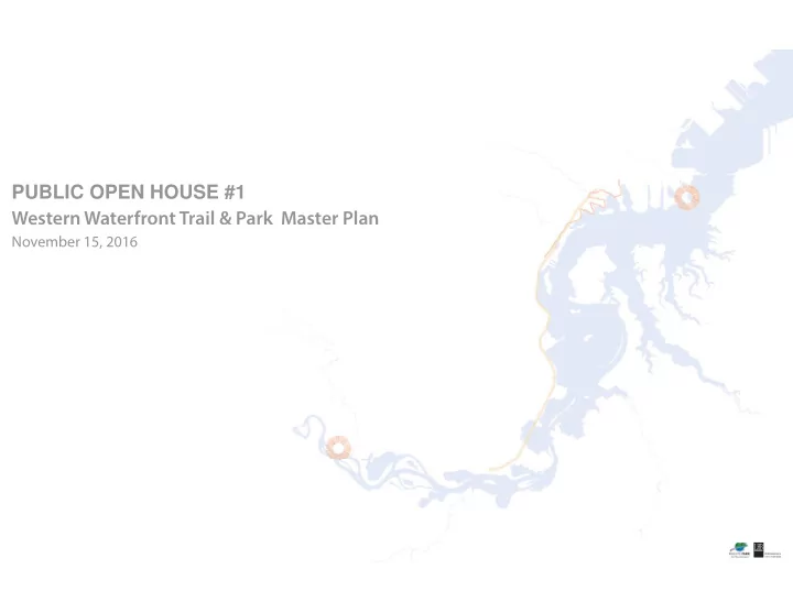
PUBLIC OPEN HOUSE #1 Western Waterfront Trail & Park Master Plan November 15, 2016 PERFORMANCE DRIVEN DESIGN. PROJECT OVERVIEW A public planning process began in August 2016 to determine the future recreational uses of a mostly
Irving Neighborhood Jay Cooke State Park E x i s t i n g R a i l C
r i d
WESTERN WATERFRONT TRAIL & PARK MASTER PLAN Duluth, Minnesota
November 15, 2016
A public planning process began in August 2016 to determine the future recreational uses of a mostly City-owned, 10-to12- mile corridor along the St. Louis River between the Irving neighborhood and Jay Cooke State Park, in West Duluth. The study area includes an existing 3.3 mile long pedestrian trail, an historic rail bed, and fjve existing or planned river access points. A portion of the historic rail bed has been leased by the City of Duluth to the nonprofjt Lake Superior and Mississippi Railroad for seasonal fee-based rail excursions.
The Master Plan’s overall project goals include, but are not limited to:
and Estuary.
the St. Louis River Corridor.
signifjcant input on the future use of the area.
riverfront rail line and renew the Lake Superior and Mississippi railroad’s lease for excursion rail trips. With these project goals in mind, the master planning process will explore
WWFT Master Plan.
and interprets the rich culture and natural heritage of the corridor.
area known as Slag Point.
Landing, Boy Scout Landing, and Perch Lake.
the excursion rail (if the City determines to extend the excursion rail lease).
Chambers Grove Park Grassy Point Spirit Lake Mud Lake
E x i s t i n g T r a i l
WESTERN WATERFRONT TRAIL & PARK MASTER PLAN Duluth, Minnesota
November 15, 2016
determine the future use of the trail and park.
trail usage patterns and needs.
conditions.
forward with development of the trail.
Trails
■ Cross City Trail 2015/2016: Mini Master Planning I-25 to Zoo: under construction 2017: Zoo to Knowlton Creek 2018: Knowlton Creek to Spirt Mt. and Grand Avenue (pending funding) ■ West DWP (Spirit Mt. to Becks Rd.) Multi-Use Trail 2018-2020: Construction (pending funding) ■ Grand Avenue Nordic Center 2015/2016: Mini Master Planning 2017: Construction of 3 km lighted trail with snowmaking (pending funding) ■ Superior Hiking Trail Improvements 2015: Design of Ely’s Peak, Spirit Mountain and Brewer Park loops 2016: Construction: Ely’s Peak, Brewer Peak, Spirit Mountain Design and construction: Enger Park and Bardon Peak ■ Duluth Traverse Trail 2015/2016: Design and construction of Lincoln Park segment, .8 miles; Mission Creek Trail Hub, 3 miles; St. Louis River Trail, 2 miles; Piedmont Connector, 1 mile; Brewer Park to Spirit Mt. (funding secured) 2018/ 2020: Spirit to Becks Rd.; Ely’s Peak Loop ■ Spirit all-weather mountain bike loop 2015/2016: Design 2016-2017: Construction (pending funding) ■ New Equestrian Trail 2015: ✔ Feasibility Study complete 2016 Ely’s Peak Loop design and construction 2017/2018: Additional trail development ■ Fairmont/Norton Park Snowmobile Trail Restoration ✔ Flood repairs complete 2016: Restoration of bridges 2016/2017: Additional work TBD ■ Kingsbury Bay Restoration 2016: Planning 2017/2018: Construction ■ Spirit Mountain River Connector 2017: Natural surface Knowlton Connector Trail (pending funding) ■ Tallas Island Paddle Center 2016: Comprehensive Mini-Master Planning 2016/2017: Construction and implementation (pending funding) ■ Indian Point Campground 2016/2017: Mini-Master Plan 2018-2019: Construction (pending funding)
Grand Avenue Parks
■ Lincoln Park 2015/2016: Mini-Master Plan 2017-2018: Construction (pending funding) ■ Wheeler Athletic Complex ✔ Mini-Master Plan complete 2016-2018: Construction (pending funding) ■ ATV Trail 2015/2016: Feasibility study and DNR Public Review 2016/2017: Construction (pending funding)
River Restoration & Access
■ National Water Trail 2015/2016: Mini Master Plan 2016/2017: Implementation/construction (pending funding) ■ Western Waterfront Trail Restoration and Extension 2015/2016: Planning and design of invasive removal and native replanting; trail surface restoration 2017: Western Waterfront Extension construction; Riverside to Morgan Park (pending funding) ■ Kingsbury Creek River Connector 2016-2018: Construction (pending funding) ■ Memorial Park 2015/2016: Mini-Master Planning 2016-2020: Construction (pending funding) ■ Gary New Duluth Recreation Area 2015/2016: Construction of Phase I & III
Other Projects
■ Quarry Park 2015/2016: Mini-Master Planning 2016/2017: Construction (pending funding) ■ Wade Stadium ✔ Tuckpointing, gates and netting complete ■ Spirit Mountain Water System ✔ Construction complete ■ Fairmont Park/Zoo 2015/2016: Master Planning 2016-2020: Construction) ■ DWP Roundhouse Site Restoration ✔ 2014: Land acquisition / Phase I invasive removal ✔ 2015: Phase II invasive removal and tree planting 2016: Final site restoration
■ Park and Trail System Infrastructure Upgrades 2016: Planning 2016/2017: Implementation of wayfinding, signage and barriers ■ Chambers Grove Park 2015: ✔ Completion of DNR Shoreline Restoration 2015/2016: Design and construction
improvements ■ Neighborhood Parks 2015/2016: Mini-Master Planning for Piedmont, Harrison, Merritt, Grassy Point, Keene Creek, Norton, Smithville, Riverside, Blackmer, Fond du Lac, and Historical parks. 2016: Grant funds become available in June to qualifying parks ✔= indicates a completed project / or phase
WESTERN WATERFRONT TRAIL & PARK MASTER PLAN Duluth, Minnesota
November 15, 2016
TRAIL AND BIKEWAY PLAN
DULUTH, MINNESOTA
OCTOBER 5, 2011
November 15, 2016
2011 Bikes and Trailway Plan 2015 Riverside Small Area Plan & 2013 Gary New- Duluth Small Area Plan 2012 Morgan Park Neighborhood Revitilization Plan 1979 Plan 2010 Parks and Recreation Plan
WESTERN WATERFRONT TRAIL & PARK MASTER PLAN Duluth, Minnesota
November 15, 2016
WESTERN WATERFRONT TRAIL & PARK MASTER PLAN Duluth, Minnesota
November 15, 2016
WESTERN WATERFRONT TRAIL & PARK MASTER PLAN Duluth, Minnesota
November 15, 2016
implementation
groups
Alliance
WESTERN WATERFRONT TRAIL & PARK MASTER PLAN Duluth, Minnesota
November 15, 2016
Western Waterfront Trail Vision (1979 to present): To create a multi-use recreational trail along the shoreline of the historic St. Louis River and Estuary from the Irving neighborhood up river to the Fond du La neighborhood in West Duluth. The lineal pathway system will provide a unique and safe experience for trail users of all abilities, and will also educate, honor, and celebrate
providing improved water access for picnicking, boating and fjshing activities.
WESTERN WATERFRONT TRAIL & PARK MASTER PLAN Duluth, Minnesota
November 15, 2016
WESTERN WATERFRONT TRAIL & PARK MASTER PLAN Duluth, Minnesota
November 15, 2016
0’ 2000’ 4000’ 8000’
SCALE: 1” = 2000’
TO CLOQUET Spirit Mountain Recreation Magney-Snively Natural Area Jay Cooke State Park Boy Scout Landing Perch Lake Landing Mud Lake Chambers Grove Park Fond du Lac campground Clough Island Spirit Lake Marina Tallas Island Slag Point Munger Landing Indian Point Campground Existing Trailhead Grassy Point T O D O W N T O W N I
5 W S t . L
i s R i v e r
EXISTING WESTERN WATERFRONT TRAIL EXTENTS EXISTING LAKE SUPERIOR MISSISSIPPI RAILROAD TOURIST LINE LEGEND
STUDY AREA 1: GRASSY POINT TO INDIAN POINT CAMPGROUND STUDY AREA 1 STUDY AREA 2 STUDY AREA 3 S T U D Y A R E A 4 STUDY AREA 2: INDIAN POINT CAMPGROUND TO SPIRIT LAKE MARINA STUDY AREA 3: SPIRIT LAKE MARINA TO BOY SCOUT LANDING STUDY AREA 4: BOY SCOUT LANDING TO CHAMBERS GROVE PARK
WESTERN WATERFRONT TRAIL & PARK MASTER PLAN Duluth, Minnesota
November 15, 2016
WESTERN WATERFRONT TRAIL & PARK MASTER PLAN Duluth, Minnesota
November 15, 2016
and defjning features along the trail corridor that we want to honor and celebrate?
Trail and Park look like to you?
1854 1808 1600 1622 1763 1861 1870 1872 1877 1855 1894 1915 1980 1979 1930’S
LaPointe Treaty
for European settlement and establishes the Fond du Lac Reservation American Fur Company organized,
post in 1817 Fond du Lac Band
Chippewa solely inhabited the shores
prior to the 1600’s
meets with the Chippewa at Sault Ste. Marie; French traders and Chippewa people establish positive alliance French and Indian War/Seven Years’ War ends, ceding French territory to Great Britain and bringing the Great Lakes region under British rule, creating greater hardship for the Chippewa people Construction
track of the Lake Superior and Mississippi Railroad (LS&M) begins First train arrives in Duluth from
LS&M is reorganized as the
Railroad, and later folded into the
Northern section of what was originally the LS&M is moved and no longer carries passengers MN Harbor Improvement Company dredges
River Estuary Locks open at Sault Ste. Marie, making it possible for large ships to sail between Lake Superior and Lake Huron, and allowing for the export
grain Logging industry
concentrated at Jay Cooke State Park; by 1894 there are at least 15 sawmills along the St. Louis River US Steel completes construction of mill
Louis River; Morgan Park community is established to house steel and cement plant workers Present day Lake Superior and Mississippi Railroad tourist train started by volunteers from the Lake Superior Transportation Club, using original track along the St. Louis River Western Waterfront Trail originally planned, designed to be 9 miles
Image: historyinanhour.com Image: trainworldcity.webs.com Image: Unknown Image: Duluth Public Library Image: reproduction of James Otto Lewis 1826 painting, Duluth Public Library Image: University of MN Duluth, Hudson Bay Trading Co. Image: LS&M Railroad Image: LHB Image: Lake Superior & Mississippi Railroad
WESTERN WATERFRONT TRAIL & PARK MASTER PLAN Duluth, Minnesota
November 15, 2016
WESTERN WATERFRONT TRAIL & PARK MASTER PLAN Duluth, Minnesota
November 15, 2016
SMALL, PEDESTRIAN-LEVEL SIGNS LARGE, LANDMARK SIGNS MEDIUM, INFORMATIONAL SIGNS
WESTERN WATERFRONT TRAIL & PARK MASTER PLAN Duluth, Minnesota
November 15, 2016
8.33%
at least 5' wide, preferably 6'-12'; at least 25' in length
to elements, heavy boat traffjc or fragile riparian habitats
ramps
provide steady surface
launching in deep enough water
water, appearing to fmoat - can be partially removable
with other launches
used in areas where water levels change dramatically
boats
areas
climate and ecological factors
always durable and require reinforcement over time
water quality, vegetation, and riparian habitats
National Park Service Report, ‘Long Lasting Launches,’ 2004 National Park Service Report, ‘Long Lasting Launches,’ 2004
WESTERN WATERFRONT TRAIL & PARK MASTER PLAN Duluth, Minnesota
November 15, 2016
accessible (not to exceed 5% for ADA, not to exceed 8.33% for ABA), and as even and level as possible without gaps or interruptions
that is stable, at least 60”x60”
in water up to 12” deep
National Park Service Report, ‘Long Lasting Launches,’ 2004
1 . 9 m il e s . 3 m i l e s
WESTERN WATERFRONT TRAIL & PARK MASTER PLAN Duluth, Minnesota
November 15, 2016 PARKLAND WATER TRAIL ACCESS POINT WATER TRAIL STREAMS BNSF LINE LSMR LINE DMIR LINE EXISTING TRAIL EXISTING WESTERN WATERFRONT TRAIL VIEWS TO POINTS OF INTEREST (SPIRIT LAKE, CLOUGH ISLAND, SPIRIT MOUNTAIN, US STEEL, ESTUARY BAYS)
MAGNEY SNIVLEY FOREST PRESERVE MAGNEY SNIVLEY PARK FREDERICK RODNEY PRAIRIE FOREST PRESERVE CHAMBERS GROVE SPIRIT MOUNTAIN RECREATION
Superior Municipal Forest
LAKE SUPERIOR ZOO GRASSY POINT
Jay Cooke State Park
BLACKMER PARK SMITHVILLE PARK MORGAN PARK COMMUNITY RECREATION CENTER GARY NEW DULUTH COMMUNITY RECREATION CENTER
Spirit Lake Clough Island Mud Lake I-35W W i l l a r d M u n g e r S t a t e T r a i l S u p e r i
H i k i n g T r a i l Boy Scout Landing Munger Landing Spirit Lake Marina Lower Spirit Riverfront Indian Point Campground
Perch Lake Landing Chambers Grove Historical Park 0.5 miles
0’ 0’ 0’ 0’ 0’ 0’ 0’ 0’ 0’ 0’ 0’ 0’ 0’ 0’ 0’ 0’ 2000’ 2000’ 2000’ 2000’ 2000’ 200 2000 000’ 2000 2000 000’ 00’ 000’ 4000’ 4000’ 4000 4000 4000’ 4000 4000 4000’ 4000 8000’ 8000’ 8000’ 8000’ 8000’ 8000’ 8000’ 8000’ 8000’ 80 8000’ 000’
SCAL SCAL SCAL SCAL SCAL SCAL AL SCAL CAL AL AL CAL CALE: E: E: E: E: E: E: E: E: E: E: E: 1” = 1” = 1” = 1” = 1” = 1” = 1” = 1” = 1” = 1” = 1” = ” = 1” 1” = 1” = 1” 1” = 200 2 200 200 200 200 200 200 200 200 200 00 20 200 00 20 0’ 0’ 0’ 0’ 0’ 0’ 0’
1 . 5 m i l e s 4 . 9 m i l e s . 4 m i l e s 1 . 3 m i l e s 1 . 7 m i l e s
LEGEND
WESTERN WATERFRONT TRAIL & PARK MASTER PLAN Duluth, Minnesota
November 15, 2016
bay
WESTERN WATERFRONT TRAIL & PARK MASTER PLAN Duluth, Minnesota
November 15, 2016
1.9 miles
1.3 miles
0.5 miles
1.5 miles
1.7 miles
View 1—Lower Spirit at Western Waterfront Trail View 2—Lower Spirit parking area View 3—Lower Spirit shoreline and pump house building View 4—View to Tallas Island from lower Spirit
WESTERN WATERFRONT TRAIL & PARK MASTER PLAN Duluth, Minnesota
November 15, 2016
Tallas Island
Pump House To Spirit Mountain Lower Chalet BNSF Rail Grand Ave W a r w i c k S t Willard Munger Trail Existing Western Waterfront Trail Riverside Park
0’ 100’ 200’ 400’
SCALE: 1” = 100’ FRESHWATER EMERGENT WETLAND FRESHWATER FORESTED/SHRUB WETLAND FRESHWATER POND PARCEL LINE EXISTING TRAIL EXISTING RAILROAD TRACKS 1’ CONTOURS LEGEND
3 2 4 1
STATE OF MN STATE OF MN WESTERN LAKE SUPERIOR SANITARY DIST STATE OF MN STATE OF MN STATE OF MN STATE OF MN CITY OF DULUTH CITY OF DULUTH CITY OF DULUTH CITY OF DULUTH CITY OF DULUTH CITY OF DULUTH NP RY CO NP RY CO SPIRIT VALLEY LAND COMPANY LLC SPIRIT VALLEY LAND COMPANY LLC SPIRIT VALLEY LAND COMPANY LLC SPIRIT VALLEY LAND COMPANY LLC SPIRIT VALLEY LAND COMPANY LLC SPIRIT VALLEY LAND COMPANY LLC JOHNSON DALE MAYNARD REV OC TRUST SPIRIT VALLEY LAND COMPANY LLC JACEN LLC JACEN LLC SPIRIT VALLEY LAND COMPANY LLC SPIRIT VALLEY LAND COMPANY LLC SPIRIT VALLEY LAND COMPANY LLC SPIRIT VALLEY LAND COMPANY LLC SPIRIT VALLEY LAND COMPANY LLC SPIRIT VALLEY LAND COMPANY LLC SPIRIT VALLEY LAND COMPANY LLC SPIRIT VALLEY LAND COMPANY LLC
WESTERN WATERFRONT TRAIL & PARK MASTER PLAN Duluth, Minnesota
November 15, 2016
Alternative 8B Visualization
Former U. S. Steel Duluth Works/Spirit Lake Sediment Remediation Project
ned disposal facilities—3 CDFs, all above high-water line
WESTERN WATERFRONT TRAIL & PARK MASTER PLAN Duluth, Minnesota
November 15, 2016
0’ 0’ 0’ 0’ 0’ 0’ 0’ 0’ 0’ 0’ 40’ 40’ 40’ 40’ 40’ 40’ 40’ 40’ 40 40’ 40’ 40’ 40’ 40’ 40’ 40 40 80’ 80’ 80 80’ 80’ 80’ 80’ 80 80’ 160’ 160’ 160’ 160’
SCAL SCA SCAL SCA SCA SCAL SCAL SCAL SCAL SC CAL CAL CAL CAL SC SC SCA SC CAL SC SC SC E: E: E: E: E: E: 1” = 1” = 1” = 1” = 1” = 1” = 1” = 1” = 1” = ” = ” = 40’ 40’ 40’ 40’ 40’ 40’ 40’
Munger Landing Clyde Ave
Munger Landing Site Statistics
2.7 acres City-owned 2 clean + drain stations 2 boat ramps 1 fjshing pier 1 boarding dock Walking distance to neighborhood, park, + bus line Paved parking for 11 car/trailers (upper lot) Renovated in 2003 with parking expansion Paved parking for 14 car/trailers (lower lot) Facility operated by the MN DNR, maintained by City of Duluth Paved parking for 2 accessible/4 cars (lower lot) LEGEND CITY OF DULUTH PROPERTY PARCEL LINE FRESHWATER EMERGENT WETLAND FRESHWATER FORESTED/SHRUB WETLAND FRESHWATER POND LAKE RIVERINE
1 2 3
1 - View east 2 - View northwest of railroad corridor 3 - View of lower lot
DNR Comments
need to be reset in spring due to unprotected winter conditions
managed boat launches: ADA, AIS, stormwater
CITY OF DULUTH 37,000 SF 11,500 SF 66,200 SF 2,200 SF CITY OF DULUTH CITY OF DULUTH CITY OF DULUTH STATE OF MN NP RY CO NP RY CO NP RY CO WHELIHAN ROSE AND NICHOLAS TRUST CLARKE TROY J TELEGA LAWRENCE SEEHUS DAVID KETAL
WESTERN WATERFRONT TRAIL & PARK MASTER PLAN Duluth, Minnesota
November 15, 2016
Boy Scout Landing Hwy 23 Commonwealth Ave S a r g e n t ' s C r e e k
0’ 0’ 0’ 40’ 40’ 40’ 40’ 80’ 80’ 80 80 80 160’ 160 160’ 160’
SCAL SCAL SCA SCALE: E: E: 1” = 1” = 1” = 1” = 1” = 40’ 40’ 40’ 40’ 40’
Boy Scout Landing Site Statistics
4.4 acres City-owned 2 clean + drain stations 2 boat ramps 1 fjshing pier 2 boarding docks Walking distance to neighborhood, park, + bus line Paved parking for 20 car/trailers (2 accessible) Renovated in 2012 to move pier/reduce parking 2 portable toilets Facility operated by the MN DNR, maintained by City of Duluth Adjacent campground LEGEND CITY OF DULUTH PROPERTY PARCEL LINE FRESHWATER EMERGENT WETLAND FRESHWATER FORESTED/SHRUB WETLAND FRESHWATER POND LAKE RIVERINE 1 - View south 2 - View of boat ramp 3 - View of temporary restroom facilities
1 2 3 DNR Comments
north, city land to west)
quantity
managed boat launches: ADA, AIS, stormwater
CITY OF DULUTH ENVALL RAYMOND L ENVALL RAYMOND L ENVALL RAYMOND L STATE OF MN STATE OF MN CITY OF DULUTH CITY OF DULUTH 104,000 SF (PICTURED) 13,000 SF 11,500 SF 7,500 SF 3,300 SF CITY OF DULUTH CITY OF DULUTH CITY OF DULUTH CITY OF DULUTH 4,145 SF 47,600 SF DEDICATED ROW D E D I C A T E D R O W
WESTERN WATERFRONT TRAIL & PARK MASTER PLAN Duluth, Minnesota
November 15, 2016
Perch Lake H w y 2 3 Perch Lake Landing
0’ 0’ 0’ 0’ 0’ 0’ 0’ 0’ 0’ 0’ 0’ 0’ 0’ 0’ 0’ 0’ 0’ 0’ 0’ 0’ 0’ 0’ 0’ 0’ 0’ 0’ 0’ 0’ 0’ 0’ 0’ 0’ 0’ 0’ 0’ 0’ 0’ 0’ 0’ 0’ 0’ 0’ 40 40 40 40 40’ 40 40’ 40’ 40’ 40’ 40’ 40’ 40’ 40 40’ 40’ 40’ 40’ 40’ 40 40’ 40’ 40’ 40’ 40’ 40’ 40’ 40’ 40’ 40’ 40’ 40’ 40’ 40’ 40 40’ 40’ 40’ 40 40 40’ 40 40 40’ 40’ 40’ 40 40’ 40’ 40’ 40 40 40 40’ 40’ 40’ 40’ 80’ 80’ 80’ 80’ 80’ 80’ 80’ 80’ 80’ 80’ 80’ 80’ 80’ 80’ 80’ 80’ 80’ 80’ 80’ 80’ 80’ 80’ 80’ 80’ 80’ 80’ 80 80 80’ 80 80 80 80 80’ 80 80 80 80 80 16 160’ 160’ 160’ 16 160’ 16 160’ 160’ 160’ 160’ 60’ 60’ 60’ 16 16 60’ 160’ 160’ 16 160 160’ 60’ 16 160 160’ 160’ 160 160 160 160 160 60’ 160’ 16 60’ 16 160
SCA SCAL SCAL SCAL SCAL SCAL SCAL SCA SCAL SCAL SCAL SCAL SCAL SCAL SCAL SCAL SCAL SCAL SCAL AL AL SCAL SCAL SCAL SC SCAL CAL SC SCAL AL SCAL SCAL SCAL SCAL SCAL SCAL CAL SCAL SCA SCA SCAL SCAL SCA SCAL SCA SCAL AL AL SCA CAL SCAL SC SCA SCA SCA SCA AL SCAL AL SCAL SCAL AL AL AL AL CA AL AL SCA AL AL AL SCA ALE: E: E: E: E: E: E: E: E: E: E: E: E: E: E: E: E: E: E: E: E: E: E: E: E: E: E: E: E: E: E: E: E: E: E: E: E: E: E: E: E: E: E: E: E: E: E: E: E: E: E: E: E: E: E: E: E: E: E: E: 1” = 1” = 1” = 1” = 1” = 1” 1” = 1” = 1” = 1” 1” 1” = 1” = 1” = 1” = 1” = 1” = 1” = 1” = 1” = 1” = ” = ” = 1” = 1” = 1” = 1” = 1” = 1” = 1” = 1” = 1” = 1” = 1” = 1” 1” = 1” = 1” = 1” = 1” = 1” = 1” = 1” 1” 1” = 1” = 1” = 1” = 1” 1” = 1” 1” = 1” = 1” = 1” = 1” 1” = 1” 1” 1” = 1” = 1” 1” = 1” = 1” = 1” 1” 1” = 1” = 1” = 1” = 1” = 1” = 1” 1” 1” = 1” 1” = 1” = 1” = 1” 1” 1” = 1” = 1” = 1” = 1” = 1” 1” 1” 1” = 1” = 1” = 1” 1” 1” = 1” = 1” 1” = 1” = 1” = 1” ” = 1” 1” = 1” = 1” ” = ” = 1” 1” = 1” = ” = ” = ” = 40 4 40 40 40 40 40 40 40’ 40’ 40’ 40’ 40’ 40’ 40’ 40’ 40’ 40’ 40’ 40’ 40 40’ 40 40’ 40’ 40’ 40’ 40’ 40’ 40 40 40’ 40’ 4 40 40’ 40’ 40 40’ 40’ 40’ 40’ 40’ 40 40 40 40’ 40’ 40’ 40’ 40 40 40 40 40’ 40’ 40’ 40’ 40 40’ 40 40’ 40’ 40 40 40 4 40’ 4 40’ 4 40 40’ 40’ 4 40 40’ 40’ 40’ LEGEND CITY OF DULUTH PROPERTY PARCEL LINE
Perch Lake Site Statistics
2.22 acres City-owned Originally built in_______ Gravel parking for 10? Facility operated by the MN DNR, maintained by City of Duluth Stair access (27 risers) to water's edge Small shoreline access with bench Adjacent informal trail Walking distance to neighborhood, park, + bus line FRESHWATER EMERGENT WETLAND FRESHWATER FORESTED/SHRUB WETLAND FRESHWATER POND LAKE RIVERINE 1 - View of parking area 2 - View of stair 3 - View of water's edge
2 3 1
CITY OF DULUTH 97,000 SF (PICTURED) STATE OF MN ESPENSON ROBERT D ETAL JASPER MICHAEL R
WESTERN WATERFRONT TRAIL & PARK MASTER PLAN Duluth, Minnesota
November 15, 2016
Vermont’s Island Line Vermont
x-country skiing Elroy Sparta State Bike Trail Wisconsin
snowmobile, Utah’s Historic Union Pacifjc Rail Trail State Park Utah
Kansas’ Prairie Spirit Trail Kansas
WESTERN WATERFRONT TRAIL & PARK MASTER PLAN Duluth, Minnesota
November 15, 2016
Heritage Rail Trail County Park and Maryland’s Torrey C. Brown Rail Trail Maryland and Pennsylvania
x-country skiing Great Allegheny Passage Maryland and Pennsylvania
fjshing, walking Santa Fe Rail Trail New Mexico
walking Astoria River Walk Oregon
walking
WESTERN WATERFRONT TRAIL & PARK MASTER PLAN Duluth, Minnesota
November 15, 2016 Existing Wetland Edge
TRADITIONAL – SECTION AT INLAND ROUTE TIGHT TO SHORELINE EMBANKMENT – SECTION AT BLACKMERE PARK TIGHT TO SHORELINE EMBANKMENT – SECTION AT MUD LAKE CAUSEWAY WETLAND ENCROACHMENT – SECTION AT EAST McCUEN ST
8’ 8.5’ min. 1’ Trail 8’ 10’ min. 1’ Trail to Trail (15’ desired) Existing Scenic Rail Landscape Barrier To St. Louis River to Trail Existing Scenic Rail Fence
8’ 8.5’ min. Trail to Trail
Mud Lake Existing Scenic Rail Existing Shoreline Barrier Rail 8’ 8.5’ min. Trail to Trail 1’ Fence
Existing Shoreline Helical Pile Existing Scenic Rail TRAIL DESIGN STANDARDS:
, a landscape barrier or grade separation will be necessary.
, an unsurmountable fence will be necessary.
WESTERN WATERFRONT TRAIL & PARK MASTER PLAN Duluth, Minnesota
November 15, 2016
0’ 1100’ 2200’ 4400’
SCALE: 1” = 1100’
Segment 1 Segment 2 Segment 3 Segment 4 Segment 5 Segment 6 Segment 7 STUDY AREA 3 S T U D Y A R E A 4
Magney-Snively Natural Area Jay Cooke State Park Boy Scout Landing Perch Lake Landing Mud Lake Chambers Grove Park Fond du Lac campground Clough Island Slag Point Munger Landing I
5 W S t . L
i s R i v e r
TRADITIONAL TRAIL INSTALL=2.58 MILES RAIL ONLY WETLAND ENCROACHMENT=1.89 MILES TRAIL ONLY TIGHT TO SHORELINE EMBANKMENT=2.23 MILES RAIL WITH OPTIMUM TRAIL (WATER'S EDGE) INLAND ROUTE INSTALL=3.88 MILES RAIL WITH VALUE ENGINEERED TRAIL (INLAND ROUTES) TRAIL OPTIONS (FOR GUIDING PRINCIPLE COMPARISON) TRAIL TYPES (FOR COST INSTALLATION COMPARISON) LEGEND EXISTING TRAIL STUDY AREA BOUNDARY FRESHWATER EMERGENT WETLAND FRESHWATER FORESTED/SHRUB WETLAND FRESHWATER POND LAKE RIVERINE
CITY OF DULUTH NP RY CO NP RY CO F I E R E K R O B E R T & M A R I A I R R E V T R U S T FIEREK ROBERT & MARIA IRREV TRUST MILES INC. SPIRIT LAKE DEVELOPMENT LLC
Munger Landing Clyde Ave Spring St
BNSF D M I R L S M R
Spirit Lake Marina
WESTERN WATERFRONT TRAIL & PARK MASTER PLAN Duluth, Minnesota
November 15, 2016
Traditional Trail Install (765 LF) Wetland Encroachment Trail Install (920 LF) Tight to Shoreline Embankment Trail Install (800 LF) Drainage Crossings (2 Total) Total Waterfront Distance Segment 1: 2485 LF (.47 mile)
Spring Street Clyde Ave
Traditional trail install 18’-24’ to wetland edge Drainage crossings Traditional trail area, adjacent to upland Wetland encroachment area, 8’ to wetland edge Tight embankment area, 15’-18’ to water’s edge on steep slope
* *
LEGEND CITY OF DULUTH PROPERTY PARCEL LINE NEIGHBORHOOD CONNECTION FRESHWATER EMERGENT WETLAND FRESHWATER FORESTED/SHRUB WETLAND FRESHWATER POND LAKE RIVERINE
WESTERN WATERFRONT TRAIL & PARK MASTER PLAN Duluth, Minnesota
November 15, 2016
WESTERN WATERFRONT TRAIL & PARK MASTER PLAN Duluth, Minnesota
November 15, 2016
Tallas Island
Existing Pump House Alternate Water Access Area (non-ADA) Stair Pebble Beach Accessible Trail 330' / 20 rods Accessible Kayak Launch Gravel Drive 50’ Bufger from OHW BN Railroad Tracks Knowlton Creek Outlet Stormwater Swale Drop-ofg and ADA Parking Gathering/ Staging Area Seat Boulders Seat Boulders Grand Ave Warwick St Willard Munger Trail Existing Western Waterfront Trail Parking Trailer/Large Vehicle Parking Trailhead Sign Turn-around Riverside Park
0’ 100’ 200’ 400’
SCALE: 1” = 100’
To Spirit Mountain Lower Chalet
Concept Plan Difgerences
2015 Plan Updated Concept 24' Paved Road 16' Gravel Connector Parking for 16+ 3 trailer Parking for 2 or 3 2 Beach Launch Areas 1 (or 2) Beach Launch Areas Restroom + Changing Enclosure Open Staging Area Elaborate Site Amenities (picnic tables, council ring, fjre pit, water pump, lighting) Modest Site Amenities (seat boulders, trailhead sign, trash receptacles) Potential for Future Development (showers, small building + retail, DNR offjce) Not Planned
WESTERN WATERFRONT TRAIL & PARK MASTER PLAN Duluth, Minnesota
November 15, 2016
Accessible Kayak Launch Swimming Beach and Natural Kayak Launch Gathering and Picnic Area Toilets ADA Parking Kayak Staging Area Additional Parking 50' railroad bufger Clyde Avenue
0’ 40’ 80’ 160’
SCALE: 1” = 40’ LEGEND CITY OF DULUTH PROPERTY PARCEL LINE
WESTERN WATERFRONT TRAIL & PARK MASTER PLAN Duluth, Minnesota
November 15, 2016
0’ 40' 80’ 160’
SCALE: 1” = 40’
ADA launch on existing fjshing pier Beach access at creek outlet Boat drop-ofg and staging area Alternate beach access Pedestrian footbridge Informal trail (wet) To Perch Lake To Slag Point Existing wetland Trail connector Relocated portable restroom with screen 15 car parking lot Existing trailer parking Striping for parallel parking Great River Snack Shack and/or ticket ofce Adjacent campground Trailhead signage and bike racks Commonwealth Ave
WESTERN WATERFRONT TRAIL & PARK MASTER PLAN Duluth, Minnesota
November 15, 2016
0’ 100’ 200’ 400’
SCALE: 1” = 100’ LEGEND CITY OF DULUTH PROPERTY PARCEL LINE
Parking and turn- around Large space for car+trailer Vault toilet Picnic area ADA beach access Beach Reinforced kayak launch Culvert with
Lowland Swamp Hwy 23 Perch Lake Restoration (part of AOC clean up)
beginner paddlers Realigned trail
WESTERN WATERFRONT TRAIL & PARK MASTER PLAN Duluth, Minnesota
November 15, 2016
0’ 40' 80’ 160’
SCALE: 1” = 40’
Parking Large space for car+trailer Overlook Vault toilet Picnic area ADA beach access Beach Reinforced kayak launch Stone
for fjshing Trail extension Proposed stair Hwy 23 To Boy Scout Landing T
h a m b e r s G r
e P a r k
WESTERN WATERFRONT TRAIL & PARK MASTER PLAN Duluth, Minnesota
November 15, 2016
0’ 200’ 400’ 800’
SCALE: 1” = 200’ LEGEND CITY OF DULUTH PROPERTY PARCEL LINE
Morgan Park Community Center Neighborhood connector Western Waterfront Trail extension (on inland side
Picnic seating area Climbing rocks/seat boulders/fjshing posts Small dock with ADA launch Beach/boat put-in site New parking lot (18)
Vegetative bufger between upland CDF and parking lot Perimeter safety fence Utilize old US Steel road bed Slag Point vehicle access at 88th Ave W Steep slopes Restored shallow sheltered bay T
l a c k m e r e P a r k & M u n g e r L a n d i n g Lake Superior & Mississippi Railroad to be restored in
accommodate trail extension Softened shoreline Climbing rocks/ fjshing posts Switchback trail to scenic overlooks Fishing pier Interpretive scenic
Stairs to scenic overlook Protected refmective seating area CDF landform (Contained Disposal Facility) with tree covered raised berms and open green space Upland CDF landform (Contained Disposal Facility) Hiking trail to raised terrace level Park sign and interpretation Slag Point Water and Trail access on old service road (sloped) Drop-ofg area, trailhead with screened/ modest toilet Great River lawn Views to Spirit Lake, St. Louis River and Estuary Wetland walk T
p i r i t P
n t , C a u s e w a y a n d B
S c
t L a n d i n g
WESTERN WATERFRONT TRAIL & PARK MASTER PLAN Duluth, Minnesota
November 15, 2016