Public Meeting #3 October 8, 2014 Tonights Schedule 6:00 7:00 pm - - PowerPoint PPT Presentation
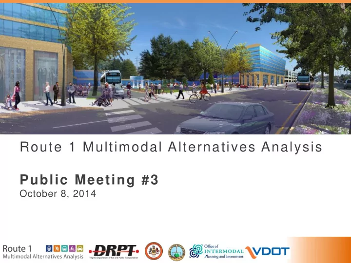
Route 1 Multimodal Alternatives Analysis Public Meeting #3 October 8, 2014 Tonights Schedule 6:00 7:00 pm Open House 7:00 7:30 pm Presentation Share Your Ideas 7:30 8:00 pm 2 Presentation Agenda 1. Purpose of the study
Tonight’s Schedule
Open House 6:00 – 7:00 pm Presentation 7:00 – 7:30 pm Share Your Ideas 7:30 – 8:00 pm
2
Presentation Agenda
- 1. Purpose of the study
- 2. What we’ve learned from you
- 3. Review of study process and status
- 4. Evaluation of Alternatives
- 5. Key considerations for implementation
Population and employment growth Traffic capacity Phasing and funding of multimodal improvements
- 6. Next Steps
3
4
What the Study Means for Prince William County
Issue: Congested commute and weekend travel north into Fairfax County and Alexandria/Arlington/DC
- Accommodate future traffic growth
along Route 1 by widening of Route 1 to Fort Belvoir, including Occoquan River bridge
Issue: Plans for significant additional mixed-use town center development in North Woodbridge
- Provide additional transportation
choices and serve as a catalyst to realize planned activity levels
- Facilitate pedestrian access to transit
services, including Woodbridge VRE station
5
Ongoing Bicycle and Pedestrian Improvements Near Woodbridge
Current Projects:
- Route 1/123 Interchange
Project
- Route 1 Widening
- Other pedestrian facility
improvement projects
6
- 1. Purpose of the Study
7
Alternatives Analysis Study Outcomes
- Recommend a program of
multimodal transportation improvements for adoption by Fairfax County and Prince William County
- Define transit, roadway, and
bicycle/pedestrian projects that could be advanced for implementation.
8
Purpose and Need
Needs:
- Attractive and competitive transit service
- Safe and accessible pedestrian and
bicycle access
- Appropriate level of vehicle
accommodation
- Support and accommodate more robust
land development Purpose: Provide improved performance for transit, bicycle and pedestrian, and vehicular conditions and facilities along the Route 1 corridor that support long-term growth and economic development.
9
Project Goals
GOAL 1: Expand attractive multimodal travel options to improve local and regional mobility GOAL 2: Improve safety; increase accessibility GOAL 3: Increase economic viability and vitality of the corridor GOAL 4: Support community health and minimize impacts on community resources
10
- 2. What we’ve learned from you
11
Where We’ve Been
Public Meeting #1 (Fall 2013)
- Study introduction
- Existing conditions
- Goals and objectives
Public Meeting #2 (Spring 2014)
- Initial alternatives
- Evaluation measures
- Land use analysis
Public Meeting #3 (Today)
- Evaluation of alternatives
- Study recommendations
- Phasing and implementation
12
Outreach Methods
- Committee Meetings
(technical, elected, community)
- Public Meetings
- Social Media
- News Ads and Press Release
- Flyers and Fact Sheets
- Metro Station and Bus Ads
- Community Event Booths
- Bilingual
- On-Line and On-Corridor
- Targeted Efforts to Engage
Diverse Populations
13
What We’ve Learned From You
Purpose and Need Weighting of evaluation measures Recommendations and action plan
Discussion with community members Sticker survey at public meeting Online survey
- Purpose and Need
- Weighting of evaluation measures
- Recommendations and action plan
14
Goals for the Meeting
Key takeaways:
- Evaluation of alternatives process
- Study recommendations
- Potential phasing and implementation sequence for corridor
improvements
We want to hear feedback from you on:
- Draft recommendations
- Implementation action plan
15
- 3. Review of study process and status
16
Alternatives Analysis Study Outcomes
The recommended projects would:
- Respond to County and State transportation and
land use plans and policies
- Support economic development goals
- Be financially feasible and potentially
competitive for federal funding
17
Study Schedule: Major Activities
We are here
18
Evaluation Process
Screen 1: Initial Alternatives Screen 2: Refined Alternatives Screen 3: Detailed Evaluation Recommendations
Public Meeting #1 (Fall 2013) Public Meeting #2 (Spring 2014) Public Meeting #3 (Fall 2014)
19
- 4. Evaluation of Alternatives:
Ability to address goals and objectives
20
Bicycle/Pedestrian and Roadway Recommendations
Recommendations:
- Roadway: Consistent, 6 vehicular lanes along the
corridor
- Bike/Ped: 10-foot multiuse path
(Note: implementation of recommended section varies along the corridor)
- Transit: Under evaluation!
21
BRT operates in dedicated curb lanes to Pohick Road North BRT operates in mixed traffic from Woodbridge to Pohick North
Huntington Penn Daw Beacon Hill Lockheed Blvd Hybla Valley Woodbridge VRE
BRT in Dedicated Lanes BRT in Mixed Traffic Proposed P&R
Alternative 1: Bus Rapid Transit 1 – Curb Running
BRT operates in median in dedicated lanes in Fairfax County
22
Huntington
Penn Daw Beacon Hill Lockheed Blvd Hybla Valley Woodbridge VRE
BRT in Dedicated Lanes BRT in Mixed Traffic Proposed Park & Ride
BRT operates in mixed traffic through Prince William County
Alternative 2: Bus Rapid Transit - Median
Alternative 3: Light Rail Transit
Light Rail operates in median in dedicated lanes for entire corridor
23
Huntington
Penn Daw Beacon Hill Lockheed Blvd Hybla Valley Woodbridge VRE
LRT in Dedicated Lanes
Proposed Park & Ride
Alternative 4: Metrorail-BRT Hybrid
24
- Metrorail underground to Hybla Valley with
supporting BRT in the long-term
Huntington Beacon Hill Hybla Valley Woodbridge VRE
BRT in Dedicated Lanes BRT in Mixed Traffic Metrorail (Underground) Proposed Park & Ride
BRT operates in mixed traffic through Prince William County
25
Summary of Key Indicators
Based on Scenario 1 Land Use (COG 2035 Forecast) Alt 1: BRT- Curb Alt 2: BRT- Median Alt 3: LRT Alt 4: Metro/BRT Hybrid Average Weekday Ridership (2035)
15,200 16,600 18,400 26,500
(BRT 10,600; Metro 22,900)
Conceptual Capital Cost
$832 M $1.01 B $1.56 B $2.46 B*
(Metro $1.46B; BRT $1 B)
Annual O&M Cost
(Each Alternative includes $5 M annual cost for Ft. Belvoir shuttle service)
$18 M
(BRT $13M; Ft Belvoir Shuttle $5M)
$17 M
(BRT $12M; Ft Belvoir Shuttle $5M)
$24 M
(LRT $19M; Ft Belvoir Shuttle $5M)
$31 M**
(Metro $17M; BRT $8M; Ft Belvoir Shuttle $5M)
Cost Effectiveness
(Annualized capital + operating cost per rider)
$19 $20 $27 $28**
(Metrorail: $28; BRT: $29)
* This figure represents full BRT construction between Huntington and
Woodbridge, then Metrorail extension from Huntington to Hybla Valley ** These figures assume operation of Metrorail between Huntington and Hybla Valley, and BRT between Hybla Valley and Woodbridge
26
Evaluation of Alternatives
Goal Example Measures Goal 1: Local and Regional Mobility
- Ridership
- Travel time savings
Goal 2: Safety and Accessibility
- Traffic
- Pedestrian access
Goal 3A: Economic Development
- Economic development effects
- Implementation
Goal 3B: Cost Effectiveness
- Capital costs
- Operating costs
Goal 4: Community Health and Resources
- Environmental impacts
- Change in Vehicle Miles Traveled (VMT)
27
Evaluation of Alternatives: Findings
- –
–
–
- Slide in Progress
Check out Board 4 for full evaluation results!
28
Draft Recommendation
Evaluation results suggest:
- Median running Bus Rapid Transit (BRT) in the
near-term would provide a cost effective transportation solution to support economic development plans.
- Metrorail extension to Hybla Valley in the long-
term has potential to provide a higher level of local and regional mobility and support long- term corridor development, contingent upon increased future land use density.
BRT median in dedicated lanes in Fairfax County BRT in mixed traffic through Prince William County Metrorail underground to Hybla Valley with supporting BRT in the long-term
29
30
- 5. Key Considerations for Implementation
Population and employment growth Traffic capacity Phasing and funding of multimodal improvements
Transportation investment supports economic viability and vitality of the corridor
Land use planning Transportation investment Support high quality community development Demand for new residential units and commercial space Employment growth Population growth
31
32
Woodlawn: Transit Oriented Development Concept
Artist’s Rendering
33
Station Activity Levels
(Population + Employment per Acre)
P-6 (70+) P-4 (14-34) P-3 (7-14) P-5 (34-70)
34 P-6 (70+) P-4 (14-34) P-5 (34-70)
Station Activity Levels
(Population + Employment per Acre)
35 P-6 (70+) P-5 (34-70)
Station Activity Levels
(Population + Employment per Acre)
36 P-6 (70+) P-5 (34-70)
Station Activity Levels
(Population + Employment per Acre)
37 P-6 (70+) P-5 (34-70)
Station Activity Levels
(Population + Employment per Acre)
38
39
Woodbridge Existing
N
40
Woodbridge Scenario 2
N
41
Traffic Capacity
Growth Scenarios and Roadway Requirements
42
Traffic Analysis Findings: Scenario 1
Addition of median transit lanes:
- Improves transit travel time
- Incrementally increases automobile
travel time
- Left turns impacted
- Does not significantly degrade overall
intersection performance
43
- For highest density proposed station areas:
Beacon Hill and Hybla Valley
Share of trips transit, walk, bike, internal, and peak spreading Add street capacity to supplement Route 1, equivalent to:
Scenario 2 20% One new 2-lane street 25% One new 2-lane street Scenario 3 25% Six new 2-lane streets 40% to 50% Three new 2-lane streets
Traffic Analysis Findings: Scenarios 2 and 3
Street Infrastructure Required to Accommodate Growth
Population and employment Growth +15-25% over Scenario 1
Time Time
70 AD (+160%) 50 AD (+80%)
Population and employment growth up to 160% over Scenario 1 +15-25%
44
Traffic Analysis Conclusions
- Major growth is anticipated in the
Route 1 corridor in all scenarios, including COG 2035 forecast
- To accommodate growth,
recommended Route 1 transportation investment must be complemented by
- ther major features (roads, schools,
public safety, parks):
– Network of local streets – Mixed use development – Walkable, pedestrian friendly environment
- Metrorail supportive growth levels
require significantly more infrastructure investment than BRT levels
45
Project Phasing and Funding
46
Huntington Hybla Valley Fort Belvoir Woodbridge
Phase I: Huntington to Hybla Valley
($306 M)
3.1 mi
Phasing and Implementation Approach
47
Phase II: Hybla Valley to Fort Belvoir
($224 M)
Huntington Hybla Valley Fort Belvoir Woodbridge
7.3 mi
Phasing and Implementation Approach
48
Phase III: Fort Belvoir to Woodbridge
($472 M)
4.6 mi
Phasing and Implementation Approach
- Widen Route 1 and Occoquan
River Bridge
- Build bicycle/pedestrian
facilities
- Provide dedicated transit lanes
through FFX Co
- New 3,000 space Park & Ride
Garages at Woodbridge and at Lorton Stations
49
Phase IV: Metrorail Yellow Line Extension to Hybla Valley*
($1.46 B)
Huntington Hybla Valley Fort Belvoir Woodbridge
3.1 mi
Phasing and Implementation Approach
*Contingent upon future land use
50
7.3 mi
Transit Funding Assumptions by Geographic Segment
Phase I+II: Huntington to Fort Belvoir
- Potentially competitive for federal
New Starts/Small Starts funding
- Highest population and employment
- Highest ridership potential
Phase III: Fort Belvoir to Woodbridge
- Less competitive for federal funding
- Lower population and employment
- Includes planned VDOT widening
50% 33% 8% 9%
Federal State Regional Local
10% 33% 20% 22% 15% Federal State Regional Local Unidentified
51
7.3 mi
Transit Funding Assumptions by Geographic Segment
Phase IV: Huntington to Hybla Valley
- Potentially competitive for federal
New Starts funding in 2040
- Contingent upon increased future
land use density
50% 33% 8% 9%
Federal State Regional Local
52
Comprehensive Plan Planning Scoping/ NEPA PE Final Design Right of Way Utilities Relocation Construction Operation
Approach: BRT and Long-Term Metrorail Implementation (2040)
Potential Implementation Timelines
Legend: General Project Development Sequence
15 16 17 18 19 20 21 22 23 24 25 26 27 28 29 30 31 32 33 34 35 36 37 38 39 40 Roadway Widening, Bike/Ped, BRT Phase I Comprehensive Plan Revisions
Phase II: Hybla Valley to Fort Belvoir
Bike/Ped, BRT Phase II Comprehensive Plan Revisions Roadway Widening, Bike/Ped, BRT Phase III Comprehensive Plan Revisions
Phase IV: Huntington to Hybla Valley Metrorail Extension
Metrorail Phase IV Comprehensive Plan Revisions Years (2015-2040)
Phase I: Huntington to Hybla Valley + Roadway Widening Phase III: Fort Belvoir to Woodbridge Improvements
Note: Timelines assume a funding stream to support projects implementation. *Contingent upon increased future land use density. *
53
Comprehensive Plan Planning Scoping/ NEPA PE Final Design Right of Way Utilities Relocation Construction Operation
Potential Implementation Timelines
Legend: General Project Development Sequence
15 16 17 18 19 20 21 22 23 24 25 26 27 28 29 30 31 32 33 34 35 36 37 38 39 40 Roadway Widening, Bike/Ped, BRT Phase I Comprehensive Plan Revisions
Phase II: Hybla Valley to Fort Belvoir
Bike/Ped, BRT Phase II Comprehensive Plan Revisions Roadway Widening, Bike/Ped, BRT Phase III Comprehensive Plan Revisions
Phase IV: Huntington to Hybla Valley Metrorail Extension
Metrorail Phase IV Comprehensive Plan Revisions Years (2015-2040)
Phase I: Huntington to Hybla Valley + Roadway Widening Phase III: Fort Belvoir to Woodbridge Improvements
Note: Timelines assume a funding stream to support projects implementation. *Contingent upon increased future land use density. *
FTA NEW STARTS PROJECT DEVELOPMENT PROCESS FTA SMALL STARTS PROJECT DEVELOPMENT PROCESS
Typical New Starts Funding Steps/Sequence:
54
- 6. Next Steps
55
Action Plan for Implementation
56
Next Steps: Adopt Study Findings and Continue Toward Implementation
-
- Study team completes
Alternatives Analysis Local and state officials adopt findings and recommendations Project team completes environmental documentation and concept engineering
Conduct Market Studies, Identify Comprehensive Plan Updates
Process Overview
Project team refines cost estimates and funding plans
Coordination with public stakeholders and state and federal agencies
57