
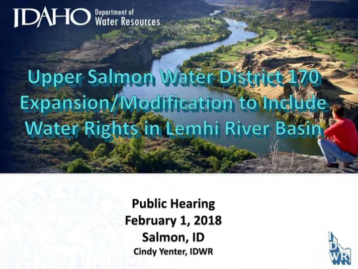
SLIDE 1
Public Hearing February 1, 2018 Salmon, ID
Cindy Venter, IDWR
Public Hearing February 1, 2018 Salmon, ID Cindy Venter, IDWR - - PowerPoint PPT Presentation
Public Hearing February 1, 2018 Salmon, ID Cindy Venter, IDWR IDWR Public Meeting Public Meeting held November 28, 2017 1100 Notices sent Water rights already administered by WD170 in Stanley, Clayton, Challis and Pahsimeroi
Public Hearing February 1, 2018 Salmon, ID
Cindy Venter, IDWR
Excluding domestic and stock water rights as defined by Idaho Code § 42-111, and rights for instream stock water use.
Individual hearing notices mailed January 19 Hold hearing at least ten days after notice Ten day comment period after hearing Issue Modification order mid February
1.
Expand the boundaries of WD170 to include all surface and ground water rights in Basin 74, with the exception
42-111 and 42-1401A(11), Idaho Code, and rights used for in-stream watering of livestock as defined by Section 42- 113, Idaho
2.
Designate the following existing water districts as sub- districts of WD170:
74 – Lemhi River 74A - Geertsen Creek 74B - Kirtley Creek 74C - Bohannon Creek 74F - Pratt Creek 74G - Sandy Creek 74J - Withington Creek 74M - Agency Creek 74Q - Mill Creek 74Z - Big Eight Mile and Lee Creeks 74W - Texas, Hawley, Timber, Junction, Bull, Jake and Canyon Creeks
3.
Sub-districts in Basin 74 will be modified to include all surface and ground water rights within their respective boundaries, with the exception of domestic and stock water rights. Ground water will be administered by local sub-district watermasters.
4.
Water Districts 74K-Pattee Creek, 74Y-Yearian Creek and 74U- Andrews and Slough Ditch will be combined into Water District 74-Lemhi River.
~
Water District 170 Expansion Area
l
77
'\. .
SRBA is complete
SRBA Court issued Final Decree – August 24, 2014 IDWR is required by law to create water districts
Administration necessary for ground water rights
Conjunctive Management Rules govern water delivery calls
Creation/Modification of Water Districts
“The director shall divide the state into water districts … such that each public stream and tributaries,
independent source of water supply, shall constitute a water district.” “The director may create, revise the boundaries of, or abolish a water district or combine two or more water districts by entry of an order . . . to properly administer uses of the water resource.” Idaho Code § 42-604
Idaho Water Districts
Regulation
priority rights as necessary
Administer/Manage water rights
(ownership, diversion descriptions, transfers review)
In the Upper Salmon:
To fulfill the Wild and Scenic mandates and satisfy the objectives of the W&S Agreement
Collect and record diversion data
Enforce water rights in priority
Curtail unauthorized or excessive diversions
To administer Federal and State Minimum Instream Flows
No water districts in the Upper Salmon were administering ground water
2004 Wild & Scenic River Stipulation signed by State of Idaho, the US Government and Tribes, and some private parties Included provisions to: Issue decreed Federal minimum instream flow rights Withdraw the Upper Salmon Moratorium Allow a limited amount of new water right development in the Upper Salmon basins (150 cfs and up to 5000 acres irrigation) not subject to the Federal minimum flow rights Create water districts which administer both ground and surface water rights
·-~··-··~··-··~··
~··-··~··-·-~·--
Idaho Rules for Conjunctive Management of Surface and Ground Water Resources (CMR)
Promulgated in 1994 Govern the distribution of ground water sources Incorporate all elements of prior appropriation doctrine Establishes a process for IDWR to respond to delivery calls made by
senior surface or ground water rights, against a junior ground water rights
Regulation of ground water must occur within a water district or
ground water management area
The inclusion of the Lemhi Basin in Water District 170 will not:
Change any Basin 74 general provision in the SRBA
decree-
Separately administered streams High flows for surface water irrigation
Cause priority curtailment of ground water rights in
the near future
·-~··-··~··-··~··
~··-··~··-·-~·--
Smaller water districts within the boundaries of WD170
which administer water rights in localized areas.
Sub-district watermasters have full regulatory authority in
their districts, and serve under the guidance of the WD170
Sub-districts operate as water districts under Idaho statute.
Each holds an annual meeting, sets a budget, elects officers and a watermaster, and makes assessments against water users.
WD170 will not make assessments to sub-districts if sub-
districts are operating in accordance with statute.
All water rights are included – participation is mandatory
minimum in-stream flow rights are exempt by law
For active administrative, measurement and/or assessment
purposes, IDWR may exclude:
42-111, Idaho Code
Hydropower and other non-consumptive rights are
included but may be assessed differently
Basins 71-73
About 1800 administered water rights – 1600 surface and
200 ground water rights (not including domestic and stockwater rights)
≈ 500 regulated stream diversions ≈ 100 regulated wells ≈ 3,750 cfs total diverted water rights (gross) Ground water rights authorizing irrigation of 5 acres or less, or
for non-irrigation uses with total diversions 0.24 cfs or less, are not required to measure diversions
Basin 74
About 1850 administered water rights – 1770 surface and
80 ground water rights (not including domestic and stockwater rights)
≈ 120 regulated stream diversions on Lemhi and connected
tribs (WD74)
≈ 75-100 regulated stream diversions on separately
administered tributaries
≈ 30 regulated wells
> 5 acres irrigation or > 0.24 cfs diversion rate for non- irrigation use
≈ 2,000 cfs total diverted water rights (gross)
Ground Water rights added to a water district
Included rights must be added to assessment rolls
Watermasters required to read flow meters monthly
GW data must be added to the annual watermaster report
Watermaster may be required to enter flow meter data to online database
Other regulatory issues – ground water and surface water rights sometimes have combined use limits which may need to be monitored by watermaster
Budget may need to be adjusted for compensation of watermaster for flow meter reading and reporting, additional mileage
m1mmmm1mmmm1mmmm1mmmmnmnmmmmnmmmnmmnmnmmmm1mmmm1mmmm1mmmmnm1mmn11
~:~1:~lllll:~llll:~;:~lllll:~llll:~;:~llllllllll:~;:~llllllllll:~;:~;;;;:~lllll:~;:~;;;;:~lllll:~;:~;;:~;:~;;;l1:~;:~;;:~;:~;;;l1:~1lll:~;:~lllll:~llll:~;:~llllllllll:~;:~llllllllll:~;:~;;;;:~lllll:~;:~;~
m1mmmm1mmmmumunmumummumummumumm1mnmmnmnmmmmuummmumummumummumumm111
m1mmmm1mmmm1mmnm1mmmmnmnmmmmnmmmnmmnmnmmmm1mmmm1mmmm1mmmmnm1mmn11
~:~;:~lllll:~llll:~;:~lllll:~llll:~;:~lllllll ll:~;:~llllllllll:~;:~;;;;:~lllll:~;:~;;;;:~lllll:~;:~;;:~;:~;;;l1:~;:~;;:~;:~;;;l1:~1lll:~;:~lllll:~llll:~;:~llllllllll:~;:~llllllllll:~;:~;;;;:~lllll:~;:~;~
mmmmnmmnmnmmmnmnnmnnmnmmnmnmmnmmumnmmumnmnmmnmnmmmnnmmmnnmmumnmu m1mmmm1mmmmumunmumummumummumumm1mnmmnmnmmmm1mmmmumummumummum1mmn11
~:~;:~lllll:~llll:~;:~lllll:~llll:~;:~lllllll ll:~;:~llllllllll:~;:~;;;;:~lllll:~;:~;;;;:~lllll:~;:~;;:~;:~;;;l1:~;:~;;:~;:~;;;l1:~1lll:~;:~lllll:~llll:~;:~llllllllll:~l:~llllllllll:~l:~llll:~lllll:~l:~l~
mmmmnmmnmnmmmnmnnmnnmnmmnmnmmnmmumnmmumnmnmmnmnmmmnnmmmnnmmumnmu m1mmmm1mmmmumunmumummumummumumm1mnmmnmnmmmm1mmmmumummumummum1mmn11
~:~l:~lllll:~llll:~l:~lllll:~llll:~l:~lllllll ll:~l:~llllllllll:~l:~llll:~lllll:~l:~llll:~lllll:~l:~ll:~l:~lllll:~l:~ll:~l:~lllll:~llll:~l:~lllll:~llll:~l:~llllllllll:~l:~llllllllll:~l:~llll:~lllll:~l:~l~
(Httttlltltlltltlltlltltlltltlltllll lltltlltlllltlltltlltltlltlltltlltltlltlltltlltltlltlltltlltltlltlltltlltltlltlltltlltltlltlllltlltltlltlllltlltltlltltHtlltltll
~:~l:~lllll:~llll:~l:~lllll:~llll:~l:~lllllll ll:~l:~llllllllll:~l:~llll:~lllll:~l:~llll:~lllll:~l:~ll:~l:~lllll:~l:~ll:~l:~lllll:~llll:~l:~lllll:~llll:~l:~llllllllll:~l:~llllllllll:~l:~llll:~lllll:~l:~l~
m1mmmm1mmmmumunmumummumummumumm1mnmmnmnmmmm1mmmmumummumummum1mmn11
~:~l:~lllll:~llll:~l:~lllll:~llll:~l:~lllllll ll:~l:~llllllllll:~l:~llll:~lllll:~l:~llll:~lllll:~l:~ll:~l:~lllll:~l:~ll:~l:~lllll:~llll:~l:~lllll:~llll:~l:~llllllllll:~l:~llllllllll:~l:~llll:~lllll:~l:~l~
(Htlltlltltlltltlltlltltlltltlltllll lltltlltlllltlltltlltltlltlltltlltltlltlltltlltltlltlltltlltltlltlltltlltltlltlltltlltltlltlllltlltltlltlllltlltltlltltHtlltltll
~:~l:~lllll:~llll:~l:~lllll:~llll:~l:~lllllll ll:~l:~llllllllll:~l:~llll:~lllll:~l:~llll:~lllll:~l:~ll:~l:~lllll:~l:~ll:~l:~lllll:~llll:~l:~lllll:~llll:~l:~llllllllll:~l:~llllllllll:~l:~llll:~lllll:~l:~l~
m1mmmm1mmmmumunmumummumummumumm1mnmmnmnmmmm1mmmmumummumummum1mmn11
m1mmmm1mmmm1mmnm1mmmmnmnmmmmnmmmnmmnmnmmmm1mmmm1mmmm1mmmmnm1mmn11
~:~l:~lllll:~llll:~l:~lllll:~llll:~l:~lllllll ll:~l:~llllllllll:~l:~llll:~lllll:~l:~llll:~lllll:~l:~ll:~l:~lllll:~l:~ll:~l:~lllll:~llll:~l:~lllll:~llll:~l:~llllllllll:~l:~llllllllll:~l:~llll:~lllll:~l:~l~
mmmmnmmnmnmmmnmnnmnnmnmmnmnmmnmmumnmmumnmnmmnmnmmmnnmmmnnmmumnmu m1mmmm1mmmmumunmumummumummumumm1mnmmnmnmmmm1mmmmumummumummum1mmn11
~:~l:~lllll:~llll:~l:~lllll:~llll:~l:~lllllll ll:~l:~llllllllll:~l:~llll:~lllll:~l:~llll:~lllll:~l:~ll:~l:~lllll:~l:~ll:~l:~lllll:~llll:~l:~lllll:~llll:~l:~llllllllll:~l:~llllllllll:~l:~llll:~lllll:~l:~l~
(Htlltlltltlltltlltlltltlltltlltllll lltltlltlllltlltltlltltlltlltltlltltlltlltltlltltlltlltltlltltlltlltltlltltlltlltltlltltlltlllltlltltlltlllltlltltlltltHtlltltll
~:~l:~lllll:~llll:~l:~lllll:~llll:~l:~lllllll ll:~l:~llllllllll:~l:~llll:~lllll:~l:~llll:~lllll:~l:~ll:~l:~lllll:~l:~ll:~l:~lllll:~llll:~l:~lllll:~llll:~l:~llllllllll:~l:~llllllllll:~l:~llll:~lllll:~l:~l~
m1mmmm1mmmmumunmumummumummumumm1mnmmnmnmmmm1mmmmumummumummum1mmn11
~:~l:~lllll:~llll:~l:~lllll:~llll:~l:~lllllll ll:~l:~llllllllll:~l:~llll:~lllll:~l:~llll:~lllll:~l:~ll:~l:~lllll:~l:~ll:~l:~lllll:~llll:~l:~lllll:~llll:~l:~llllllllll:~l:~llllllllll:~l:~llll:~lllll:~l:~l~
(Htlltlltltlltltlltlltltlltltlltllll lltltlltlllltlltltlltltlltlltltlltltlltlltltlltltlltlltltlltltlltlltltlltltlltlltltlltltlltlllltlltltlltlllltlltltlltltHtlltltll
~:~l:~lllll:~llll:~l:~lllll:~llll:~l:~lllllll ll:~l:~llllllllll:~l:~llll:~lllll:~l:~llll:~lllll:~l:~ll:~l:~lllll:~l:~ll:~l:~lllll:~llll:~l:~lllll:~llll:~l:~llllllllll:~l:~llllllllll:~l:~llll:~lllll:~l:~l~
m1mmmm1mmmmumunmumummumummumumm1mnmmnmnmmmm1mmmmumummumummum1mmn11
m1mmmm1mmmm1mmnm1mmmmnmnmmmmnmmmnmmnmnmmmm1mmmm1mmmm1mmmmnm1mmn11
~:~l:~lllll:~llll:~l:~lllll:~llll:~l:~lllllll ll:~l:~llllllllll:~l:~llll:~lllll:~l:~llll:~lllll:~l:~ll:~l:~lllll:~l:~ll:~l:~lllll:~llll:~l:~lllll:~llll:~l:~llllllllll:~l:~llllllllll:~l:~llll:~lllll:~l:~l~
m1mmmm1mmmmumunmumummumummumumm1mnmmnmnmmmm1mmmmumummumummum1mmn11
m1mmmm1mmmmmm1hnmmmmmnmmmmnmmmnmnmmnmnmmmm1mmmm1mmmm1mmmmnmnmmn1
~:~l:~lllll:~llll:~l:~lllll:~llll:~l:~llllllllll:~l:~llllllllll:~l:~llll:~lllll:~l:~llll:~lllll:~l:~ll:~l:~lllll:~l:~ll:~l:~lllll:~llll:~l:~lllll:~llll:~l:~llllllllll:~l:~llllllllll:~l:~llll:~lllll:~l:~l~
m1mmmm1mmmm1mmmm1mmmmmmnmmnmnmmmnnnmmmmmmm1mmmm1mmmm1mmmmmmnmnm
IDWR will send Measurement Order IDWR and WD170 watermaster will
inventory all ground water diversions review measurement plans inspect all new installations, follow up on compliance provide training to sub-district watermasters
Sub-district watermaster will
make regular visits to collect usage data (monthly) report any problems to WD170
Wells where measurement will be required Wells expected to be waived from measurement
For Ground Water Measurement, IDWR will exclude:
single family domestic/stock water uses
IDWR proposes to exclude:
small irrigation uses, 5 acres or less small non-irrigation rights/uses 0.24 cfs div rate or less
All other ground water rights/diversions subject to
measurement
Pre-approved flow meters will be required for all
pressurized systems – limited variances will be considered for some systems
Department of Search IDWR
Water Resources
Wells Streams/ Dams/ Floods Forms Water Dat a Maps/ Spatial Dat a Legal Actions Water Resource Board Home Water Data Vlater Measurement
Water Measurement
Forms 11 Resources 11 Research a Maps 11 Contacts I
OVERVIEW
Originally created to support the measurement of ground water on the Eastern Snake Plain Aquifer (ESPA), the Water Measurement program now functions statewide to establish, maintain, and implement state water measurement and reporting standards. ID WR works directly with water districts and water measurement dist ricts to implement measurement requirements and programs within the state. E xamples of these efforts include: closed conduit and open channel measurement methods diversion and control works for surface and ground water diversions automation, data logging, and telemetry of water diversion and measurement systems development and maintenance of reporting systems for water diversion measurements
Guidelines
Use the following guidelines and procedures to collect water measurement data and report that information to IDWR. Using these procedures provides a uniform measuring and reporting method within the State of Idaho, including within water districts. The information below also assists in measuring and reporting diversions pursuant to various water measurement orders issued by IDWR.
et Minimum Acceptable Standards for Open Channel and Closed Conduit
Measuring Devices
et List of Approved Closed Conduit Flow
Meters
e IDWR Water Measurement and Reporting Guidelines
13 External link ESPA Measurement Order
e Final Order on Reconsideration
Requi ring Measuring Devises for Ground Water in Water Districts 31, 34, 100, 110, 120, 130, and 140 - July
22, 2016
jl Administrative Actions
Helpful Links
Water Districts Water Measurement Districts Water Rights Accounting Eastern Snake Plain Aquifer Model 42-701 - General statutory requirement for water measurement and reporting in Idaho
Rights diverting at L-6 were decreed in the 1930’s as
the result of a private lawsuit. Parties petitioned the Department to appoint a watermaster (aka lateral manager).
After the Lemhi Decree, IDWR assigned this area a
water district number – even though it doesn’t really fit the criteria:
Delivery must be from a public water source Annual meetings are held but no individual measurements are being reported
.
······-----------------------------------------------------------------------------------------------
The laterals are being operated in accordance with Title 42
Chapter 13, Lateral Water Users Associations and should continue to do so.
WD74 will continue to deliver these rights to the head of
the laterals and assess water users
Advantages –
No further reporting requirements to IDWR No formal measurement requirements down ditches
Disadvantages - ??
.
······-----------------------------------------------------------------------------------------------
Water districts 74K-Pattee Creek and 74Y-Yearian
Creek are not actively operating
There is only a single active diversion in each area These diversions could be effectively administered by
the Watermaster of WD74-Lemhi River
Public Hearing Today – Oral or Written Testimony
Accepted
Ten day comment period after hearing – Written
Testimony may be submitted until February 12 to: IDWR PO Box 83720 Boise ID 83720-0098
Modification order will be mailed to all affected water
users
Order to require installation, upgrade or maintenance of control structures and measuring devices
After district modification order Issue separate order in spring 2018 April, 2019 tentative deadline for compliance – all
new devices or upgrades to existing devices
WD170 will oversee measurement compliance in all
sub-districts of Upper Salmon
Ground water irrigation diversions authorizing 5 acres or less Ground water non-irrigation with diversion rates 0.24 cfs or less