
SLIDE 1
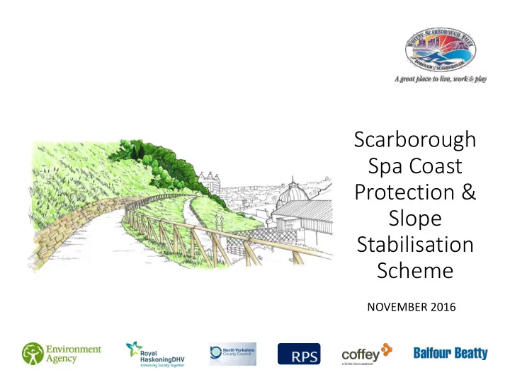
Scarborough Spa Coast Protection & Slope Stabilisation Scheme
NOVEMBER 2016
Protection & Slope Stabilisation Scheme NOVEMBER 2016 - - PowerPoint PPT Presentation
Scarborough Spa Coast Protection & Slope Stabilisation Scheme NOVEMBER 2016 Contents Context Slope Stabilisation, Geology and Engineering Landscape Management Ecology Trees Cultural Heritage Noise, Vibration,
NOVEMBER 2016
The South Cliff upon which the proposed works area lies is inherently unstable. As a result the area has witnessed major landslides, including in 1737, when the cliff collapsed destroying the spa buildings. In 1993, approximately 1km to the south
Hotel was destroyed with a substantial part of the Holbeck Gardens removed
whilst the mud/debris flow overran the sea wall to project 135m onto the beach. Numerous smaller scale landslides have
resulting in the closure of footpaths. Furthermore, investigations in the 1970s and 1980s found that several locations in The Spa Complex were being adversely affected by earth pressure and soil movements, probably caused by water
water pressure, but these were found to be no longer effective in the 1990s.
Deep seated multiple rotational landslide mainly developed in till Coastal slopes developed in glacial till and underlying bedrock. Currently affected by small-scale shallow landslides
The north east coastline of England has a history of slips. Many people will remember the famous landslip that caused Holbeck Hall to fall into the sea. However, the particular mechanism of how the coast slips depends on numerous factors. This includes:
At Scarborough Spa, deep seated slips occur along the top of the bedrock (sandstone) through a thin layer of weak sandstone. The engraving above , is of a large slip that destroyed the original spa building in 1737. By considering the history, geology and groundwater conditions at the site, we can develop an engineering solution to reduce the risk of future slope failure.
A A
This poster shows a section through the Spa Building, running down from the esplanade to the Spa Building. We have carried out ground investigations and conducted engineering analysis that has helped us to quantify the risk of slope failure behind the Spa Building. Our analysis has shown there is risk of two types of slope failure in this particular section: The first is a deep slip occurring from the Esplanade, passing beneath the Spa building and surfacing in front of the building but behind the sea-wall (See the red line on the Image to the right). The second is shallow slips occurring from the mid-way down the slope and surfacing in the bottom third of the slope above the lower paths (See the blue line on the image above the deep slip line to the right ) In addition there is also the risk of lots of very shallow slips occurring at the surface.
Spa Building Esplanade
To resist the deep seated slip (shown in Red) it is proposed to install a number of steel piles embedded into the bed rock below (Sandstone). The piles terminate in the Sandstone as it is a strong competent layer that slips cannot easily pass through. The steel piles prevent slips occurring above the Sandstone by reinforcing the soil in that area. The piles will have a diameter of approximately 0.4m (or just over a foot). The piles will be installed by widening the existing path to make room for a piling platform. To ensure the path is stable during construction the piling platform will be constructed using soil nails above and below the path, and a shotcrete (sprayed concrete) face. After construction, the path will be returned to its original
engineered fill in front of the shotcrete face and then finishing off with a traditional stone wall.
Soil nails in lower slope to allow installation of piles Pile to resist deep slips
The steel piles are installed deep into the sandstone to arrest the risk of deep slips, however
between the top of the slope and the piles (as shown by the blue line). To resist the shallow slips above the piles it is necessary to install soil nails above the pile and re-grade the soil profile. The soil nails penetrate potential slip circles, by acting like reinforcement elements. For the soil nails to work they must be installed in conjunction with a facing system. The facing system consists of steel head plates and a steel mesh, which help to transfer the weight of the soil between the nails back into the soil nails. Soil nail heads and mesh can look unsightly. Therefore they have been designed with a covering (geo-cell) that will allow topsoil to be replaced and planted with seeds – see the later soil nail head
the topsoil will ‘green’ up and the soil nails and topsoil containers (geo-cell) will not be visible. Finally, between the ground and the steel mesh an erosion protection mat and a drainage layer is
water eroding the soil and reduce the water within the slope, thus improving the stability.
(temporary construction platform)
Precise placement of nails along the length of the construction zones using anchored long arm reach excavator plant
The Proposed Development for which planning permission is sought comprises: “Slope stabilisation scheme including clearance works to remove existing trees, regrading of existing slope and use of soil nailing and soil piling measures, retention and reinstatement of masonry walls, installation of new drainage measures and subsequent landscaping works.”
to 25m) to extend past the active slip plane and provide shear resistance to increase the factor of safety against shallow failures. The spacing of the soil nails will vary from 1.5m to 2.5m horizontally and 1m to 1.5m vertically.
place and hence reduce local surface instability between nails. Nail heads will be of sufficient size and thickness to ensure adequate load transfer to the nails.
heads to help with erosion control and establishment of vegetation on the slope.
system will be used over the top of the mesh to retain topsoil in place and hide the soil nails and head plates.
Following the completion of the engineering activities a scheme of landscape reinstatement works would be implemented to ensure that the intrinsic character of the public space is retained and enhanced in the long term. Dense woodland would be removed to create an open parkland space from which views of the Scarborough coastline can be enjoyed. The network of footpaths would be rationalised and reduced in overall
would arise due, primarily, to the removal of a large number of mature trees, would be offset by the creation of a more diverse and attractive garden space that would have a strong relationship with the Spa buildings and the wider public spaces of the South Cliff and Valley Gardens. The site would lie at the heart of possible future Heritage Lottery funded South Cliff and Valley Gardens scheme and could complement the future aspirations for the comprehensive restoration and enhancement of the whole of the public gardens.
Retention of existing walls Existing masonry walls will be retained if at all possible. In locations where they are not damaged and there is not considered to be a long term risk associated with keeping them it is considered that they should be preserved. Where new masonry facing is required we will design replacement masonry walls that will be sympathetic with the appearance of the existing walls. Soil Nailing Soil nailing will be adopted in areas within the gardens where the slope angles are considered significant and in line with recently completed study and recommendations made on slope stability.
Slopes LESS THAN 45o Slopes GREATER THAN 45o
Detailed tree and vegetation survey undertaken to establish:
Overall the survey was able to demonstrate the poor quality
coverage. We will clear the site of this poor quality vegetation – with the exception of a handful of higher quality trees Phased site clearance is planned in January 2017 and is expected to be completed before the beginning of the nesting season in March 2017.
Survey as existing As proposed
The Application Site is not covered by any international, national or local nature conservation designations. The survey area comprises a steep coastal slope supporting semi-natural habitats including broad-leaved woodland and semi-improved neutral
neutral grassland and coastal cliff mosaics are identified as Local Priority Habitats in the Scarborough Biodiversity Action Plan The site forms part of the a network of coastal gardens inland of the Scarborough Spa. The gardens form a series of public walks and parks laid
the 1930’s and are designated as Grade II Listed on the English Heritage Register of Parks and Gardens
The proposed scheme will affect the setting of Grade II* listed Spa, affecting views of The Spa Complex from the beach and across the bay, replacing the heavily wooded backdrop to The Spa with a grassed backdrop broken by planting of shrubs and trees. Initially the newly completed scheme will present bare slopes and geocell material visible to varying degrees, thereby affecting the aesthetic appreciation of The Spa. This represents a low to moderate degree of harm in the spectrum of less than substantial harm to The Spa’s significance, but this will be temporary in nature and will reduce as the new planting matures. The proposed scheme will restore views that have been lost as a result of unmanaged tree growth. The Spa’s roofscape will be better revealed, thereby improving the experience of its significance. The proposed scheme will stabilise the slope above The Spa thereby preventing landslips from adversely affecting the significance of The Spa. The proposed scheme can therefore be seen to protect The Spa from potentially substantial damage from landslips that could go so far as to destroy the heritage asset.
The construction noise assessment has demonstrated that the stated construction activities will not exceed noise thresholds. However, construction noise predictions have shown that noise levels at the Spa building are likely to exceed standard criteria as a result of piling and soil nailing activities. This assessment has considered a partially open window scenario for offices within the building. It should be noted that the acoustic performance of the façade with closed windows will provide significantly more attenuation. In our experience, residents of buildings and in the surrounding areas in which construction activities are being undertaken are more amenable to the resultant noise as they will ultimately benefit from the works. It is therefore our view that although the noise thresholds may be exceeded due to certain construction activities, the likelihood of a significant long term noise impact on the residents is negligible. A qualitative assessment of construction traffic noise has been undertaken. It is not predicted that increased traffic movements as a result of construction will increase traffic flow on public highways in the vicinity by more than 25%. On this basis, construction traffic is likely to result in negligible noise impacts. A vibration impact assessment has shown that due to the nature of the proposed activities, and the relative distances to the principal identified receptors, the construction activity is unlikely to result in vibration impacts of above negligible significance. Based on the assessment, the proposed construction activity associated with the Scarborough Spa slope stabilisation scheme should not result in a significant noise or vibration impact at the nearest receptor with the exception of the Spa building.
\
Monitoring Position (MP2) Monitoring Position (MP1) NVSR_1 NVSR_3 NVSR_2 NVSR_4 NVSR_5 NVSR_6
The assessment of construction dust impacts indicates that before the implementation of mitigation and controls, the risk of dust impacts will be medium for demolition, earthworks and construction; and low for removal of waste materials. The dust control and mitigation measures recommended will result in low impacts and is classed as “not significant”. The proposed slope stabilisation works does not, in air quality terms, conflict with national or local policies. There are no constraints to the development in the context of air quality.
Following the completion of the engineering works a landscape reinstatement project would be implemented to ensure that the intrinsic character of the public space is retained and enhanced in the long term. Dense woodland would be removed to create an open parkland space from which views of the Scarborough coastline can be
footpaths would be rationalised and reduced in overall extent. Any perceived adverse effect that would arise due, primarily, to the removal of a large number of mature trees, would be offset by the creation of a more diverse and attractive garden space that would have a strong relationship with the Spa buildings and the wider public spaces of the South Cliff and Valley Gardens. The proposed slope stabilisation activities will offer the
landscape scheme and management regime that will ultimately improve the character and quality of the public gardens and reverse the ongoing atmosphere of decline.”
Typical cross section: Existing Typical cross section: Proposed
There are unlikely to be any significant adverse effects on the visual amenity of the works area in the long term as the landscape proposals develop and mature. Members of the public and visitors to Scarborough using the Esplanade, residential properties and tourist accommodation immediately
Esplanade, outdoor areas of the Spa Complex and adjacent areas of the South Cliff and Valley Gardens would initially experience a Moderate to Minor adverse level of effect in year one which would improve to Minor or Moderately beneficial as the landscape proposals mature.
The vehicles generated during the works would be of typical HGV dimensions and generally be HG Rigid vehicles of up to 12.0m long. The number generated on a daily basis is not expected to be of a level that would result in highway capacity issues. Therefore, the strategy has concentrated on the suitability of access routes by way
Vehicular access to the works area has been identified at an existing vehicular access into the cliff area at the bottom of Ramshill Road adjacent to its roundabout junction with Valley Road and Vernon
Albion Road and Prince of Wales Terrace and consisting of staff welfare facilities and tool and small material storage. An office area consisting of site offices, staff and subcontractor parking and material storage will be created on the Oliver Street Car Park. A range of agreed routes have been identified with North Yorkshire County Council (the Highway Authority), which are suitable for HGV use and can be used at any time. The preferred route option to the works area is as follows:
A64 and A171;
and A170 / A64; and
The preferred route option to the welfare area is as follows:
A64;
Proposed Temporary one way system extension
system
Balfour Beatty welfare office and Esplanade works area Balfour Beatty proposed main compound, storage and parking
Site boundary Optional Balfour Beatty parking
Work Area
Access 1
Access 2 Access 3 Access 4 BB Office area & car parking Option 1 BB Office area & car parking Option 2
Ramshill Road Access
Barrier segregated footpath to ensure safe movements of pedestrians and site operations Chalet junction managed to ensure safe passage of public during plant and material deliveries Plant and material access onto site Birdcage Walk providing public access to the Spa, Esplanade and footbridge Public access Site access
southcliffscheme@scarborough.gov.uk or call us on 01723 232323 and ask to speak to a member of the Capital Projects Team.