
SLIDE 1
GEOCES, nepremičninski inženiring Bogdan Jančič s.p., Trdinova ulica 1 8250 Brežice
Stran 1 od 7
PRESENTATION OF THE RESULTS OF VLS TECHNOLOGY
Based on this technology we can produce precise, high-resolution orthophoto (DOF 1cm), accurate 3D point cloud and of course the associated digital surface or terrain models (DSM/DTM). The results are useful for flood studies, monitoring of landslides, reconstruction and planning of infrastructure (roads, water supply, sewerage, etc.). On the other side we can produce geodetic plans for a variety of needs. By adding special sensors we could intervene in the field of agronomy by monitoring vegetation stress (NDVI - Vegetation Index) and consequently soil fertility of certain area and adjustment needs for the fertilization.
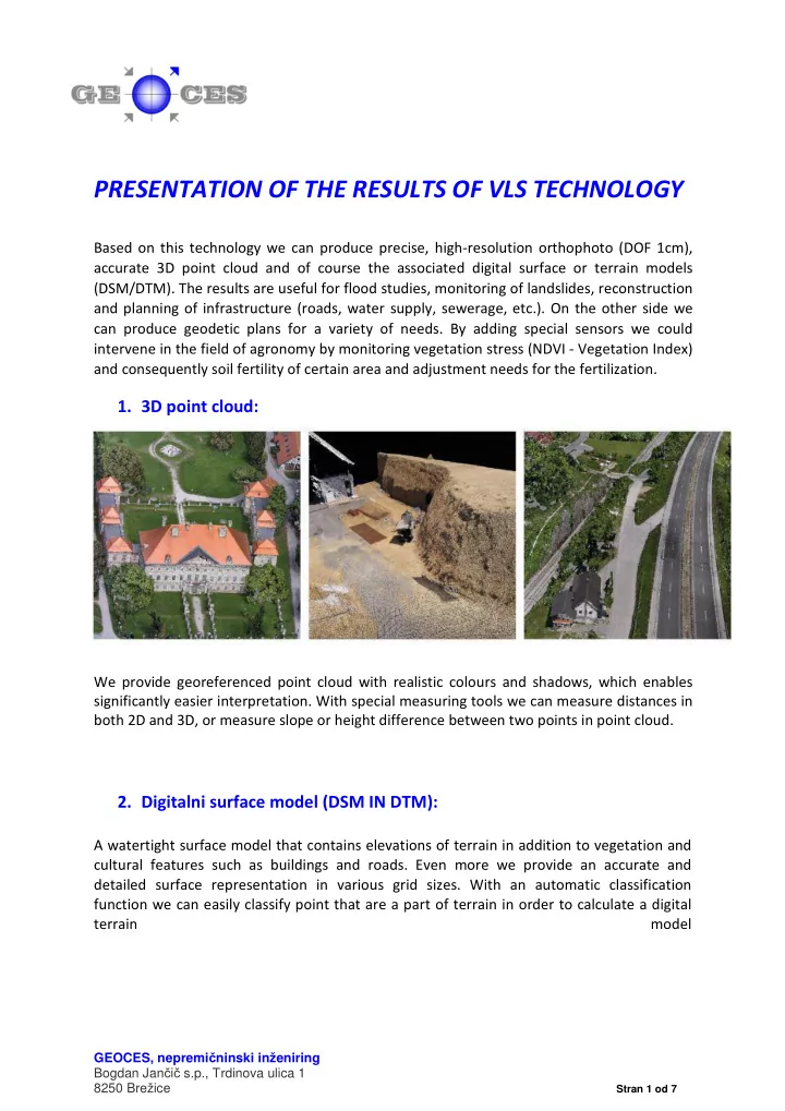
- 1. 3D point cloud:
We provide georeferenced point cloud with realistic colours and shadows, which enables significantly easier interpretation. With special measuring tools we can measure distances in both 2D and 3D, or measure slope or height difference between two points in point cloud.
- 2. Digitalni surface model (DSM IN DTM):