Fire refugia in late-successional forests Garrett Meigs, Meg - - PowerPoint PPT Presentation
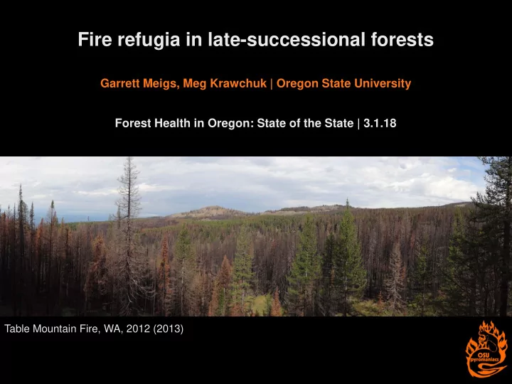
Fire refugia in late-successional forests Garrett Meigs, Meg Krawchuk | Oregon State University Forest Health in Oregon: State of the State | 3.1.18 Table Mountain Fire, WA, 2012 (2013) Fire refugia context Fire mosaics have key
Fire refugia context
- Fire mosaics have key implications for biodiversity and ecosystem services.
- Widespread concerns about increasing fire activity, particularly high-severity fire.
- Increasing interest in fire refugia among researchers, managers, and policy makers.
- Working definition: places that burn less frequently or severely than the surrounding
landscape (Krawchuk et al. 2016).
Pole Creek Fire, OR, 2012 (2013)
Fire refugia definition
Working definition: places that burn less frequently or severely than the surrounding landscape (Krawchuk et al. 2016). Global change context:
- Fire refugia are a subset of broader refugia.
- Refugia provide protection for something,
from something.
Fire refugia definition
Working definition: places that burn less frequently or severely than the surrounding landscape (Krawchuk et al. 2016). Global change context:
- Fire refugia are a subset of broader refugia.
- Refugia provide protection for something,
from something. Key aspects:
- Predictability
- Persistence
unburned / low severity fire refugia topographic “predictable” fire refugia persistent topographic fire refugia
Fire refugia definition
Working definition: places that burn less frequently or severely than the surrounding landscape (Krawchuk et al. 2016). Global change context:
- Fire refugia are a subset of broader refugia.
- Refugia provide protection for something,
from something. Key aspects:
- Predictability
- Persistence
- Scale: species vs. landscape pattern
unburned / low severity fire refugia topographic “predictable” fire refugia persistent topographic fire refugia
Fire refugia mapping
- Landsat: go-to satellite for
mapping fire effects
- (R)dNBR: go-to metric to assess
change from pre- to post-fire
- Monitoring Trends in Burn Severity
(MTBS): go-to source
- Pre-fire composition and structure
are critical
Landscape context: Table Mountain MTBS
24%
Landscape context: Table Mountain MTBS with forest mask
24%
Nonforest land cover matters
Table Mountain Fire, 2012 (2013)
Nonforest land cover matters
Table Mountain Fire, 2012 (2013)
What is the forest composition and structure of refugia?
Approach:
- Fire perimeters from Monitoring Trends in Burn Severity (mtbs.gov).
- Landsat imagery from LandTrendr algorithm (Kennedy et al. 2010).
- Severity thresholds from US Forest Service inventory data (Reilly et al. 2017).
- % change in basal area: 0-10, >10-25, >25-75, >75-90, >90-100
- Pre-fire forest composition and structure based on Gradient Nearest Neighbor maps
(GNN; Ohmann et al. 2012).
Pacific Northwest study area
Study area and selected fires (n = 99)
50,000 100,000 150,000 200,000 NONFOREST Other PSME-TSHE Subalpine Mixed-conifer PIPO JUOC Burn severity extent (ha) GNN forest type Very high High Moderate Low Very low / unchanged
Burn severity across selected PNW fires with ≥50% forest (n = 99) 200,000 150,000 100,000 50,000 Burn severity extent (ha)
Very high High Moderate Low Very low / unchanged
Some forest types have more refugia than others
Other PSME / TSHE GNN forest type PIPO NONFOREST JUOC Subalpine Mixed- conifer
50,000 100,000 150,000 200,000 NONFOREST Other PSME-TSHE Subalpine Mixed-conifer PIPO JUOC Burn severity extent (ha) GNN forest type Very high High Moderate Low Very low / unchanged
Burn severity across selected PNW fires with ≥50% forest (n = 99)
0% 10% 20% 30% 40% 50% 60% 70% 80% 90% 100% NONFOREST Other PSME-TSHE Subalpine Mixed-conifer PIPO JUOC Burn severity extent (%) GNN forest type Very high High Moderate Low Very low / unchanged
Burn severity across selected PNW fires with ≥50% forest (n = 99) 200,000 150,000 100,000 50,000 Burn severity extent (ha) Burn severity extent (%) 100 75 50 25 Other PSME / TSHE Subalpine Mixed- conifer GNN forest type PIPO NONFOREST JUOC
Very high High Moderate Low Very low / unchanged
Some forest types have more refugia than others
n = 99 fires across OR and WA from 2004 to 2015
a
50,000 100,000 150,000 200,000 250,000 Nonforest Sparse Open Closed w/ small trees Closed w/ medium trees Closed w/ big trees Burn severity extent (ha) GNN structural condition Very high High Moderate Low Very low / unchanged
Burn severity across selected PNW fires with ≥50% forest (n = 99)
250,000 200,000 150,000 100,000 50,000 Burn severity extent (ha) Sparse Open Closed, small trees GNN structural condition Closed, medium trees NONFOREST Closed, big trees
Very high High Moderate Low Very low / unchanged
Forest structure affects the distribution of low- and high-severity fire
50,000 100,000 150,000 200,000 250,000 Nonforest Sparse Open Closed w/ small trees Closed w/ medium trees Closed w/ big trees Burn severity extent (ha) GNN structural condition Very high High Moderate Low Very low / unchanged
Burn severity across selected PNW fires with ≥50% forest (n = 99)
0% 10% 20% 30% 40% 50% 60% 70% 80% 90% 100% Nonforest Sparse Open Closed w/ small trees Closed w/ medium trees Closed w/ big trees Burn severity extent (%) GNN structural condition Very high High Moderate Low Very low / unchanged
Burn severity across selected PNW fires with ≥50% forest (n = 99)
250,000 200,000 150,000 100,000 50,000 Burn severity extent (ha) Burn severity extent (%) 100 75 50 25 Sparse Open Closed, small trees GNN structural condition Closed, medium trees NONFOREST Closed, big trees
Very high High Moderate Low Very low / unchanged
Forest structure affects the distribution of low- and high-severity fire
n = 99 fires across OR and WA from 2004 to 2015
- Recognize that all refugia are not equal; nonforest and late-successional forest are two
ends of a spectrum.
- Use off-the-shelf maps with caution; consider forest mask for forest applications.
- Incorporate mapping uncertainty, fire weather, and topography.
- Mt. Hood Complex, OR, 2006 (2012)
Implications for burn severity assessments
- 1. Forest fire refugia vary with pre-fire composition and structure.
- 2. Late-successional forests contain substantial low-severity and refugia areas.
- 3. Burn severity depends on pre-fire conditions, fire effects, and post-fire responses.
Key points
Table Mountain Fire, WA, 2012 (2013)
Fire Bark beetle Defoliator Pathogen
learnforestry.com
- MTBS, GAP, GNN map makers
- Oregon State University College of Forestry
- Landscape Fire and Conservation Science
Research Group: Meg Krawchuk, Anna Barros, Nathan Blades, Will Downing, Kurt Frei, Andrew Merschel, Anna Talucci, Clare Tortorelli
- Ray Davis, Matt Gregory, Zhiqiang Yang
- OSU Pyromaniacs and Fierylabs
Acknowledgements
Table Mountain Fire, WA, 2012
Questions?
High-severity fire = refugia for lodgepole pine? (Table Mountain Fire)
garrett.meigs@oregonstate.edu
Kennedy R E, Yang Z G and Cohen W B. 2010. Detecting trends in forest disturbance and recovery using yearly Landsat time series: 1. LandTrendr - Temporal segmentation
- algorithms. Remote Sens. Environ. 114 2897-2910.
Krawchuk M A, Haire S L, Coop J, Parisien M-A, Whitman E, Chong G and Miller C. 2016. Topographic and fire weather controls of fire refugia in forested ecosystems of northwestern North America. Ecosphere 7 1-18. Ohmann J L, Gregory M J, Roberts H M, Cohen W B, Kennedy R E and Yang Z. 2012. Mapping change of older forest with nearest-neighbor imputation and Landsat time series.
- For. Ecol. Manage. 272 13–25,
Miller J D and Thode A E. 2007. Quantifying burn severity in a heterogeneous landscape with a relative version of the delta Normalized Burn Ration (dNBR). Remote Sens.
- Environ. 109 66-80.
Reilly M J, Dunn C J, Meigs G W, Spies T A, Kennedy R E, Bailey J D and Briggs K. 2017. Contemporary patterns of fire extent and severity in forests of the Pacific Northwest, USA (1985–2010). Ecosphere 8 1-28.
References
- The northern spotted owl (NSO)
evolved with frequent fire in a portion of it’s range.
- High-severity fire has emerged as
a driver of habitat change in mature and old forests (habitat for NSO and other species) and the increasing frequency of large wildfires is of concern.
- Forest managers and planners
would benefit from a quantitative understanding of locations that are less vulnerable to stand- replacing fire and more likely to persist in a hotter, drier future.
2017 fires (red), smoke, and late- successional habitat reserves (hatched) across the US Pacific Northwest, 9/5/17
Next steps: Fire refugia in spotted owl habitat
Study area and example of fire effects on spotted owl habitat
- 1. Advance a species-centric approach
to characterize burn severity in terms
- f spotted owl habitat suitability.
- 2. Develop and validate statistical
models of fire refugia in recently burned spotted owl habitat based on topographic and fire weather indices.
- 3. Scale refugia predictions from recent fires
to broader landscapes across the region and under future climatic conditions.
- 4. Work with forest and fire managers,