Pedestrian Pathway Connection Across CNR Lands in Kiwanis Park - - PowerPoint PPT Presentation
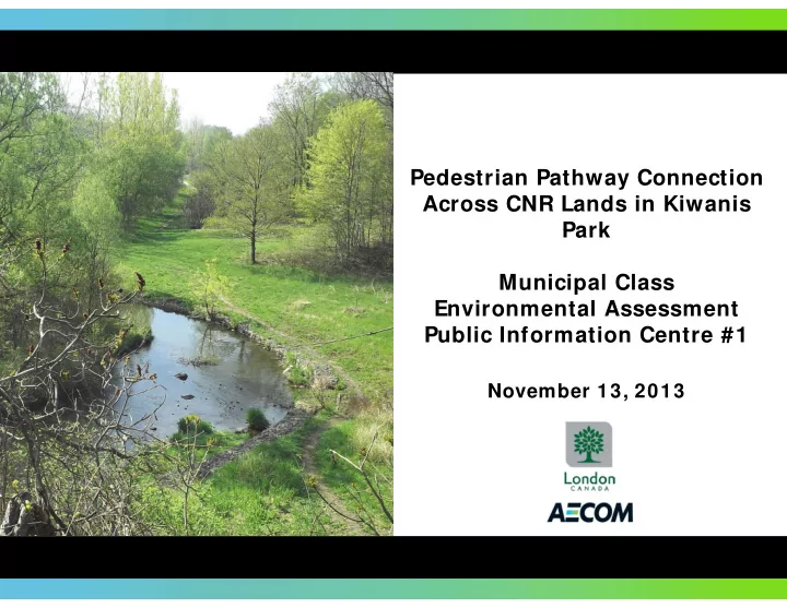
Pedestrian Pathway Connection Across CNR Lands in Kiwanis Park Park Municipal Class E Environmental Assessment i t l A t Public Information Centre #1 November 13, 2013 Welcome Welcome to the first Public Information Centre (PIC) for the
Welcome
Welcome to the first Public Information Centre (PIC) for the Pedestrian Pathway Connection Across CNR Lands in Kiwanis Park Class Environmental Assessment (EA). The purpose of this PIC is to present:
- a description of the Class EA process;
- a summary of the existing conditions;
- a summary of the problems and opportunities;
- a description of the alternative solutions considered (i.e. do nothing, improve the existing
pedestrian/bicycle crossing construct a new pedestrian/bicycle crossing); pedestrian/bicycle crossing, construct a new pedestrian/bicycle crossing);
- the evaluation criteria and methodology; and
- a summary of the future activities to be completed as part of the EA Study.
y p p y
Pedestrian Pathway Connection Across CNR Lands in Kiwanis Park
Welcome
Your comments are important to us. Following your review of the information, please complete one of the comment forms and place it in the box provided or send it back to the address on the form prior to November 29, 2013. The comment form can also be found on the City website. If you have any questions our representatives will be pleased to assist you.
Project Team
AECOM Canada Ltd. Corri Marr - Project Manager Tony Fediw – Project Engineer City of London Jeff Bruin – Project Manager Andrew MacPherson – Parks Planning y j g Jill Deman – Ecologist Nancy Martin – Project Coordinator Please direct additional inquiries to: Corri Marr Project Manager g Manager Linda McDougall - Ecologist Please direct additional inquiries to: Jeff Bruin Project Manager Corri Marr - Project Manager Phone: 519.963.5872 Fax: 519.673.5975 Email: corri.marr@aecom.com Jeff Bruin - Project Manager Phone: 519.661.2500 ext. 5067 Fax: 519.963.1483 Email: jbruin@london.ca
Additional information can be found on the City’s website at: www.london.ca/residents/Environment/EAs/Pages/Kiwanis‐Park.aspx
Pedestrian Pathway Connection Across CNR Lands in Kiwanis Park
Municipal Class Environmental Assessment Process
- The Class EA process is a five phase planning
process which:
- identifies reasonable solutions to the
Schedule A Projects
Typical Municipal Infrastructure Projects
Pre‐approved – Proceed to Construction
Problem;
- considers advantages and
disadvantages including net environmental effects;
Phase 1
Identify & Describe the
Typical Municipal Infrastructure Projects
Pre‐approved – Notify Public Prior to Implementation
Schedule A+ Projects
environmental effects;
- requires public consultation; and
- provides clear documentation that
d ib th d i i ki
Schedule B Projects
Problem or Opportunity Phase 2
Prepare Environmental Inventory, Identify/Evaluate Alternative Solutions, Effects & Mitigation Problem/Opportunity
describes the decision making process.
- This study will :
- Follow the Schedule ‘B’ Class EA
i
Schedule C Projects
Alternative Solutions Alternative Design Phase 3
Evaluate Alternative Design Concept and Establish the Preferred Solution – Prepare and File Project File
requirements.
- Complete Phases 1 & 2.
- Document the decision making process
Prepare and File Environmental Study ( )
Concepts for Preferred Solution Environmental Study Report Phase 4
Design Concept, Identify Environmental Effects – Mitigation & Preferred Concept
in a Screening Report to be filed for a 30 calendar day review period.
Report (ESR) Documenting Phases 1‐ 3 for Public Review
Report
Project Constructed / Restore Disturbed Areas
Implementation Phase 5
All Projects
This project is proceeding as a Schedule B
Pedestrian Pathway Connection Across CNR Lands in Kiwanis Park
Project Schedule
Notice of Project Commencement issued September 17, Project Team Meetings Receive and Address Notice of PIC issued October 28 2013
PI C #1 November 13,
Summer 2013
Class EA Phase 1
Fall 2013
Agency/Stakeholder Consultation p , 2013 Distribution of :
- Letter
- Newspaper Notice
g
- Project Team
meets regularly throughout the
- Review existing
conditions
- Identify the Problem
f Comments October 28, 2013
, 2013
- Present evaluation
criteria & methodology
- Alternative solutions
Distribution of :
- Letter
- Newspaper Notice
f
- UTRCA
- MNR
- MOE
- Newspaper Notice
- City of London
website study
- Includes City
personnel and consultants
- Confirm the need
and justification
- Identify solutions
- Evaluation Criteria
Winter 2013
- City of London
website
- CNR
- AANDC/MAA
Draft Recommendations to the City Notice of Project Completion
City of London Pathway Connection Across CNR Lands In Kiwanis Park Municipal Class Environmental Assessment
30 Day Review Period
Winter 2013
City Council Endorsement Notice of PIC TBD
PIC #2 TBD 2014
Class EA Phase 2 Document Class EA process,
- File Class EA
documentation for mandatory Distribution of :
- Letter
- Newspaper Notice
- Present evaluation
- f alternatives and
recommended alternative Distribution of :
- Letter
- Newspaper Notice
- City of London
website
- Evaluate
alternative solutions
- Identify impacts
- Identify mitigation
alternatives and recommendations 30 day review period.
Indicates where we are in the process.
- City of London
website measures
Pedestrian Pathway Connection Across CNR Lands in Kiwanis Park
Study Area
Pedestrian Pathway Connection Across CNR Lands in Kiwanis Park
^ _ ^ _
POTENTIAL PEDESTRIAN PATHWAY CONNECTION ACROSS CNR LANDS IN KIWANIS PARK
Scale: As Shown Date: November 2013
This drawing has been prepared for the use of AECOM's client and may not be used, reproduced or relied upon by third parties, except as agreed by AECOM and its client, as required by law or for use by governmental reviewing
- agencies. AECOM accepts no responsibility, and denies
any liability whatsoever, to any party that modifies this drawing without AECOM's express written consent.
! ( ! = ! = Û ! = ! ( ! ( ! = ! = ! ( ! ( ! = ! = ! ( ! = ! ( ! = ! = ! ( ! ( ! = ! ( ! = ! = ! = ! ( ! = ! ( ! ( ! = ! ( ! ( ! ( ! ( ! ( ! = ! = ! ( ! = ! = ! = ! = ! ( ! = ! =
^ _
n n n n n n n n n n n
Vauxhall Park St Julien Park Rivers Edge Disc Golf Course Shelbourne Park Norlan Ave Open Space Pottersburg Park River East Optimist Park Kiwanis Park South Tall Tree Park Kiwanis Park Central South Kiwanis Park Fairmont Park Silverwoods Park LTC-Brydges Park Oakland Ave Park Glass Ave Park Kiwanis Park Central North Nelson Park Admiral Park Argyle Arena East Lions Park Kiwanis Park North
T R A F A L G A R S T C L A R K E R D HAMILTON RD HALE ST GORE RD D U N D A S S T W A V E L L S T B R Y D G E S S T E L G I N S T EAST ST ADMIRAL DR K I N G S T GILES ST YORK ST F L O R E N C E S T M A R C O N I B L V D BOW ST SANDERS ST ROYAL CRES S T J U L I E N S T A S H L A N D A V E P A R K A V E DAWN DR PRICE ST WHITEHALL DR PINE ST W H I T N E Y S T T W E E D S M U I R A V E HOMAN ST C H U R C H I L L A V E HUME ST S A S K A T O O N S T VANCOUVER ST WINNIPEG BLVD ASH ST S E E L E Y D R MERLIN CRES EDMONTON ST EGERTON ST BORDEN ST FALCON ST M A G E E S T CORNISH ST BRISBIN ST DAKIN ST MANITOBA ST C A L G A R Y S T S C O T T S T A T K I N S O N B L V D HIGHBURY AVE N O A K L A N D A V E WEXFORD AVE GLASS AVE N O R L A N A V E WILTON AVE H Y L A S T BEATTIE AVE STARLIGHT AVE D O U L T O N S T C L A S S I C D R BAFFIN RD G L E N W O O D A V E B A N C R O F T R D EASTMAN AVE E L E A N O R S T THIEL ST HILTON AVE DELAWARE ST HOLGATE RD GODDARD BLVD F I R S T S T B R A E S Y D E A V E FRANCES ST L A N G M U I R A V E MANITOULIN DR HORACE ST DUMONT ST ELM ST MONTEBELLO DR MADISON AVE O A K S T PENSION LANE HYDRO ST FAIRMONT AVE S Y C A M O R E S T WINNIPEG ST NOEL AVE TREMONT RD STEVENSON AVE P O N D M I L L S R D GRAYDON ST FIRESTONE BLVD HAIG ST ALAUNIA ST ELDORADO AVE K I W A N I S P A R K D R SUDBURY AVE K I P L I N G A V E CARTIER RD R I V E R R U N T E R R MEADOWLILY RD N T R A P P E R S T BURSLEM ST BUCHAN RD M O F F A T C R E S B U R N S I D E D R HUDSON DR MOFFATT AVE F A I R H A V E N C I R CONDOR CRT C O V E N T R Y A V E LOGGERS GROVE ELLSWORTH AVE RIVER RD M A J O R S T MONTAGUE PL ALGONQUIN CRES FAIRWAY AVE STRATHCONA DR PINE LAWN AVE DULUTH CRES F E L L N E R A V E RAINBOW AVE SHORT AVE G R A H A M C R E S MASEFIELD CRES AVONDALE RD HALL ST COURT LANE MUIR ST POCHARD LANE B R E T O N P A R K C R E S J E N A C R E S W E L L E S L E Y C R E S R O C K W Y N C R E S M C L A R E N W O O D T E R R C H I L D E R S S T TOMMY HUNTER WAY C O U S I N S A V E CALVIN ST G O U L D S T WATMAR AVE T H O M P S O N R D TENNYSON ST GILBERT ST A L L E N A V E B A F F I N P L A B B O T T S T N I A G A R A S T A R U N D E L L S T WOODFERN RD ALBANY ST CORNELL CRES F A I R H A V E N S T SPRUCE ST BURDICK PL TALLTREE CRES H A M B E R C R T J U L I A C R T S T R A T T O N D R TANNER DR C L A S S I C C R E S GARLAND CRES SELKIRK ST C H A R T E R H O U S E C R E S F U N D Y A V E W A R D S T VAUXHALL ST LAURENTIAN DR N T O U L O N C R E S LAURENTIAN DR S F R O B I S H E R C R E S FIELDGATE CIR HEATHER CRES J A S P E R C R E S F E R E N A V E V I L L E N E U V E C R E S CRONYN CRES QUAIL RIDGE CRES COLDSTREAM CRES FLORA ST BALFOUR PL TALAVERA CRES CRYSTAL CRES TYNEMOUTH DR DENGATE CRES SECOND ST QUEENSTON CRES P R I T C H A R D P L DICKENS AVE SCENIC DR ARCADIA CRES MEADOWLILY RD S POWER ST CRIMSON CRES MCDIARMID ST ROSEWOOD AVE S A U L S T S P A R T O N S T EXMOUTH DR GLEESON ST E L L S W O R T H C R E S CALEDONIA ST MARBENOR CRES THORNE AVE OSBORNE ST TROOPER WILSON PL DANIELLE CRES GARLAND LANE KERNOHAN ST MAGEE PL CASTLE DR HIGHBURY AVE S BAYVIEW CRT HEATHER PL P U R C E L L D R D A N I E L L E L A N E GRAMERCY PARK PL FREDERICK CRES ASCOT ST CORNERBROOK AVE KIRKLAND CRES A L L E N P L N A P O L E O N D R EXMOUTH CIR F A I R H A V E N G A T E WEXFORD CRT F A R M B R O O K R D CLASSIC CRT KIPLING CRT OTTAWA CRT EDGEPARK PL WOODVIEW CRT WHITLOW CRT SPRUCE ST V A N C O U V E R S T G I L E S S T LANGMUIR AVE ELM ST OAKLAND AVE C H U R C H I L L A V E MERLIN CRES BORDEN ST PRICE ST M O F F A T T A V E O A K L A N D A V E WILTON AVE ASHLAND AVE HUME ST FELLNER AVE FLORA ST
¹
Legend n
Schools
^ _
Community Centres
Sports Fields and Recreation
! = Baseball ! ( Basketball Û Skateboard Park ! ( Soccer ! ( Tennis Study Area Existing Secondary Recreational Bike Route Existing Multi-Use Pathway Parks
Context Map
250 500 750 1,000 125 Metres
¹
Background
- Kiwanis Park is a long linear park that extends south from Dundas
Street to Hamilton Road and links to the Thames River.
- Multiple projects have been completed as part of the pathway
system from 2010 – 2013 including improvements to the multi‐use pathway within Kiwanis Park.
- These improvements included the construction of an asphalt path
extending the full length of the park, linking neighborhoods surrounding Pottersburg Creek to the Thames Valley Parkway (TVP) lti th t (TVP) multi‐use pathway system.
- The connection located between Trafalgar Street and Tweedsmuir
Avenue has not been completed due to the presence of the CNR li line.
- It is a priority of City Council to link the Kiwanis corridor with the
TVP multi‐use pathway system.
Pedestrian Pathway Connection Across CNR Lands in Kiwanis Park
Project Justification
h l l d f d h d h f ll
- The 2005 Bicycle Master Plan identified a pathway extending the full
length of Kiwanis Park linking to the TVP and a crossing of the CNR lands.
- The Parks & Recreation Master Plan (2009) recommended the need to
address gaps within the pathway system.
- The Thames Valley Corridor Plan (2011) also identified completing gaps
in the pathway system as a priority for the City.
- Trespassing across CNR lands in this area is an ongoing safety issue.
CNR is required to implement access control measures on their property by order of Transport Canada.
- The pathway within Kiwanis Park is expected to generate intensities of
use similar to other secondary paths in the City once fully constructed (ie. Stoney Creek– approximately 12,000 users/monthly).
Pedestrian Pathway Connection Across CNR Lands in Kiwanis Park
Existing Conditions – Social Environment
- Pathways within proximity to residential areas encourage and facilitate opportunities for exercise.
- Increased health benefits associated with increased physical activity.
- Residential properties that are adjacent to or in proximity to recreational amenities and pathways are
desirable to home buyers.
- Pathways offer a low cost physical activity facility.
- Kiwanis Park is a beautiful park where both active and passive activities can be enjoyed
- Kiwanis Park is a beautiful park where both active and passive activities can be enjoyed.
- Areas of negative social behaviour (vandalism, vagrancy) can be improved with the implementation of
pathway development.
Pedestrian Pathway Connection Across CNR Lands in Kiwanis Park
Existing Conditions – Land Use
- Schedule A of the City of
London Official Plan identifies land use designations adjacent
- Schedule B1 identifies the
natural heritage features of the
- area. This includes areas of
- Schedule B2 indentifies natural
resources and hazards for the area and identifies the study to the study area as low & medium density residential, light & general industrial and
- pen space.
unevaluated vegetation patches and significant corridors along the Pottersburg Creek. area as being within the Upper Thames River Conservation Authority regulation limit and within the regulatory floodline.
Study Area
Pedestrian Pathway Connection Across CNR Lands in Kiwanis Park
Existing Conditions – Natural Environment
- Seven Ecological Community Series exist within the
study area including Cultural Meadow, Meadow Marsh, Tallgrass Prairie Cultural Thicket Cultural Woodland
- Big Bluestem is found predominantly along the south
side of the CNR tracks. S h f h C k l b C k
Vegetation
Tallgrass Prairie, Cultural Thicket, Cultural Woodland, Deciduous Forest, and Swamp Forest.
- The most significant vegetation community found is a
tallgrass prairie remnant of big bluestem with butterfly
- South of the CNR tracks along Pottersburg Creek, a
deciduous forest comprised of Manitoba maple/willow/poplar occurs within the floodplain. At higher elevation, sugar maple/oak forest communities i tallgrass prairie remnant of big bluestem with butterfly
- weed. Big Bluestem is a rare species typical of prairie
habitats.
- There is an abundance of wild parsnip and great
exist.
- Wetland communities are north of Pottersburg Creek
and consist of meadow marsh with grasses and a i f h b i h d j
- There is an abundance of wild parsnip and great
ragweed along Pottersburg Creek floodplain area. variety of herbaceous species, such as spotted joe‐ pyeweed, swamp thicket and deciduous swamp.
Butterfly Weed Great Lobelia Poplar Trees Prairie Grass
Pedestrian Pathway Connection Across CNR Lands in Kiwanis Park
Existing Conditions – Natural Environment
Pedestrian Pathway Connection Across CNR Lands in Kiwanis Park
Existing Conditions – Natural Environment
- Pottersburg Creek has been historically realigned and is
currently comprised mainly of flat, gentle runs within
Aquatic
the study area.
- In‐stream cover is provided by abundant cobbles
throughout the channel but there is little diversity in
Pottersburg Creek north of the CNR corridor.
cover types with a marked lack of woody debris, and aquatic vegetation. However the meadow, shrubs and scattered trees provide a moderate amount of shading.
- Gabions are located along the bank to reduce erosion
along the creek .
- The greatest aquatic habitat diversity within the creek
Pottersburg Creek north of the CNR corridor.
exists upstream and downstream of the CNR crossing.
- AECOM is currently updating the Pottersburg Creek
Subwatershed Study.
Gabions along the creek south of the existing culvert.
Pedestrian Pathway Connection Across CNR Lands in Kiwanis Park
Existing Conditions – Natural Environment
- A total of 25 species of birds were identified within the study area.
- Key species that were documented include:
Birds & Insects
E t W d P ( tl d i t d i f i l
- Eastern Wood‐Pewee (currently designated as a species of special concern
by COSEWIC);
- Species that were observed that are identified in the Partners in Flight
Conservation Plan include: Baltimore Oriole, Eastern Wood‐Pewee, N th Fli k d R b t d G b k d
Eastern Wood Pewee
- A variety of insects were observed and include Eastern Forked Tail (damselfly),
Northern Flicker and Rose‐breasted Grosbeak; and
- Species that were observed that are identified as Area Sensitive Species
include: White‐breasted Nuthatch. y ( y), Green Darner (dragonfly), Ebony Jewelwing (dragonfly), Morning Cloak (butterfly) and Cabbage White (butterfly).
Wildlife and Reptiles
Paper Wasp
p
- The following mammals were observed directly or through incidental
- bservations: White‐tailed Deer, Raccoon, Squirrel, Skunk, Ground Hog,
Coyote, Cottontail, Virginia Opossum, Chipmunk and Muskrat.
- Reptile surveys have not been completed however it is anticipated the
following species would be located in the study area: Garter Snake, American Toad, Leopard Toad and Chorus Frog.
Green Darner
Pedestrian Pathway Connection Across CNR Lands in Kiwanis Park
Issues Summary
Pedestrian Pathway Connection Across CNR Lands in Kiwanis Park
Alternative Solutions Screening/Evaluation Process
The following illustrates the process that has been followed for this project to determine a ‘short list’ of crossing locations and types and pathway alignment.
Step 1 Consider whether the Alternative Planning Solutions meet the project bj i Step 2 Elaborate on the alternatives from Step 1 to determine possible C i T /L ti O ti Step 3 Crossing Type/Locations Options carried forward are then evaluated i d t il d t f i t l
- bjectives:
- provide a safe and appropriate
crossing of the CNR corridor
- support recreational activities in
Crossing Type/Location Options. These Crossing Type/Location Options are pre‐screened based on a review of criteria that includes: using a detailed set of environmental criteria for the following environmental components:
- social/cultural environment;
the area;
- provide increased commuter
- pportunities; and
- makes the area more attractive to
residents
- technical feasibility;
- distance to existing pathway
terminus; and
- potential to reduce trespassing and
provide a safe pedestrian link.
- natural environment;
- technical environment; and
- economic environment.
Status (Next Steps): To be residents. Status: Completed provide a safe pedestrian link. Crossing Type/Location Options that meet the criteria are then carried forward for detailed evaluation. Status (Next Steps): To be completed following comments received from Agencies, Aboriginal Communities, Stakeholders and the
- Public. Results will presented at
the next PIC Status: Completed (subject to comments received) the next PIC.
Pedestrian Pathway Connection Across CNR Lands in Kiwanis Park
Alternative Planning Solutions – Step 1
CONSTRUCT A NEW CROSSING
This option would consider various rail crossing locations, structures (tunnel/bridge) and pathway
IMPROVE EXISTING CROSSING AT HALE STREET & TRAFALGAR STREET
The existing infrastructure at Hale
DO NOTHING
Under this alternative, no measures would be taken to connect the north and south sections of the pathway alignments.. This alternative addresses the identified issues (connection between the north and south portion of Kiwanis / g Street and Trafalgar Street would be used as the crossing location of the CNR line. This alternative could become viable within Kiwanis Park. The pathway would remain in its present condition. This alternative does not provide a direct and exclusive link across the Park, improves pedestrian/cyclist connectivity, improves safety and reduces trespassing on CNR lands) (Options B‐H). by linking the pathway on the north side by way of Stevenson Avenue or through the hydro corridor. The south alignment may not link with the existing terminus but would proceed CNR corridor for pedestrians and cyclists and it does not address the current issue of trespassing across CNR lands.
Preferred Alternative
to the Thames River via an alternative alignment (Option A).
Preferred Alternative
.
Note: At grade crossings are not acceptable to CNR therefore they have not been considered as part of this project.
Pedestrian Pathway Connection Across CNR Lands in Kiwanis Park
Note: At grade crossings are not acceptable to CNR therefore they have not been considered as part of this project.
Location of CNR Crossing & Possible Pathway Linkages
Pedestrian Pathway Connection Across CNR Lands in Kiwanis Park
Option A: Hale & Trafalgar Intersection
On Street Crossing:
- The existing sidewalk would be used to convey pedestrians across
the east side of the existing roundabout. Carried Forward for Further Evaluation
- Alternatively, the pathway could be cantilevered to the existing
roundabout structure.
- An on‐street bike route would be implemented to convey cyclist
across the roundabout. Pathway:
- Proposed pathway could connect on the north side to the existing
pathway in Kiwanis Park by way of the existing sidewalk on T f l St t th h li k t St A Trafalgar Street or through a link to Stevenson Avenue.
- Proposed pathway could connect on the south side of the existing
pathway in Kiwanis Park by way of the Fairmont Trail.
- Approximate length of the proposed pathway: 2200m.
- Alternatively, the south alignment of the pathway may not link
with the existing terminus. A new pathway could proceed to the Thames River via an alternative alignment.
Pedestrian Pathway Connection Across CNR Lands in Kiwanis Park
Option B: East of Hale/Trafalgar Intersection
Bridge:
- Overall structure length of ±70m (property line to property line).
- Two span structure consisting of concrete deck on concrete or
Not Carried Forward for Further Evaluation steel girders.
- Structure provides a 7.01m vertical clearance over the tracks.
- Horizontal clearance crossing 2 CNR main lines and one spur line
(21m), an access road (4m) and spur line (11m) required.
- Combination of stairs and ramp provided at each end to
p p accommodate barrier free access. Various options are available for ramp layout / configuration.
- North approach would be within the CNR corridor.
- South approach would be along the Fairmont Trail corridor south
- f the CNR tracks
- f the CNR tracks.
Tunnel:
- Overall structure length of ±70m (property line to property line).
Not Carried Forward for Further Evaluation Overall structure length of ±70m (property line to property line).
- Buried structure to provide internal clearance 6.0m wide x 4.5m
high.
- Structural options include concrete box or circular steel plate.
- Ramps provided at each end to accommodate barrier free
access Various options are available for ramp layout / Pathway:
- Proposed pathway could connect on the north side to the existing
pathway in Kiwanis Park by way of access on CNR lands or along the hydro corridor to McLarenwood Terrance.
- access. Various options are available for ramp layout /
configuration.
- North approach would be within the CNR corridor.
- South approach would be along the Fairmont Trail corridor.
the hydro corridor to McLarenwood Terrance.
- Proposed pathway could also connect via a link along Stevenson
Avenue.
- Proposed pathway could connect on the south side of the existing
pathway in Kiwanis Park by way of the Fairmont Trail. A i t l th f th d th 1900
Pedestrian Pathway Connection Across CNR Lands in Kiwanis Park
- Approximate length of the proposed pathway: 1900m.
Option C: Hydro Corridor
Bridge:
- Overall structure length of ±90m (property line to property line).
- Two span structure consisting of concrete deck on concrete or
Not Carried Forward for Further Evaluation steel girders.
- Structure provides a 7.01m vertical clearance over the tracks.
- Horizontal clearance crossing 2 CNR main lines (15m) and 2 spur
lines (22m) required.
- Combination of stairs and ramp provided at each end to
p p accommodate barrier free access. Various options are available for ramp layout / configuration.
- North approach would be within the CNR corridor.
- South approach would be within the hydro corridor or Fairmont
Trail corridor south of the CNR tracks Trail corridor south of the CNR tracks. Tunnel: O ll t t l th f ±100 ( t li t t li ) Not Carried Forward for Further Evaluation
- Overall structure length of ±100m (property line to property line).
- Buried structure to provide internal clearance 6.0m wide x 4.5m
high.
- Structural options include concrete box or circular steel plate.
- Ramps provided at each end to accommodate barrier free
Pathway:
- Proposed pathway could connect on the north side to the existing
h i Ki i P k b f CNR l d l
- access. Various options are available for ramp layout /
configuration.
- North approach would be within the CNR corridor.
- South approach would be within the hydro corridor or Fairmont
Trail corridor. pathway in Kiwanis Park by way of access on CNR lands or along the hydro corridor to McLarenwood Terrace.
- Proposed pathway could connect on the south side to the
existing pathway in Kiwanis Park by way of the Fairmont Trail.
- Approximate length of the proposed pathway: 1500m.
Pedestrian Pathway Connection Across CNR Lands in Kiwanis Park
Trail corridor.
Option D: West Limit of Kiwanis Park
Bridge:
- Overall structure length of ±118m (property line to property line).
- Three span structure consisting of concrete deck on concrete or
Carried Forward for Further Evaluation steel girders.
- Structure provides a 7.01m vertical clearance over the tracks.
- Horizontal clearance crossing 2 CNR main lines (15m) required.
- Constructed with concrete or steel girders.
- Combination of stairs and ramp provided at each end to
Combination of stairs and ramp provided at each end to accommodate barrier free access. Various options are available for ramp layout / configuration.
- North approach would be within Kiwanis Park.
- South approach would be within the Fairmont Trail corridor south
- f the CNR tracks
- f the CNR tracks.
Tunnel: O ll t t l th f ±125 ( t li t t li ) Not Carried Forward for Further Evaluation
- Overall structure length of ±125m (property line to property line).
- Buried structure to provide internal clearance 6.0m wide x 4.5m
high.
- Structural options include concrete box or circular steel plate.
- Ramps provided at each end to accommodate barrier free
Pathway:
- Proposed pathway could connect on the north side to the existing
h i Ki i P k
- access. Various options are available for ramp layout /
configuration.
- North approach would be within Kiwanis Park.
- South approach would be within the Fairmont Trail corridor.
pathway in Kiwanis Park.
- Proposed pathway could connect on the south side to the
existing pathway in Kiwanis Park by way of the Fairmont Trail corridor.
- Approximate length of the proposed pathway: 800m.
Pedestrian Pathway Connection Across CNR Lands in Kiwanis Park
Option E: Mid Park
Bridge:
- Overall structure length of ±118m (property line to property line).
- Three span structure consisting of concrete deck on concrete or
Carried Forward for Further Evaluation Three span structure consisting of concrete deck on concrete or steel girders.
- Structure provides a 7.01m vertical clearance over the tracks.
- Horizontal clearance crossing 2 CNR main lines (15m) required.
- Constructed with concrete or steel girders.
- Combination of stairs and ramp pro ided at each end to
- Combination of stairs and ramp provided at each end to
accommodate barrier free access. Various options are available for ramp layout / configuration.
- North approach would be within Kiwanis Park.
- South approach would be within the Fairmont Trail corridor south
- f the CNR tracks.
Tunnel: O ll t t l th f ±130 ( t li t t li ) Not Carried Forward for Further Evaluation
- Overall structure length of ±130m (property line to property line).
- Buried structure to provide internal clearance 6.0m wide x 4.5m
high.
- Structural options include concrete box or circular steel plate.
- Ramps provided at each end to accommodate barrier free
Pathway:
- Proposed pathway could connect on the north side to the existing
h i Ki i P k
- access. Various options are available for ramp layout /
configuration.
- North approach would be within Kiwanis Park.
- South approach would be within the Fairmont Trail corridor.
pathway in Kiwanis Park.
- Proposed pathway could connect on the south side to the
existing pathway in Kiwanis Park by way of the Fairmont Trail corridor.
- Approximate length of the proposed pathway: 500m.
Pedestrian Pathway Connection Across CNR Lands in Kiwanis Park
Option F: West of Existing Culvert
Tunnel:
- Overall structure length of ±45m (property line to property line).
B i d id i l l 6 0 id 4 5 Carried Forward for Further Evaluation
- Buried structure to provide internal clearance 6.0m wide x 4.5m
high.
- Structural options include concrete box or circular steel plate.
- Ramps provided at each end to accommodate barrier free
- access. Various options are available for ramp layout /
configuration.
- North approach would be within Kiwanis Park.
- South approach would be within CNR lands.
Pathway:
- Proposed pathway could connect on the north side to the existing
pathway in Kiwanis Park.
- Proposed pathway could connect on the south side to the
existing pathway in Kiwanis Park across CNR lands.
- Approximate length of the proposed pathway: 450m.
Pedestrian Pathway Connection Across CNR Lands in Kiwanis Park
Option G: Existing Culvert
Tunnel:
- Requires use of existing culvert.
A ddi i l l ld b d i hi h Not Carried Forward for Further Evaluation
- An additional concrete culvert would be constructed within the
existing culvert to accommodate new pathway section.
- New culvert would require adequate clearance above the creek
surface to accommodate sewer conveyance and potential flooding.
- Potential culvert length 40.0 m.
Pathway:
- Pathway could connect on the north side to the existing pathway
in Kiwanis Park.
- Pathway could connect on the south side to the existing pathway
in Kiwanis Park across CNR lands.
- Approximate length of the proposed pathway: 500m
- Approximate length of the proposed pathway: 500m.
Pedestrian Pathway Connection Across CNR Lands in Kiwanis Park
Option H: East of Existing Culvert
Tunnel:
- Overall structure length of ±45m (property line to property line).
- Buried structure to provide internal clearance 6 0m wide x 4 5m
Carried Forward for Further Evaluation Buried structure to provide internal clearance 6.0m wide x 4.5m high.
- Structural options include concrete box or circular steel plate.
- Ramps provided at each end to accommodate barrier free
- access. Various options are available for ramp layout /
fi ti configuration.
- North approach would be within private property.
- South approach would be within CNR lands.
Pathway:
- Potential crossings of Pottersburg Creek may be considered to
connect to existing pathways.
- Pathway could connect on the north to the existing pathway in
Kiwanis Park. Alternatively, several possible alignment
- pportunities exist to connect the pathway with city streets.
- Pathway could connect on the south to the existing pathway in
Kiwanis Park across CNR lands. Kiwanis Park across CNR lands.
- Approximate length of the proposed pathway: 600m ‐ 1100m
Pedestrian Pathway Connection Across CNR Lands in Kiwanis Park
Alternatives To Be Carried Forward For Further Evaluation – Step 2
The following alternatives have been considered and will be carried forward for further evaluation for the following reasons: Option Reasons for Carrying Forward
Option A: Hale and Trafalgar Intersection
- The north/south approach and pathway alignments would be located within existing infrastructure.
- This alternative does not address the project need however t could become viable if other alternatives are considered technically unfeasible or cost prohibitive.
The following alternatives have been considered and will be carried forward for further evaluation for the following reasons: Carried Forward for Further Evaluation
Intersection Option D: West of Kiwanis Park Bridge
- The north approach and pathway alignment would be located within the existing Kiwanis Park.
- Due to the crossing location, this alignment has a higher probability of addressing the trespassing issues across CNR lands and improve the safety of the users.
- The length of this crossing could be reduced if land acquisition/easement can be negotiated with CNR.
- Potential to enhance the existing natural features.
- Potential to provide an aesthetic park experience to users.
Option E: Mid Park Bridge
- The north approach and pathway alignment would be located within the existing Kiwanis Park.
- The pathway location is shorter than other options and is a direct alignment with existing pathway terminus points.
- Due to location, this crossing and alignment have a higher probability of addressing the trespassing issues across CNR lands and improve the safety of the users.
- The length of this crossing can be reduced if land acquisition/easement could be negotiated with CNR.
- Potential to enhance the existing natural features.
- Potential to provide an aesthetic park experience to users.
Potential to provide an aesthetic park experience to users.
- Although the north pathway alignment would be located within a low lying area, a wooden boardwalk could be constructed along a portion of the pathway.
Option F: West of Existing Culvert Tunnel
- The north approach and pathway alignment would be located within the existing Kiwanis Park.
- Pathway alignment is shorter than other options and is a direct alignment with existing pathway terminus points.
- Shorter crossing required.
- Due to the crossing location, this alignment has a higher probability of addressing the trespassing issues across CNR lands and improve the safety of the users.
Th l th f thi i b d d if l d i iti / t b ti t d ith CNR
- The length of this crossing can be reduced if land acquisition/easement can be negotiated with CNR.
- Potential to enhance the existing natural features.
- Potential to provide an aesthetic park experience to users.
- North and south pathway alignments located within low lying areas. Wooden boardwalks may be required for sections of the pathway.
- Possible crossings of Pottersburg Creek required to connect to existing pathway.
Option H:
- The north approach and pathway alignment would be located immediately adjacent to and within Kiwanis Park.
p East of Existing Culvert Tunnel
- A possible pathway alignment is shorter than other options and is a direct alignment with existing pathway terminus points.
- Short crossing length required.
- Due to location, this crossing and alignment have a higher probability of addressing the trespassing issues across CNR lands.
- Although the north pathway alignment would be located within a low lying area, a wooden boardwalk could be constructed along a portion of the pathway.
- Potential to construct two crossings of Pottersburg Creek to connect to existing pathway and improve pathway circulation.
- Potential to enhance the existing natural features.
Pedestrian Pathway Connection Across CNR Lands in Kiwanis Park
Alternative Not Carried Forward For Further Evaluation – Step 2
Th f ll i l i h b id d b ill b i d f d f f h l i f h f ll i Option Reasons for Not Carrying Forward The following alternatives have been considered but will not be carried forward for further evaluation for the following reasons: Not Carried Forward for Further Evaluation
Option B: East of Hale/Trafalgar Bridge & Tunnel
- This option requires a long diversion from the existing pathway.
- Medium crossing length required.
- Due to the location of the crossing (further to the east of the existing pathway) this crossing and alignment have a lower probability of addressing the
trespassing issues across CNR lands .
- Land acquisition/easement would be required from CNR and hydro utility company to accommodate approach and possible pathway alignment on north side.
Option C: Hydro Corridor Bridge & Tunnel
- This option requires a long diversion from the existing pathway therefore this crossing and alignment have a lower probability of addressing the trespassing
issues across CNR lands .
- Land acquisition/easement would be required from CNR and hydro utility company to accommodate approach and a portion of the pathway alignment.
- Due to existing ground elevations construction of a tunnel would be more difficult and expensive.
- Adequate hydro line clearance is required for bridge construction, therefore construction maybe more difficult.
Option D: West Limit of Kiwanis Park Tunnel
- Although this crossing is centrally located, it would required a long tunnel , therefore perception of public safety is reduced (one way in‐one way out).
- Due to existing ground elevations construction of the tunnel would be more difficult and expensive.
Option E
- Although the location of this crossing is centrally located it would required a long tunnel therefore perception of public safety is reduced (one way in one
Option E: Mid Park Tunnel
- Although the location of this crossing is centrally located, it would required a long tunnel , therefore perception of public safety is reduced (one way in‐one
way out).
- Due to existing ground elevations construction of the tunnel would be more difficult and expensive.
Option G: Existing Culvert
- As part of the Pottersburg Creek Subwatershed study no improvements are required to the existing culvert.
- In order to provide serviceability to pedestrian users , a platform would be required within the existing culvert. This would result in some loss of conveyance
Existing Culvert
In order to provide serviceability to pedestrian users , a platform would be required within the existing culvert. This would result in some loss of conveyance and possibly hydraulic capacity.
- Ecological impacts and regulatory impacts associated with in‐water works.
Pedestrian Pathway Connection Across CNR Lands in Kiwanis Park
Evaluation Criteria/Methodology – Step 3
The following criteria will be used to evaluate the alternatives carried forward as part of the pre‐screening process. The evaluation process is based on a qualitative assessment to consider the suitability of each solution and identify significant advantages and disadvantages.
Social/Cultural Criteria
- Public Health & Safety
- Cultural Heritage Resources
- Aesthetics
Technical Criteria
- Design
- Construction
- Operation & Maintenance
Aesthetics
- Functionality
- Property Impacts
- Aboriginal Issues
p
- Approval & Regulatory Requirements
Recommended Preferred Solution
Natural Environment Criteria Economic & Financial Criteria
- Terrestrial Wildlife & Vegetation
- Aquatic Life & Vegetation
- Initial capital Costs
- Operating & Maintenance Costs
Pedestrian Pathway Connection Across CNR Lands in Kiwanis Park
Comments
Comments received from members of the public /Stakeholders/Aboriginal Communities prior to PIC#1 include the following:
- A concern was raised regarding safety issues and the increased risk of potential break‐ins, resulting from an access being provided behind existing
residents.
- Members of the public expressed support for Option C & Option H.
p p pp p p
- Members of the public expressed support for a tunnel below the tracks.
- A member of the public recommended an overpass at Hale/Trafalgar if tunneling is not feasible.
- Members of the public support implementation of a crossing to connect the north and south pathways across the CNR lands.
- A concern was raised regarding dirt bikes currently being driven behind residential properties along the existing pathway.
- Requests were made to include natural features and heritage sites into the design.
- A member of the public noted that the CNR embankment was constructed over a wooden trestle that may be encountered if tunneling is
considered as a result the site may possess design challenges.
- Members of the public requested that impacts to adjacent residential properties be factored into the evaluation process.
- If Options A or B are considered a member of the public suggested lights at Trafalgar/Stevenson Ave. be implemented.
- A member of the public asked about the requirements for easements or land acquisition on private property if required.
- A member of the public requested the City consider a connection path on both sides Pottersburg Creek.
- A member of the public requested that improved drainage be implemented to address flooding of the existing path and to avoid flooding of the
new path.
- Support for a path and crossing further to the west of the study area was expressed since it may provide improved security.
- Support for a barrier free pathway connection was expressed.
Comments from Agencies prior to PIC#1 include the following:
- Upper Thames River Conservation Authority regulates interference with wetlands and alterations to shorelines and watercourses. The preferred
alternative should have regard for approval requirements. Th Cit h ld id t ti l i t t i ti t ti
- The City should consider potential impacts to existing vegetation.
- Compliance with Upper Thames River Conservation Authority Environmental Planning Policies is required.
- The study should have regard for creek channel morphology.
PLEASE REMEMBER TO FILL OUT AND SUBMIT A COMMENT SHEET TO THE CITY OR AECOM PRIOR TO NOVEMBER 29, 2013.
Pedestrian Pathway Connection Across CNR Lands in Kiwanis Park
PLEASE REMEMBER TO FILL OUT AND SUBMIT A COMMENT SHEET TO THE CITY OR AECOM PRIOR TO NOVEMBER 29, 2013.
Next Steps
- Consider input from public and agency consultation to confirm or refine the
alternative solutions.
- Evaluate alternative solutions carried forward for further evaluation.
Fall 2013
- PIC #2 to present Recommended Alternative to the public.
- Prepare Screening Report
- Present recommendations to Civic Works Committee & Council (opportunity for
public participation at Civic Works Committee).
- Issue a Notice of Completion and File the Screening Report for the mandatory 30
day review period.
- Address comments raised during the 30 day review period.
Winter 2013/
- Anyone with outstanding concerns, which cannot be addressed, may, within 30
calendar days of the Notice of Completion, request the Minister of Environment to issue an order to comply with Part II of the EA Act. This is known as a ‘Part II Order’, bumping up the status of the project.
Spring 2014
- If no Part II Order requests are received, then the City may proceed with detailed
design & implementation.
Summer/Fall
- Detailed Design
2015
g
- Tender
2016
- Construction