Pawling Pedestrian Plan Presentation June 17, 2019 Pawling - - PowerPoint PPT Presentation

pawling pedestrian plan
SMART_READER_LITE
LIVE PREVIEW

Pawling Pedestrian Plan Presentation June 17, 2019 Pawling - - PowerPoint PPT Presentation

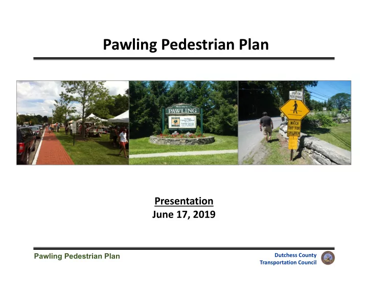
Pawling Pedestrian Plan Presentation June 17, 2019 Pawling Pedestrian Plan Dutchess County Transportation Council 1 Plan Objectives Improve pedestrian access to key destinations Improve safety for people walking in the Village


slide-1
SLIDE 1

1

Pawling Pedestrian Plan

Dutchess County Transportation Council

Pawling Pedestrian Plan

Presentation June 17, 2019

slide-2
SLIDE 2

2

Pawling Pedestrian Plan

Dutchess County Transportation Council

Plan Objectives

  • Improve pedestrian access to key destinations
  • Improve safety for people walking in the Village
  • Enhance the pedestrian experience in the Village
slide-3
SLIDE 3

3

Pawling Pedestrian Plan

Dutchess County Transportation Council

DCTC’s Pedestrian Plans

  • 2011: Village of Rhinebeck
  • Subcommittees for research & outreach, trees,

construction & finance, code enforcement

  • New crosswalks & ramps; sidewalk repairs
  • 2013: Hyde Park Town Center
  • Economic development/commercial center
  • New sidewalks; TAP & CDBG funding; zoning
  • 2014: Pine Plains Town Center
  • Coordinated with Town’s trail planning process;

sidewalk repairs

  • 2017: Arlington Town Center
  • Worked with Business Improvement District (BID);

Main Street Redesign Concept

  • 2018: Village of Millerton
  • Results TBD
slide-4
SLIDE 4

4

Pawling Pedestrian Plan

Dutchess County Transportation Council

Work Program

  • Organize Pedestrian Task Force
  • Village Trustees, Clerk, Highway Dept, Town

& Village residents

  • Review Village Comp Plan, Village Code,

& County Plans

  • Conduct Sidewalk Inventory
  • Identify conditions and issues
  • Global Positioning System (GPS) data
  • Solicit Public Input
  • Arts & Crafts Fair; Comp Plan survey;

November Open House

  • Develop Pedestrian Plan
  • Recommendations, maps, design concepts
slide-5
SLIDE 5

5

Pawling Pedestrian Plan

Dutchess County Transportation Council

Project Timeline

  • Village Resolution: April 2018
  • Task Force meetings: June, August,

October 2018; January, April 2019

  • Sidewalk inventory: July 2018
  • Improvement concepts: Fall 2018
  • Arts & Crafts Fair: September 2018
  • DEC meeting: September 2018
  • NYSDOT meeting: November 2018
  • Metro‐North call: December 2018
  • Public Open House: November 2018
  • Feedback & revisions: Fall‐Winter

2018‐19

  • Final Plan: Spring‐Summer 2019
slide-6
SLIDE 6

6

Pawling Pedestrian Plan

Dutchess County Transportation Council

Study Area

Downtown

slide-7
SLIDE 7

7

Pawling Pedestrian Plan

Dutchess County Transportation Council

Key Data Elements

  • Condition: Excellent, Good, Fair, Poor, or No Sidewalk
  • Issues: Lifted, Cracked, Uneven, Obstruction, Clearance, Removed/Missing, Other
  • Street Furniture: Street trees, pedestrian‐scale lights, benches, outdoor tables,

trash cans, bike racks, bus stop shelters

Other Data Elements

  • Sidewalk width & material
  • Buffer width & material
  • Curb ramps & detectable warnings
  • Crosswalk locations & type
  • Curb extensions
  • Pedestrian‐related signs
  • Commercial driveways
  • On‐street parking

Sidewalk Inventory

slide-8
SLIDE 8

8

Pawling Pedestrian Plan

Dutchess County Transportation Council

Recommendations

  • Main Street corridor
  • East Main St/Coulter Ave

intersection

  • Village Center – Charles Colman

Blvd

  • Train Station area
  • Dutcher Avenue
  • South Street
  • Middle/High School access
  • Route 22/Coulter Ave/Pine Dr

intersection

  • Route 22/East Main St/Quaker Hill

Rd intersection

  • Coulter Ave
  • Henry St/Dutcher Ave intersection
  • Lakeside & Murrow Park access
  • Village‐wide infrastructure
  • Parking
  • Bicycle access
  • Codes & Policies
  • Programs
slide-9
SLIDE 9

9

Pawling Pedestrian Plan

Dutchess County Transportation Council

  • Issues
  • West Main Street sidewalk condition
  • Pedestrian visibility & safety
  • Driver awareness & yielding
  • Inconsistent signage

Main Street Corridor

slide-10
SLIDE 10

10

Pawling Pedestrian Plan

Dutchess County Transportation Council

Curb Extensions:

  • East Main St at Dutcher
  • East Main St at Charles Colman
  • East Main St at Memorial
  • Install consistent crosswalk signs
  • Add warning strips at ramps
  • Evaluate a stop sign for westbound

East Main St at Memorial Ave

  • Replace West Main St sidewalk

Main Street Corridor: Recommendations

= Curb Extension

slide-11
SLIDE 11

11

Pawling Pedestrian Plan

Dutchess County Transportation Council

  • Issues
  • Safety/Accessibility
  • Incomplete sidewalks (east side)
  • No crosswalks
  • Wide open intersection
  • Eastbound traffic is uncontrolled
  • Multiple driveways at auto shop

East Main St/Coulter Ave Intersection

slide-12
SLIDE 12

12

Pawling Pedestrian Plan

Dutchess County Transportation Council

  • Add a stop sign on the

west leg (create an all‐ way stop)

  • Mark a crosswalk on the

west leg

  • Consider a median on

the west leg

  • Consider a crossing

guard at the CVS crosswalk

East Main St/Coulter Ave Intersection: Recommendations – short term

slide-13
SLIDE 13

13

Pawling Pedestrian Plan

Dutchess County Transportation Council

In conjunction with land use changes on the east corner:

  • Extend sidewalk on

north side

  • Add crosswalks on

north and east legs

  • Limit driveways on east

corner

  • Consider additional

traffic calming/gateway measures

East Main St/Coulter Ave Intersection: Recommendations – longer term

slide-14
SLIDE 14

14

Pawling Pedestrian Plan

Dutchess County Transportation Council

  • Issues
  • Sidewalk gap
  • Wide open, undefined area in the heart of the Village
  • Medians without pedestrian refuge islands

Village Center – Charles Colman Blvd

slide-15
SLIDE 15

15

Pawling Pedestrian Plan

Dutchess County Transportation Council

Village Center – Charles Colman Blvd: Recommendations

Enhance Village Green Trim trees/bushes for visibility Extend sidewalk Walkable development Median refuge(s) at Colman/Broad Adjust curb ramp; realign crosswalk

slide-16
SLIDE 16

16

Pawling Pedestrian Plan

Dutchess County Transportation Council

Charles Colman Boulevard Truck Turning Analysis

slide-17
SLIDE 17

17

Pawling Pedestrian Plan

Dutchess County Transportation Council

  • Issues
  • Limited accessibility: stairs, missing ramps
  • Pedestrian safety & visibility

Train Station Area

slide-18
SLIDE 18

18

Pawling Pedestrian Plan

Dutchess County Transportation Council

Train Station Area: Recommendations

Add ramp (alternative to stairs) Mark a walkway Extend sidewalk Add curb ramp Consider a second ramp & crosswalk Maintain walking areas clear of

  • bstructions
slide-19
SLIDE 19

19

Pawling Pedestrian Plan

Dutchess County Transportation Council

Train Station Area ‐ Pedestrian Improvements Conceptual Plan

slide-20
SLIDE 20

20

Pawling Pedestrian Plan

Dutchess County Transportation Council

  • Issues
  • Pedestrian access
  • Wetlands
  • Stream crossing/culvert
  • Railroad crossing

Dutcher Avenue & South Street

slide-21
SLIDE 21

21

Pawling Pedestrian Plan

Dutchess County Transportation Council

Dutcher Avenue: Recommendations

  • Dutcher Avenue Boardwalk
  • Extend sidewalk to Oblong‐owned parcel
  • Construct a boardwalk to South Street

through wetland

  • Mark a crosswalk across South Street to

connect to future South Street sidewalk

Boardwalk Sidewalk Fire House Sidewalk to East Main St Boardwalk

slide-22
SLIDE 22

22

Pawling Pedestrian Plan

Dutchess County Transportation Council

slide-23
SLIDE 23

23

Pawling Pedestrian Plan

Dutchess County Transportation Council

South Street: Recommendations

  • Sidewalk connection to East Main Street
  • Sidewalk along south side to East Main St
  • Crossing at East Main Street to connect to existing sidewalk
  • Consider re‐aligning sidewalk at East Main Street, or extend to intersection
  • Work with Metro‐North on at‐grade pedestrian rail crossing

Boardwalk Sidewalk to East Main St Pedestrian rail crossing

slide-24
SLIDE 24

24

Pawling Pedestrian Plan

Dutchess County Transportation Council

  • Issues
  • Student safety & comfort
  • No sidewalks north of cemetery
  • No crosswalks
  • Middle/High School sidewalk gap

Middle/High School Access

slide-25
SLIDE 25

25

Pawling Pedestrian Plan

Dutchess County Transportation Council

  • Route 22 sidewalk extension
  • Route 22/Reservoir Rd intersection
  • Reservoir Rd sidewalk/path
  • High School connections

Project requires coordination with Trinity‐Pawling School, NYSDOT, and Pawling Central School District.

Middle/High School Access: Recommendation Concepts

Route 22 Sidewalk Reservoir Road Sidewalk Intersection Improvements School Connections

slide-26
SLIDE 26

26

Pawling Pedestrian Plan

Dutchess County Transportation Council

  • Issues
  • Pedestrian safety & visibility at uncontrolled crosswalk
  • Pedestrian access at Route 22 intersection

Route 22/Pine/Coulter intersection

slide-27
SLIDE 27

27

Pawling Pedestrian Plan

Dutchess County Transportation Council

Route 22/Pine/Coulter intersection: Recommendations

  • Short term:
  • Trim trees, upgrade signage
  • Medium term:
  • Sidewalk on north side of Pine Dr
  • Full crosswalks & pedestrian

signals at Route 22

  • Crosswalk across slip lane at stop

sign

  • Remove uncontrolled crosswalk &

path (unless Coulter Ave east sidewalk is extended)

North sidewalk (with controlled crosswalks)

slide-28
SLIDE 28

28

Pawling Pedestrian Plan

Dutchess County Transportation Council

  • Issues
  • No sidewalks
  • No crosswalks
  • Signal pole, cemetery & stone wall on NW corner
  • Right turns onto southbound Route 22

Route 22/East Main/Quaker Hill Intersection

slide-29
SLIDE 29

29

Pawling Pedestrian Plan

Dutchess County Transportation Council

  • Provide full crosswalks &

pedestrian signals at Route 22

  • Restrict right turns on red when

pushbutton is activated

  • Extend East Main St sidewalk
  • Tighten intersections & mark

crosswalks at South St and Holm Run

  • Consider gateway improvements

(landscaping, signage)

Route 22/East Main/Quaker Hill: Recommendations

Sidewalk extension Narrow/square off intersections

slide-30
SLIDE 30

30

Pawling Pedestrian Plan

Dutchess County Transportation Council

  • Extend curbs and sidewalks
  • Mark a crosswalk
  • Consider adding parking

spaces along the northern sidewalk extension

Henry/Dutcher intersection: Recommendations

slide-31
SLIDE 31

31

Pawling Pedestrian Plan

Dutchess County Transportation Council

  • Murrow Park access: West Main Street sidewalk extension

Park Access: Recommendations

slide-32
SLIDE 32

32

Pawling Pedestrian Plan

Dutchess County Transportation Council

  • Lakeside Park access (Town)
  • Evaluate relocating vehicle

access to West Dover Rd to eliminate 5‐way intersection

  • Improve pedestrian

connections between Lakeside & Murrow parks

  • Evaluate a potential

sidewalk along Corbin Rd (long‐term)

Park Access: Recommendations

slide-33
SLIDE 33

33

Pawling Pedestrian Plan

Dutchess County Transportation Council

Coulter Ave: Recommendations – long term

Fill sidewalk gap Fill sidewalk gaps

slide-34
SLIDE 34

34

Pawling Pedestrian Plan

Dutchess County Transportation Council

Village‐wide Infrastructure: Recommendations

  • Upgrade pedestrian signage
slide-35
SLIDE 35

35

Pawling Pedestrian Plan

Dutchess County Transportation Council

Village‐wide Infrastructure: Recommendations

  • Repair/replace poor & fair sidewalks
slide-36
SLIDE 36

36

Pawling Pedestrian Plan

Dutchess County Transportation Council

Village‐wide Infrastructure: Recommendations

  • Accessibility Improvements: Construct curb ramps where missing; install

detectable warnings; provide ramps instead of stairs; replace diagonal curb ramps

slide-37
SLIDE 37

37

Pawling Pedestrian Plan

Dutchess County Transportation Council

  • Mark parking spaces/clarify

restrictions

  • Conduct a parking study

(supply/demand analysis)

  • Implement a parking

management plan

  • Consider options for merchant

parking, including off‐site lots

  • Consider meters for key areas

instead of time limits

  • Enforcement & education

Parking: Recommendations

slide-38
SLIDE 38

38

Pawling Pedestrian Plan

Dutchess County Transportation Council

  • Install bicycle parking
  • Consider wayfinding signage
  • Adjust sharrows on Charles Colman

Bicycle Access: Recommendations

slide-39
SLIDE 39

39

Pawling Pedestrian Plan

Dutchess County Transportation Council

  • Develop Sidewalk Design,

Construction & Maintenance Guidelines

  • Concrete
  • 5 ft minimum width
  • Encourage 5 ft buffer
  • Continue sidewalks across driveways
  • Consistent ‘continental’ crosswalks
  • Restrict parking within 20 ft of all

crosswalks

  • Promote walkable development:

review/revise codes; work with landowners

  • Update parking requirements

Codes & Policies: Recommendations

slide-40
SLIDE 40

40

Pawling Pedestrian Plan

Dutchess County Transportation Council

  • Develop a capital plan for sidewalk

construction & maintenance

  • 5‐year plan with budget
  • Prioritized list of projects
  • Track sidewalk conditions & maintenance
  • Evaluate personnel, capital, & equipment

needs (plowing, maintenance, repair)

  • Pedestrian safety education &

enforcement

  • Adopt the Pedestrian Plan;

designate an implementation entity

Programs: Recommendations

slide-41
SLIDE 41

41

Pawling Pedestrian Plan

Dutchess County Transportation Council

Implementation: Funding

Local

  • General funds/Capital Program/CHIPS
  • Local bonds
  • Sidewalk Improvement District

Private

  • Development conditions of approval
  • Public‐private partnerships
  • Non‐profit grants; Foundation grants
slide-42
SLIDE 42

42

Pawling Pedestrian Plan

Dutchess County Transportation Council

Implementation: Funding

State & County

  • Community Development Block Grants
  • Consolidated Funding Application (CFA)
  • NYS Multi‐Modal program; Legislative

Discretionary Funds

Federal

  • National Highway Performance Program

(20% local match)

  • Surface Transportation Block Grant Program

(20% local match)

  • Surface Transportation Block Grant Program

set‐aside/Transportation Alternatives Program (20% local match)

slide-43
SLIDE 43

43

Pawling Pedestrian Plan

Dutchess County Transportation Council

  • Provide final plan to Village, DPW, NYSDOT & Metro‐North
  • Provide inventory data to Village
  • Develop a two‐page summary

Next Steps

slide-44
SLIDE 44

44

Pawling Pedestrian Plan

Dutchess County Transportation Council

Contact Information

Emily Dozier, Senior Planner Dutchess County Transportation Council 85 Civic Center Plaza, Suite 107 Poughkeepsie, NY 12601 (845) 486‐3600 Email: dctc@dutchessny.gov Internet: http://www.dutchessny.gov/PawlingPedestrianPlan