
SLIDE 1
Overview Enview turns massive datasets into operational insights to - - PowerPoint PPT Presentation
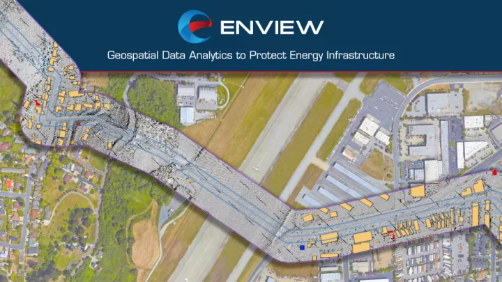
Overview Enview turns massive datasets into operational insights to support pipeline operational safety and reliability Computer Vision Machine Learning Data Visualization Actionable Results See the Invisible Predictive Insights Pipeline
Computer Vision
See the Invisible
Machine Learning
Predictive Insights
Data Visualization
Actionable Results
3rd
rd Pa
Party Dig-In Ins
49 49 CFR 192.614 192.614
Ve Vegetative Obscuration
49 49 CFR 192.701 192.701 & 705 705 NE NERC FAC-003 003-3
De Depth of Cover
49 49 CFR 192.620 192.620
RO ROW Encroachment
CP CPUC C GO 112-F F (143.6)
St Structure Co Count
49 49 CFR 192.5, 192.5, 613 613 & 905 905
Pr Predictive Analytics
1 mile. 19M points. 5 GB.
baseline and for future analyses
Original LiDAR Data Decimated LiDAR Data
Landslide Detection New Structure Detection Raw change detection – not operationally useful Automated anomaly detection – operationally useful
Views of same excavation in an interactive, 3D data viewer Excavation near pipeline ROW – Top View