
SLIDE 1
Roman Hanney (and Beyond)
26th February 2019
- Important Iron Age Sites
(Dyke Hills, Cherbury Camp)
- Important Roman Sites
(Marcham / Frilford)
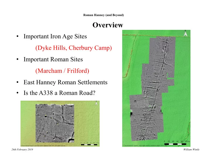
- East Hanney Roman Settlements
- Is the A338 a Roman Road?
Overview
William Wintle