
SLIDE 1
Northern California Catastrophic Flood Response Plan (NCCFRP) - - PowerPoint PPT Presentation
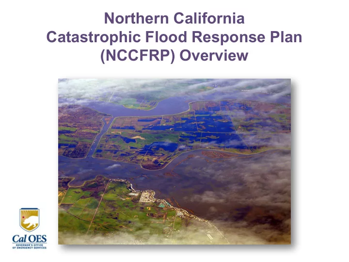
Northern California Catastrophic Flood Response Plan (NCCFRP) Overview Why a Catastrophic Flood Plan? Sacramento-San Joaquin Delta Emergency Preparedness Act of 2008 (SB27) Establish Sacramento-San Joaquin Delta Multi-Hazard Task Force
Sacramento-San Joaquin Delta Emergency Preparedness Act of 2008 (SB27)
Multi-Hazard Task Force
for: – A unified command system
– Emergency preparedness and response strategy for the Delta region
Plan – Conduct exercises and training
The NCCFRP is more than just a Delta flood response plan.
Earthquake Plan, Southern CA Earthquake Plan, & Cascadia Earthquake & Tsunami Plan)
plan which presented unique challenges (progressive weather event vs no-notice event).
flood zone).
training, and exercises. Plan can also be used for any type
[OAs] and Branch profiles).
phases, assumptions, and planning factors.
Oroville Dam Response Plan.
for county flood plans.
Bay Area Earthquake Plan Northern CA Flood Response Plan
Version: Update to existing plan Version: New plan Event: No Notice, Sudden Earthquake Event: Progressive Weather Event Declarations: Immediate (Local, State, Federal) Declarations: Local – 1 to 2 days State – 5 to 6 days after locals Federal – 7 to 9 days after event Area Affected: 18 Counties around San Francisco Bay Area (San Andreas and Hayward Fault) Area Affected: 10 counties in the Sacramento Valley (Assumes all 58 counties affected by flooding) Time of Year: Year round Time of Year: December - April Weather: Unknown but assumes mild Weather: Winter (Cold, Rain, Snow) Strategy: Gaining access through a multi- modal transportation access strategy to enable response and recovery operations (shelter in place) Strategy: Revolves primarily around evacuations, search and rescue, mass care, medical support, infrastructure recovery, and other response and recovery efforts in support of local government (no shelter in place) Federal Support: Immediate Federal Support: Gradual (over days or weeks) Logistics: Commodity Points of Distribution strategy to support shelter in place populations Logistics: Support shelter and medical/health
Phase 2: Response Phase 3: Recovery 1a
Normal Operations
1b
Elevated Threat
1c
Credible Threat
2a
Initial Response
3
Recovery
Information
readiness
situational awareness
resource needs
2b
Intermediate Response
Planning
resources
Mobilization
actions
Declares State
Coordination Group
resources to priority areas
Presidential Declaration and federal assistance
Deploys IMAT to SOC
SOC and REOC functions transfer to IOF/JFO Recovery Organization
Phase 1: Pre-Incident
DWR FOC activated SOC and REOCs activated
Forecast & Pre-arrival Precipitation & increasing runoff Additional precipitation & inundation Recession & dewatering
2c
Joint State/Federal Operations
Joint Field Office
Federal Resources
A weather event large enough to cause catastrophic flooding will have far reaching impacts affecting
Sacramento River Hydrologic Region (5) includes the northern half of the Central
north down through Sacramento into the Delta and is the most heavily dammed and diverted rivers in planning area. Major rivers include the Sacramento, Feather, American, Yuba, San Joaquin, Consumnes and the Mokelumne with several creeks and streams. San Joaquin River Hydrologic Region (6) includes the Central Valley. The San Joaquin River runs northwesterly through the Delta to Suisun Bay and has the least storage and channel capacity. Major rivers include the San Joaquin, Merced, Chowchilla, Fresno, Stanislaus and Tuolumne with several creeks and streams. All water drains through the Delta to the
The Numbers:
with 350,000 requiring shelter
endangered species
Source: DWR CA’s Flood Future Report (2013)
County Total Acreage Area Exposed in 100 Yr Flood Zone Area Exposed in 500 Yr Flood Zone Acres % of Area Exposed Acres % of Area Exposed
Butte 1.1 million 198,800 19 271,300 25 Colusa 740,000 175,300 24 229,200 31 Contra Costa 514,000 113,000 22 125,300 24 Glenn 849,100 123,300 15 133,800 16 Sacramento 636,100 119,300 19 273,500 43 San Joaquin 912,600 242,900 27 435,200 48 Solano 582,400 119,200 34 224,400 39 Sutter 389,300 195,000 50 308,400 79 Yolo 653,500 239,900 37 260,600 40 Yuba 412,000 51,800 13 95,400 23
Source: 2015 Census Data
Operational Area/County Total Population Population Exposed to Flooding in 100 Yr Event Population Exposed to Flooding in 500 Yr Event Total Population Exposed to Flooding
Branch I Division A – Yolo 206,439 68,614 (33%) 9,587 (5%) 78,201 (38%) Division B – Colusa 22,143 4,210 (19%) 2,106 (10%) 6,316 (29%) Division C – Glenn 28,864 4,517 (16%) 5,532 (19%) 10,049 (35%) Branch II Division D – Butte 223,456 17,327 (8%) 31,620 (14%) 48,947 (22%) Division E – Sutter 95,894 9,479 (10%) 83,757 (87%) 93,236 (97%) Division F – Yuba 74,505 26,594 (36%) 26,229 (35%) 52,823 (71%) Branch III Division G – Sacramento 1,456,424 103,209 (7%) 502,691 (35%) 605,900 (42%) Division H – San Joaquin 711,503 53,524 (8%) 369,064 (52%) 422,588 (59%) Branch IV Division J – Contra Costa 1,089,972 47,069 (4%) 32,932 (3%) 80,001 (7%) Division K – Solano 422,431 39,661 (9%) 21,926 (5%) 61,587 (15%) Totals 4,331,631 374,204 (9%) 1,085,444 (25%) 1,459,648 (34%)
flooding will affect most of California. Response assets will be engaged throughout the state.
About 350,000 (25%) may require sheltering or support.
transportation networks. Ports, major highways, airports, and railroads will be affected.
landslides will affect roads going into the Sierra and limit evacuations to the east.
general population and medical facilities.
strategy.
flooding can be reduced by timely warnings (evacuations, mitigation measures).
during an unexpected levee break or if people refuse to evacuate.
transportation, communications, healthcare, and
flood zones.
down prior to flooding.
aging infrastructure, low elevation, and subsidence. Other areas in Northern California are considered at high-risk.
economic damages and losses totaling more than $2.7 billion.
located in the flood zone including the State Capitol and many State agency
Government/Operations will run concurrently with state response activities.
La Nina, and ARkStorm scenario.
conditions/operations.
San Francisco Bay Area.
change, marine debris, and hazardous waste.
(monitor/flood/danger stages) and local evacuation triggers.
– Levees (State Plan of Flood Control and Non-State Plan of Flood Control) – Levee Vulnerability (86 Critical Points
Interest)
– 110 State Jurisdictional Dams – 14 Federal Dams – New Dam Classifications – 30 dams in the 100 yr flood zone – ID’ed other dams impacting planning area
By-passes
– 18 in 100 yr flood zone – 32 in 500 yr flood zone
– 52 in 100 yr flood zone – 94 in 500 yr flood zone
– 6 in 100 yr flood zone – 18 in 500 yr flood zone
– 6 in 100 yr flood zone – 12 in 500 yr flood zone
– 1 in 100 yr flood zone – 6 in 500 yr flood zone
– 3 in 100 yr flood zone
– 164 (7%) in 100 yr flood zone – 711 (32%) in 500 yr flood zone
– 84 in 100 yr flood zone – 160 in 500 yr flood zone
(58 at risk)
– 37 in 100 yr flood zone – 21 in 500 yr flood zone
– 41 in 100 yr flood zone – 331 in 500 yr flood zone
– 17 (39%) may require full or partial evacuation – 37 emergency departments and 14 (38%) exposed to flooding
– 8 in 100 yr flood zone – 102 in 500 yr flood zone
– 34 in 100 yr flood zone (21,760 cows) – 19 in 500 yr flood zone (12,160 cows)
– 346,063 dogs – 378,060 cats – 42,073 birds – 24,296 horses
– A: Response and Recovery Core Capabilities – B: Acronyms – C: References
Operations
Government Operations
Operations
recovery)
Points with E-19 Impact Information
and Population Movement
Communications,
Schools, Tribal
Facilities and Pets
– All Facilities – Tracked Beds by Type – Surge Capacity – General Acute Care Hospitals – Trauma Centers – Emergency Departments – Psychiatric Hospitals – Skilled Nursing Facilities – Chronic Dialysis – Long Term Health Care – Alternative Birth Center and Ambulatory Surgery Centers – Adult Day Health Center, Home Health Agencies, and Hospice – Community and Rehabilitation Type Services – Correctional Treatment Centers – Medical Health Operational Area Coordinator Information
Transmission
seat, city/county EOC, SOC/REOC, fire stations, law enforcement stations, prisons)
with Levee Vulnerability
(Mass Care)
members)