Navigation Dredging in the Navigation Dredging in the Champlain - - PowerPoint PPT Presentation

navigation dredging in the navigation dredging in the
SMART_READER_LITE
LIVE PREVIEW

Navigation Dredging in the Navigation Dredging in the Champlain - - PowerPoint PPT Presentation

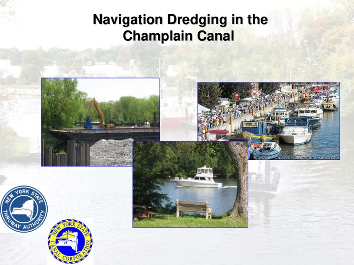
Navigation Dredging in the Navigation Dredging in the Champlain Canal Champlain Canal Canal System Overview The Canal System is comprised of four waterways: The Erie Canal 338 miles long The Champlain Canal 60 miles long


slide-1
SLIDE 1

Navigation Dredging in the Navigation Dredging in the Champlain Canal Champlain Canal

slide-2
SLIDE 2

Canal System Overview

  • The Canal System is comprised of four waterways:
  • The Erie Canal – 338 miles long
  • The Champlain Canal – 60 miles long
  • The Oswego Canal – 24 miles long
  • The Cayuga & Seneca Canal – 12 miles long
  • The System includes approximately 1,800 structures

including 57 locks, 20 moveable bridges, dams, and walls.

slide-3
SLIDE 3

What is the Navigation Channel?

  • An area of the waterway that is maintained

to allow the safe passage of vessels.

  • Champlain Canal has design depth of 12

feet within the navigation channel boundaries.

  • Channel width in the river section is 200

feet.

  • Champlain Canal is “canalized river” from

Fort Edward to Waterford.

slide-4
SLIDE 4

History of the Champlain Canal

  • Modern Champlain Canal was fully
  • pened to traffic in 1916.
  • By 1920s, the need for routine

maintenance dredging became apparent.

  • NYS built or commissioned a number of

dredges and support vessels to conduct regular maintenance.

slide-5
SLIDE 5

History of the Champlain Canal

  • 1973: Removal of the Fort Edward Dam
  • 1974-79: Multiple rounds of emergency

dredging necessary to restore navigation

  • 1980-Present: No maintenance dredging

(with the exception of Hoosic River)

slide-6
SLIDE 6

History of the Champlain Canal

slide-7
SLIDE 7

History of the Champlain Canal

  • Since the early 1980s, New York State DOT and

Canal Corporation have not been able to maintain the navigation channel in the Hudson River/Champlain Canal due to the presence of sediments contaminated with PCBs.

  • Navigability of the Hudson River/Champlain

Canal has gradually declined over the years. Large vessels now routinely have difficulty navigating some sections of the canalized river.

slide-8
SLIDE 8

Navigational Impacts of PCB Contamination

  • Available depths and channel widths are

reduced (see NYSCC maps)

  • Reduced depths and widths particularly

impact the size of tug boats and barges that can safely navigate the river

  • Commercial traffic must use smaller,

lighter loads which has a direct impact on the cost-effectiveness of water transport

  • Even some large recreational vessels are

impacted

slide-9
SLIDE 9
slide-10
SLIDE 10

Navigational Dredging vs. Remedial Dredging

  • EPA Remedy is based on “hot spot”

removal

  • “3/10/Select” hot spot standard
  • All “hot spots” will be dredged to achieve

goal of 1 ppm Tri+ PCB residuals

  • Majority of the river below Lock C6 will

remain unremediated.

slide-11
SLIDE 11

Navigational Dredging vs. Remedial Dredging

  • Out of 2.4 million cubic yards in GE’s dredging

program, only 92,000 cubic yards will improve navigation.

  • The remedial dredging program will remove less

than 15% of the total navigation dredging needs in the river.

  • More than 628,000 cy of contaminated sediment

will remain in the navigation channel

slide-12
SLIDE 12

Navigational Dredging vs. Remedial Dredging

BEFORE: 13,103 cy Navigation Dredging Needed AFTER: GE/EPA Removes 2,010 cy 11,093 cy Remaining

slide-13
SLIDE 13

Requirements for Navigational Dredging

  • Navigational Dredging is governed by

state and federal requirements:

– Army Corps Section 404 Permit – DEC Section 401 Water Quality Certification – DEC Part 360 Solid Waste Regulations – EPA TSCA Requirements – DEC Part 370 Hazardous Waste Regulations

slide-14
SLIDE 14

Navigational Dredging vs. Remedial Dredging

  • EPA Remedial Residual Standard

= 1ppm Tri+ PCBs (Approximately equal to 2-3 ppm Total PCBs)

  • DEC Standard for PCBs is 1 ppm Total

PCBs

– Greater than this and special handling and disposal requirements apply (case-by-case)

slide-15
SLIDE 15

Requirements for Navigational Dredging

  • Complications from PCBs:

– Cannot use existing NYSCC equipment – Cannot use traditional Upland Disposal Sites – New dewatering facility would require Solid Waste Facility Permit – High PCB concentrations may require Hazardous Waste Facility Permit

  • Siting requirements
slide-16
SLIDE 16

Solutions

  • Current remedial project is exempt from
  • btaining permits (substantive requirements

must be met).

  • It is administratively and economically more

feasible to conduct navigational dredging during Phase 2.

  • 32 Champlain Canal municipalities have passed

resolutions advocating that navigational dredging be conducted during Phase 2.

slide-17
SLIDE 17

Contact Information Contact Information

Joseph Moloughney, P.E., Director of Environmental Affairs New York State Canal Corporation P.O. Box 189, Albany 12201 (518) 436 - 3055 www.nyscanals.gov