
SLIDE 1
1
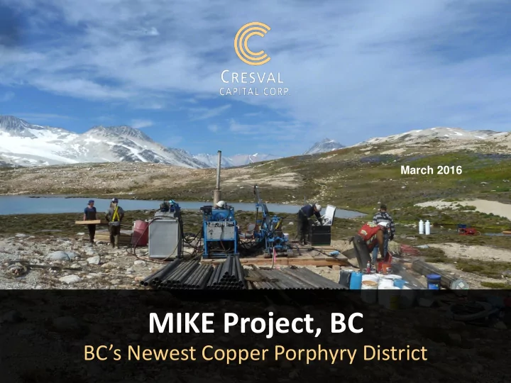
MIKE Project, BC
BC’s Newest Copper Porphyry District
March 2016
MIKE Project, BC BCs Newest Copper Porphyry District 1 Cautionary - - PowerPoint PPT Presentation
March 2016 MIKE Project, BC BCs Newest Copper Porphyry District 1 Cautionary Disclaimer This presentation may contain statements that constitute forward - looking information for the purposes of Canadian securities laws. Such statements
1
March 2016
This presentation may contain statements that constitute “forward-looking information” for the purposes of Canadian securities laws. Such statements are based on Cresval’s (“CRV” or “CRV’s”) current expectations, estimates, forecasts and projections. Such forward-looking information includes statements regarding (CRV’s) outlook for future
historical fact. The words “estimates”, “projects”, “expects”, “intends”, “believes”, “plans”, “will”, “may”, or their negatives or other comparable words and phrases are intended to identify forward-looking information. Such forward-looking information is based on certain factors and assumptions and is subject to risks, uncertainties and
forward-looking information. Important factors that could cause actual results to differ materially from (CRV’s) expectations include uncertainties relating to interpretation of drill results and geology, additional drilling results, continuity and grade of deposits, participation in joint ventures, reliance on other companies as operators, fluctuations in metals prices and currency exchange rates, changes in environmental and other laws affecting exploration and mining, and other risks and uncertainties disclosed in CRV’s Annual Information Form and other filings with the applicable Canadian securities commissions on SEDAR. Many of these factors are beyond the control
statement and there can be no assurance that actual results or developments anticipated by CRV will be realized. For the reasons set forth above, investors should not place undue reliance on such forward-looking information. Except as required by applicable law, CRV disclaims any intention or obligation to update or revise forward-looking information, whether as a result of new information, future events or otherwise.
2
4
Shares Issued
141,352,632 22,073,231 61,800,000
Market Cap
$ 14,135,263 $ 882,929 $ 5,771,736
Fully Diluted
144,403,932 27,050,731 72,146,704
Best Leverage
1 From Interim Financials dated June 30, 2015; market cap as of Nov 2, 2015 2 As of January 1, 2016; market cap as of Feb 1, 2016 3 From Corporate Presentation dated Nov 1, 2015; market cap as of Nov 2, 2015
COPPER-RICH INTRUSION LARGER THAN IKE WITHIN A HIGHLAND VALLEY-SCALE PORPHYRY DISTRICT
“This isn’t just one deposit, it’s a whole entire district that’s going to come to the fore, and it doesn’t get any better…”
Robert Dickinson
5
GOLD BRIDGE BRALORNE
6
OWNED 100%, NO ROYALTIES. 11,127 HECTARES (27,500 ACRES)
Approx: 235 km by road from Vancouver 175 km by road from Lillooet 50 km by road from Goldbridge
7
8
8
1928-30 Discovery of Cu mineralization at Nichol & Russnor 1929-36 COMINCO: underground development and hand trenching on Russnor & Nichol, with 1.1% Cu/12.2m true width in Russnor adit and 0.57% Cu over 60m from chip sampling the canyon exposure; 2.8% Cu/4.5m on Nichol from trenching. Discovery of Showing #3, 3.26% Cu/9.1m 1955 NORANDA: 1.1% Cu/26.2m in Russnor adit 1961-63 PHELPS DODGE: 613m in 5 DDH on Russnor in 1961, mineralization in 4/5 holes, 0.3% Cu over 36.6m Discovery and hand trenching of BR, 0.57%Cu/7.6m in 1961 Mapping, magnetic and soil surveys on Nichol 1969 TCML: 51.2m diamond drilling in 2 holes on Russnor; entire holes ran 0.3% Cu/26.5m & 0.14% Cu/23.9m 1970-71 CANEX: 590m in 4 90º BQ DDH on BR with 0.134% Cu/9m but no other results reported. Cerro:. Limited mapping & soils on Russnor, 915 ppm Cu, 47 Mo TCML: 1.38 % Cu over 33m from Russnor adit (Elwell, 1970) 1979-81 Polischuk and Goldbridge: 30.5m in 2 DDH, 3.5% Cu, 0.08% Mo/3m, limited sampling on Nichol 381m in 8 BQ DDH, 0.97% Cu/3m. AMAX: Mapping, magnetic & IP surveys on BR
9
10
10
11
Windy Copper Showing: Open 400m by 1km zone Nichol Showing: Open 400 by 600m zone Russnor Showing: Open 1150m by 600m zone Copper Plateau Showing: Partly open 450 by 550m zone, adjoining BR BR Showing: Open 1700m by 500m zone Key showings lie on edge of basalt caps – possible large porphyry extends underneath.
11 Bridge River Pluton
12
Nichol
Interval Cu Grade % Ag Grade g/t Au Grade g/t Mo Grade % 1.0 metres T 4.37 32.8 0.16 0.015 0.6 metres T 8.91 33.1 0.043 8.5 metres* DD 3.50 34.3 0.079
Historical Trench re-sampling (T) & Drilling (DD) Highlights:
IKE
12 Near water, road, valley access (view looking easterly) *Limited and incomplete sampling. Historical references at end of presentation
13
13
3.26% Cu/9.1m 0.44% Cu/24.5m View looking northerly towards IKE
13
14
BR Showing
Interval Cu Grade 17 metres .14%
Historical Trenching Highlights:
Interval Cu Grade 9 metres .134%
Historical Drilling Highlights:
14
15
Interval Cu Grade Location 60.0 m 0.57% Canyon 30.5 m 1.38% Adit 16.2 m 1.00% Canyon
Russnor Historic Sampling Highlights:
Interval Cu Grade 36.6 metres 0.300% 48.0 metres 0.091% 26.5 metres 0.300%
Russnor Historic Drill Highlights:
613m/5 holes by PD, 51.2/2 holes by TCML and rest by New Jersey Zinc (no data). CRV in 2011
15 Adit
2.96% Cu /9.1m from here
16
Mineralization extends significantly into plateau area
Interval Cu Grade 99.1 metres .051%
.149%
2011 Drilling Highlights:
Interval Cu Grade 205.75 metres .033%
.060%
2011 Drilling Highlights:
16 Copper Plateau Showing
450 by 550m Cu soil anomaly, open to S & E (max. 4120 ppm Cu, 75 ppb Au, 457 ppm Mo). Amenable to open pit mining.
200m
RUSSNOR SHOWING
Location of 2011 Russnor drilling
after Mark, 2010
13.5 line km soil survey in 2010 Open ended 1 km long 600m wide Cu-Au-Ag +Mo, Sb, Zn
985 ppm Cu 81 ppb Au 71.1 ppm Mo RUSSNOR SHOWING Location of Cresval’s 2011 Russnor drilling 17
18 Copper Plateau Russnor
19
Name Million T Cu % Mo % Au g/t Ag g/t
Red ChrisA 288 0.37
831 0.23
87 0.29
0.4 MorrisonD 267 0.35 0.005 0.17
478 0.20
512 0.31
233 0.36
1.3 Gibralter (GDP3)H 752 0.30 0.008
663 0.29 0.008
40 0.34
A – I: For information sources refer to reference page in Appendix
RESOURCES AND RESERVES AT SELECTED MINES AND PROJECTS1 19
20
COMPLETED NOVEMBER 2015
20
2.7 km trend of Au mineralization Diamond drilling, 481m in 10 holes: 5.8 g/t Au over 2.8m, 8.87 g/t Au over 2.4m, incl 15.64 over 1.2m 15.64 g/t Au over 1.5m Au
2 zones Lower: open 600m by 100-300m zone Trenching: 5.3 g/t Au, 583.6 g/t Ag/ 0.8m Upper: open 450 by 100m zone Trenching 1.0 g/t Au, 10.5 g/t Ag / 3m Historical placer gold production downstream
21
Lee Ann Wolfin, President President of CRV since 2006. Has funded and managed reconnaissance and drill
Southwestern University of Law, California, 1984. Former Director of Avino Silver & Gold Mines Ltd. Louis Wolfin, Founder and Director Management and finance career spans more than 60 years. Developed the Avino silver mine in Mexico, which operated for 27 years. Acquired the Bralorne, King and Pioneer mines and combined them into one company which reopened as the Bralorne Mine in 2011. Has directed Cresval's growth from its inception in 2001. David Wolfin, Director Over 30 years’ experience in mining and finance. CEO, President and Director of Avino Silver & Gold Mines, Bralorne Gold Mines Ltd. ( a subsidiary of Avino Silver & Gold Mines), President and Director Coral Gold Resources Ltd., Director of Berkley Renewables, President and Director Gray Rock Resources Ltd and former Director of Levon Resources. In his various roles with these companies within the Oniva Mining Group, he has helped raise over C$100 million.
22
Florian Riedl-Riedenstein, Director More than 30 years' experience in corporate finance and international banking. Based in Vienna Austria he provides Cresval with valuable exposure and counsel regarding foreign investment. Specializes in the funding of resource companies. Ernest A. Calvert, Director Director of Cresval since 2004. Brings to the company more than 40 years' experience in the mining industry and many years in the financial industry. 23
24
metals properties in North America.
helped mining companies raise millions of dollars.
are part of the Oniva Group of Companies that include:
years, producing silver, gold, copper and lead. Re-opened in June of 2011.
project in Mexico.
Project adjoining Barrick’s Pipeline Gold Mine; negotiated joint ventures on the property with Amax Gold, Placer Dome, Barrick Gold.
Louis Wolfin near Gold Bridge, BC.
24
25
Jean Pautler, Cresval Geologist
Addison Mines
Jean Pautler manages exploration of Cresval’s projects.
Andrew Kaplan, Advisor
Capital Special Situations Fund, LP which was launched January 1,
pre-public and publicly traded companies.
years, a leading financial public relations firm for both public and private companies in the US, Canada and abroad.
25
23,273,231 shares issued & outstanding 1,707,500 options outstanding 600,000 warrants outstanding Fully Diluted 25,580,731
An Oniva International associated company
26
President: Lee Ann Wolfin 604.913.7788 Head Office: Suite 900, 570 Granville Street Vancouver, BC V6C 3P1 604.682.3701 Shares Traded: TSX.V – Symbol CRV Frankfurt Exchange – Symbol CFV
27
28
28
29
>
MIKE PROJECT COPPER PLATEAU DRILL, TRENCH & SOIL PLAN
JP Exploration Services Inc. April 28, 2012 > > 0-99 in ppm DDH71-4 DDH71-1 DDH71-3 BASALT BASALT QUARTZ MONZONITE QUARTZ MONZONITE DDH71-2 QM Bx QUARTZ MONZONITE QUARTZ MONZONITE
ABBREVIATIONS
OVB overburden BAS basalt LT latite dyke/sill FEL felsic dyke REG regolith QM quartz monzonite QM Bx quartz monzonite breccia FEL LT
0.053%Cu/85.6m
0.033%Cu/205.75m
0.051%Cu/99.1m
0.043%Cu/68.95m
30
MIKE PROJECT RUSSNOR DRILL PLAN
JP Exploration Services Inc. July 17, 2012 4800’ 4900’
ADIT
1.38% Cu/30.5m Elwell, 1970 470000mE 470400mE 5640000mN
100m
69-2: 0.14% Cu/23.9m 69-1: 0.30% Cu/26.5m
OVB overburden B basalt AND andesite LT latite dyke FEL felsic dyke REG regolith AP aplite QM granite QM Bx granite breccia
0.10% Cu/3.05m near bottom
63.7 m 188.67 m 280.4m 163.2 m 142.5 m 82.3m 73.5 m 151.5 m
adit
LEGEND
quartz vein
5639800mN
0.043%Cu/189m
0.03%Cu/36.6m
0.074%Cu/69.3m