micro tech corocam air pli 280 corocam air pli 280 asset
play

Micro Tech CoroCam Air PLI 280 CoroCam Air PLI 280 Asset Management - PowerPoint PPT Presentation

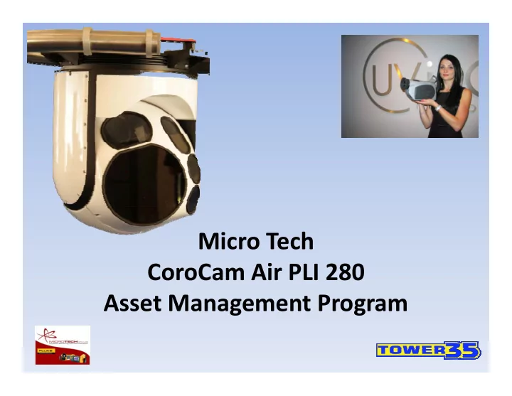
Micro Tech CoroCam Air PLI 280 CoroCam Air PLI 280 Asset Management Program Airborne Power Line Inspection Airborne Power Line Inspection CoroCam Air (PLI280) Prepared by: Pieter van Jaarsveld Jacques Theron October 2010 Scenario:


  1. Micro Tech CoroCam Air PLI 280 CoroCam Air PLI 280 Asset Management Program

  2. Airborne Power Line Inspection Airborne Power Line Inspection CoroCam Air (PLI280) • Prepared by: Pieter van Jaarsveld Jacques Theron • October 2010

  3. Scenario: • Power lines and their associated servitudes are long distance features that requires structured and repeatable management approaches • A key component in this process is collection of condition data in a cost effective and repeatable manner • This condition data consist of a complex arrangement of information, spread over large distances • The information needs to be collected, stored and managed in an accessible and repeatable manner • Examples of relevant data is video imagery, high resolution still imagery, UV imagery, infra red imagery and spatial data • With the source data available, reporting is required to reduce this data to an accessible and manageable format

  4. Approach: • Airborne to cover distances at speed and without terrain limitation • Stabilized and steerable and protected sensor suite to improve view and Stabilized and steerable and protected sensor suite to improve view and remove airframe dynamics from the sensor line of sight • Sensors in order of importance is HD color video, high resolution photogrammetric still, UV and thermal imager h t t i till UV d th l i • Image information excluding still is fused as a single display, providing overview of all information to the operator • Information is recorded with spatial information (position, orientation and time) embedded • Post processing automatically links information to spatial position, to form the backdrop for reporting • Reports are thus linked to spatial position, with all the supporting imagery interactively available

  5. Implementation: Simple architecture consisting of: • Gimbal with sensors • Laptop gimbal and sensor controller • High definition display • High definition recorder • Post processing and reporting PC and software.

  6. Features: Features: • 4 axis light weight, non ITAR, purpose designed, stabilized payload system • Highly transportable and easy to mount • High resolution photogrammetric color stills • HD video imagery • UV sensor option UV ti • Radiometric infrared sensor option • Multi ‐ spectral image fusion • Spatial referencing on all imagery Spatial referencing on all imagery • Interactive imagery / position display and reporting environment

  7. Operational Approach: • The system is configured to supply maximum information, with minimum operator input • All sensors, except the HD day are focused at infinity, to simplify • All sensor information (except still) is fused into a single image, to provide maximum id identification capability tifi ti bilit • Information is recorded with integrated spatial information, making it possible to automatically relate imagery to position and time • The operator will steer the line of sight to view objects of interest. On the HD day image the filtered UV and filtered IR information is super imposed • This queues the operator towards possible problem areas. The HD zoom camera can then be controlled to look at detail • The photogrammetric still camera provides overview and servitude information • Object positions can be determined through still imagery

  8. Airborne Hardware Monitor M lti S Multi Sensor Gimbal Gi b l Recorder Laptop Controller

  9. Specifications Specifications Day Still Ultra Violet Infra Red Sony FCB-H11 Canon EOS 550D Uvirco CoroCAM 504 core Thermoteknix Miricle 307 8 x 5.5 0 field of view 1920 x 1080 pixels 18 mega pixel 8 - 12 μ m micro bolometer 16 : 9 aspect ratio 5184 x 3456 pixels 20 m minimum focus distance 640 x 480 pixels Sensors Spatial resolution 1 2 mm @ 30 m Spatial resolution 1.2 mm @ 30 m 35 mm lens 35 mm lens 50 mm focal length 50 mm focal length 35 x 24 0 field of view 18.2 x 13.7 0 field of view 5.1 to 51 mm zoom 4.4 x 2.5 0 Narrow Spatial resolution 3.6 mm @ 30 m Spatial resolution 15 mm @ 30 m 42 x 24 0 Wide 18 m minimum focus distance Gimbal Laptop Controller Monitor Recorder 280 mm diameter Converted to HD-SDI 1080 50i JVC BT-LH1710 Client furnished < 22 kg mass Contains spacial information 16:9 aspect ratio Gimbal + 10 0 to - 140 0 elevation freedom HD-SDI input 360 0 continuous azimuth freedom < 15 μ rad rms stabilization μ System Optical serial digital output Onboard digital excitation and control 150 knots maximum speed - 10 to + 45 0 C operating temperature

  10. Conclusion: Conclusion: • The complexity, data quantity and reporting requirements demands a purpose specific implementation, mechanizing repeatable data collection and reporting, from a airborne platform • The PLI280 provides an operational cost ‐ effective solution, through high levels of integration, combined with small size and low mass

  11. Corona Detection & P.D. • Broken or damaged strands • Damaged insulator discs g • Spark gaps on loose clamp • Pollution,conductors,insulators • Missing or damaged rings g g g • Incorrect arc horns • Flash ‐ over paths • Sharp hardware protrusions Sharp hardware protrusions • Corroded conductors • Power loss • Environmental Pollution Environmental Pollution

Download Presentation
Download Policy: The content available on the website is offered to you 'AS IS' for your personal information and use only. It cannot be commercialized, licensed, or distributed on other websites without prior consent from the author. To download a presentation, simply click this link. If you encounter any difficulties during the download process, it's possible that the publisher has removed the file from their server.

Recommend


More recommend