
SLIDE 1
McKay Road Interchange and Salem / Lockhart Crossing
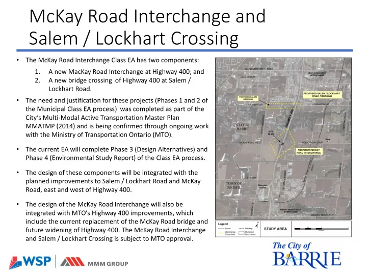
- The McKay Road Interchange Class EA has two components:
1. A new MacKay Road Interchange at Highway 400; and 2. A new bridge crossing of Highway 400 at Salem / Lockhart Road.
- The need and justification for these projects (Phases 1 and 2 of
the Municipal Class EA process) was completed as part of the City’s Multi-Modal Active Transportation Master Plan MMATMP (2014) and is being confirmed through ongoing work with the Ministry of Transportation Ontario (MTO).
- The current EA will complete Phase 3 (Design Alternatives) and
Phase 4 (Environmental Study Report) of the Class EA process.
- The design of these components will be integrated with the
planned improvements to Salem / Lockhart Road and McKay Road, east and west of Highway 400.
- The design of the McKay Road Interchange will also be
integrated with MTO’s Highway 400 improvements, which include the current replacement of the McKay Road bridge and future widening of Highway 400. The McKay Road Interchange and Salem / Lockhart Crossing is subject to MTO approval.