Location, Location, Location, Location, Location: Location: GPS - - PDF document

location location location location location location gps
SMART_READER_LITE
LIVE PREVIEW

Location, Location, Location, Location, Location: Location: GPS - - PDF document

Location, Location, Location, Location, Location: Location: GPS and Google Earth GPS and Google Earth South Carolina Conference for the Social Studies October 5, 2007 Myrtle Beach, SC Julia Davis judavis@richlandone.org MaryAnn Sansonetti


slide-1
SLIDE 1

Location, Location, Location, Location, Location: Location: GPS and Google Earth GPS and Google Earth

South Carolina Conference for the Social Studies October 5, 2007 Myrtle Beach, SC Julia Davis judavis@richlandone.org MaryAnn Sansonetti msansonetti@richlandone.org Information is available at http://rcsd1teched.pbwiki.com/location Richland County School District One Instructional Technology Services

Content Resources and Vocabulary - Original Information gathered by Tom Taylor, Spartanburg 5 Adapted by MaryAnn Sansonetti, RCSD1 Instructional Technology Services, 10/2007

slide-2
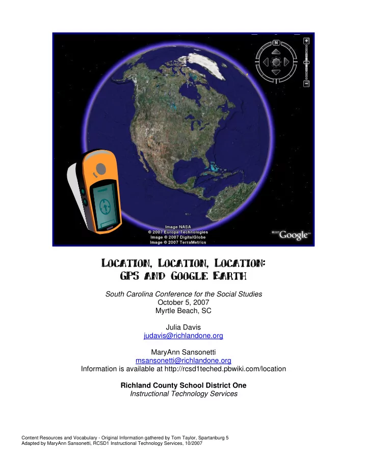
SLIDE 2

Location, Location, Location: Using GPS and Google Earth

Julia Davis, judavis@richlandone.org MaryAnn Sansonetti, msansonetti@richlandone.org Technology Education Specialists, Richland County School District One

Agenda

Global Positioning System (GPS) Google Earth Linking them together Classroom Uses While creating lessons with Global Positioning Systems (GPS) or Google Earth the following Social Studies Literacy Standards can be addressed. Social Studies Literacy Elements addressed: Literacy Element K 1 2 3 4 5 6 7 8 HS

  • F. Ask geographic questions: Where is it located? Why is it

there? What is significant about its location? How is its location related to that of other people, places, and environments? I I D D D D D D D D

  • G. Make and record observations about the physical and human

characteristics of places I I D D D D D D D D

  • H. Construct maps, graphs, tables, and diagrams to display social

studies information I I I D D D D D D D I. Use maps to observe and interpret geographic information and relationships I I I D D D D D D D L. Interpret calendars, time lines, maps, charts, tables, graphs, flow charts, diagrams, photographs, paintings, cartoons, architectural drawings, documents, letters, censuses, and

  • ther artifacts

I I D D D D D D D

  • P. Locate, gather, and process information from a variety of

primary and secondary sources including maps I I D D D D

  • Q. Interpret information obtained from maps, aerial photographs,

satellite-produced images, and geographic information systems I D D D

  • S. Interpret and synthesize information obtained from a variety of

sources—graphs, charts, tables, diagrams, texts, photographs, documents, and interviews I D D D

  • T. Plan and organize a geographic research project (e.g., specify

a problem, pose a research question or hypothesis, identify data sources) I I D

  • V. Use a variety of media to develop and organize integrated

summaries of social studies information I I D

  • W. Apply geographic models, generalizations, and theories to the

analysis, interpretation, and presentation of geographic information I I D

I= Introduced D= Developed http://ed.sc.gov/agency/offices/cso/standards/ss/ Content Resources and Vocabulary - Original Information gathered by Tom Taylor, Spartanburg 5 Adapted by MaryAnn Sansonetti, RCSD1 Instructional Technology Services, 10/2007

slide-3
SLIDE 3
  • Use the PAGE button on the top

right of the receiver to switch between the different screens. The dark bars show the satellites you are “locked” on. You need at least 3 bars to use the receiver.

  • Go in the direction the arrow is pointing to

move towards your waypoint or landmark. NOTE: You must be moving in order for the GPS unit to determine where you are and which way you are moving.

slide-4
SLIDE 4
  • 1 – Press and hold the THUMB STICK until the MARK WAYPOINT screen appears

with the guy holding a flag. 2 – Your waypoint is automatically assigned a three-digit number. To change the name of the waypoint, use the THUMB STICK button to highlight its name. Use the THUMB STICK to select the new name for the waypoint. 3 – When you are done, use the THUMB STICK to highlight the OK button and press the THUMB STICK button once.

  • 1 - Use the PAGE button to find the

main menu. Use the THUMB STICK to go to the FIND option and press the same button to select this option. 3 - Select WAYPOINTS by pressing the THUMB STICK button. 4 - Choose NEAREST on the next menu. 5 - Select the waypoint you want using the THUMB STICK button. 6 - Use the THUMB STICK button to select GOTO at the bottom of the screen. 7 - Use the navigation screen to help you locate your destination. You need to move in the direction of the large arrow. When you get close to your destination, an “Arriving at Destination” message will be displayed.

You can also press the bottom left button on the receiver to go directly to the Find screen. Remember ... You must be moving in order for the receiver to keep track

  • f your location!
slide-5
SLIDE 5

GPS Links for You to Use GPS Lesson Plans - http://www.ilega.org/lessonplans/gpsplans.htm Science Spot Learning with GPS - http://www.sciencespot.net/Pages/classgpslsn.html GPS at the Smithsonian - http://www.nasm.si.edu/exhibitions/gps/si.html Basic Geography: Latitude and Longitude - http://www.socialstudiesforkids.com/articles/geography/latitudelongitude.htm Geocaching Website - http://www.geocaching.com Geocaching with Kids - http://eduscapes.com/geocaching/kids.htm Mapping Your Community - http://www.cfa.harvard.edu/space_geodesy/ATLAS/community.html Global Positioning of History Lessons - http://sites.arnold.k12.ne.us/gswingle/stories/storyReader$4 Content Resources These links either have content specific for Google Earth, or have information that could be used to generate Google Earth files and/or lessons.

NASA Earth Observations NEO provides real-time and historic data about atmospheric and

  • ceanographic readings. These are displayed as Google Earth
  • verlays.

http://neo.sci.gsfc.nasa.gov/Search.html USGS Geographic Name Server Need to find a location and all you have is a place name? This is the resource for you! Enter a place name, select a feature type (whether mountain, river, town, etc.) and enter a state. The query will return a list of possible results, along with lat/long coordinates. http://geonames.usgs.gov Library of Congress The LOC has many resources, but of particular interest is the American Memory project. There are many historic maps that can be used as overlays in Google Earth. http://www.loc.gov Knowitall.org SCETV's Knowitall.org site has many features that are place specific and work well linked to Google Earth Placemarks. The RiverVenture and virtual tour series are especially useful. http://www.knowitall.org SCIWAY SCIWAY - South Carolina Information Highway, is a privately funded collection of information about the state. There is an extensive collection of links to historical maps that can be used as

  • verlays and other data that is location-specific.

http://www.sciway.net

Content Resources and Vocabulary - Original Information gathered by Tom Taylor, Spartanburg 5 Adapted by MaryAnn Sansonetti, RCSD1 Instructional Technology Services, 10/2007

slide-6
SLIDE 6

Content Resources and Vocabulary - Original Information gathered by Tom Taylor, Spartanburg 5 Adapted by MaryAnn Sansonetti, RCSD1 Instructional Technology Services, 10/2007

TravelbyGPS This site predates Google Earth. The site owner began by posting his own collections of GPS waypoints, routes, and tracks. Since then, others have contributed to the collection. The site is broken down into categories for hiking, scenic drives, etc. The files can be

  • pened by Google Earth, but contain only brief titles for each

location and no descriptions. http://www.travelbygps.com Panoramio Panoramio is an image hosting site that is specific to geotagging. Uploaded images must be geotagged with lat/long data. Panoramio also appears as an available layer within the Google Earth program itself. http://www.panoramio.com Yuan Maps Yuan is an avid geocacher and map maker. He has developed several applications using Google Earth and Maps, including a neat file for viewing Flickr photos in Google Earth. http://maps.yuan.cc The Freesound Project This site attempts to geotag various ambient sounds. The sounds are available for download. http://freesound.iua.upf.edu/geotagsView.php Geocaching While not specifically about Google Earth, the sport of Geocaching involves lat/long coordinates and can output data to Google Earth. http://www.geocaching.com South Carolina Birding Sites This is an example of an organization that is using Google Earth and Google Maps to promote their activities. http://www.carolinabirdclub.org/sites/SC/index.html

slide-7
SLIDE 7
  • !"#$
  • !
  • %

&' ( (( &)( !&'

  • (
  • (

!(

  • !&

(

  • !
  • !
  • (

! * (+

  • %
  • (
  • (
  • (

!"(&

  • &(

( ! (( ( #&' ( &

slide-8
SLIDE 8
  • !
  • !

"#$%

slide-9
SLIDE 9

What is it?

Google Earth is a free, downloadable application that works as a browser for all sorts of information on

  • Earth. It uses satellite imagery to grab, spin, pan, tilt

and zoom down to any place on Earth. Students can explore every corner of the globe, measure distances, create their own virtual tours, and share their tours with others. You can also create and download layers

  • f information and view them in geographic context.

Why use it?

Students can use Google Earth to:

  • study natural and political maps
  • learn map reading and navigation
  • visually explore historical, news, and census data
  • annotate locations and share with others
  • create their own 3D models to overlay on maps
  • download geographically-referenced information

created by others

Instructional Ideas

  • Elementary. Have students explore verified locations where

meteors have hit the Earth (http://www.gearthblog.com/ kmfiles/impacts.kmz), then create a chart of the number of craters per continent. Middle School. Have students explore the 19 annotated placemarks mentioned in Jules Verne’s “Around the World in 80 Days” (http://bbs.keyhole.com/ubb/download. php?Number=156427). Then have them annotate 19 different places they would stop if they were traveling around the world. High School. Have students pretend they are with Sir Ernest Shackelton during his adventure in Antarctica. Explore the virtual tour in Google Earth (http://bbs.keyhole. com/ubb/download.php?Number=151193) and have students write diary entries to personalize the experience. mapping, the iterative design process, and user feedback.

http://earth.google.com

Expert Tip

To help you know what is possible with Google Earth, download and explore lots of virtual tours (KML and KMZ files) before creating your

  • wn tours.

Get the tool:

Google Earth in the Classroom

Created by WestEd for Google

slide-10
SLIDE 10

Google Earth in Action

Project: San Francisco Seismic Hazards Grade/Subject: 7th grade URL:http://www.juicygeography.co.uk/googleearthsanfran.htm

How can we minimize the worst effects of earthquakes by designing safer cities? In small groups, students use a variety

  • f spatial data to make decisions about seismic hazards and

building locations in San Francisco. Using Google Earth, students locate existing hospitals and consider the requirements for a new hospital building, such as population density, access to roads and transportation, etc. They then create a new placemark for the new hospital somewhere in San Francisco and describe the rationale for their location.

Additional Resources

Find and Share Virtual Tours Global Earth Community http://bbs.keyhole.com/entrance.php More Examples Google Earth Blog http://www.gearthblog.com/ Google Sightseeing http://www.googlesightseeing.com/ Juicy Geography http://www.juicygeography.co.uk/googleearth.htm Geographic Information Systems Geospatial21 http://www.geospatial21.org/ The History and Application of GIS in Education http://spatialnews.geocomm.com/features/ historygisedu/ Complimentary Tools Google SketchUp http://earth.google.com United Streaming http://www.unitedstreaming.com/ GE Graph http://www.sgrillo.net/googleearth/ Earth Plot http://www.earthplotsoftware.com/

slide-11
SLIDE 11

Placemark Description

A Candidate Watch with Google Tools

Geography, Politics and Civic Literacy As the 2008 presidential election gets underway, use collaborative interactive tools to engage your students in the election story. With a project based approach, help them follow the issues, the politics and use analysis as they become involved in the election process. Start with Google Earth http://earth.google.com/

  • 1. In teams, assign students a

candidate(s) watch.

  • 2. Teams locate and "Placemark"

potential and announced candidates in a Google Earth tour.

  • 3. Teams link Earth "Placemark

Descriptions" to video of candidate announcement or speeches.

  • 4. Using Earth's "Image Overlay". teams

link photos of the candidates to the map. Placemark Image Overlay

  • 5. In "Placemark Descriptions", teams include pertinent information (date
  • f announcement, links to the candidates web sites, state electoral

number, party affiliation) and links to their Google Docs & Spreadsheet and Blogs (see below).

  • 6. Teams update their candidates "Placemark" with additional videos and links as the campaign

progress (including campaign ads).

  • 7. Teams save file as kmz to share with class (In Earth go to: File/Save/Save Place as).
  • 8. Teacher centralizes current kmz file from each team and combines files to make a class "kmz

candidates file". Each time student kmz files are updated, teacher adds them to class "kmz candidates file". Ongoing class discussion centers on the role of geography in an election, the campaigns and the issues. Lesson resource sites for students:

  • C-SPAN Classroom http://www.c-spanclassroom.org/
  • Videos of candidates in Real Player can be linked to Google Earth. Teachers can join C-SPAN

Classroom for free. Campaign Networks: http://www.campaignnetwork.org/

slide-12
SLIDE 12

A Candidate Watch with Google Tools

Continue with Docs & Spreadsheets

http://www.google.com/google-d-s/b1.html

  • 1. Set up a collaborative Google Docs & Spreadsheet.

Each team to analyses the candidate's announcement speech, outlines the candidate's position on the issues and reflects on each candidate's chances. Brainstorm with class for questions and statistics to include on each Doc and Spreadsheet.

  • 2. Teams share, update and revise their documents as

they continue to follow the candidates. Add a Backstory Google Search

http://news.google.com/archivesearch

Teams research, reflect and record (in Google Docs) links to background news stories on each candidate. They use Google Search News Archives to create a timeline of news articles. They brainstorm a list of common questions to apply as they research the news. e.g. Has the candidates views on issues changed over time? Is there anything in the background of the candidate that might prove to be a problem in the campaign? Top it off with Google Blogger

http://www2.blogger.com/home

Set up a class Blog where students can voice their opinions about the 2008 campaign. Each student team takes turns with Blog entries and contributing comments. Blog entries may include topics such as political ads, local Issues from the campaign trail and, of course, links to the candidates Blog, where students can make additional comments participating in the political discourse!