
SLIDE 1
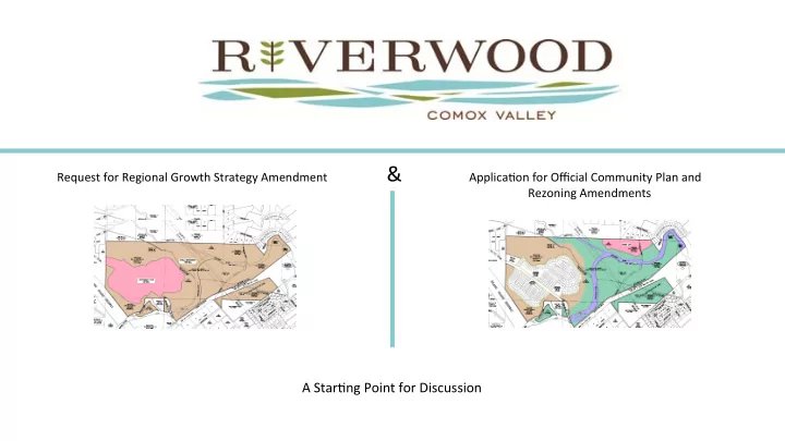
Request for Regional Growth Strategy Amendment & Applica;on for Official Community Plan and Rezoning Amendments
A Star;ng Point for Discussion
Introduc)on: density (56 units) mul;family housing (with provisions - - PowerPoint PPT Presentation
Request for Regional Growth Strategy Amendment & Applica;on for Official Community Plan and Rezoning Amendments A Star;ng Point for Discussion Riverwood is an approximately 201 hectare (500 acres) master planned community in the Comox
Request for Regional Growth Strategy Amendment & Applica;on for Official Community Plan and Rezoning Amendments
A Star;ng Point for Discussion
development approach.
the total site area which will place about 97 hectares into public ownership and create a network of public trails. This significant park and trail dedica;on will include the Puntledge and Brown’s Riverbeds and adjacent green belts.
Valley Regional District’s Parks and Greenway Strategy which calls for the acquisi;on of the Puntledge triangle trail system and Stotan Falls. These dedica;ons would place these important lands with ecological and recrea;onal values into the control and stewardship of the Comox Valley Regional District and enable achieving a number of regional policy goals.
change goals are addressed.
The following efforts will be undertaken as the applica;on and development proceeds: 1) An archaeological review where the development footprint includes areas of moderate to high archaeological poten;al. 2) Additional environmental assessments. 3) Work with CVRD staff to detail zoning regulations, prepare a local area plan, and create development agreements to secure commitments. 4) Connection to the greenways located to the north and south. 5) Sight line improvements (vegetation removal) and pavement marking improvements in accordance with the TrafQic Assessment. 6) Incorporation of trafQic sustainability measures including walking, cycling, car pooling, and car sharing per the Bunt TrafQic Assessment. 7) Compliance with the Qlood plain set back and Qlood construction levels recommended in the McElhanney Flood Plain Analysis.
will make a meaningful contribu;on to the supply of housing in the Comox Valley.
significant contribu;on to the affordable rental housing stock. Afffordability Assessme ment:
average lone parent household.
as well as for most, in not all, of the lone parent households.
to $474,000 (excluding the luxury market) with a cluster around $400,000.
Therefore, it is reasonable to conclude that all of the apartment and town house units will add to the stock of affordable housing.
single family dwellings much more affordable to the home purchasers.
per month at 3% interest. In 2015, 30% of the average household income was $2,225.
be affordable for the average household income.
It is proposed to remove the Settlement Expansion area in the south east area of the site and replace that designation with Rural Settlement. It is also proposed to remove an area of Rural Settlement in the north west part of the plan and replace it with Settlement Node. These changes relocate planned settlement lands. They do not add settlement lands.
The suitability of the lands currently designated for urban expansion south east por;on of the site is ques;onable. 1) Designated urban expansion lands (UEL) currently hosts areas
impacted with development (this is in conflict with RGS Objec;ve 2-A). 2) Access to UEL would be imprac;cal with the Penstock dissec;ng the land. 3) There is a major hydroelectric transmission line dissec;ng the property . Residen;al use under or near these lines should be avoided because of electromagne;c radia;on concerns. The relocation of the planned development does not increase development in the Comox Valley. It relocates it across the Puntledge River onto a more suitable site that protects ecological values and realizes recreational values. This node would be separated from the adjacent urban and suburban development by a large park and green belt that is called for generally by the RGS and the Parks and Greenway strategy.
SeRlement Node we propose for the Riverwood Lands.
RGS Affordable Housing goals
The third trend (RGS Page 9) notes the increasing trend towards unaffordable housing. (see VIREB and CVRD references). Riverwood responds to this robustly.
RGS Transporta?on goals
The proposed Riverwood seRlement node will open up a closed logging road for public access. Development of these lands will improve the Regional Transporta;on network by offering more direct routes for some traffic. (Trend 6, p 10). The Region’s transporta;on plan iden;fies a north south road through Riverwood and a bicycle lane through the land. Development of Riverwood would facilitate these plan goals.
RGS Parks and Greenways
This node will allow the CVRD to realize one of its important parks and greenway strategy goals which is to have a greenway and trail system through the property (Trend 4, p 9)
RGS Low Impact Development Goals
The Riverwood SeRlement node offers an opportunity for a low impact development being very level and with an exis;ng impacted ecosystem due to recent logging. (RGS Trend 4, p 9)
The Riverwood SeRlement node offers the opportunity for food produc;on within three minute walk on surrounding rural resource land (RGS Trend 8, p 10) The RGS sets policies regarding farming and food produc;on as follows: Objec;ve 6-A: Protect land for exis;ng and future agriculture and associated ac;vi;es and allow for the growth and expansion of such ac;vi;es.
agricultural enterprises and loca;on of agricultural- supported ac;vi;es in these areas, such as food processing plants, storage and distribu;on centres (e.g., farmers markets). The Riverwood plan proposes: 1) The development will add to the supply of agricultural land in the area surrounding the development. 2) The agricultural land will be improved and made ready for agriculture. 3) The development would include allotment gardens adjacent to the perimeter trail. 4) The allotment gardens will be provided with water service. These gardens would act as a food produc;ve buffer to the adjacent proposed farm land. 5) The zoning is proposed to include the sale of produce and other agricultural products. 6) The central commercial area will be designed to include a local farmer market area for local produc;on to be sold and exchanged.
RGS Public Health Goals
Goal 10, p 11)
RGS First Na?ons Economic Development
through a gif of land and opportunity for employment opportuni;es (RGS Goal 11, p 11)
RGS Parks and Greenway Goals
2-D (Ensure access to parks, recrea;on areas) would be realized with the development of the property as a seRlement node.
RGS Electric Vehicle Goals
The RGS encourages the use of electric vehicles as follows:
infrastructure for low-emissions vehicles such as recharging infrastructure and priority parking.
RGS Climate Change and GHG Emissions:
consump;on and GHG emissions the development will include a neighbourhood shopping complex. Further measures to address GHG emissions and climate change include: building solar ready homes, providing transit facili;es, bicycle facili;es and electric car charging sta;ons in the commercial centre. We would be open to exploring other ideas to address this goal further.
Protect Key Natural and Ecological Features
Comox Valley”. Riverwood provides a unique opportunity to protect key green ecological corridors.
The RGS calls for aRen;on to interface fire hazard protec;on as follows:
interface areas where there is a high risk of forest fires. The loca;on of Riverwood provides a number of advantages for interface fire hazard protec;on. 1) The Inland Island Highway provides a significant fire break 2) The Browns and Puntledge Rivers provide significant fire breaks. 3) A perimeter trail around the node will provided an addi;onal fire-break and ability for firefighters to defend structures from interface fire. 4) Low combus;ble roofing and other Firesmart construc;on measures will be used. 5) The area around the development will be prepared for agriculture and on-site vegeta;on from clearing will be used as soil amendments to improve that soil when prac;cal.
CVOCP Transporta?on Plan Objec?ves:
residents to walk, bicycle and use public transit”. The trails within Riverwood and along the Puntledge and Browns Rivers will increase walking opportuni;es. Improvement and access to the Comox Main will secure a por;on of the planned bicycle route through the property. Public transit facili;es will be provided within Riverwood.
Transporta?on Road Network Plan:
Plan shows the Duncan Bay main as an exis;ng part of the road network and bicycle network. Development of this seRlement node will facilitate securing and improving these transporta;on elements thus improving the connec;vity of the regional system and enable shorter trips/fewer GHG emissions.
Map 1 Excerpt Road Network Plan Map 2 Excerpt of Ac;ve Transporta;on Plan
The Comox Valley Official Community Plan contains a number
achieving. CVOCP Natural environment – objec;ves: 1) To iden;fy and protect unique natural features and characteris;cs of the Comox Valley. 2) To protect, restore and enhance coastal shorelines, streams, wetlands and the marine environment. Riverwood would protect and preserve a cri;cal segment of the Valley’s green corridor and trail system along with the Puntledge and Browns river ecosystems.
The CVOCP has specific park and greenway policies that Riverwood would assist in achieving. The Riverwood SeRlement node will provide access to the Puntledge River and Stotan falls.
Development of Riverwood would help achieve the CVOCP policy regarding
SeRlement Nodes – objec;ves:
in the electoral areas of the CVRD to the seRlement nodes.
amount of available housing including rooming, boarding and lodging houses, accessory dwelling units, infill, re-development and conversions within exis;ng neighbourhoods, provided the addi;onal housing is compa;ble with the scale, design context and community features of the neighbourhood.
enhances the character of exis;ng dis;nc;ve loca;ons and neighbourhoods, and that proposals for intensifica;on and infill within exis;ng neighbourhoods are designed to be compa;ble with the exis;ng neighbourhood character.
and provide for a supply of assisted and special needs housing.
seRlement nodes where people can live, work, play and shop. In response to these objec;ves, Riverwood would help keep development in a seRlement node, allow the integra;on of assisted and special needs housing in the seRlement, and provide a complete neighbourhood by providing homes, recrea;on, shopping, working and food produc;on land uses.
The Riverwood SeRlement node is key to the ability of the Comox Valley Regional District to achieve several of its important regional growth management, parks and greenway, and transporta;on goals. The plan is consistent with many of the CVRD’s growth management policies. It would be an important measure to start addressing the housing affordability crisis that has developed in the Comox Valley. It does not create addi;onal planned seRlement areas; rather, it simply shifs planned growth from one part of the property to another part. Finally, with the Riverwood SeRlement node, a very important and cherished part of the Comox Valley will be protected from poten;al resource extrac;on ac;vi;es and be accessible to public use and enjoyment. The op;ons:
1. Non-approval does not mean protec;on of the environment, provision of park land and green ways, river access, bikeway or transporta;on links. It achieves the opposite and may make these policy goals unachievable. 2. Approval of the proposal achieves the above policy goals. 3. Public purchase would also achieve the above policy goals and would be welcomed.