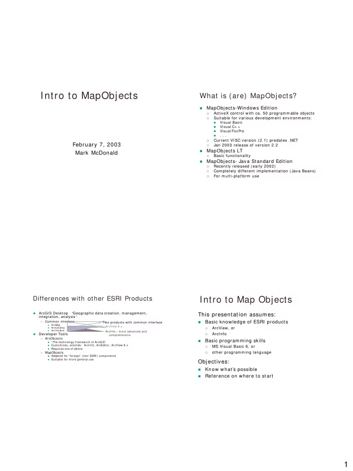
Intro to MapObjects What is (are) MapObjects? MapObjects-Windows - - PDF document

intro to mapobjects
SMART_READER_LITE
LIVE PREVIEW

Intro to MapObjects What is (are) MapObjects? MapObjects-Windows - - PDF document

Intro to MapObjects What is (are) MapObjects? MapObjects-Windows Edition ActiveX control with ca. 50 programmable objects Suitable for various developm ent environm ents: Visual Basic Visual C+ + Visual FoxPro .


slide-1
SLIDE 1

1

Intro to MapObjects

February 7, 2003 Mark McDonald

What is (are) MapObjects?

  • MapObjects-Windows Edition
  • ActiveX control with ca. 50 programmable objects
  • Suitable for various developm ent environm ents:
  • Visual Basic
  • Visual C+ +
  • Visual FoxPro
  • . . .
  • Current VI SC version (2.1) predates .NET
  • Jan 2003 release of version 2.2
  • MapObjects LT
  • Basic functionality
  • MapObjects- Java Standard Edition
  • Recently released (early 2002)
  • Com pletely different im plem entation (Java Beans)
  • For m ulti-platform use

Differences with other ESRI Products

  • ArcGI S Desktop “Geographic data creation, m anagem ent,

integration, analysis ”

  • Common interface
  • ArcMap
  • ArcCatalog
  • ArcToolbox
  • Developer Tools
  • ArcObjects
  • “The technology fram ework of ArcGI S”

Custom izes, extends: ArcI nfo, ArcEditor, ArcView 8.x Requires one of above

  • MapObjects

Adapted for “foreign” (non- ESRI ) com ponents Suitable for m ore general use

  • Two products with common interface

ArcView 8.x ArcI nfo – m ore advanced and com prehensive

Intro to Map Objects

This presentation assum es:

  • Basic knowledge of ESRI products
  • ArcView, or
  • ArcI nfo
  • Basic program m ing skills
  • MS Visual Basic 6, or
  • ther program m ing language

Objectives:

  • Know w hat’s possible
  • Reference on where to start
slide-2
SLIDE 2

2

Basics

Creating a Map

  • Add MapObjects Control to VB Toolbox
  • Add Map to a form
  • Add data layer(s) to Map

Project1.vbp

slide-3
SLIDE 3

3

slide-4
SLIDE 4

4

MapObjects Basics

Basics

  • Add MapObjects Control to VB Toolbox
  • Add Map to a form
  • Add data layer(s) to Map

Map manipulation

  • Add VB controls
  • Add three lines of code
  • Results in ability to:
  • Zoom I n
  • Pan
  • Zoom Out to original view

Draw VB controls on blank form Object Browser view Project2.vbp

slide-5
SLIDE 5

5

I NSERT OBJECT BROWSER VI EW HERE

Private Sub Com m and1_Click() 'Extent: Returns or sets the spatial extent of an object 'FullExtent: Returns or sets a special Rectangle object ‘ (Rectangle represents the bounding box of a Map) Map1.Extent = Map1.FullExtent End Sub Private Sub Map1_MouseDown(Button As I nteger, Shift As I nteger, _ X As Single, Y As Single) I f Option1.Value = True Then ' Zoom In 'Function TrackRectangle(): ' Rubber- bands a rectangle on the Map and returns a Rectangle object Map1.Extent = Map1.TrackRectangle ElseIf Option2.Value = True Then ' Pan 'Sub Pan(): Tracks the mouse while panning the Map Map1.Pan End If End Sub

Map Objects by Type

  • Dat a Access
  • Obtain geographic data from database
  • Projection
  • Transform 3- D data for display
  • Map Display
  • Display data on a 2- D map
  • Address Matching
  • Match address(es) with location(s) on m ap
  • Geom etric & Utility
  • Create and m anipulate points, lines, polygons, ...
  • Manipulate text strings
  • MapObjects Helper Com ponents
  • Add Legend, Scalebar

Com m ents:

  • bjects grouped by function

not an object hierarchy

slide-6
SLIDE 6

6

Map Objects

  • Dat a Access
  • DataConnection
  • Represents connection to geographic data source
  • Analogous to VB Connection object
  • GeoDataset
  • Represents layer of geographic data on a m ap
  • Associated with a MapLayer object
  • Can be in m ost vector data form ats
  • Recordset
  • Represents records from a GeoDataset, or ….
  • ….resulting from a query
  • St at ist ics
  • Result of calculation on a num eric Field of a Recordset using

Recordset object's CalculateStatistics m ethod

  • Other objects- . . .
  • Projection
  • Map Display
  • Address Matching
  • Geom etric & Utility
  • MapObjects Helper Com ponents

Map Objects

  • Data Access
  • DataConnection
  • GeoDataset (GeoDatasets Collection)
  • Recordset
  • Other objects
  • TableDesc
  • Represents a description of the Fields collection of a Recordset.
  • Return or set properties for Field in a Recordset, where

appropriate, i.e. within the lim its of the GeoDataset from which the Recordset is derived

  • FieldLength, FieldNam e, FieldPrecision, FieldScale, FieldType

among choices

  • Table
  • read- only object corresponding to a table in a relational

database

  • Used for standard relational DB ’s, not geodatasets
  • Field (Fields Collection)
  • represents a colum n of data within a Recordset with a com m on

data type and a com m on set of properties.

  • Projection
  • Map Display
  • Address Matching
  • Geometric & Utility
  • MapObjects Helper Com ponents

Searching GeoDatasets

Can be done by searching for:

  • Text in an attribute
  • Proxim ity to a spatial feature

Project3.vbp

slide-7
SLIDE 7

7

Private Sub Com m and2_Click() ' build a search expression Dim exp As St ring ' "NAME" is field nam e in shapefile city_bnd.shp exp = "NAME = '" & UCase(Text1.Text) & "'" ' perform t he search Dim recs As MapObjects2.Recordset Set recs = Map1.Layers("city_bnd").SearchExpression(exp) ' show the results, if any I f Not recs.EOF Then Dim sh p As Obj ect Set shp = recs. Fields( "Shape “ ). Value Dim r ect As MapObj ects2.Rectangle Set r ect = shp.Extent ' r ect equals city’s ext ent rect.ScaleRectangle 1 0 ' Scale up r ect by factor of 10 Set Map1.Extent = rect ' Make t he m ap’s extent = rect Map1.Refresh ' redraw the m ap Map1.FlashShape shp, 10 ' flash it so we see it End I f End Sub

Searching GeoDatasets

Can be done based by searching for:

  • Text in an attribute
  • Proxim ity to a spatial feature

Project3.vbp

slide-8
SLIDE 8

8

Dim gSel As MapObjects2.Recordset

. . .

Private Sub Map1_MouseDown(Button As I nteger, …… ………. ElseIf Option3.Value = True Then ' spatial query Dim p As Point Set p = Map1.ToMapPoint(x, y) ' search for a highway within the tolerance Dim recs As MapObjects2.Recordset Set recs = Map1.Layers("interstates"). SearchByDistance(p, Map1. _ ToMapDistance(100), "") ' If nothing is found If recs.EOF Then Set gSel = Nothing ' Else search for townships intersecting Else Set gSel = Map1.Layers("township_bnd") _ .SearchShape(recs.Fields ("Shape").Value, m oAreaI ntersect, "") End If Map1.Refresh ' trigger a redraw of the map End If End Sub Dim gSel As MapObjects2.Recordset

. . .

Private Sub Map1_MouseDown(Button As I nteger, …… ………. ElseIf Option3.Value = True Then ' spatial query Dim p As Point Set p = Map1.ToMapPoint(x, y) ‘Converts com puter’s (x,y) to m ap’s (x,y) ' search for a highway within the tolerance Dim recs As MapObjects2.Recordset Set recs = Map1.Layers("interstates"). SearchByDistance(p, Map1. _ ToMapDistance(200), "") 'SearchByDistance() searches "interstates.shp" for anything near Point p 'ToMapDistance() converts computer distance units to map distance units ' If nothing is found If recs.EOF Then Set gSel = Nothing ' Else search for townships intersecting Else Set gSel = Map1.Layers("township_bnd") _ .SearchShape( recs.Fields ("Shape“ ).Value, m oAreaI ntersect, "") End If Map1.Refresh ' trigger a redraw of the map End If Private Sub Map1_AfterLayerDraw(ByVal index As _ Integer, ByVal canceled As Boolean, ByVal hDC _ As stdole.OLE_HANDLE) I f Map1.Layers(index).Nam e = "township_bnd" Then I f Not gSel I s Nothing Then Dim sym As New MapObjects2.Symbol sym .Color = m oYellow Map1.DrawShape gSel, sym End If End If End Sub

Connecting to a GeoDatabase

  • Data not known during developm ent?
  • Connect to data as needed!
  • Allows flexibility

DescribeShapefile.Vbp

slide-9
SLIDE 9

9

'This example demonstrates using a 'MapLayer object without attaching it to a Map control. Dim g_layer As MapLayer Private Sub Com m and1_Click() 'Use Com m on Dialog Form to select a particular shapefile Com m onDialog1.Filter = "ESRI Shapefiles (* . sh p)| * . shp" Com m onDialog1.ShowOpen I f Len(Com m onDialog1.FileNam e) = 0 Then Exit Sub . . . . . Dim dc As New DataConnection dc.Database = CurDir ' CurDir = VB function returning String of current directory I f Not dc.Connect Then Exit Sub . . . . . Dim nam e As String nam e = Left(Com m onDialog1.FileTitle, Len(Com m onDialog1.FileTitle) -4) 'Rem ove “. shp ” Dim gs As GeoDataset Set gs = dc.FindGeoDataset(nam e ) 'Get geodataset If gs I s Nothing Then Exit Sub ‘ Make a new MapLayer based on this new GeoDataset Set g_layer = New MapLayer Set g_layer.GeoDataset = gs . . . .

Map Objects by Type

  • Data Access
  • Projection
  • Datum
  • Defines datum , the basis of geographic coordinate system
  • GeoCoordSys
  • Represents a geographic coordinate system (GCS)
  • Positions described with latitude-longitude (degrees on world surface)
  • View: a 3- D spheroid
  • ProjCoordSys
  • Represents a projected coordinate system
  • Positions described with X and Y coordinates on m ap
  • View: a 2- D m ap
  • Other obj ects . . . .
  • - -

Typically use ESRI- predefined constants for Datum, GCS, PCS - - -

  • Map Display
  • Address Matching
  • Geometric & Utility
  • MapObjects Helper Com ponents

Map Objects by Type

  • Data Access
  • Projection
  • Datum
  • GeoCoordSys
  • ProjCoordSys
  • Other obj ects-
  • Projection- Specifies m athem atical transform ation of GCS to

projected coordinates

  • Spheroid - specified from pre -defined SpheroidConstants or by user -

definition

  • Prim eMeridian- defines line of zero longitude for coordinates in a

GCS/ GeoCoordSys object

  • Unit- defines units of m easurem ent used in a GeoCoordSys or

ProjCoordSys object.

  • GeoTransformation - object converts vector data from one coordinate

system to another (geographic transform ation or datum shift)

  • Map Display
  • Address Matching
  • Geometric & Utility
  • MapObjects Helper Com ponents
slide-10
SLIDE 10

10

Map Objects by Type

  • Data Access
  • Projection
  • Map Display
  • Address Matching
  • Geom etric & Utility
  • MapObjects Helper Com ponents

Map Display Objects

  • Map- A Map control displays a collection of Layers.
  • Layers Collection-

Layers based on geographic data:

  • MapLayer
  • Vector geographic data
  • Represents a GeoDataset data layer on a Map
  • Can be from ESRI shapefile, an SDE layer, an ARC/ I NFO

coverage, CAD files and VPF data.

  • I m ageLayer
  • Raster data from an im age file
  • Has additional transform ation data (allows alignm ent with

vector MapLayer objects)

  • TrackingLayer
  • Displays geographic phenom ena that m ay change position
  • Represented as GeoEvent objects
  • Sym bol- control how a feature or shape is displayed
  • . . . . . .

Map Display Objects: Renderers

Renderers- Sym bolize feature(s) of a MapLayer:

  • ChartRenderer
  • Depict attribute values as elem ents of a single pie or bar chart, or
  • Show m ultiple charts, varying relative size of each feature's ch

art

  • ClassBreaksRenderer
  • Break dataset into categories or classes based on som e specific num eric

attribute

  • Draw different sym bol for each class
  • DotDensityRenderer
  • draw dots on a feature, dot density proportional to a feature’s value
  • e.g., dot density proportional to population density
  • ValueMapRenderer
  • draw a Sym bol for each unique data value
  • ZRenderer
  • sym bolize Z values of features in a MapLayer
  • (Z: third- dim ension, perpendicular to X & Y values in m ap plane)
  • GroupRenderer
  • associate m ultiple renderers with a given MapLayer

MapObjects

Using ClassBreaksRenderer

ArcCatalog: township_bnd.shp Project4.vbp

slide-11
SLIDE 11

11

Private Sub Form _Load() ' counties layer Dim rC As New MapObjects2.ClassBreaksRenderer Set Map1.Layers("township_bnd").Renderer = rC rC.Field = "FIPS_SQMI" Dim stats As MapObjects2.Statistics Set stats = Map1.Layers("township_bnd").Records.CalculateStatistics("FI PS_SQMI ") ' calculate breaks away from the m ean, ' only add breaks within the range of values Dim breakVal As Double breakVal = stats.Mean - (stats.StdDev * 3) Dim i As Integer For i = 0 To 6 I f breakVal > = stats.Min And breakVal < = stats.Max Then rC.BreakCount = rC.BreakCount + 1 rC.Break(rC.BreakCount - 1) = breakVal End If breakVal = breakVal + stats.StdDev Next i rC.Ram pColors m oPaleYellow, m oNavy End Sub

Map Display Objects: Labeling

LabelRenderer - draw label on a

feature.

TextSym bol- attributes that control

how text is rendered

LabelPlacer- sim ilar to LabelRenderer

but finer adjustm ents possible

slide-12
SLIDE 12

12

Map Display Objects: Events

GeoEvent

  • Phenom enon whose geographic position

m ay change

  • Displayed on a TrackingLayer

EventRenderer

  • Renders GeoEvent(s) occurring on a

MapLayer

  • Draws a Sym bol for each event

Tracking a GeoEvent

Use for objects which m ay m ove or be

moved

‘ User selects highway with SHI FT+ Mouse Click ‘ GeoEvent m oves along the length of that highway segm ent Dim gLine As Object ' gLine: a line object that gets extracted from the highways Dim gCurPoint As I nteger ' gCurPoint: keeps track of current point in gLine . . . . . . . . . . Private Sub Form _Load() ' load dat a int o t he m ap Dim dc As New DataConnection dc.Database = ReturnDataPath("usa") ' ReturnDataPath not shown

  • sim ply returns data directory

I f Not dc.Connect Then End Dim layer As MapLayer Set layer = New MapLayer Set layer.GeoDataset = dc.FindGeoDataset("states") layer.Sym bol.Color = m oPaleYellow Map1.Layers.Add layer Set layer = New MapLayer Set layer.GeoDataset = dc.FindGeoDataset("ushigh") layer.Sym bol.Color = m oRed Map1.Layers.Add layer ' set the sym bol of the TrackingLayer Map1.TrackingLayer.Sym bol(0).Style = m oCircleMarker Map1.TrackingLayer.Sym bol(0).Color = m oRed Map1.TrackingLayer.Sym bol(0).Size = 6 End Sub

slide-13
SLIDE 13

13

Sub DoTravel(x As Single, y As Single) ' convert the selected point to m ap coordinates & search for a highway Set pt = Map1.ToMapPoint(x, y) Set recs = Map1.Layers(0).SearchByDistance(pt, Map1.ToMapDistanc e(100), "") ' if a highway is found, extract the shape and store it in gLine I f Not recs.EOF Then Set gLine = recs("Shape").Value Set pt = gLine.Parts(0).I tem (0) ' get first point gCurPoint = 0 ' initialize the point counter ' add an event Map1.TrackingLayer.ClearEvents Map1.TrackingLayer.AddEvent pt, sym Tim er1.I nterval = 75 End I f End Sub Private Sub Timer1_Timer() ' if the point counter reaches the end of the line ' reset the counter, the tim er, and the TrackingLayer I f gCurPoint = gLine.Parts(0).Count - 1 Then gCurPoint = 0 Tim er1.I nterval = 0 Map1.TrackingLayer.ClearEvents Else ' m ove the event to the next position along the line ' then increm ent the point counter Set pt = gLine.Parts(0) Map1.TrackingLayer.Event(0).MoveTo pt(gCurPoint).x, pt(gCurPoint).y gCurPoint = gCurPoint + 1 End I f End Sub

Map Objects by Type

  • Data Access
  • Projection
  • Map Display
  • Address Matching
  • Geocoder - allows specification of address, street

intersection, or table of addresses to m atch against a street network

  • AddressLocation - represents the results of an

address m atch

  • PlaceLocator - m atch place nam es to a specified

GeoDataset

  • Standardizer - standardize address strings, street

abbreviations, etc.

  • Geom etric & Utility
  • MapObjects Helper Com ponents

Matching an Address

Can match single address Can m atch table of addresses

Geocode.vbp

slide-14
SLIDE 14

14

Map Objects by Type

  • Dat a Access
  • Projection
  • Map Display
  • Address Matching
  • Geom etric & Utility
  • Point- single point in space
  • Points Collection- a collection of Point objects
  • Line- open geom etric shape with > = 2 vertices
  • Polygon- closed geometric shape with > = 3 vertices
  • multi-part Polygon - m ay consist of one or m ore discontinuous Parts
  • Parts Collection- holds the set of Points objects that m ake up

the parts of a Polygon or Line object

  • Most Polygons or Lines are single part shapes, and have a Parts collection

containing a single Points object

  • Rectangle, Ellipse- used in Zoom In, Map resizing, etc.
  • Strings Collection- a standard collection that includes a set of

unique string data types.

  • MapObjects Helper Com ponents

Map Objects by Type

Data Access Projection Map Display Address Matching Geom etric & Utility MapObjects Helper Com ponents

  • MapObjects Legend Control
  • MapObjects Scalebar Control

Creating a Map Legend

Add Legend control to VB Set its m ap source

slide-15
SLIDE 15

15

Private Sub Form _Load() legend1.setMapSource Map1 legend1.LoadLegend True End Sub

Acknowledgem ents

ESRI Bob Regan Ken Sochats