
SLIDE 1
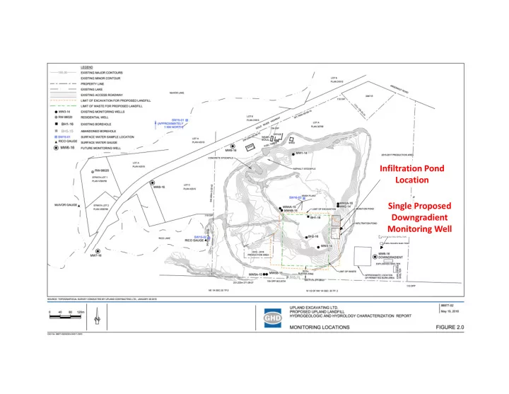
Infiltration Pond Location Single Proposed Downgradient Monitoring Well
Infiltration Pond Location Single Proposed Downgradient Monitoring - - PowerPoint PPT Presentation
Infiltration Pond Location Single Proposed Downgradient Monitoring Well Groundwater Contours GHD Comments on GW contours GHD groundwater contours are limited by a lack of borehole data to the West and East of the site. Aquifer
Infiltration Pond Location Single Proposed Downgradient Monitoring Well
GHD Hydraulic Gradient GWS Hydraulic Gradient MW location proposed despite little understanding
Infiltration Pond
Infiltration Pond/Recharge “Regional” Groundwater Discharge? Local Groundwater Discharge? Unsaturated Saturated Water Table Groundwater Divide?
BH1‐16 MW2a‐16 Rico Lake
Water Quality/Monitoring Well Array Needed Test Boreholes and Monitoring Wells Needed