
SLIDE 1
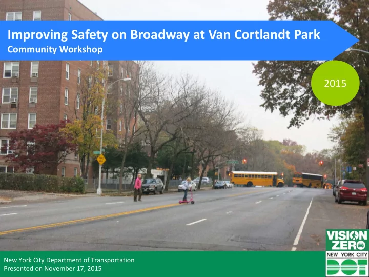
Improving Safety on Broadway at Van Cortlandt Park
Community Workshop
2015
New York City Department of Transportation Presented on November 17, 2015
Improving Safety on Broadway at Van Cortlandt Park Community - - PowerPoint PPT Presentation
Improving Safety on Broadway at Van Cortlandt Park Community Workshop 2015 New York City Department of Transportation Presented on November 17, 2015 Overview Westchester County North Riverdale Background Existing Conditions
New York City Department of Transportation Presented on November 17, 2015
2
Van Cortlandt Park North Riverdale Fieldston
Westchester County
W 242nd St
3
Van Cortlandt Park North Riverdale Fieldston
Westchester County
W 242nd St
4
Multiple bus stops along Broadway Senior Housing in the Area Van Cortlandt Park is a popular destination in the neighborhood
5
54 Av
Van Cortlandt Park North Riverdale Fieldston
Westchester County
W 242nd St
Source: NYPD AIS/TAMS Crash Database
Source: Radar speed study taken on July 15, 2010 on Broadway and again on August 28, 2013. Speed limit at the time of both studies was 30 mph.
7
54 Av
Source: NYPD AIS/TAMS Crash Database
54 Av Lakeview Pl W 261 St
8
Manhattan College Parkway
W 251 St W 252 St Lakeview Pl
W 254 St
W 256 St W 259 St W 260 St W 261 St
5 14 23 12 18 23 1 14 23 12 15 11
W 262 St
8 2 3 1
Moshulu Ave
Source: NYPD AIS/TAMS Crash Database 1 1 1 8 2 6
10
11
12
13
14
15
16
Refuge Island, Chrystie St, Manhattan
17
Protected Bike Lane, Prospect Park West, Brooklyn Concrete Extension, Jewel Ave & 69th Rd, Queens Ramp Crossing, Pelham Parkway, Bronx
18
19