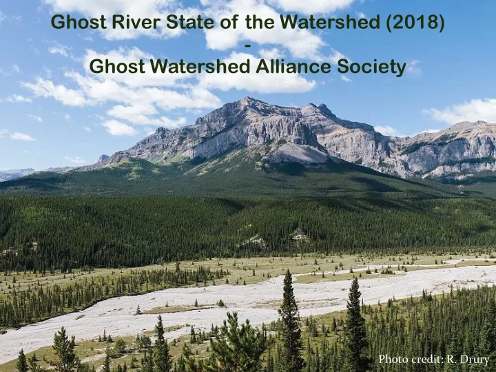
SLIDE 1 Ghost River State of the Watershed (2018)
- Ghost Watershed Alliance Society
Photo credit: R. Drury
SLIDE 2 State of the Watershed Report
✦ Formal process by Alberta Government ✦ Followed “Handbook for State of the Watershed Reporting” ✦ Used existing data.
Handbook for State of the Watershed Reporting:
A Guide for Developing State of the Watershed Reports in Alberta
November 2008
photo: Travel Alberta
SLIDE 3 State of the Watershed Report
✦ ALCES Landscape & Land-use Ltd. contracted to
develop report.
✦ Led by Hydrologist Ryan MacDonald, Ph.D, EP. ✦ Socio-Economic history chapter compiled by GWAS
with input from members and local residents.
Photo credit: M. Krainer
SLIDE 4
State of the Watershed Report
✦ Completed two rounds of reviews prior to release of report. ✦ Reviewed by Steering Committee, GoA staff and ENGOs.
SLIDE 5
SLIDE 6
Ghost Watershed is 947 km2 in size
The Ghost Watershed
SLIDE 7
Elevations range from 3,163 m at the summit of Mt. Aylmer, to 1,190 m at the confluence with the Bow River near the mouth of the Ghost Reservoir.
Topography
SLIDE 8
Natural Regions and subregions
SLIDE 9 Land Cover
Land Cover Type Percent of watershed Deciduous Grassland Lodgepole Pine Mixed forest Non-vegetated Other coniferous Shrubland Subalpine meadow Wetland White spruce Yellow mountain avens No Data 4.75% 6.19% 26.98% 3.47% 0.69% 7.18% 1.91% 26.28% 6.25% 12.32% 0.02% 3.97%
SLIDE 10 Socio-Economic History
Chapter covers:
✦ Pre-settlement, First Nations, settlement, early
communities.
✦ History of place names and artistic inspiration. ✦ Historic context for current land-uses, public perceptions
and concerns.
Photo credit: J. Velletta Alberta Forest History Photographic Collection
SLIDE 11 Socio-Economic History highlights
✦ Humans have inhabited the area for about 13,000 years.
Site near Lake Minnewanka has been radiocarbon dated to show humans existed there about 10,250 years ago.
✦ Between the years 1887 and 1930, a portion of the Ghost
Watershed was part of the Rocky Mountains Park, which later became Banff National Park.
✦ Eau Claire Lumber Company acquired rights to log in 1906
and had several camps in the Ghost Watershed.
Alberta Environment and Parks Library
SLIDE 12 Socio-Economic History highlights
✦ First ranches in the 1880’s. ✦ 1910 Rocky Mountains Forest Reserve established for the
maintenance of timber and a continuous water supply.
✦ Grazing of livestock in Forest Reserve allowed in 1914. ✦ Fire lookout on Black Rock Mountain built in 1928. ✦ Forestry Trunk Road completed in 1952 between Bow
Valley and Red Deer River Valley.
Photo credit: H. Unger
SLIDE 13 Socio-Economic History highlights
Inspiration to artists such as Roland Gissing and Mary Vaux Walcott
The Legend of the Ghost of Ghost River by Roland Gissing. Courtesy of the Estate of Roland Gissing Silverberry by Mary Vaux Walcott. Smithsonian American Art Museum
SLIDE 14 Air Quality
Only one passive monitoring station exists in the Ghost
- Watershed. However, the evidence that is available
suggests that air quality is generally excellent. Recommendation: Install a continuous air quality monitoring station in the Ghost Watershed.
SLIDE 15 Water Quantity & Allocation
✦ Streamflow dominated by snowmelt, much of which
recharges groundwater aquifers.
✦ Contributes app. 7% to the flow of the Bow River upstream of
Calgary.
SLIDE 16 Water Quantity & Allocation
✦ Only 2 active hydrometric monitoring stations in the
watershed at this time. Other stations have been discontinued.
✦ Results from an automated baseflow separation method,
suggest that groundwater contributes an average of app. 85% of the total streamflow in the Ghost River over the year.
✦ At this time, no Water Conservation Objectives (WCOs) are
set for the Ghost River.
✦ WCOs are in place for Waiparous Creek.
Photo credit: M. Krainer
SLIDE 17
Water Quantity & Allocation
✦ Currently, surface water is not highly allocated. ✦ Diversion has been inactive since the flood of 2013. ✦ Households Statutory Rights, proclaimed in the Water Act,
have priority over all other users and allocations.
SLIDE 18 Water Quantity & Allocation
Recommendations:
✦ Install hydrometric monitoring sites in the headwaters of both
the North and South Ghost rivers to improve our understanding of the current and future hydrologic conditions
✦ Conduct a comprehensive wetland inventory in the Ghost
Watershed, as these areas provide important hydrologic and ecosystem functions.
✦ Endeavour to better understand the role of land use and
climate change and their associated effects on hydrology.
Photo credit: M. Enns
SLIDE 19 Water Quality
✦ Overall rating for all
indicators of “Natural” to “Good”.
✦ Long-term water clarity
(measured by turbidity) is rated only “Fair” at several
- sites. Past water quality
studies have attributed this sedimentation issue to anthropogenic causes.
✦ Fecal coliform and
Escherichia coli (E. coli) levels exceeded thresholds
- f concern within the lower
reaches of the watershed.
SLIDE 20 Water Quality
Recommendations:
✦ Continue water quality monitoring at spatially representative
sites within the watershed.
✦ Conduct further assessment into the sources of erosion and
carry out a study to understand the role of human land use relative to natural sediment inputs.
✦ Conduct further investigations to identify the source of fecal
coliform inputs to the watershed.
✦ Perform aquatic invertebrate sampling.
Photo credit: M. Krainer
SLIDE 21
Groundwater
Groundwater use is considered low in the Ghost Watershed. Groundwater use is currently assumed to be sustainable.
SLIDE 22 Groundwater Vulnerability
Largest portion ranked as “high”, followed by “low” ranking, followed by “very high” and “medium”.
SLIDE 23
Groundwater Quality
✦ Chemical analysis reports are available for 83 groundwater
locations (wells and springs) in the Ghost Watershed.
✦ Groundwater sampling was conducted in the 1920s, 1970s
and 1980s.
✦ None of the available reports include trace element, organic
contaminant or microbiological analyses.
SLIDE 24 Groundwater
Recommendations:
✦ Collect more detailed spatial data concerning aquifer location
and depth.
✦ Update groundwater quality datasets with current samples to
provide a better understanding of the present groundwater condition.
✦ Establish a long-term monitoring plan to survey the state of
groundwater in the Ghost Watershed to enable better watershed management in the face of a changing climate and increased anthropogenic pressures.
Photo credit: A. Holcroft Weerstra
SLIDE 25 Riparian Health
✦ Riparian Health inventories completed by Cows & Fish in
2010 to 2011.
✦ 34 lotic sites and 3 lentic sites were assessed.
SLIDE 26 Riparian Health
✦ Overall rating is healthy, with some sites rating as healthy but
with problems.
✦ Problems were
associated with:
✦ OHV use ✦ Livestock grazing ✦ Invasive species ✦ Bank armouring
SLIDE 27 Riparian Health
Recommendations:
✦ Focus environmental management on areas where trends in
riparian health are decreasing, or are currently sub-optimal.
✦ Monitor the existing riparian health sites every 3-5 years to
provide information on trends in riparian health.
✦ If feasible, add additional riparian monitoring sites,
particularly in areas where recreational and industrial activity is prevalent.
✦ Obtain riparian health assessment results undertaken for
grazing allotments.
Photo credit: M. Krainer
SLIDE 28 Riparian Health
Recommendations:
✦ Implement measures to decrease the spread of invasive
species, such as minimization of exposed soil and maintenance of native plant communities.
✦ Improve livestock management and discourage livestock
presence in riparian areas.
✦ Limit recreational impacts on riparian areas in order to
maintain riparian function.
✦ Conduct a comprehensive wetland inventory in the Ghost
Watershed.
Photo credit: M. Krainer
SLIDE 29 Biodiversity & Wildlife Resources
✦ Biota in the watershed is rich and diverse, with a variety of
wildlife, fish and plant populations.
✦ Several species at risk occur in the watershed. ✦ Several rare plant species have been documented. ✦ While species at risk indicators suggest that biodiversity is
relatively high, it is likely that certain populations will decline in the future.
Westslope Cutthroat Trout Sprague’s Pipit Barred Owl
SLIDE 30 ✦ Pressure from disturbance, such as habitat fragmentation and
spread of invasive species, is generally rated as low in the Ghost Watershed.
✦ Road densities have approached levels at which grizzly bears will
be significantly displaced and bull trout populations are at high risk.
✦ A high density of roads and trails immediately adjacent to streams
pose substantial risk to riparian and aquatic habitats, and ultimately downstream water users.
Biodiversity & Wildlife Resources
Photo credit: H. Unger
SLIDE 31 Biodiversity & Wildlife Resources
Environmentally sensitive areas:
✦ Aura Sand Hills, the Cache and Horse Lake. ✦ Located within Key Wildlife and Biodiversity Zones ✦ Threats to these environmentally sensitive areas include
erosion from OHV use.
Photo credit: M. Krainer
SLIDE 32 Biodiversity & Wildlife Resources
Recommendations:
✦ Conduct spatially representative and scientifically sound
wildlife surveys.
✦ Carry out regular habitat surveys to monitor the change in
habitat cover.
✦ Monitor native fish populations’ response to invasion from
brook trout and rainbow trout
Photo credit: M. Enns
SLIDE 33 Biodiversity & Wildlife Resources
Recommendations:
✦ Prevent loss and degradation of habitat of westslope
cutthroat trout, bull trout and spoonhead sculpin through proper land management.
✦ Quantify the effects of habitat fragmentation on keystone
species (grizzly bear) and species at risk.
✦ Conduct detailed vegetation inventories to quantify and
document the plant diversity in the basin and monitor effects
- f invasive plant species on ecosystems.
Bull trout Photo credit: TU Canada
SLIDE 34 ✦ Large portions of the upper reaches of the Ghost Watershed are
protected (Ghost River Wilderness, Don Getty Wildland Provincial Park).
✦ Outside of protected areas, land-use has increased over time.
Land-use & Development
SLIDE 35 Land-uses include:
✦ Residential ✦ Oil & Gas ✦ Hydropower ✦ Forestry ✦ Agriculture and Livestock Grazing ✦ Hunting & Fishing ✦ Motorized and non-motorized recreation
Land-use & Development
SLIDE 36 ✦ OHV use: lack of enforcement of existing regulations and education
✦ High density of trails adjacent to streams (0.5km/km2).
Land-use & Development
Photo credit: H. Unger
SLIDE 37
250 km highway and designated motorized trails. 1,650 km of documented linear features.
Land-use & Development
Density of documented roads and trails within Ghost PLUZ is 3 km/km2.
> 3km/km2 – High Pressure 1.2 to 3 km/km2 – Moderate Pressure ≤ 1.2 km/km2 – Low Pressure
SLIDE 38
The current extent of logged cut blocks is an estimated 3% of the watershed (5.7% of the forested area) or approximately 31.4 km2.
Land-use & Development
SLIDE 39 Land-use & Development
Recommendations:
✦ Conduct maintenance and monitoring of private septic
systems throughout the watershed.
✦ Conduct a detailed analysis of linear features within the
Ghost Watershed.
✦ Employ a holistic land use management approach that
considers all land uses in context of each other.
✦ Encourage operators on public lands to ensure that all of their
data are available to the public in a transparent manner.
Photo credit: M. Krainer
SLIDE 40 Existing Plans, Programs and Watershed Stewardship
✦ Ghost River Sub-Regional Integrated Resource Plan ✦ Ghost-Waiparous Operational Access Management Plan ✦ Land Use Framework ✦ South Saskatchewan Regional Plan ✦ MD of Bighorn Municipal Development Plan ✦ Spray Lake Sawmills 5-year Stewardship Report ✦ and more.
SLIDE 41 Conclusions:
✦ Although the current state of the Ghost Watershed is
generally in good health, increasing anthropogenic pressures can pose significant threats to the watershed.
✦ Sparsely inhabited year-round, the Watershed is highly
frequented on a more seasonal basis for recreational use, which has continuously grown and evolved over time.
✦ The Ghost Watershed is currently under high pressure from
human use. In order to maintain the health of the watershed for future generations, it must be managed in a holistic and proactive manner.
Photo credit: M. Krainer
SLIDE 42 State of the Watershed Report
Next steps:
✦ develop an innovative product to disseminate the results of the
report
✦ send to and promote with GoA ✦ work on closing data gaps ✦ move forward on recommendations
Photo credit: M. Krainer
SLIDE 43 State of the Watershed Report
Thank you to our funders and supporters:
✦ Bow River Basin Council ✦ Cochrane Environmental Action Committee ✦ Elbow River Watershed Partnership ✦ Land Stewardship Centre ✦ MD of Bighorn #8 ✦ TransAlta ✦ all members of the steering committee, the SOW sub-committee
and reviewers
Photo credit: M. Krainer
SLIDE 44 For more information please visit our website:
WWW.GHOSTWATERSHED.CA
Ghost Watershed Alliance Society P.O. Box 1461 Cochrane, AB T4C 1B4