SLIDE 1
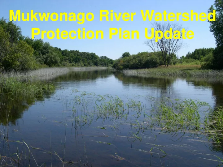
Mukwonago River Watershed Mukwonago River Watershed g Protection Plan Update Protection Plan Update
SLIDE 2 Tonight’s Objectives Tonight’s Objectives Tonight s Objectives Tonight s Objectives
Summarize elements completed to date Summarize elements completed to date
Summarize assets of the Mukwonago River Summarize assets of the Mukwonago River Watershed Watershed
Revised important issues/concerns in the watershed Revised important issues/concerns in the watershed
Alternatives/Opportunities to address issues of Alternatives/Opportunities to address issues of concern concern
Proposed refined plan goals & objectives Proposed refined plan goals & objectives
Prioritize lands for protection Prioritize lands for protection Groundwater Groundwater
Groundwater Groundwater
Outreach summary Outreach summary---
SLIDE 3 Plan Chapters
1
Introduction Introduction
1.
Introduction
2.
- 2. Natural and Human Features of the
Natural and Human Features of the Watershed Watershed
3.
- 3. Related Plan, Regulations, and Programs
Related Plan, Regulations, and Programs
4.
- 4. Background and Summary of Inventory
Background and Summary of Inventory g y y g y y Findings Findings
5.
- 5. Watershed Goals, Objectives, and
Watershed Goals, Objectives, and R d d A ti R d d A ti Recommended Actions Recommended Actions
6.
Plan Implementation
SLIDE 4 Informational Meetings
April 9 2009 April 9, 2009 April 9, 2009
June 29, 2009— —Draft Chapters 1 Draft Chapters 1-
3
September 29 2009—Reviewed Inventory for Reviewed Inventory for September 29, 2009 September 29, 2009 Reviewed Inventory for Reviewed Inventory for Chapter 4 Chapter 4
April 8, 2010 p , p ,
Plan Completion---
June 29, 2010
SLIDE 5
2000 L d U i h 2008 2000 Land Use with 2008 Waukesha County Update
SLIDE 6
Assets of the Assets of the Mukwonago Mukwonago River River River River Watershed? Watershed?
SLIDE 7
Chemical: Chemical: Excellent water quality within Excellent water quality within the stream and lakes systems the stream and lakes systems
SLIDE 8 Biological: G ll d h l h f d
- Generally good health of stream and
diversity
- Highly diverse warmwater fishery
g y y
- Diverse and abundant mussels
- Diverse and abundant aquatic insects
- High quality coldwater stream
- High quality coldwater stream
- Large trout
- Good quality Lake Sport Fisheries---
Hi h di it & b d f ildlif
- High diversity & abundance of wildlife
species
- Numerous threatened, endangered,
, g , and species of special concern
SLIDE 9 Physical: Physical:
- Well connected floodplain and good flood
control
- Stable streambed & banks
- Low density of development
Low density of development
- Significant amount of infiltration
areas/groundwater recharge potential High groundwater discharge
- High groundwater discharge
- natural meanders-limited
channelization/diversions
- low number of road crossings
- extensive riparian buffers
SLIDE 10 Physical-Habitat High quality quantity and diversity of instream High quality, quantity, and diversity of instream and in-lake habitats:
- Flows
- pool-riffle structure
- substrates, water depths
- aquatic vegetation
q g
SLIDE 11
High quality & diverse recreational experience: Boating/Skiing Boating/Skiing Canoeing Hunting Fishing Fishing Wildlife viewing Golfing Biking Picnicking Public access Public access
SLIDE 12 Goals: Goals:
- Protect and improve wildlife, land, surface water ,
Protect and improve wildlife, land, surface water , d d t d d t and groundwater resources and groundwater resources
- Minimize impacts of land development by controlling
Minimize impacts of land development by controlling agriculture and urban runoff pollution and flooding agriculture and urban runoff pollution and flooding g p g g p g
- Build partnerships and inform public to promote
Build partnerships and inform public to promote protection and use of natural resources protection and use of natural resources
SLIDE 13 Protect and improve wildlife, land, surface water , and Protect and improve wildlife, land, surface water , and groundwater resources groundwater resources groundwater resources groundwater resources
Land Management Measures
Objective-
- Preserve and protect environmentally
Preserve and protect environmentally sensitive areas such as designated natural areas sensitive areas such as designated natural areas sensitive areas such as designated natural areas, sensitive areas such as designated natural areas, wetlands, fish and wildlife habitat, riparian buffers, and wetlands, fish and wildlife habitat, riparian buffers, and primary and secondary environmental corridors. primary and secondary environmental corridors.
- Groundwater Protection Measures
Groundwater Protection Measures
- Groundwater Protection Measures
Groundwater Protection Measures
Objective-
- Preserve groundwater recharge areas and
Preserve groundwater recharge areas and prevent groundwater contamination from stormwater prevent groundwater contamination from stormwater infiltration practices. infiltration practices. infiltration practices. infiltration practices.
- Fisheries and Wildlife Enhancement
Fisheries and Wildlife Enhancement
Objective-
- Protect lakes and streams to support a high
Protect lakes and streams to support a high quality sustainable coldwater and warmwater fishery quality sustainable coldwater and warmwater fishery quality sustainable coldwater and warmwater fishery quality sustainable coldwater and warmwater fishery community, habitat, and water quality. community, habitat, and water quality.
SLIDE 14 Minimize impacts of land development by controlling agriculture Minimize impacts of land development by controlling agriculture and urban runoff pollution and flooding and urban runoff pollution and flooding
- Land Use Management and Zoning
Land Use Management and Zoning Land Use Management and Zoning Land Use Management and Zoning
Objective-
- Develop policies and install practices that
Develop policies and install practices that reduce urban nonpoint source water pollution and help reduce urban nonpoint source water pollution and help achieve the recommended water use objectives and achieve the recommended water use objectives and j j supporting water quality standards for surface waters. supporting water quality standards for surface waters.
Stormwater and Floodland Floodland Management Measures Management Measures
Objective-Preserve floodwater storage areas and Preserve floodwater storage areas and Objective Objective Preserve floodwater storage areas and Preserve floodwater storage areas and control the quantity of runoff from new urban control the quantity of runoff from new urban development. development.
- Agricultural Land Use Planning and Zoning Measures
Agricultural Land Use Planning and Zoning Measures Agricultural Land Use Planning and Zoning Measures Agricultural Land Use Planning and Zoning Measures
Objective-
- Preserve and protect environmentally
Preserve and protect environmentally sensitive areas such as designated natural areas, sensitive areas such as designated natural areas, wetlands, fish and wildlife habitat, riparian buffers, and wetlands, fish and wildlife habitat, riparian buffers, and , , p , , , p , primary and secondary environmental corridors. primary and secondary environmental corridors.
- Agricultural Pollution Control Measures
Agricultural Pollution Control Measures
Objective-Promote the use of agricultural nonpoint Objective Objective Promote the use of agricultural nonpoint pollution control practices to meet or exceed State and Federal standards.
SLIDE 15 Build partnerships and inform public to promote protection and Build partnerships and inform public to promote protection and use of natural resources use of natural resources
- Targeted Informational Programming
Targeted Informational Programming Targeted Informational Programming Targeted Informational Programming
Objective-
- Develop or expand land use and water
Develop or expand land use and water quality information and education programs as needed quality information and education programs as needed to implement plan goals and objectives. to implement plan goals and objectives. p p g j p p g j
- Waukesha & Walworth Counties Nonpoint Information and
Waukesha & Walworth Counties Nonpoint Information and Education Program Proposal Education Program Proposal
Objective-Comply with educational component of Comply with educational component of Objective Objective Comply with educational component of Comply with educational component of Municipal Separate Storm Sewer System (MS4) Permit Municipal Separate Storm Sewer System (MS4) Permit Requirements under NR 216 of the Wisconsin Requirements under NR 216 of the Wisconsin Administrative Code. Administrative Code.
- Stakeholder participation
Stakeholder participation
Objective – –Continue cooperation among community Continue cooperation among community
- rganizations and municipalities, and develop public
- rganizations and municipalities, and develop public
g p , p p g p , p p participation opportunities. participation opportunities.
Recreational development
Objective-Promote and expand safe recreational Promote and expand safe recreational Objective Objective Promote and expand safe recreational Promote and expand safe recreational
- pportunities
- pportunities
SLIDE 16 Goals: Goals:
Protect and impro e ildlife land s rface ater and Protect and impro e ildlife land s rface ater and
- Protect and improve wildlife, land, surface water , and
Protect and improve wildlife, land, surface water , and groundwater resources groundwater resources
Land Management Measures G d t P t ti M G d t P t ti M
- Groundwater Protection Measures
Groundwater Protection Measures
- Fisheries and Wildlife Enhancement
Fisheries and Wildlife Enhancement
SLIDE 17
Riparian buffers Riparian buffers
SLIDE 18
SLIDE 19
Stream and Riparian Conditions: 1941 Stream and Riparian Conditions: 1941
SLIDE 20
Stream and Riparian Conditions: 2007 Stream and Riparian Conditions: 2007 Conditions Change… Conditions Change… Conditions Change… Conditions Change…
SLIDE 21 Riparian buffers Riparian buffers How defined within Mukwonago River Watershed? How defined within Mukwonago River Watershed?
- 2005 Wisconsin Wetland inventory
2005 Wisconsin Wetland inventory P i E i t l C id P i E i t l C id
- Primary Environmental Corridors
Primary Environmental Corridors
SLIDE 22
Environmental Environmental Corridors Corridors
SLIDE 23 Environmental Environmental Corridors Corridors
Environmental corridors are divided into the following three categories. Prim ary environm ental corridors contain concentrations of our most significant natural resources. They are at least 400 acres in size at least two miles long and at least 200 feet wide They are at least 400 acres in size, at least two miles long, and at least 200 feet wide. Secondary environm ental corridors contain significant but smaller concentrations of natural
- resources. They are at least 100 acres in size and at least one mile long, unless serving to link primary
corridors. I solated natural resource areas contain significant remaining resources apart from environmental I solated natural resource areas contain significant remaining resources apart from environmental
- corridors. They are at least five acres in size and at least 200 feet wide.
SLIDE 24
SLIDE 25
Minimum goals of 75?
SLIDE 26 How to identify lands for protection or purchase? How to identify lands for protection or purchase?
Prioritization strategy Id tif l d t t d b l ti & hi / t Id tif l d t t d b l ti & hi / t
- Identify lands protected by regulation & ownership/easement
Identify lands protected by regulation & ownership/easement
100-
year floodplain boundary
- lands protected: Public & Private (need to distinguish
lands protected: Public & Private (need to distinguish ) public access public access vs vs not) not)
SLIDE 27
100-Year & 500-Year Floodplain
SLIDE 28
Protected Lands: Public & Private
SLIDE 29 How to identify lands for protection or purchase? How to identify lands for protection or purchase?
Prioritization strategy Id tif l d t t d b l ti & hi / t Id tif l d t t d b l ti & hi / t
- Identify lands protected by regulation & ownership/easement
Identify lands protected by regulation & ownership/easement
100-
year floodplain boundary
- lands protected: Public & Private (need to distinguish
lands protected: Public & Private (need to distinguish ) public access public access vs vs not) not)
Identify what to do
- Lands planned for development
Lands planned for development-
higher candidate for p p p p g conservation type setback/conservation easement with conservation type setback/conservation easement with development development
- Lands not planned for development
Lands not planned for development-
higher candidate for p p p p g purchase purchase
Minimum goals of 75 g g
400-
foot minimum & 900-
- foot optimum protection width
foot optimum protection width assessment assessment
- Groundwater recharge potential
Groundwater recharge potential –using good & very good using good & very good Groundwater recharge potential Groundwater recharge potential using good & very good using good & very good recharge categories recharge categories
SLIDE 30
Groundwater Recharge Groundwater Recharge
SLIDE 31
Groundwater Discharge Groundwater Discharge
SLIDE 32
Groundwater & Groundwater & Surface Water Surface Water C ti C ti Connections Connections
SLIDE 33 Groundwater Tools: SEWRPC MR Groundwater Tools: SEWRPC MR-
188
SLIDE 34 Groundwater Tools: SEWRPC MR Groundwater Tools: SEWRPC MR-
188
SLIDE 35
Groundwater Groundwater & & W t S l W t S l Water Supply Water Supply
SLIDE 36 Water Conservation Water Conservation
Base-Level Program: Providing about a 4 percent reduction in average daily demand and from 6 to 10 percent reduction in maximum daily demand.
- Water supply system efficiency actions including meter testing,
Water supply system efficiency actions including meter testing, leak detection and repair, water main maintenance replacement, water system audits, and water production system refinement. These measures are at least in part being applied by most of the These measures are, at least in part, being applied by most of the water utilities within the Region;
- Moderate level of public information and education programming,
including redesign of water bills, collation and distribution of educational materials, and presentations to school and civic groups; and groups; and
- Outdoor watering reduction measures such as the use of rain
barrels, and imposition of lawn and landscape plant watering restrictions such as time of day and limited day watering restrictions, such as time-of-day and limited-day watering requirements.
SLIDE 37 Water Conservation Water Conservation
Intermediate-Level Program: Providing from about 6 to 8 percent reduction in average daily demand and 12 to 16 percent reduction in maximum daily demand. in maximum daily demand.
- All of the components of the low-level program;
- Higher levels of public information and education programming,
including the development of school curriculum and broader including the development of school curriculum and broader informational programs involving newspapers, websites, and flyers;
- Plumbing retrofits, including the provision and installation of low-
volume shower heads and toilet displacement device kits;
- Use of water conservation rate structures; and
Use of water conservation rate structures; and
- More aggressive outdoor watering restrictions.
SLIDE 38 Water Conservation Water Conservation
Advanced-Level Program: Providing about a 10 percent reduction in average daily demand and 18 percent reduction in maximum daily demand. daily demand.
- All of the components of the moderate-level program;
- Fixture and plumbing management, including toilet, water
softener and clothes washing machine replacement rebate softener, and clothes washing machine replacement rebate programs; and
- Even more aggressive water conservation rate structures and
- utdoor watering restrictions considerations.
SLIDE 39
Water Conservation Water Conservation Where does your water come from? Where does your water come from? H h t d ? H h t d ? How much water do you use? How much water do you use? How far do we take recommendations? How far do we take recommendations? How far do we take recommendations? How far do we take recommendations?
SLIDE 40 Build partnerships and inform public to promote protection and Build partnerships and inform public to promote protection and use of natural resources use of natural resources
- Targeted Informational Programming
Targeted Informational Programming Targeted Informational Programming Targeted Informational Programming
- Waukesha & Walworth Counties Nonpoint Information and
Waukesha & Walworth Counties Nonpoint Information and Education Program Proposal Education Program Proposal
- Stakeholder participation
Stakeholder participation
- Stakeholder participation
Stakeholder participation
Recreational development
SLIDE 41
Partners
A Joint Effort of the: A Joint Effort of the: Eagle Spring Lake Management District Eagle Spring Lake Management District Phantom Lakes Management District Phantom Lakes Management District The Nature Conservancy The Nature Conservancy Mukwonago Fisheries Committee Mukwonago Fisheries Committee Fox River Partnership Fox River Partnership Friends of the Mukwonago River Friends of the Mukwonago River Fox River Commission Fox River Commission Schools & Libraries Schools & Libraries Municipalities Municipalities Wisconsin Department of Natural Resources Wisconsin Department of Natural Resources
SLIDE 42
Recreational Trails
SLIDE 43
Thank you