George Massey Tunnel Replacement Project Technical Briefing - - PowerPoint PPT Presentation

george massey tunnel
SMART_READER_LITE
LIVE PREVIEW

George Massey Tunnel Replacement Project Technical Briefing - - PowerPoint PPT Presentation

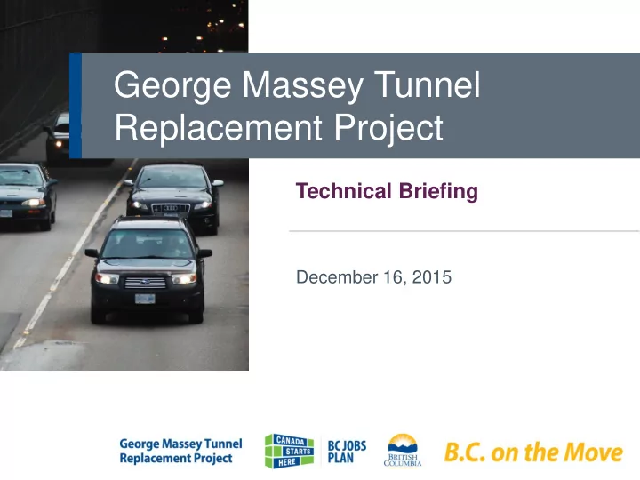
George Massey Tunnel Replacement Project Technical Briefing December 16, 2015 2 Overview New 3.3 km bridge Cost: $3.5 billion (8 lanes plus 2 transit/HOV lanes) Benefit/Cost Ratio: Replace 3 key interchanges 2.1 to 1 24 km of Highway 99


slide-1
SLIDE 1

George Massey Tunnel Replacement Project

Technical Briefing

December 16, 2015

slide-2
SLIDE 2

New 3.3 km bridge

(8 lanes plus 2 transit/HOV lanes)

Replace 3 key interchanges 24 km of Highway 99 improvements 50 km of dedicated transit/HOV lanes

(transit priority to Canada Line at Bridgeport)

Bike and pedestrian pathway Allow for future rapid transit Decommission Tunnel

Cost: $3.5 billion Benefit/Cost Ratio: 2.1 to 1 Funding: Funded through user tolls

Overview

30-year public private partnership Procurement to begin in 2016

2

slide-3
SLIDE 3

Project Chronology

2013 2014-2015 2012

November: Phase 1 Consultation (understanding the need) March: Phase 2 Consultation (exploring the options); technical work September: New bridge within the existing corridor announced, subject to a Project Definition Report and Business Case Technical work; cost estimate; business case analysis Consultation with municipalities, stakeholders and First Nations Alternative Corridor Studies

1991-1995 2001/2004

Tunnel Seismic Reviews

3

slide-4
SLIDE 4

Existing Challenges

  • Collisions
  • Congestion
  • Unreliability
  • Seismic vulnerability
  • Tunnel dimensions

sub-standard

  • No capacity for

cycling or walking

  • Impacts on:
  • People
  • Goods
  • Jobs
  • Tourism
  • Transit users
slide-5
SLIDE 5

Condition of Existing Tunnel

5

Opened in 1959 Designed to highway standards of the 1950s Electrical/mechanical system is 50+ years 30+ year old counterflow system Partial seismic upgrade completed spring 2006 Vulnerable to seismic event; 1950s approach Additional seismic upgrades are high risk

slide-6
SLIDE 6
slide-7
SLIDE 7
slide-8
SLIDE 8

Project Goals

Improve safety Reduce congestion Enhance the Environment Support improved transit on Hwy 99 Support trade and commerce Support options for pedestrians and cyclists

8

slide-9
SLIDE 9

George ge Masse sey y Tunnel

40%

Vancouver

59%

Richmond

1%

Burnaby/ New Westminster

19%

North Delta/Surrey

8%

Tilbury

2%

Deltaport

19%

Tsawwassen

17%

Ladner

35%

U.S. Border/ White Rock/ South Surrey ORIGIN DESTINATION

Traffic Analysis: Northbound Traffic

slide-10
SLIDE 10

George ge Masse sey y Tunnel

34%

Vancouver

65%

Richmond

1%

Burnaby/ New Westminster

21%

North Delta/Surrey

7%

Tilbury

36%

U.S. Border/ White Rock/ South Surrey

34%

Ladner/ Tsawwassen

2%

Deltaport

Traffic Analysis: Southbound Traffic

ORIGIN DESTINATION

slide-11
SLIDE 11

Options Analysis: Phase 2 Consultation

11

ALIGNMENT EFFECTS AGRICULTURAL PARKLAND RESIDENTIAL/COMMERCIAL MARINE

slide-12
SLIDE 12

Tunnel Scenario Effects

12

VANCOUVER

CONSTRUCTION IMPACTS AGRICULTURAL COMMERCIAL MARINE PARKLAND RESIDENTIAL

EXISTING TUNNEL NEW BRIDGE NEW TUNNEL SCENARIO

slide-13
SLIDE 13

Project Scope

13

slide-14
SLIDE 14

Bridge Concept

14

  • 3.3 km long
  • 660 m clear span
  • ver the Fraser River
  • 200 m high towers
  • 2-way navigation

channel with 57 m clearance

  • 100 year service life
  • Optimize lifecycle

performance

  • Design for future

rapid transit

  • 34,000 concrete

trucks

  • 50,000 t rebar
  • 30,000 t steel
  • 66 km of pile length
  • 18,000 t asphalt
slide-15
SLIDE 15

Major Bridges in the Lower Mainland

15

slide-16
SLIDE 16

1 Dedicated transit/HOV lanes 3 Regular traffic lanes

(same as today in rush hour)

1 Lane for slow, merging traffic

Benefits:

  • Improved merging safety
  • Reduced weaving
  • Reduced congestion/increased

reliability

  • Improved emergency response

access

Why Five Lanes in Each Direction?

16

Four lanes in each direction would result in congestion on

  • pening day
slide-17
SLIDE 17

Project Scope

17

Bridgeport Road to Highway 91

  • 200 lane km of roadway
  • 50 km of new dedicated

transit/HOV lanes

  • Replace 3 interchanges
  • Construct new bridge
  • Replace 5 overpasses
  • Decommission Tunnel
slide-18
SLIDE 18

50 LANE KILOMETRES OF DEDICATED/MEDIAN TRANSIT LANES

Project Scope – Transit

18

Dedicated Transit connection between Highway 99 and Bridgeport Canada Line Station Integrated Transit Stop: Steveston Highway Integrated Transit Stop: Highway 17A

RICHMOND DELTA

slide-19
SLIDE 19

Project Scope – Transit

  • 50 km of new dedicated transit lanes
  • Transit stops integrated with the

Steveston Highway and Highway 17A interchanges

  • Dedicated transit ramp from Highway

99 to Bridgeport Road

  • Safe and reliable transit access to

Canada Line at Bridgeport Station

  • Allowance for future rapid transit on

the new bridge

  • Highway 99 is already

a major transit route

  • One bus through the

tunnel every 3-4 minutes

  • More than 10,000

transit riders daily through the tunnel

  • Highest transit use of

any Fraser River road crossing

19

slide-20
SLIDE 20

Bridgeport Road

20

  • Northern terminus of transit/HOV lane
  • Dedicated transit ramp and connection to Canada Line
  • Ramp improvements

VANCOUVER

slide-21
SLIDE 21

What Happens at the Oak Street Bridge?

  • Morning queues will continue as they do today; traffic patterns

may change somewhat but no significant change in total traffic

  • 60% of tunnel users end their trip in Richmond
  • Efficiency of Oak Street Bridge will continue to be governed by traffic

lights at 70th Street

  • Traffic volumes on the Oak Street

Bridge have been relatively constant

  • r declining over the past decade

(Canada Line effect)

21

slide-22
SLIDE 22

Bridgeport Road to Highway 91

22

No change at Cambie Overpass Widen Shell Road Overpass

VANCOUVER

slide-23
SLIDE 23
  • Replace structures
  • Replace Westminster ramps
  • Improve access/egress at Highway 91

Highway 91/Westminster Highway

23

VANCOUVER

slide-24
SLIDE 24

Westminster Highway to Steveston

24

  • Replace Blundell Overpass to accommodate highway widening
  • Dedicated median transit/HOV lanes

VANCOUVER

slide-25
SLIDE 25

Steveston Highway

25

  • Full movement

interchange

  • Compact footprint

to minimize property impacts

  • No traffic lights
  • Connection with

Rice Mill Road

  • Integrated transit

stop

VANCOUVER

slide-26
SLIDE 26

Bridge

26

  • New 10-lane (2 transit lanes) bridge on existing corridor
  • Multi-use pathway for cyclists and pedestrians
  • River Road access ramp to Ladner
  • Restore Green Slough
  • Bio-filtration/environmental enhancements under bridge

VANCOUVER

slide-27
SLIDE 27

Highway 17A

27

  • Replace Highway 17A Interchange
  • Dedicated entrance to Highway 99
  • Integrated transit stop
  • Free flow access between Highway

17A and River Road

VANCOUVER

slide-28
SLIDE 28

Highway 17A – Highway 17

28

  • Construct ramp to Highway 17 eastbound
  • New dedicated transit/HOV lanes

VANCOUVER

slide-29
SLIDE 29

Highway 17 to Ladner Trunk Road

29

  • Replace Ladner Trunk Road/Matthews Overpass
  • Add dedicated transit/HOV lanes

VANCOUVER

slide-30
SLIDE 30

Ladner Trunk Road – Highway 91

30

  • Replace 112th Street Overpass
  • Continue transit/HOV lanes

VANCOUVER

slide-31
SLIDE 31

Benefit/Cost Analysis

  • Quantified User Benefits:
  • Congestion reduction, travel time savings, improved

reliability, vehicle operating cost savings

  • Traffic safety (35% reduction in collisions)
  • Reduced seismic risk
  • Non-quantified User Benefits:
  • Cyclist/pedestrian, transit, marine traffic

improvements

  • Long-term economic development

31

Cost: $3.5 billion Benefit/Cost Ratio: 2.1 to 1

slide-32
SLIDE 32

Travel Time Savings

32

TUNNEL TODAY

  • Rush Hour:
  • at capacity
  • totally congested 6-8 hrs/day
  • Midday:
  • near congestion
  • incident sensitive

WITH A NEW BRIDGE

  • Free-flow conditions – safer,

no congestion, efficient merges/lane changes

  • Average commuter will

save 25 to 35 minutes per day

  • Travel time savings and

reliability benefits – more than $70 million in the first year; growing annually

slide-33
SLIDE 33

Why Tolling?

  • Significant benefits for those using the

new Bridge

  • Allows project to proceed now, without

taking away from government funding for health and education

  • Similar format to Port Mann Bridge
  • Working with federal government on

potential contributions

33

slide-34
SLIDE 34

Anticipated Effects of Tolling New Crossing

34

TUNNEL TODAY

“Rush Hour” (6-8 hours):

  • The Tunnel and Alex Fraser

Bridge (AFB) are heavily congested Midday (6 hours):

  • Tunnel, AFB and Richmond

Connector near congestion; incident sensitive Overnight/Weekends:

  • Free-flowing traffic

WITH A NEW BRIDGE

Rush Hour:

  • New Bridge free-flowing
  • Traffic in queues at AFB will

move to new Bridge Midday:

  • Limited traffic diversion to

AFB due to congestion on East/West Connector Overnight/Weekends:

  • Some traffic diversion to AFB
slide-35
SLIDE 35

Won’t People Use Alex Fraser Bridge?

Port Mann Experience:

  • Traffic by time of day:
  • Rush-hour traffic increased

significantly

  • Midday and overnight traffic

decreased

  • Weekends:
  • Traffic volumes decreased
  • Total average daily traffic:
  • Traffic volumes decreased in 2013/2014 after tolling started in 2012
  • Traffic has increased each month in 2015

35

slide-36
SLIDE 36

Traffic Volumes: Port Mann Bridge Rush Hour

36

Note: volumes represent the peak hour during rush hour periods

slide-37
SLIDE 37

Environmental Benefits

37

  • Transit enhancements to increase ridership
  • Multi-use pathway to encourage cycling/walking
  • Less idling; reduced GHG emissions
  • Restoring Green Slough to historic alignment
  • Bio-filtration marshes for stormwater

management

  • Environmental enhancements in Deas Slough
  • Improvements to Millennium Trail
slide-38
SLIDE 38

w: www.masseytunnel.ca t: 1-8-555-MASSEY e: masseytunnel@gov.bc.ca

Phase 3 Consultation: Project Definition Report Consultation takes place December 16, 2015 to January 28, 2016. For more information: