SLIDE 1
From Shenandoah Valley Karst Terrain to the Chesapeake Bay
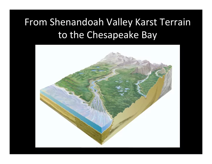
SLIDE 2
Let’s Start at the Beginning
SLIDE 3
The Water Budget
Precipitation Evapotranspiration Surface Groundwater Runof f
SLIDE 4
Ground Water Criteria for Flowing Water Porosity – voids in bedrock to hold water Permeability – ability of water to flow through the rocks
Fractures Other open spaces
SLIDE 5
Fracture Flow
SLIDE 6
Watersheds of VA
SLIDE 7
Geology of the Shenandoah Valley
To the East on the Blue Ridge 500 million to 1.1 billion year old sediments – Igneous rocks including volcanic rocks; sedimentary rocks including silts, sands, and shale. To the West 320 – 410 millions year old shale and sandstone Most of central Shenandoah Valley 410 to 500 million year old Primarily limestone and dolomite
SLIDE 8 Limestone/Dolomite Terrain of the Shenandoah Valley
Source: Environmental Science Institute, University of Texas at Austin
SLIDE 9
Karst – How would you define it?
Karst is Landscape or Topography Term Karst is a landscape shaped by the dissolution of a layer or layers of soluble bedrock, usually carbonate rock such as limestone or dolomite.
SLIDE 10 Counties in VA Containing Karst
Source: Virginia Department of Conservation & Recreation,
SLIDE 11 Department of Conservation and Recreation, Virginia Karst Program
SLIDE 12
How is Karst Formed
SLIDE 13 Source: Environmental Science Institute, University of Texas at Austin
SLIDE 14
SLIDE 15
Clarke County, VA
SLIDE 16
C A V E S
SLIDE 17 Department of Conservation and Recreation, Virginia Karst Program
SLIDE 18
Water Budget for the Limestone Terrain
Evapotranspiration – 50 ‐80% Surface Runoff – Less than 10% Water Table Recharge 30‐40%
SLIDE 19
What do we know?
Map of the watershed and its link to the Chesapeake General geology of the Valley and specifically the limestone and dolomite terrain Water budget for limestone and dolomite terrain Characteristics of karst topography
SLIDE 20
If less than 10% of the precipitation is surface runoff , what feeds the streams and rivers?
In the carbonate areas of the Valley up to 95% is coming from the groundwater, AND, this percentage may increase during times of drought.
SLIDE 21 What are the facts?
From looking at the Karst Model?
Precipitation moves quickly and abundantly into the
- groundwater. That means that most of what is on the
ground, will end up in the groundwater with minimal filtering by the soils.
From the Research
The majority of stream/river water comes from the groundwater – up to 95% or more. Some moves quickly into streams and rivers (2 – 3 days), some moves slowly (100 – 1,000 yrs). Water in these sediments is high in Oxygen
SLIDE 22
Why Do We Care What Happens in the Shenandoah Valley?
SLIDE 23
Why Do We Care What Happens in the Shenandoah Valley?
All land‐use practices that add chemicals to the ground can be quickly transported to the groundwater. The groundwater is transporting those chemicals to the streams and rivers in 2 days to 100s of years. Once in the groundwater, there is no capacity in the limestone and dolomite to denitrify nitrates, one of the big problems for the Chesapeake. Any nitrates on the land will flow into the groundwater and become part of the base flow for the streams and rivers that feed the Chesapeake.
SLIDE 24
What is it about nitrates that pose a problem? aa Why can’t the limestone and dolomite sequences denitrify the nitrates?
SLIDE 25
Fixing the Problem What can we do?
Consider all farming and land‐use practices. Manage what you put on the ground. When fertilizing, put on what you need when the plants can absorb it. Use best management practices for waste‐ water. Don’t assume that whatever you try will fix the problem immediately. Some water takes 100 or more years to move out of the groundwater.
SLIDE 26 2012
- Chesapeake Bay ‘dead zone' smaller this
year (Baltimore Sun, June 22, 2012)
- DNR says warmer, drier conditions this
winter, compared to the extremely wet spring last year may be the difference. (CBS – Baltimore, June 21, 2012)
SLIDE 27