What is a Karst Topography Karst is a three dimensional soluble - - PowerPoint PPT Presentation

what is a karst topography
SMART_READER_LITE
LIVE PREVIEW

What is a Karst Topography Karst is a three dimensional soluble - - PowerPoint PPT Presentation

What is a Karst Topography Karst is a three dimensional soluble rock landscape that develops by the dissolving action of water on soluble bedrock. Include caves, epikarst exposure, sinkholes, sinking streams, springs Can have


slide-1
SLIDE 1
slide-2
SLIDE 2

What is a Karst Topography

Karst is a three dimensional soluble

rock landscape that develops by the dissolving action of water on soluble bedrock.

Include caves, epikarst exposure,

sinkholes, sinking streams, springs

Can have recreational, cultural and

biodiversity significance

slide-3
SLIDE 3
slide-4
SLIDE 4
slide-5
SLIDE 5
slide-6
SLIDE 6
slide-7
SLIDE 7
slide-8
SLIDE 8
slide-9
SLIDE 9
slide-10
SLIDE 10
slide-11
SLIDE 11

Interaction of Karst System

slide-12
SLIDE 12
slide-13
SLIDE 13
slide-14
SLIDE 14
slide-15
SLIDE 15
slide-16
SLIDE 16
slide-17
SLIDE 17

Karst Routine Monitoring

Priority Evaluation Question

“Are current forest practices adequately

protecting and maintaining the structure, function and ecological integrity of the surface and subsurface elements of karst systems”

slide-18
SLIDE 18

Karst Sample Units and Selection

Criteria for samples units

Random, 1996-2006 Within 100 m of block or road from 500m

  • utside of block

KSU sample of each feature, looking for

indicators for location of karst in block

slide-19
SLIDE 19

Environmental factors

Removal of native forest cover Reduction of shade Change to native lower plant communities Soil/ground disturbance Post-harvest windthrow Introduced materials Burning Other

slide-20
SLIDE 20

Karst Inventory Location and Distribution

slide-21
SLIDE 21

Karst locations

slide-22
SLIDE 22

Karst Sample Unit

  • Cutblock and Karst Potential

Unit intersection

  • Eligible areas for sampling

include inside cutblock, 100m around cutblock and roads

slide-23
SLIDE 23

Karst Sample Unit – opening information

  • Record information about the block

and Karst Sample Unit,

  • Information may be obtained from a

SP or Karst Assessment

slide-24
SLIDE 24

Karst Field Data Card

  • Records indicator information

such as

  • Windthrow,soil disturbance,

introduced material, burning, retention,

slide-25
SLIDE 25

Karst Field Data Card

  • Summary of indicator status for

individual features

slide-26
SLIDE 26

Karst Summary Card

  • Summary of indicators for

entire sample unit

  • Level of risk
  • Professional opinion
slide-27
SLIDE 27

Karst Assessment Map Showing Features

slide-28
SLIDE 28

Feature is a sinkhole with a cave

  • entrance. Retention Patch and Machine

free Zone

slide-29
SLIDE 29

Cave entrance within the sinkhole.

slide-30
SLIDE 30

Feature is a Shaft located under an old log. Trying to measure depth 5+ meters

slide-31
SLIDE 31

Feature is a Shaft that was missed during Karst assessment, Logging engineers located and a machine free zone established.

slide-32
SLIDE 32

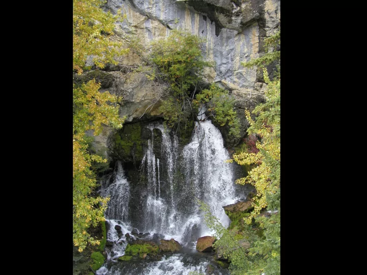
Feature is an exsurgence The channel originates at a sinkhole-like feature approximately 2 m in diameter and 1 m relief.

slide-33
SLIDE 33

How did this get here??

slide-34
SLIDE 34

Joint field session DCR and DNI staff. Feature is a localized limestone

  • bluff. Bluff is approximately 30m x 5 m.
slide-35
SLIDE 35

The feature is a concave depression that occurs along a vertical section of the bluff. The feature is arc shaped approximately 3m x4 m

slide-36
SLIDE 36

Feature is a sinkhole approximately 4 m x 2m x 1.5 m. Sinkhole is poorly managed, filled with logging slash and soil disturbance

slide-37
SLIDE 37

Sinkhole approximately 4 m diameter and 2.5 m relief. Managed with a modified retention patch and a machine free zone.

slide-38
SLIDE 38

An exsurgence from the soil/bedrock. Ephemeral in nature. Located

  • utside of block.
slide-39
SLIDE 39

Feature is grike, 10m long, 1 m wide and more than 1 m

  • deep. Machine free zone and

a modified retention patch.

slide-40
SLIDE 40

Safety issue. Underground cavity was covered by thin layer of roots and moss.

slide-41
SLIDE 41

Epikarst feature located outside of block and exposed by wind throw.

slide-42
SLIDE 42

Sinkhole with a disappearing stream and a cave entrance. Retention patch surrounding feature blew over.

slide-43
SLIDE 43

Sinkhole and cave entrance buried by windfall. Retention patch approximately 1.5 ha. With 90% blow down.

slide-44
SLIDE 44

Sinkhole with side slope disturbance. Stream on the right