Feasibility Study to Eradicate Aquatic Invasive/Nuisance Species in - - PowerPoint PPT Presentation

feasibility study to eradicate aquatic invasive nuisance
SMART_READER_LITE
LIVE PREVIEW

Feasibility Study to Eradicate Aquatic Invasive/Nuisance Species in - - PowerPoint PPT Presentation

Consultant Team: Nelson, Pope & Voorhis/Nelson & Pope B. Laing Associates Dr. Chris Gobler, SoMAS Orson Environmental Dr. Richard Orson Consulting Feasibility Study to Eradicate Aquatic Invasive/Nuisance Species in Canaan Lake,


slide-1
SLIDE 1

Consultant Team: Nelson, Pope & Voorhis/Nelson & Pope

  • B. Laing Associates
  • Dr. Chris Gobler, SoMAS
  • Dr. Richard Orson

Feasibility Study to Eradicate Aquatic Invasive/Nuisance Species in Canaan Lake, North Patchogue and Upper and Lower Lakes, Yaphank Steering Committee Interim Meeting March 30, 2010

Orson Environmental Consulting

Lower (Lily) Lake

slide-2
SLIDE 2

Mike Bontje’s House March 30, 2010 10:30 AM March 30, 2010 4:30 PM

slide-3
SLIDE 3

Project Overview

September 2, 2009 – April 30, 2011

– Task 1: Lakes Characterization & Existing Conditions (through Summer 2010) – Task 2: Management Alternatives

(Draft – Summer 2010; Finalized Winter 2010/11)

– Task 3: Meetings & Stakeholder Involvement

(Steering Committee Meetings: Interim - Spring 2010, Progress – Summer 2010, Wrap-up - Winter/Spring 2010/11, Final - Spring 2011; Public Meetings: Spring & Summer 2010, Final in late Fall 2010)

– Task 4: Options for Fish Passage at Upper & Lower Lakes

(Draft - Spring 2010; Finalized Winter 2010/11)

– Task 5: Annual Reports and Public Summary (Finalized Spring 2011) – Task 6: Establish & Maintain a Public Domain Website (ongoing)

slide-4
SLIDE 4

Project Overview

– Task 1: Lakes Characterization & Existing Conditions – Task 2: Management Alternatives – Task 3: Meetings & Stakeholder Involvement – Task 4: Options for Fish Passage at Upper & Lower Lakes

– Task 5: Annual Reports and Public Summary – Task 6: Establish & Maintain a Public Domain Website

slide-5
SLIDE 5

Watershed Area & Characterization

95% of Carmans River is Groundwater Fed

slide-6
SLIDE 6

Watershed Area Land Use & Public Lands

Land Use: Low density residential (some high density) Parks/Rec/ Open Space Major roadways

slide-7
SLIDE 7

Ownership of Underwater Land

slide-8
SLIDE 8

Pollution & Shoreline Inventory (100’ Buffer) – Upper Lake

Stormwater Inputs (CSYL Survey) Direct Stormwater- contributing Watersheds (SCDPW, 2008) Bulkheads Developed Lands

slide-9
SLIDE 9

Stormwater Inputs (CSYL Survey) Direct Stormwater-contributing Watersheds (SCDPW, 2008) Bulkheads Developed Lands

Pollution & Shoreline Inventory (100’ Buffer) – Lower Lake

slide-10
SLIDE 10

Water Quality Review, Monitoring & Sediment Composition

Existing Data

  • 2007 Depth & Sediment Maps (A. Graves, Town)
  • June 2009 – 2010 Water Quality Data (CSYL)
  • Oct/Dec’08 WQ at Upper Spillway (SCDHS)
  • SUNY 4-season wq and sediment sampling (1st, October

2009; 2010: April, June, July)

  • B. Laing Depth updates (2009)
slide-11
SLIDE 11

Bathymetry & Muck Depth – Upper Lake

Fall 2009 (B. Laing) January 2008 (PWG)

slide-12
SLIDE 12

Bathymetry & Muck Depth – Lower Lake

slide-13
SLIDE 13

Density of Aquatic Invasive Plants – Upper Lake

Fall 2007 (Town)

slide-14
SLIDE 14

Density of Aquatic Invasive Plants – Upper Lake

Fall 2009 (B. Laing) Fall 2007 (Town)

slide-15
SLIDE 15

Density of Aquatic Invasive Plants – Lower Lake NYSDEC Mechanical Harvesting Permit (9/9/08)

Fall 2007 (Town) NYSDEC Mechanical Harvesting Permit (9/9/08)

slide-16
SLIDE 16

Density of Aquatic Invasive Plants – Lower Lake

Fall 2009 (B. Laing) Fall 2007 (Town)

slide-17
SLIDE 17

2009 Invasive Plant Distribution Map – Upper Lake

slide-18
SLIDE 18

Invasive Plant Distribution Maps – Upper & Lower Lake

slide-19
SLIDE 19

Project Overview

– Task 1: Lakes Characterization & Existing Conditions – Task 2: Management Alternatives – Task 3: Meetings & Stakeholder Involvement – Task 4: Options for Fish Passage at Upper & Lower Lakes – Task 5: Annual Reports and Public Summary – Task 6: Establish & Maintain a Public Domain Website

slide-20
SLIDE 20

Task 4: Options for Fish Passage at Upper & Lower Lakes

  • Dams inventoried by NP&V in 2007 (SSER

Barrier Inventory/Prioritization Project )

  • Prior Engineering/DPW Rehabilitation Reports

(e.g. 2007 Dam Inspection Report for Upper Lake - PWG Engineering)

  • Previous options considered & funded, but

never proceeded

  • Fresh look with public meetings to gather input

& build consensus

  • Partner with USFWS through formal DEC

request

  • Additional conceptual alternatives by N&P/OEC

Upper Lake Dam, as seen from Mill Road.

slide-21
SLIDE 21

Upper Lake – Conceptual Fish Passage Design

slide-22
SLIDE 22

Lower Lake – Conceptual Fish Passage Design

slide-23
SLIDE 23

Lower Lake – Conceptual Fish Passage Design

slide-24
SLIDE 24

Project Overview

– Task 1: Lakes Characterization & Existing Conditions – Task 2: Management Alternatives – Task 3: Meetings & Stakeholder Involvement – Task 4: Options for Fish Passage at Upper & Lower Lakes – Task 5: Annual Reports and Public Summary – Task 6: Establish & Maintain a Public Domain Website

slide-25
SLIDE 25

Task 2: Management Alternatives

  • Matrices to assess alternatives (Pros/Cons/Costs)

– Dredging – Aquatic herbicide – Shading (chemical dyes) – Mechanical harvesting (existing) – Benthic barriers (blanketing) – Hand/suction harvesting – Drawdown/Drawup – Biological control (grass carp) – Dam removal/modification – Combination (Integrated Plant Management) – No action

  • Impacts Analysis

– Direct/Indirect Impacts – Maintenance Effort/Cost

  • Short & long-term control

– Regulatory Requirements/Considerations – Community Support

slide-26
SLIDE 26

Build on Existing Information – Work With Stakeholders – Equally Assess ALL Options – Work Toward Consensus

slide-27
SLIDE 27

Optimum conditions for Invasive Plants

Myriophyllum heterophyllum (Variable watermilfoil)

  • Slow moving, acidic waters (but can exist in any condition due to

durability)

  • Soft waters (saltier, fewer minerals)
  • Depths up to 10 feet
  • High nutrient concentrations
  • Native to U.S, but not yet known if native to NY; can co-exist

peacefully with other plants, but invasive weed growth becoming more commonplace (often competes with fanwort). Cabomba caroliniana (Fanwort)

  • Slow moving, variable pH waters (5.7 to 9.2)
  • Depths from 3 to 10 feet (but recently found in deep,

coldwater lakes of upstate NY)

  • High anaerobic tolerance
  • High nutrient concentrations
  • Native to Southeastern U.S
slide-28
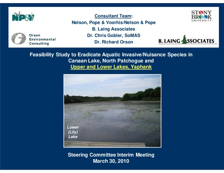
SLIDE 28

Making Conditions Less Favorable for Long-Term Control

Existing Conditions Cause Cure/Solution Progress & Attempts

Shallow Depths (2’ to 3’ avg; max of 6-7’)

  • natural topography
  • build-up of organic sediments
  • dredge

none Nutrients – sediments (short retention time & low retention of nutrients exhibited thus far)

  • build-up of decomposed

plant/animal material

  • dredge
  • reduce biomass (benthic barrier,

herbicide, shading, biocontrol, harvesting, etc.)

  • mechanical harvesting

(limited, very short-term success) Nutrients – surface/groundwater (low nutrients in October 2009 samples)

  • fertilizers
  • sanitary systems
  • pet waste

Watershed Management:

  • reduce fertilizer use in watershed
  • ensure sanitary systems are

properly functioning

  • limit future development that

could increase nutrient load

  • prevent direct stormwater inputs
  • Upper & Lower Lake - CR 21

stormwater improvements - SCDPW RFP issued in 2010 and survey work has begun (Credit to Leg. Kate Browning) Warm water

  • shallow depths
  • increase depths
  • decrease retention time

none Low Flows

  • Impoundment on river
  • Remove impoundment and restore

natural flows none pH (6.18 – 8.09 in 2009; 6.5 and 8.5 are NYS standards)

  • photosynthesis (pH increases as

CO2 is used up and O2 levels rise during the day)

  • pollutants (CO2 from PAHs -

excess CO2 cannot be consumed by plants and results in acid water; also fertilizers)

  • modify plant biomass
  • add compounds

none

slide-29
SLIDE 29

Project Overview

– Task 1: Lakes Characterization & Existing Conditions – Task 2: Management Alternatives – Task 3: Meetings & Stakeholder Involvement – Task 4: Options for Fish Passage at Upper & Lower Lakes – Task 5: Annual Reports and Public Summary – Task 6: Establish & Maintain a Public Domain Website

slide-30
SLIDE 30

Task 3: Meetings & Stakeholder Involvement

  • Coordination with:

– Suffolk County – Town of Brookhaven – Local Councilperson – Stakeholders (e.g. residents) – Coalition to Save the Yaphank Lakes

  • Public Education (& Collaboration) to

– Tell a Story (e.g. Historical Modification) – Learn modes of introduction – Control inoculants – Instill responsibility

  • Meetings

– Steering Committee (for each lake) – 1 start-up (September/October 2009) – 1 interim (March 2010) – 1 Progress (single meeting at end of Tasks 1&2) (July 2010?) – 1 wrap-up (January – February 2011) – Public Meetings (for each lake) – County to publicize two weeks in advance – 1 initial to highlight existing conditions; discuss options (April 2010) – 1 interim to build consensus toward preferred alternative (July – August 2010) – 1 additional final (if necessary, to assist in selecting alternative) (Nov. – Dec. 2010)

slide-31
SLIDE 31

Project Overview

– Task 1: Lakes Characterization & Existing Conditions – Task 2: Management Alternatives – Task 3: Meetings & Stakeholder Involvement – Task 4: Options for Fish Passage at Upper & Lower Lakes – Task 5: Annual Reports and Public Summary

  • Public summary to be provided with final annual report & published on

website

– Task 6: Establish & Maintain a Public Domain Website

  • www.suffolkcountylakes.net
slide-32
SLIDE 32

The Consultant Team

Orson Environmental Consulting

slide-33
SLIDE 33

Nelson, Pope & Voorhis/Nelson & Pope

  • SSER Fish Barrier Inventory

– Including Upper & Lower Lake Dams – Habitat assessment; GIS Database; Barrier Prioritization

  • Lake Agawam Comprehensive Management Plan

– Worked with Dr. Gobler (wq & nutrient inputs) – Shoreline inventory, stormwater improvements – Heavy community involvement; public education

  • Lake Ronkonkoma Clean Lakes Study Update

– Nutrient inputs/sources; management strategies

  • Mt. Sinai Harbor Management Plan

– Balancing recreational, commercial, ecological & residential uses – Diverse stakeholders

  • SC North Shore Embayments Watershed

Management Plan – Strategy to achieve required nitrogen reductions (Long Island Sound TMDL) – wq/natural resource characterizations; pollutant loading models

slide-34
SLIDE 34
  • B. Laing Associates

Artist’s Lake, Yaphank, NY – Control strategies for elodea and watermilfoil (Myriophyllum sp.) – Chemical, harvesting and triploid grass carp

  • considered. Chemical selected.

Private Lake, Ossening, NY – Problem: coontail (Ceratophyllum demersum). – Nutrient/sediment controls, chemical, harvesting, dredging, water flow, water level, benthic smothering and carp considered. Nutrient/sediment controls, aqua-shade and water flow revisions recommended. Private Lake, Sullivan County, NY – Problem: American lotus (Nelumbo lutea), Phragmites, purple loosestrife. – Water level controls, targeted bio release, spot backpack chemical controls used. Black Pond, Bedford, NY – Problem: coontail (Ceratophyllum demersum). – Dredging, nutrient/sediment controls, water level control and open water expansion used.

slide-35
SLIDE 35
  • Dr. Chris Gobler, SoMAS

Lake Agawam – Water quality monitoring – Cyanobacteria inventory – Pollutant loading analysis Suffolk County Cyanobacteria Study – Not documented on Long Island until 2003 – Assessed multiple lakes throughout County – Encountered several lakes with elevated levels at times unsafe for public health

slide-36
SLIDE 36

Orson Environmental Consulting

Jordan Mill Pond Fish Passage Project, Waterford, CT (2005) – 15 foot high stone dam at head of Jordan Cove – Design/funding/installation of Alaskan Steep Pass Fishway Ingham Hill Fishway, Old Saybrook, CT (2006) – Design/installation of steep pass fishway & “eelavator” in Oyster River Basin Saugatuck River Fish Passage Enhancements, Westport, CT (2006) – Installation of rock fish ramps and modified oil booms to direct fish to entrance pool and around obstructions Wallace Dam, Wallingford, CT (ongoing) – Modeled/designed denil fish pass to bypass 8’ stone dam on Quinnipiac River – Project manager for proposed installation – Community Lake to remain – Remote video feeds proposed to monitor fish Supply Ponds Fish Passage, Branford, CT (2007) – Design/funding/installation of steep pass fishway on Branford River – Rock berm to direct fish into entrance pool – Automated fish counters in place Nissequogue River Feasibility Study (in early stages) – Restoring fish passage, beginning at North Dam – Alternatives include relocating dam, installing fish ladder, or cirucumventing dam with old bypass channel